Holy Cross is a city in Dubuque County, Iowa, United States. It is part of the Dubuque, Iowa Metropolitan Statistical Area. The population was 356 at the time of the 2020 census, down from 399 in 2000.
| Name: | Holy Cross city |
|---|---|
| LSAD Code: | 25 |
| LSAD Description: | city (suffix) |
| State: | Iowa |
| County: | Dubuque County |
| Elevation: | 1,211 ft (369 m) |
| Total Area: | 0.33 sq mi (0.85 km²) |
| Land Area: | 0.33 sq mi (0.85 km²) |
| Water Area: | 0.00 sq mi (0.00 km²) |
| Total Population: | 356 |
| Population Density: | 1,085.37/sq mi (419.31/km²) |
| ZIP code: | 52053 |
| Area code: | 563 |
| FIPS code: | 1936885 |
| GNISfeature ID: | 0457572 |
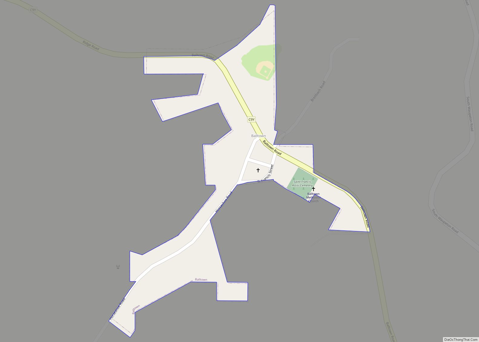
Online Interactive Map
Click on ![]() to view map in "full screen" mode.
to view map in "full screen" mode.
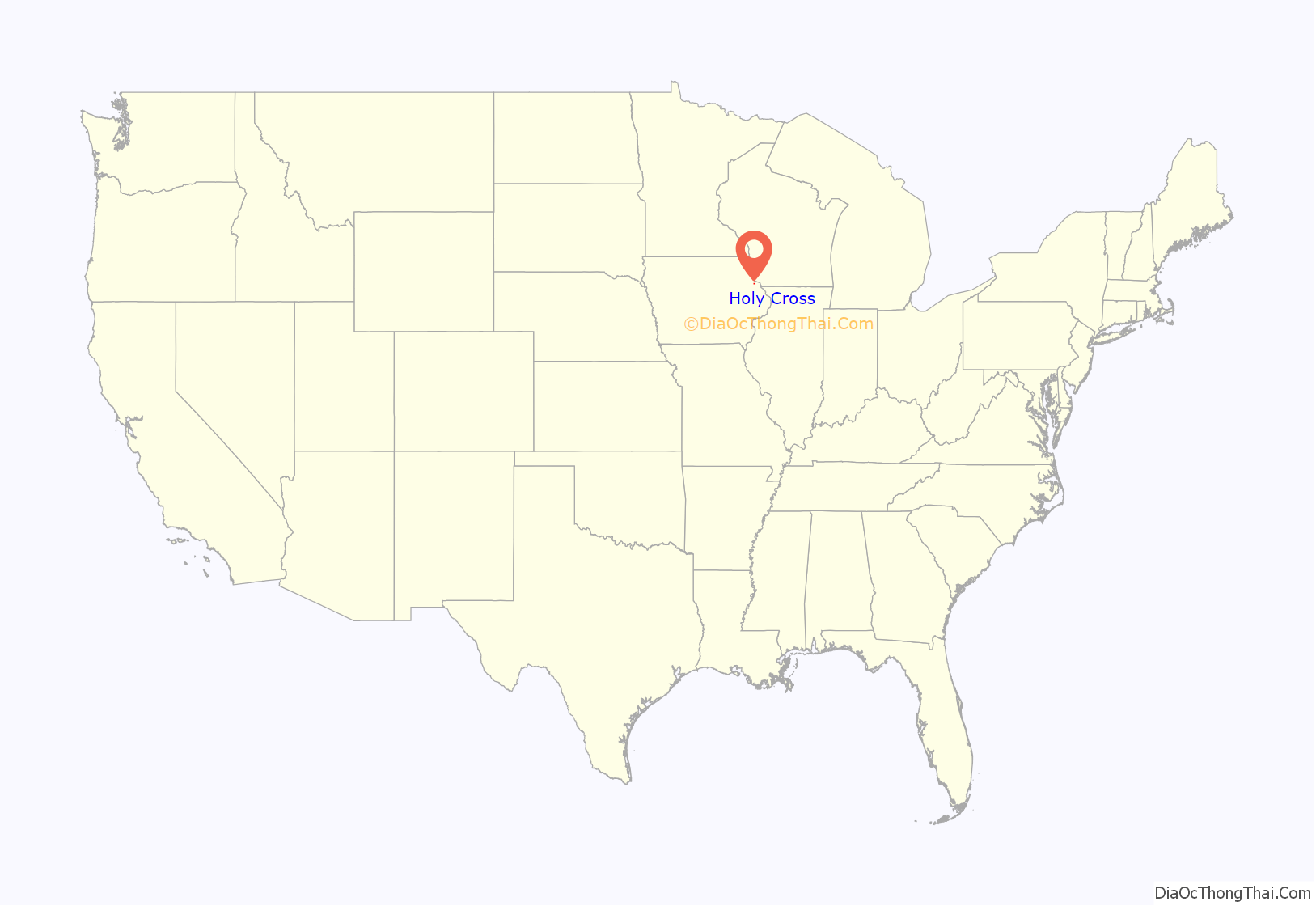
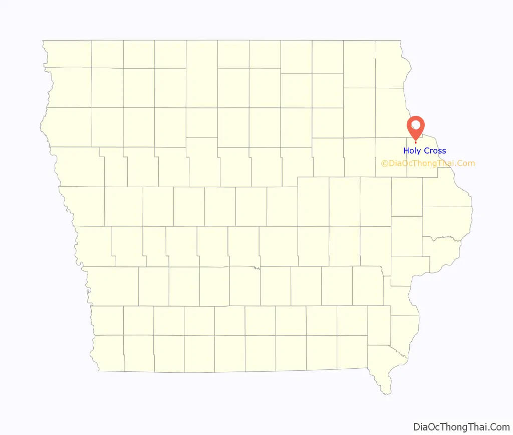
Holy Cross location map. Where is Holy Cross city?
History
Originally the community was settled by Irish and German immigrants in the early 19th century. The settlement became known as Pin Oak in 1844, the name originating from the many pin oak trees native to the area and after the rural post office located near there.
In 1855 the settlement’s name changed again, to Georgetown. This name honored George Gallon, who offered to donate part of his land to build a town. In 1898 the name was once again changed to Holy Cross.
On May 17, 2004 several buildings in town were either damaged or destroyed when major storms ripped through the area. One notable casualty was the Holy Cross Catholic Church. The church suffered serious damage when part of its roof was ripped off in the storm. The interior of the church suffered water damage from the rain. Following the storm, a new roof was placed on the church building, and the interior was also repaired.
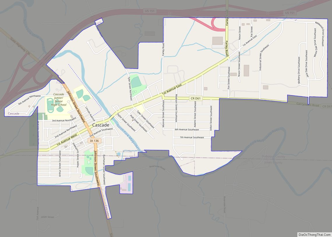
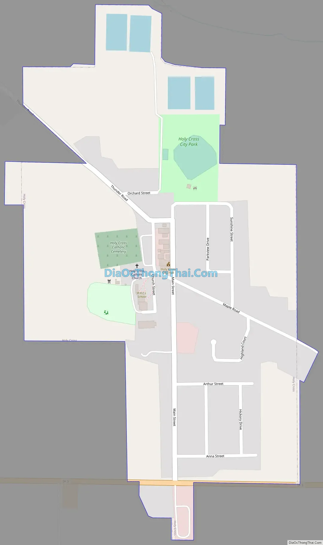
Holy Cross Road Map
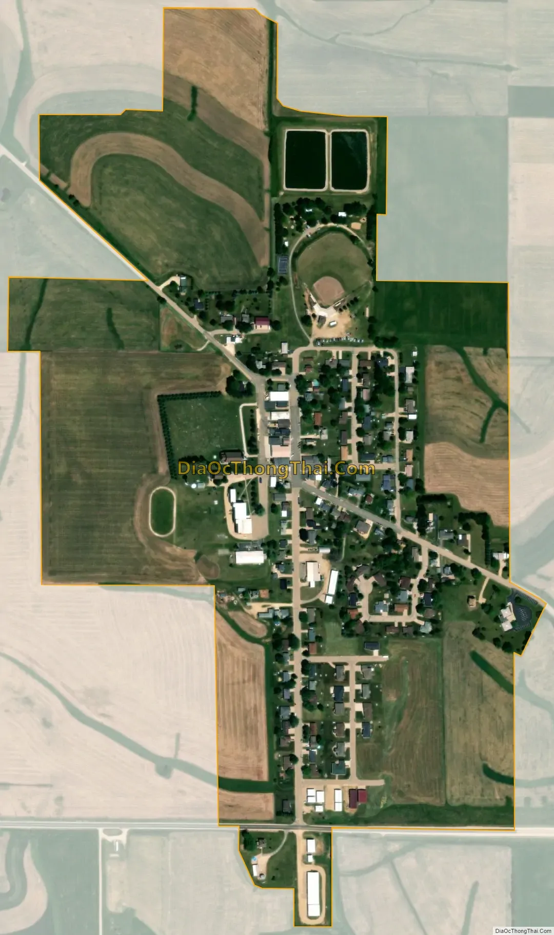
Holy Cross city Satellite Map
Geography
Holy Cross is located at 42°36′1″N 90°59′40″W / 42.60028°N 90.99444°W / 42.60028; -90.99444 (42.600334, -90.994557).
According to the United States Census Bureau, the city has a total area of 0.34 square miles (0.88 km), all land.
The city is located approximately four miles east of Luxemburg and about 25 miles northwest of Dubuque.
See also
Map of Iowa State and its subdivision:- Adair
- Adams
- Allamakee
- Appanoose
- Audubon
- Benton
- Black Hawk
- Boone
- Bremer
- Buchanan
- Buena Vista
- Butler
- Calhoun
- Carroll
- Cass
- Cedar
- Cerro Gordo
- Cherokee
- Chickasaw
- Clarke
- Clay
- Clayton
- Clinton
- Crawford
- Dallas
- Davis
- Decatur
- Delaware
- Des Moines
- Dickinson
- Dubuque
- Emmet
- Fayette
- Floyd
- Franklin
- Fremont
- Greene
- Grundy
- Guthrie
- Hamilton
- Hancock
- Hardin
- Harrison
- Henry
- Howard
- Humboldt
- Ida
- Iowa
- Jackson
- Jasper
- Jefferson
- Johnson
- Jones
- Keokuk
- Kossuth
- Lee
- Linn
- Louisa
- Lucas
- Lyon
- Madison
- Mahaska
- Marion
- Marshall
- Mills
- Mitchell
- Monona
- Monroe
- Montgomery
- Muscatine
- O'Brien
- Osceola
- Page
- Palo Alto
- Plymouth
- Pocahontas
- Polk
- Pottawattamie
- Poweshiek
- Ringgold
- Sac
- Scott
- Shelby
- Sioux
- Story
- Tama
- Taylor
- Union
- Van Buren
- Wapello
- Warren
- Washington
- Wayne
- Webster
- Winnebago
- Winneshiek
- Woodbury
- Worth
- Wright
- Alabama
- Alaska
- Arizona
- Arkansas
- California
- Colorado
- Connecticut
- Delaware
- District of Columbia
- Florida
- Georgia
- Hawaii
- Idaho
- Illinois
- Indiana
- Iowa
- Kansas
- Kentucky
- Louisiana
- Maine
- Maryland
- Massachusetts
- Michigan
- Minnesota
- Mississippi
- Missouri
- Montana
- Nebraska
- Nevada
- New Hampshire
- New Jersey
- New Mexico
- New York
- North Carolina
- North Dakota
- Ohio
- Oklahoma
- Oregon
- Pennsylvania
- Rhode Island
- South Carolina
- South Dakota
- Tennessee
- Texas
- Utah
- Vermont
- Virginia
- Washington
- West Virginia
- Wisconsin
- Wyoming