Asbury is a city in Dubuque County, Iowa, United States, and adjacent to the westside of the city of Dubuque. It is part of the Dubuque, Iowa Metropolitan Statistical Area. The population was 5,943 at the 2020 census. Asbury is the second-largest city in Dubuque County, surpassing Dyersville to become the second-largest in the 2010 U.S. Census count. The city is largely a bedroom community, made up of subdivisions whose residents work in Dubuque or Peosta.
| Name: | Asbury city |
|---|---|
| LSAD Code: | 25 |
| LSAD Description: | city (suffix) |
| State: | Iowa |
| County: | Dubuque County |
| Founded: | 1830s |
| Incorporated: | 1933 |
| Elevation: | 932 ft (284 m) |
| Land Area: | 3.18 sq mi (8.22 km²) |
| Water Area: | 0.00 sq mi (0.00 km²) |
| Population Density: | 1,871.22/sq mi (722.55/km²) |
| ZIP code: | 52002 |
| Area code: | 563 |
| FIPS code: | 1903160 |
| GNISfeature ID: | 0454247 |
| Website: | www.cityofasbury.com |
Online Interactive Map
Click on ![]() to view map in "full screen" mode.
to view map in "full screen" mode.
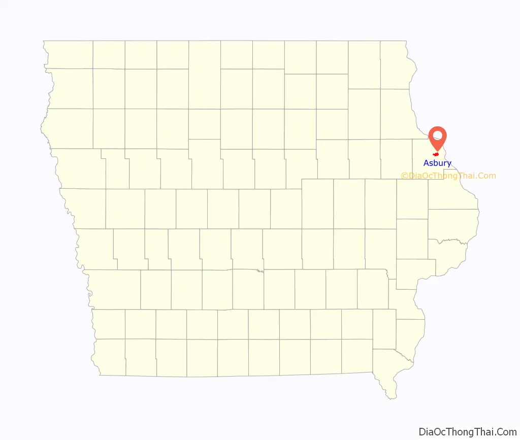
Asbury location map. Where is Asbury city?

History
Asbury was settled beginning in the 1830s, at first by Methodists. The city is named after British-born Bishop Francis Asbury, one of the first two bishops of the Methodist Episcopal Church in the United States. The city was incorporated in 1933, following the passage of the Twenty-first Amendment to the United States Constitution, which ended prohibition. The city incorporated to gain the legal standing necessary to sell alcohol, as liquor licenses were still forbidden in rural areas.
For most of its history, Asbury was very small, much like hundreds of other towns in rural Iowa. In the 1960 census, Asbury still had only 71 residents. During this time, the City of Dubuque grew immensely, and the sprawl reached the Asbury area beginning in the 1960s. By 1970, Asbury had 410 residents and had grown fast enough to become the fastest growing city in the state of Iowa.
Asbury continues to grow at a rapid pace today, expanding over 50% since the year 2000, and currently (2020) counts 5,943 residents. This number is increasing, as a number of new subdivisions are being built or planned for the area.
Asbury Road Map
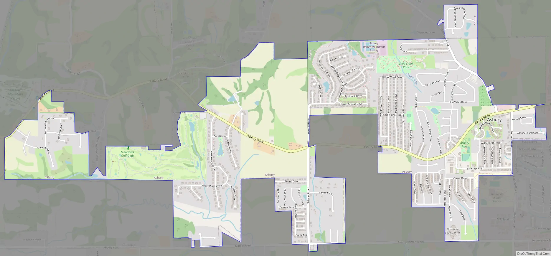
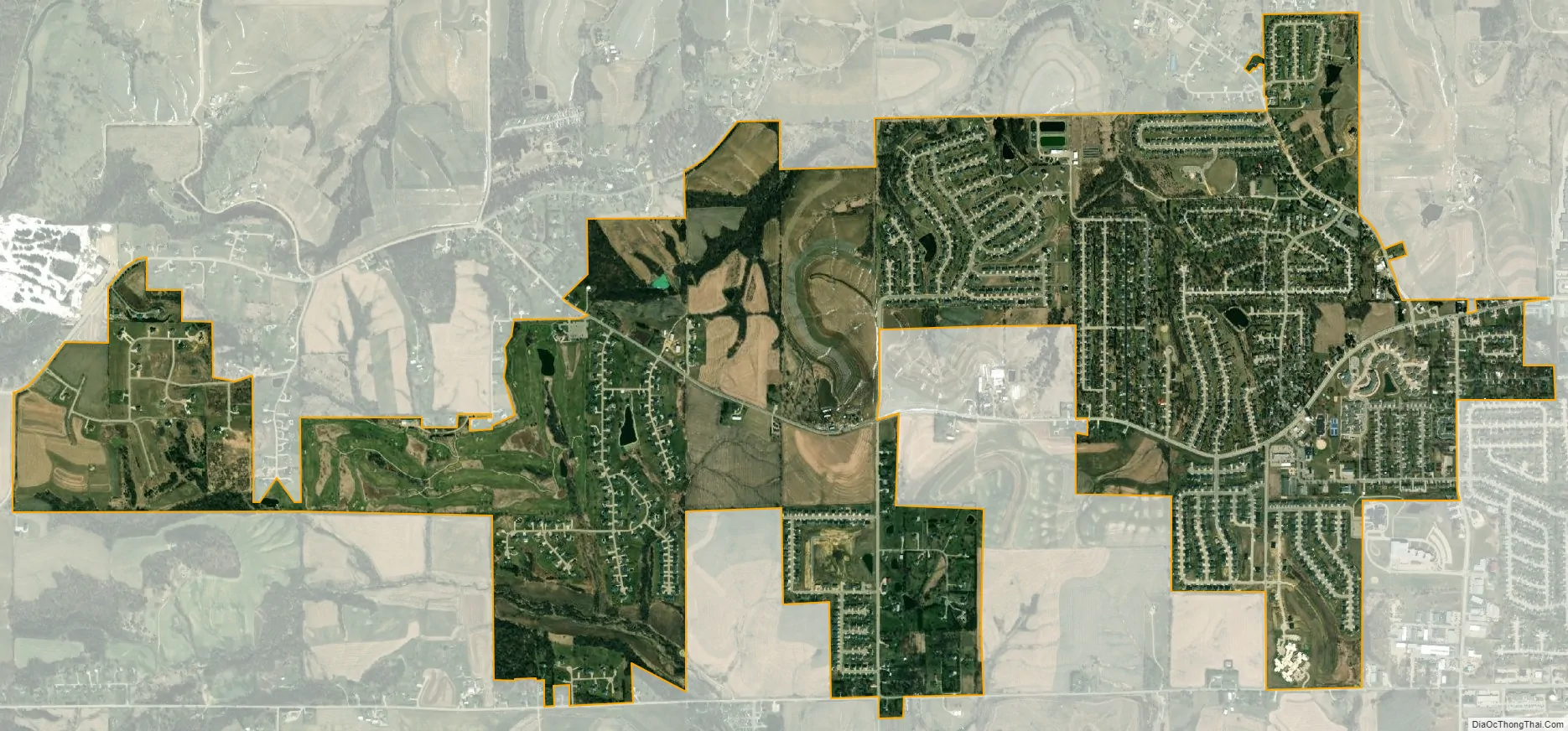
Asbury city Satellite Map
Geography
Asbury is located at 42°30′56″N 90°45′48″W / 42.51556°N 90.76333°W / 42.51556; -90.76333 (42.515648, -90.763235).
According to the United States Census Bureau, the city has a total area of 2.66 square miles (6.89 km), all land.
The city operates four parks and pedestrian and mountain bike trails. The parks include: Althaus Wetland & Nature Preserve, Asbury Park, Cloie Creek Park, and Maple Hills Park. The trail runs from Asbury Rd. to Maple Hills Park, and is part of Asbury’s plan for having a citywide trail network.
See also
Map of Iowa State and its subdivision:- Adair
- Adams
- Allamakee
- Appanoose
- Audubon
- Benton
- Black Hawk
- Boone
- Bremer
- Buchanan
- Buena Vista
- Butler
- Calhoun
- Carroll
- Cass
- Cedar
- Cerro Gordo
- Cherokee
- Chickasaw
- Clarke
- Clay
- Clayton
- Clinton
- Crawford
- Dallas
- Davis
- Decatur
- Delaware
- Des Moines
- Dickinson
- Dubuque
- Emmet
- Fayette
- Floyd
- Franklin
- Fremont
- Greene
- Grundy
- Guthrie
- Hamilton
- Hancock
- Hardin
- Harrison
- Henry
- Howard
- Humboldt
- Ida
- Iowa
- Jackson
- Jasper
- Jefferson
- Johnson
- Jones
- Keokuk
- Kossuth
- Lee
- Linn
- Louisa
- Lucas
- Lyon
- Madison
- Mahaska
- Marion
- Marshall
- Mills
- Mitchell
- Monona
- Monroe
- Montgomery
- Muscatine
- O'Brien
- Osceola
- Page
- Palo Alto
- Plymouth
- Pocahontas
- Polk
- Pottawattamie
- Poweshiek
- Ringgold
- Sac
- Scott
- Shelby
- Sioux
- Story
- Tama
- Taylor
- Union
- Van Buren
- Wapello
- Warren
- Washington
- Wayne
- Webster
- Winnebago
- Winneshiek
- Woodbury
- Worth
- Wright
- Alabama
- Alaska
- Arizona
- Arkansas
- California
- Colorado
- Connecticut
- Delaware
- District of Columbia
- Florida
- Georgia
- Hawaii
- Idaho
- Illinois
- Indiana
- Iowa
- Kansas
- Kentucky
- Louisiana
- Maine
- Maryland
- Massachusetts
- Michigan
- Minnesota
- Mississippi
- Missouri
- Montana
- Nebraska
- Nevada
- New Hampshire
- New Jersey
- New Mexico
- New York
- North Carolina
- North Dakota
- Ohio
- Oklahoma
- Oregon
- Pennsylvania
- Rhode Island
- South Carolina
- South Dakota
- Tennessee
- Texas
- Utah
- Vermont
- Virginia
- Washington
- West Virginia
- Wisconsin
- Wyoming