Livermore is a city in Humboldt County, Iowa, United States. The population was 381 at the time of the 2020 census. Livermore is the hometown of former University of Iowa and NFL tight end Dallas Clark.
| Name: | Livermore city |
|---|---|
| LSAD Code: | 25 |
| LSAD Description: | city (suffix) |
| State: | Iowa |
| County: | Humboldt County |
| Incorporated: | March 11, 1882 |
| Elevation: | 1,142 ft (348 m) |
| Total Area: | 0.69 sq mi (1.78 km²) |
| Land Area: | 0.69 sq mi (1.78 km²) |
| Water Area: | 0.00 sq mi (0.00 km²) |
| Total Population: | 381 |
| Population Density: | 556.20/sq mi (214.61/km²) |
| ZIP code: | 50558 |
| Area code: | 515 |
| FIPS code: | 1945975 |
| GNISfeature ID: | 0458536 |
| Website: | www.livermoreiowa.org |
Online Interactive Map
Click on ![]() to view map in "full screen" mode.
to view map in "full screen" mode.
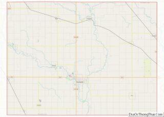
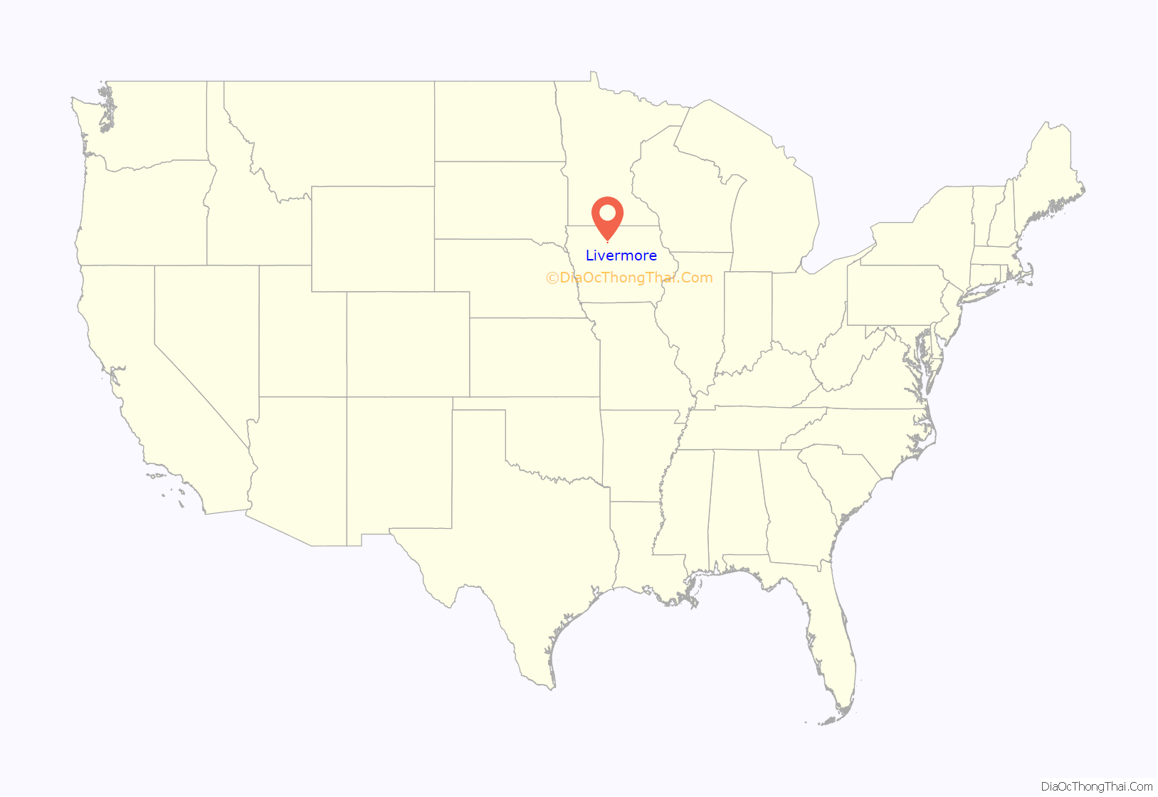
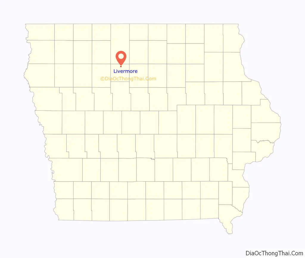
Livermore location map. Where is Livermore city?
History
Livermore was founded in 1879. The community grew in importance as an agricultural center with grain elevators and feed mills and merchants serving the surrounding rich farmland. The community is located adjacent to the confluence of the East Fork Des Moines River and Lott’s Creek. Early industries included a brick and tile factory and agricultural products processing. As north central Iowa’s rural population dwindled, so has Livermore’s population. Its remaining elementary school closed in 2005.
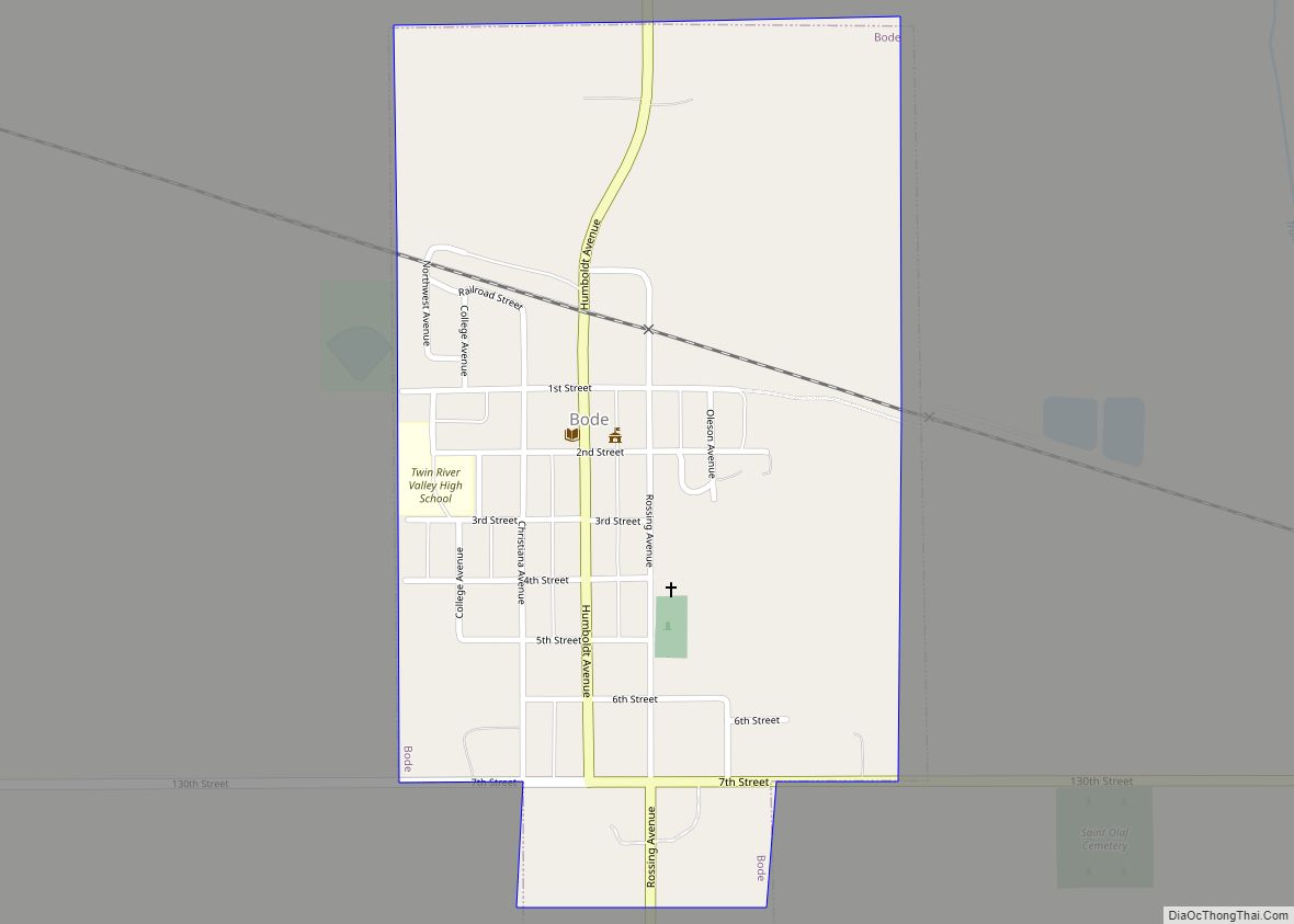
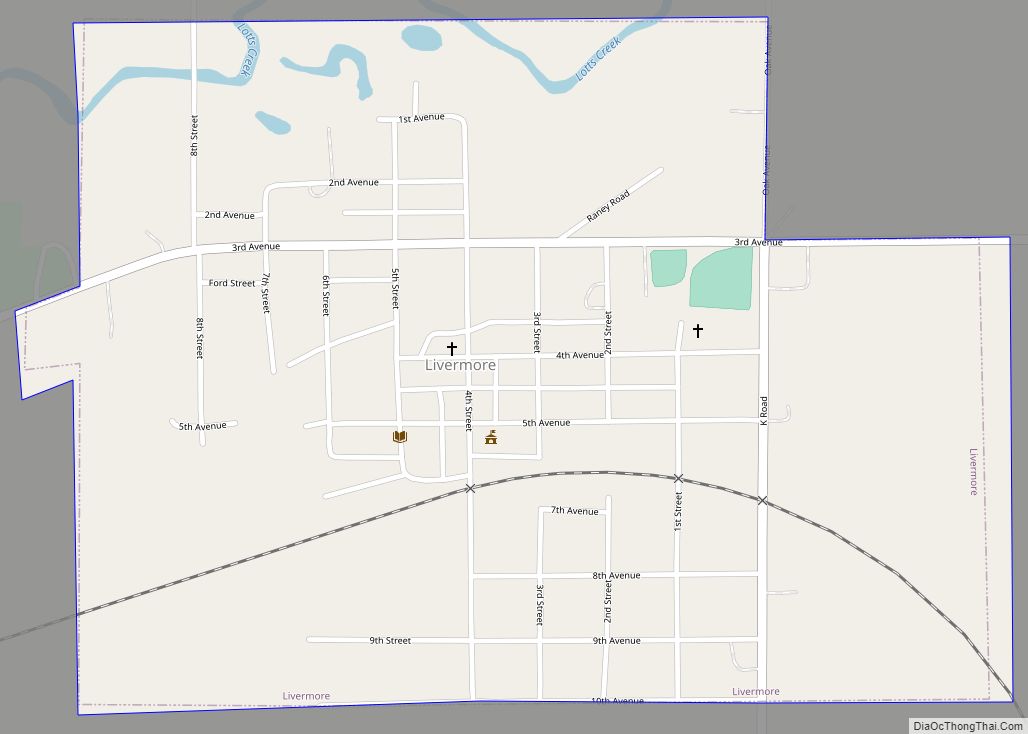
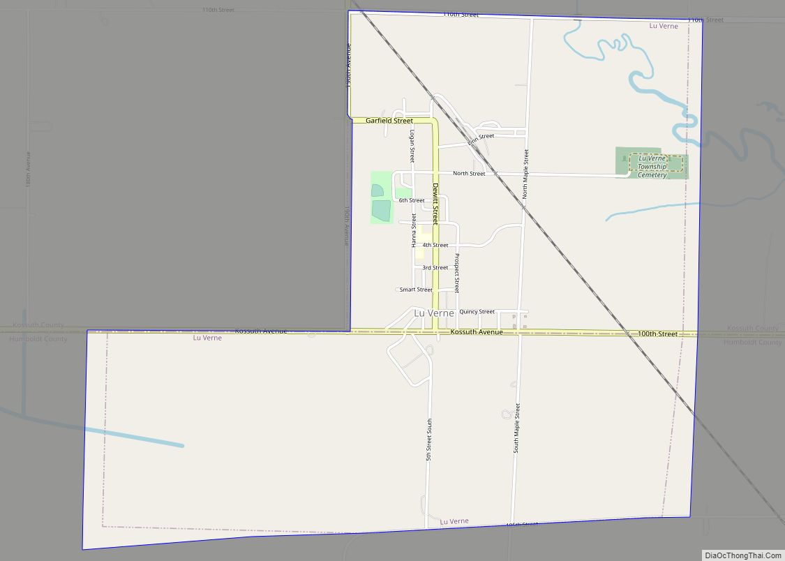
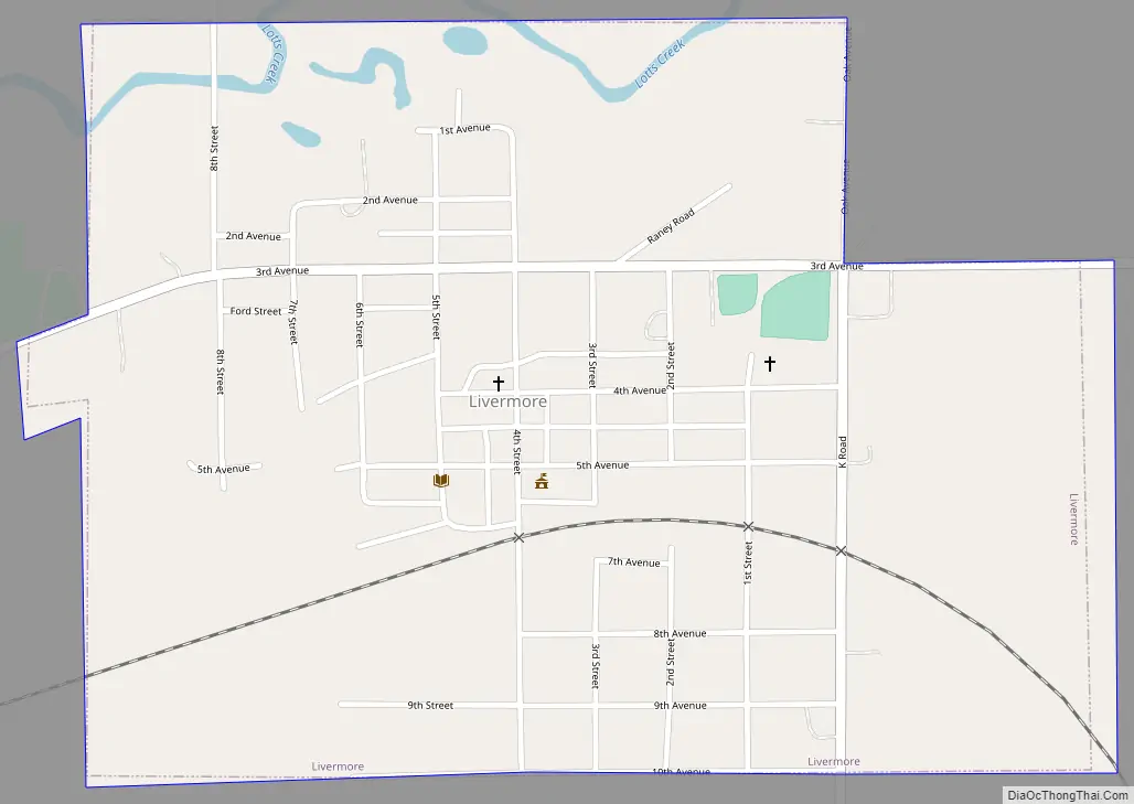
Livermore Road Map
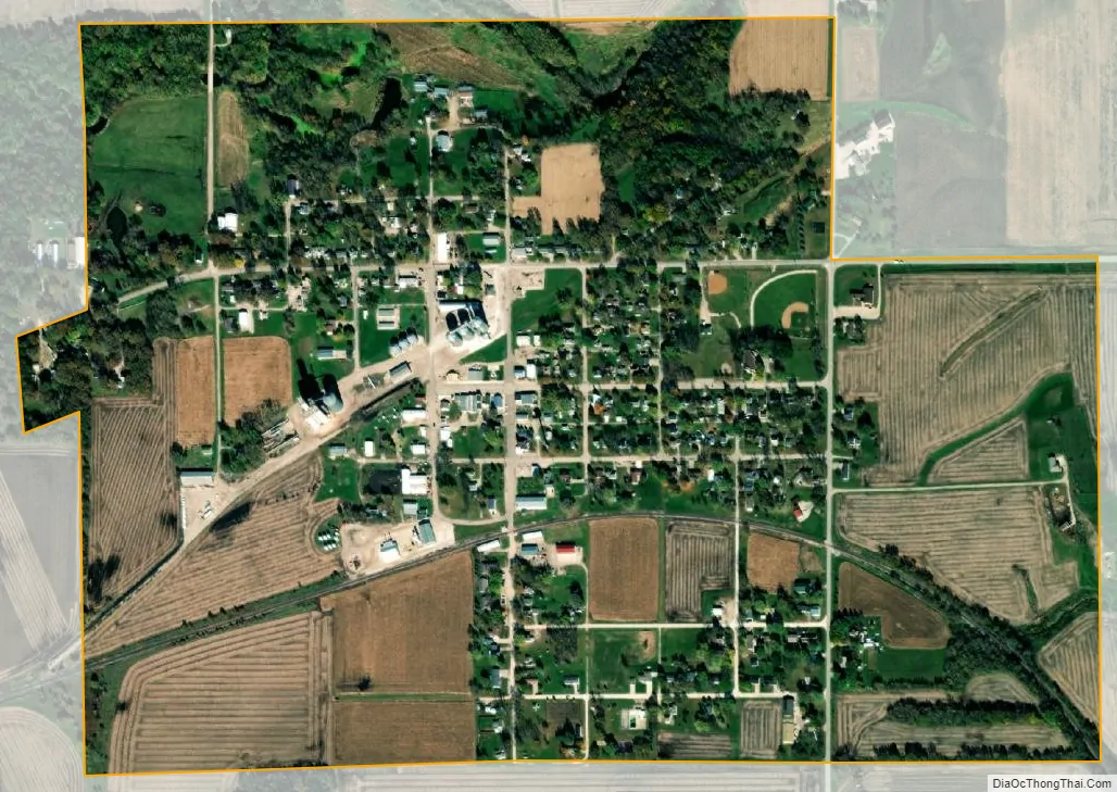
Livermore city Satellite Map
Geography
Livermore is located at 42°52′1″N 94°11′3″W / 42.86694°N 94.18417°W / 42.86694; -94.18417 (42.866849, -94.184051) at the confluence of Lotts Creek with the East Fork Des Moines River.
According to the United States Census Bureau, the city has a total area of 0.70 square miles (1.81 km), all land.
Climate
Livermore has a humid continental climate (Köppen Dfa), including all four seasons characterized by harsh winters, and mild summers.
July is the hottest month of the year, with an average high of 84 °F (29 °C) and an average low of 62 °F (17 °C). Temperatures above 100 °F (38 °C) are uncommon. January is the coldest month with an average high of 25 °F (−4 °C) and an average low of 7 °F (−14 °C). The city’s highest temperature was 104 °F (40.0 °C), recorded in 1982. The lowest temperature recorded was −33 °F (−36 °C), in 1985.
See also
Map of Iowa State and its subdivision:- Adair
- Adams
- Allamakee
- Appanoose
- Audubon
- Benton
- Black Hawk
- Boone
- Bremer
- Buchanan
- Buena Vista
- Butler
- Calhoun
- Carroll
- Cass
- Cedar
- Cerro Gordo
- Cherokee
- Chickasaw
- Clarke
- Clay
- Clayton
- Clinton
- Crawford
- Dallas
- Davis
- Decatur
- Delaware
- Des Moines
- Dickinson
- Dubuque
- Emmet
- Fayette
- Floyd
- Franklin
- Fremont
- Greene
- Grundy
- Guthrie
- Hamilton
- Hancock
- Hardin
- Harrison
- Henry
- Howard
- Humboldt
- Ida
- Iowa
- Jackson
- Jasper
- Jefferson
- Johnson
- Jones
- Keokuk
- Kossuth
- Lee
- Linn
- Louisa
- Lucas
- Lyon
- Madison
- Mahaska
- Marion
- Marshall
- Mills
- Mitchell
- Monona
- Monroe
- Montgomery
- Muscatine
- O'Brien
- Osceola
- Page
- Palo Alto
- Plymouth
- Pocahontas
- Polk
- Pottawattamie
- Poweshiek
- Ringgold
- Sac
- Scott
- Shelby
- Sioux
- Story
- Tama
- Taylor
- Union
- Van Buren
- Wapello
- Warren
- Washington
- Wayne
- Webster
- Winnebago
- Winneshiek
- Woodbury
- Worth
- Wright
- Alabama
- Alaska
- Arizona
- Arkansas
- California
- Colorado
- Connecticut
- Delaware
- District of Columbia
- Florida
- Georgia
- Hawaii
- Idaho
- Illinois
- Indiana
- Iowa
- Kansas
- Kentucky
- Louisiana
- Maine
- Maryland
- Massachusetts
- Michigan
- Minnesota
- Mississippi
- Missouri
- Montana
- Nebraska
- Nevada
- New Hampshire
- New Jersey
- New Mexico
- New York
- North Carolina
- North Dakota
- Ohio
- Oklahoma
- Oregon
- Pennsylvania
- Rhode Island
- South Carolina
- South Dakota
- Tennessee
- Texas
- Utah
- Vermont
- Virginia
- Washington
- West Virginia
- Wisconsin
- Wyoming