Manchester is a city in Delaware Township, Delaware County, Iowa, United States. The population was 5,065 at the time of the 2020 census. It is the county seat of Delaware County. Manchester is located at the intersection of U.S. Route 20 and State Highway 13 and is the largest community in Delaware County.
| Name: | Manchester city |
|---|---|
| LSAD Code: | 25 |
| LSAD Description: | city (suffix) |
| State: | Iowa |
| County: | Delaware County |
| Elevation: | 942 ft (287 m) |
| Total Area: | 4.85 sq mi (12.57 km²) |
| Land Area: | 4.84 sq mi (12.53 km²) |
| Water Area: | 0.01 sq mi (0.04 km²) |
| Total Population: | 5,065 |
| Population Density: | 1,046.92/sq mi (404.23/km²) |
| ZIP code: | 52057 |
| Area code: | 563 |
| FIPS code: | 1948810 |
| GNISfeature ID: | 0458752 |
| Website: | manchester-ia.org |
Online Interactive Map
Click on ![]() to view map in "full screen" mode.
to view map in "full screen" mode.
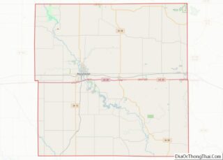
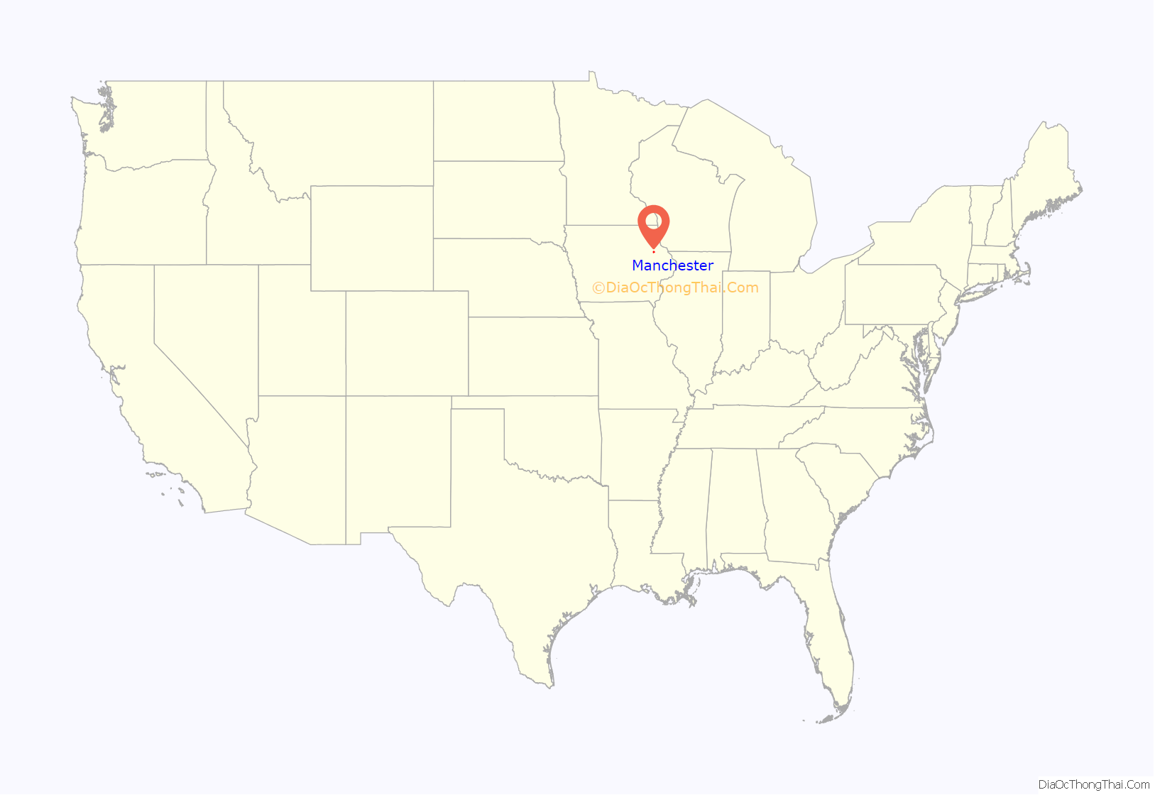
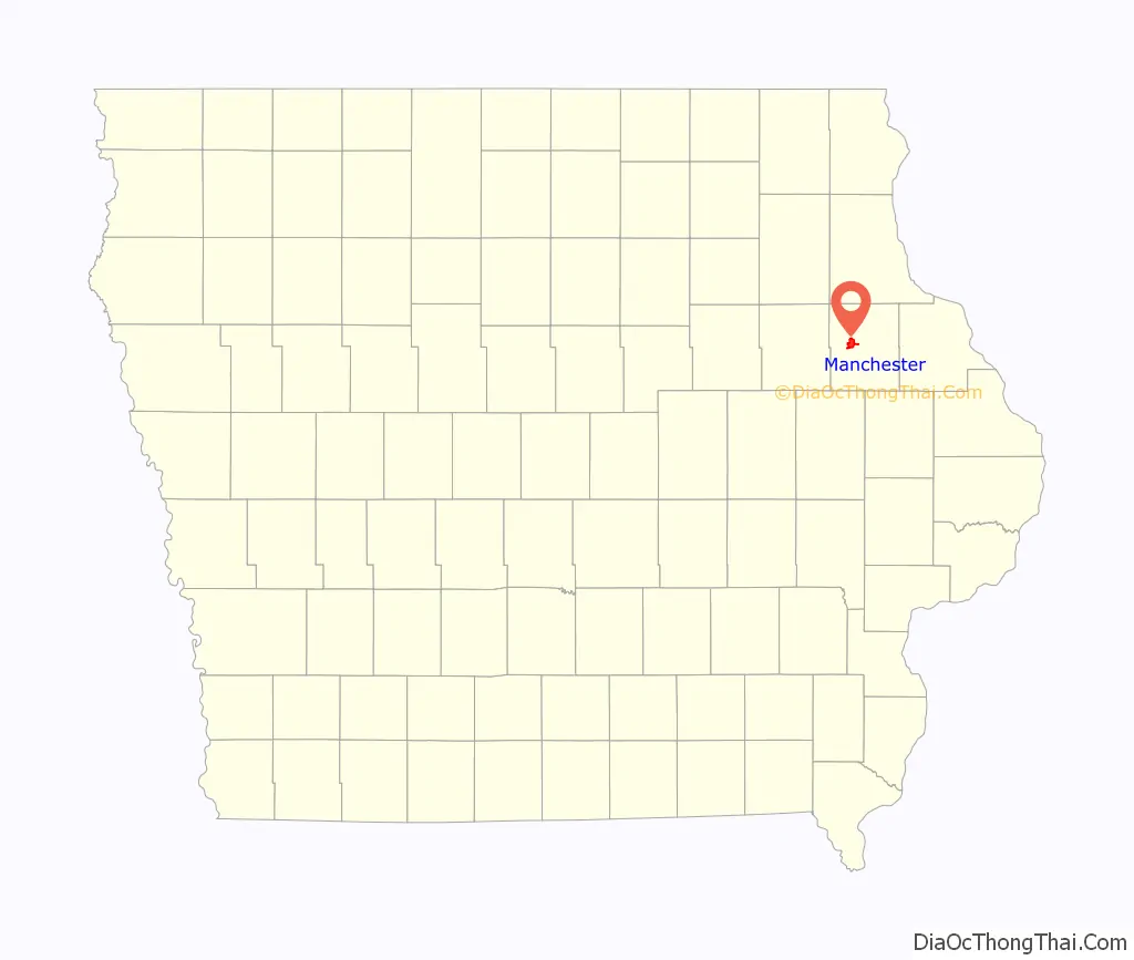
Manchester location map. Where is Manchester city?
History
Manchester was founded in the 1850s. It was originally called Burrington after its founder, Levings Burrington, who settled there in 1852. The name was subsequently changed to Manchester.
The county courthouse was built in 1894 for $38,000. The clock in the tower was paid for with contributions from 700 county citizens. C.E. Bell designed the Romanesque Revival building,[1] which is constructed of red pressed brick. The main body of the building measures 76 by 100 feet.[3] The tower and spire are 135 feet (41 m) high, and the walls of the building are 18 inches (45.7 cm) thick.[3] The decorative metal ceilings on the first floor and the elaborate woodwork are original to the building. It was listed on the National Register of Historic Places in 1981 as a part of the County Courthouses in Iowa Thematic Resource.
Manchester Road Map
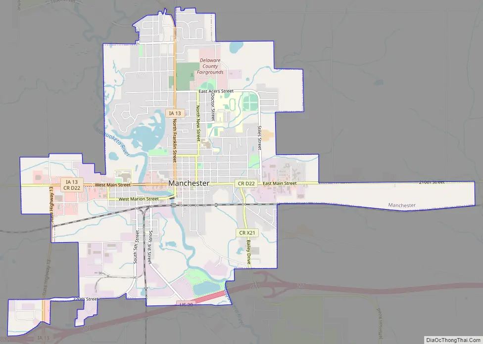
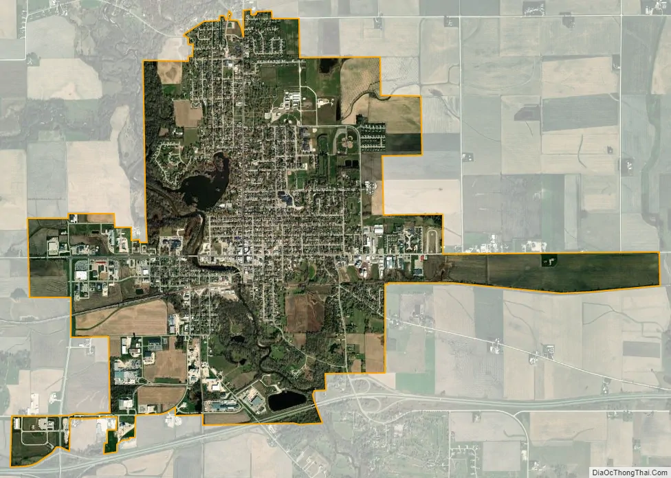
Manchester city Satellite Map
Geography
The community is located along the Maquoketa River. According to the United States Census Bureau, the city has a total area of 4.70 square miles (12.17 km), of which 4.68 square miles (12.12 km) is land and 0.02 square miles (0.05 km) is water.
See also
Map of Iowa State and its subdivision:- Adair
- Adams
- Allamakee
- Appanoose
- Audubon
- Benton
- Black Hawk
- Boone
- Bremer
- Buchanan
- Buena Vista
- Butler
- Calhoun
- Carroll
- Cass
- Cedar
- Cerro Gordo
- Cherokee
- Chickasaw
- Clarke
- Clay
- Clayton
- Clinton
- Crawford
- Dallas
- Davis
- Decatur
- Delaware
- Des Moines
- Dickinson
- Dubuque
- Emmet
- Fayette
- Floyd
- Franklin
- Fremont
- Greene
- Grundy
- Guthrie
- Hamilton
- Hancock
- Hardin
- Harrison
- Henry
- Howard
- Humboldt
- Ida
- Iowa
- Jackson
- Jasper
- Jefferson
- Johnson
- Jones
- Keokuk
- Kossuth
- Lee
- Linn
- Louisa
- Lucas
- Lyon
- Madison
- Mahaska
- Marion
- Marshall
- Mills
- Mitchell
- Monona
- Monroe
- Montgomery
- Muscatine
- O'Brien
- Osceola
- Page
- Palo Alto
- Plymouth
- Pocahontas
- Polk
- Pottawattamie
- Poweshiek
- Ringgold
- Sac
- Scott
- Shelby
- Sioux
- Story
- Tama
- Taylor
- Union
- Van Buren
- Wapello
- Warren
- Washington
- Wayne
- Webster
- Winnebago
- Winneshiek
- Woodbury
- Worth
- Wright
- Alabama
- Alaska
- Arizona
- Arkansas
- California
- Colorado
- Connecticut
- Delaware
- District of Columbia
- Florida
- Georgia
- Hawaii
- Idaho
- Illinois
- Indiana
- Iowa
- Kansas
- Kentucky
- Louisiana
- Maine
- Maryland
- Massachusetts
- Michigan
- Minnesota
- Mississippi
- Missouri
- Montana
- Nebraska
- Nevada
- New Hampshire
- New Jersey
- New Mexico
- New York
- North Carolina
- North Dakota
- Ohio
- Oklahoma
- Oregon
- Pennsylvania
- Rhode Island
- South Carolina
- South Dakota
- Tennessee
- Texas
- Utah
- Vermont
- Virginia
- Washington
- West Virginia
- Wisconsin
- Wyoming