Maquoketa (/məˈkoʊkɪtə/) is a city in Jackson County, Iowa, United States. Located on the Maquoketa River, it is the county seat of Jackson County.
U.S. Route 61 adjoins the city, which therefore hosts traffic between Dubuque and the Quad Cities. Iowa Highways 62 and 64 also pass through the city. Maquoketa Caves State Park is located a few miles northwest of Maquoketa.
The population was 6,128 at the time of the 2020 census.
| Name: | Maquoketa city |
|---|---|
| LSAD Code: | 25 |
| LSAD Description: | city (suffix) |
| State: | Iowa |
| County: | Clinton County, Jackson County |
| Incorporated: | January 27, 1857 |
| Elevation: | 702 ft (214 m) |
| Total Area: | 4.54 sq mi (11.76 km²) |
| Land Area: | 4.52 sq mi (11.70 km²) |
| Water Area: | 0.03 sq mi (0.07 km²) |
| Total Population: | 6,128 |
| Population Density: | 1,356.65/sq mi (523.78/km²) |
| ZIP code: | 52060 |
| Area code: | 563 |
| FIPS code: | 1949215 |
| GNISfeature ID: | 0458789 |
| Website: | www.maquoketaia.com |
Online Interactive Map
Click on ![]() to view map in "full screen" mode.
to view map in "full screen" mode.
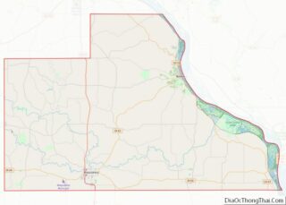
Maquoketa location map. Where is Maquoketa city?


History
Maquoketa was originally called Springfield, and under the latter name was laid out in 1838. The present name, after the Maquoketa River, was adopted in 1844. The river’s name derives from Maquaw-Autaw, which means “Bear River” in Meskwaki.
The Davenport and St. Paul Railroad was extended to Maquoketa in 1870 prompting growth. The county seat was transferred from Andrew to Maquoketa in 1873.
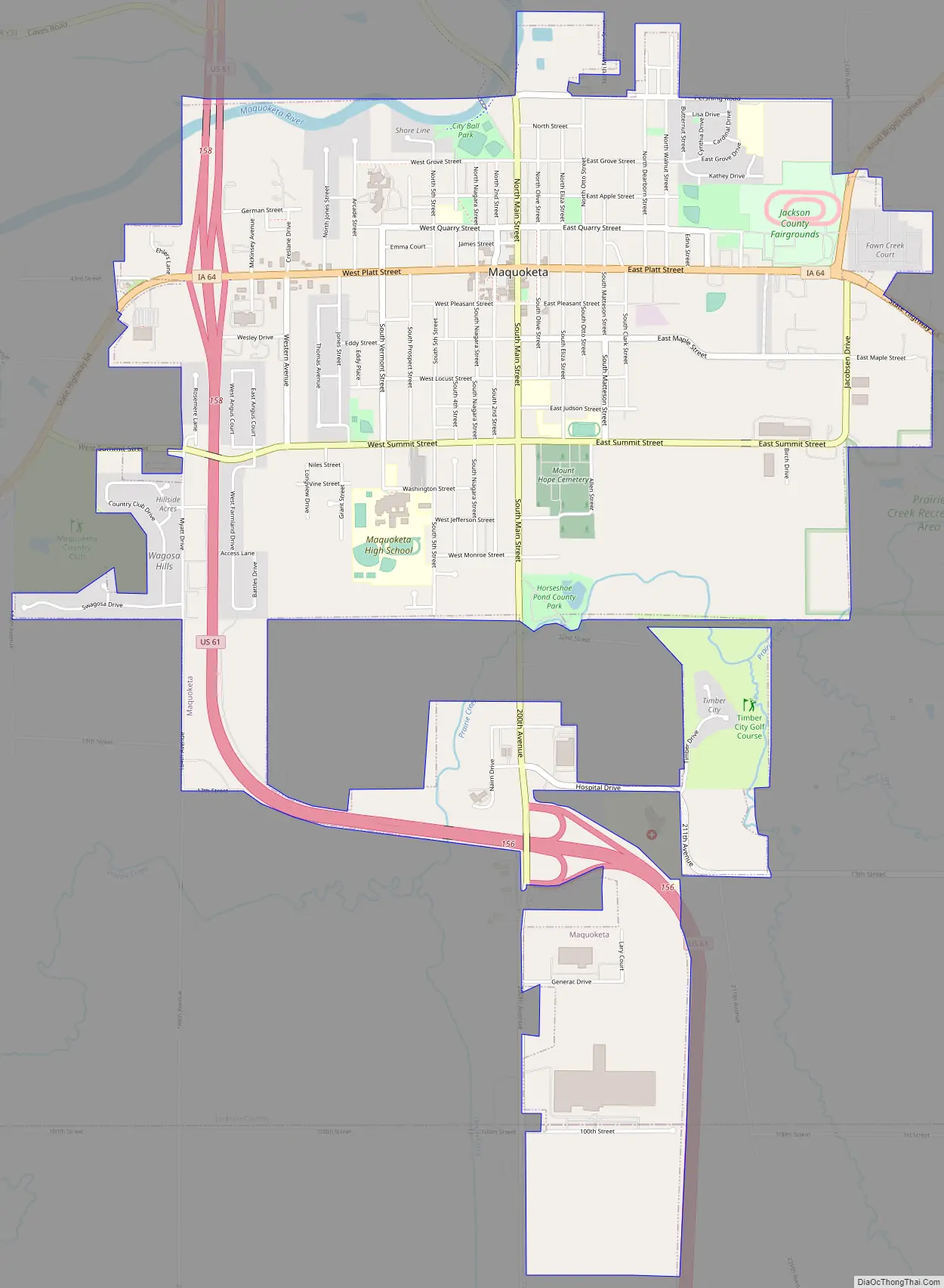
Maquoketa Road Map
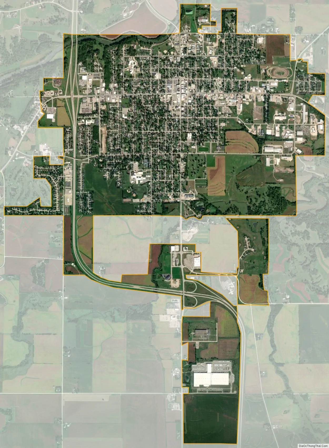
Maquoketa city Satellite Map
Geography
Maquoketa is located at 42°4′1″N 90°39′58″W / 42.06694°N 90.66611°W / 42.06694; -90.66611 (42.066901, −90.666238), primarily in Jackson County.
According to the United States Census Bureau, the city has a total area of 4.37 square miles (11.32 km), of which 4.33 square miles (11.21 km) is land and 0.04 square miles (0.10 km) is water.
Climate
See also
Map of Iowa State and its subdivision:- Adair
- Adams
- Allamakee
- Appanoose
- Audubon
- Benton
- Black Hawk
- Boone
- Bremer
- Buchanan
- Buena Vista
- Butler
- Calhoun
- Carroll
- Cass
- Cedar
- Cerro Gordo
- Cherokee
- Chickasaw
- Clarke
- Clay
- Clayton
- Clinton
- Crawford
- Dallas
- Davis
- Decatur
- Delaware
- Des Moines
- Dickinson
- Dubuque
- Emmet
- Fayette
- Floyd
- Franklin
- Fremont
- Greene
- Grundy
- Guthrie
- Hamilton
- Hancock
- Hardin
- Harrison
- Henry
- Howard
- Humboldt
- Ida
- Iowa
- Jackson
- Jasper
- Jefferson
- Johnson
- Jones
- Keokuk
- Kossuth
- Lee
- Linn
- Louisa
- Lucas
- Lyon
- Madison
- Mahaska
- Marion
- Marshall
- Mills
- Mitchell
- Monona
- Monroe
- Montgomery
- Muscatine
- O'Brien
- Osceola
- Page
- Palo Alto
- Plymouth
- Pocahontas
- Polk
- Pottawattamie
- Poweshiek
- Ringgold
- Sac
- Scott
- Shelby
- Sioux
- Story
- Tama
- Taylor
- Union
- Van Buren
- Wapello
- Warren
- Washington
- Wayne
- Webster
- Winnebago
- Winneshiek
- Woodbury
- Worth
- Wright
- Alabama
- Alaska
- Arizona
- Arkansas
- California
- Colorado
- Connecticut
- Delaware
- District of Columbia
- Florida
- Georgia
- Hawaii
- Idaho
- Illinois
- Indiana
- Iowa
- Kansas
- Kentucky
- Louisiana
- Maine
- Maryland
- Massachusetts
- Michigan
- Minnesota
- Mississippi
- Missouri
- Montana
- Nebraska
- Nevada
- New Hampshire
- New Jersey
- New Mexico
- New York
- North Carolina
- North Dakota
- Ohio
- Oklahoma
- Oregon
- Pennsylvania
- Rhode Island
- South Carolina
- South Dakota
- Tennessee
- Texas
- Utah
- Vermont
- Virginia
- Washington
- West Virginia
- Wisconsin
- Wyoming