Marshalltown is a city in and the county seat of Marshall County, Iowa, United States, located along the Iowa River. It is the seat and most populous settlement of Marshall County and the 16th largest city in Iowa, with a population of 27,591 at the 2020 census. Marshalltown is home to the Iowa Veterans Home and Marshalltown Community College.
| Name: | Marshalltown city |
|---|---|
| LSAD Code: | 25 |
| LSAD Description: | city (suffix) |
| State: | Iowa |
| County: | Marshall County |
| Founded: | 1853 |
| Incorporated: | March 5, 1923 |
| Elevation: | 942 ft (287 m) |
| Total Area: | 19.22 sq mi (49.79 km²) |
| Land Area: | 19.20 sq mi (49.72 km²) |
| Water Area: | 0.03 sq mi (0.07 km²) |
| Total Population: | 27,591 |
| Population Density: | 1,437.18/sq mi (554.89/km²) |
| ZIP code: | 50158 |
| Area code: | 641 |
| FIPS code: | 1949755 |
| Website: | www.marshalltown-ia.gov |
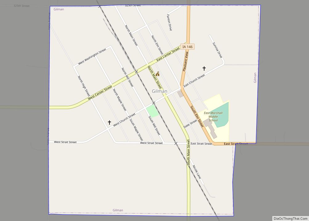
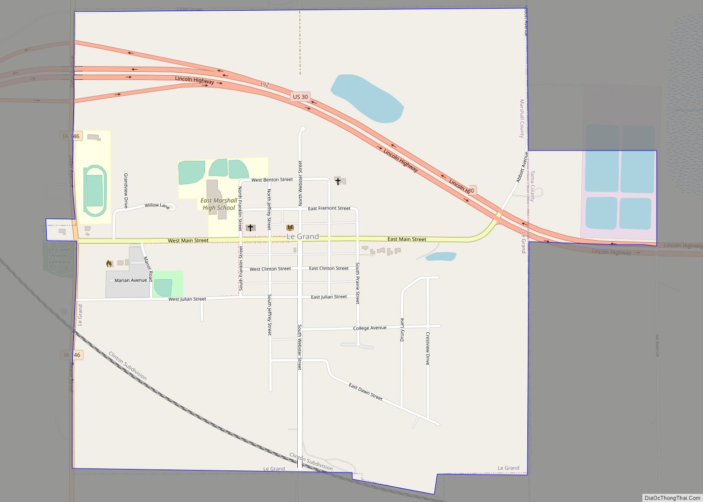
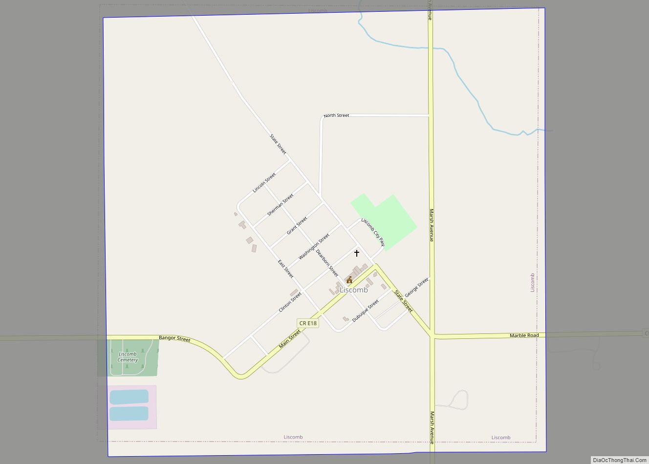
Online Interactive Map
Click on ![]() to view map in "full screen" mode.
to view map in "full screen" mode.
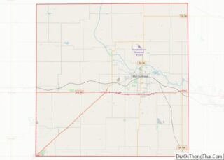
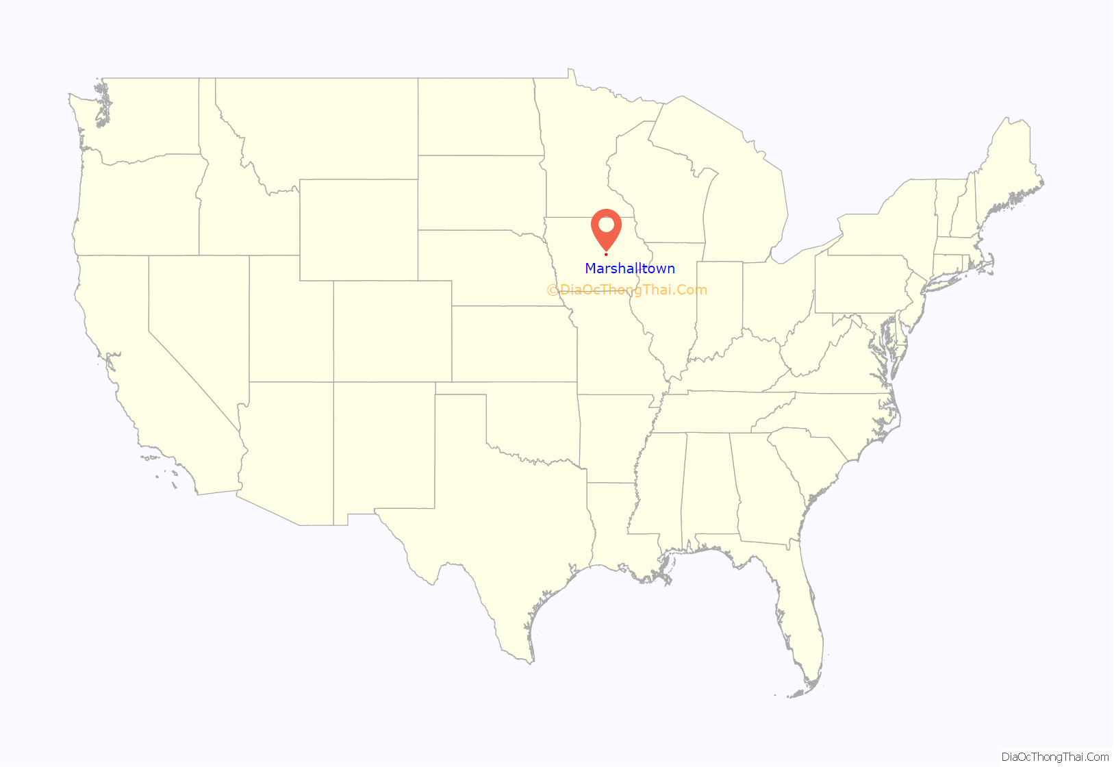
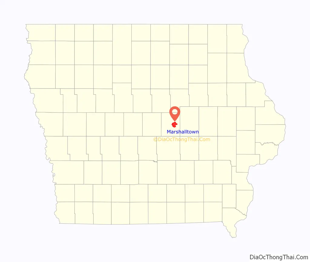
Marshalltown location map. Where is Marshalltown city?
History
Henry Anson was the first European settler in what is now called Marshalltown. In April 1851, Anson found what he described as “the prettiest place in Iowa.” On a high point between the Iowa River and Linn Creek, Anson built a log cabin. A plaque at 112 West Main Street marks the site of the cabin. In 1853 Anson named the town Marshall, after Marshall, Michigan, a former residence of his.
The town became Marshalltown in 1862 because another Marshall already existed in Henry County, Iowa (In 1880, Marshall’s name changed to Wayland). With the help of Potawatomi chief Johnny Green, Anson persuaded early settlers to stay in the area. In the mid-1850s, Anson donated land for a county courthouse. Residents donated money for the building’s construction. In 1863 the title of county seat transferred from the village of Marietta to Marshalltown. The young town then began growing. By 1900, Marshalltown had 10,000 residents. Many industries began developing in Marshalltown, like Fisher Controls, Lennox International and Marshalltown Company.
Marshalltown plays a small but significant role in the life of Ebe Dolliver, a main character in MacKinlay Kantor’s Pulitzer Prize-winning novel “Andersonville” (1955).
Baseball
Adrian Constantine “Cap” Anson, son of Henry and Jennette Anson, was the first European child born in the new pioneer town and is today known as Marshalltown’s “first son.” Adrian became a Major League Baseball player and was inducted into the National Baseball Hall of Fame in 1939. He was regarded as one of the greatest players of his era and one of the first superstars of the game.
Baseball steadily became popular as Marshalltown grew in the mid-1800s. Adrian’s brother Sturgis also became a talented baseball player and both went to play on intra-school teams at the University of Notre Dame. Both later returned to Marshalltown to play baseball for the town team. Along with their father Henry, the town’s founder, they put together a team and became the most prominent team in the state of Iowa. The Marshalltown team, with Henry Anson at third base, Adrian’s brother Sturgis in center field, and Adrian at second base, won the Iowa state championship in 1868. In 1870 Marshalltown played an exhibition game with the talented Rockford Forest Citys. Although Marshalltown lost the game, Rockford’s management offered contracts to all three of the Ansons. Adrian accepted the contract, which began his professional career in baseball in 1871.
Baseball continued its popularity in Marshalltown. In the early 1880s Billy Sunday played for the town baseball team. In 1882, with Sunday in left field, the Marshalltown team defeated the state champion Des Moines team 13–4. Marshalltown later formed a minor league team naming it after the Anson family, the Marshalltown Ansons. From 1914 to 1928 the team played in the Central Association and Mississippi Valley League.
Natural disasters
On April 23, 1961, the south side of town was hit by an F3 tornado. It damaged numerous structures in the area, causing $1 million (1961 USD) in the town alone. It killed one person and injured 12. Marshalltown would be hit again on July 19, 2018, when another EF3 tornado with peak winds of 144 mph moved directly through downtown at 4:37 p.m. local time. It destroyed the spire from the top of the courthouse, while heavily damaging or destroying several homes, businesses, and historic downtown buildings. It was on the ground for 23 minutes along a 8.41-mile-long (13.53 km) path of destruction up to 1,200 yards (1,100 m) wide. Although there were no fatalities, 23 people were injured.
On August 10, 2020, Marshalltown was hit by a powerful derecho, which caused extensive damage throughout the city. Over a hundred cars parked near a factory had their windows blown out. Reports described 99 miles per hour (160 kilometers per hour; 44 meters per second) winds, roofs being ripped off, and loose wood debris embedded in the sides of buildings. One week after the storm, nearly 7,000 residents of the city were still waiting for power restoration; 99 percent restoration was achieved on August 23. The damage to public parks in the city and surrounding Marshall County was “extensive”, particularly to trees.
Immigration
Marshalltown’s Hispanic population in particular boomed in the 1990s and 2000s with immigrants mostly from Mexico, just like in many other Midwestern towns with meat-packing plants. Another smaller wave of Burmese refugees later arrived in the 2010s.
Federal law enforcement have twice raided the Swift & Company (now JBS) meatpacking plant, first in 1996 and again in 2006, arresting suspected undocumented immigrants for alleged identity theft. One study estimated the 2006 raid caused a 6-month to 1-year economic recession in the area. Explaining the 2006 raid’s effect on the community, Police Chief Michael Tupper told The Washington Post in 2018 that “I think that there’s just a lot of fear that it could happen again. It was a very traumatic experience for our community. Not just for the families and people that were directly impacted, but for our school system, for our local economy, for our community as a whole. It was, in many ways, a devastating experience.”
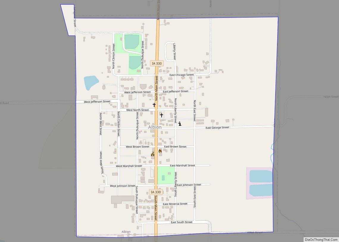
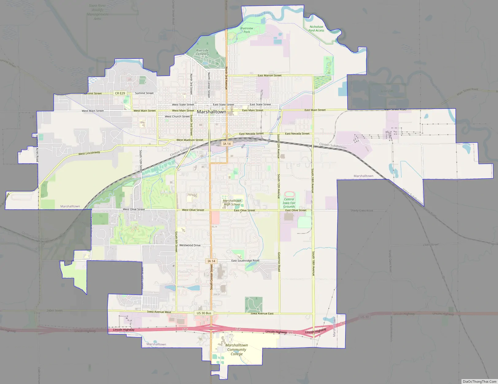
Marshalltown Road Map
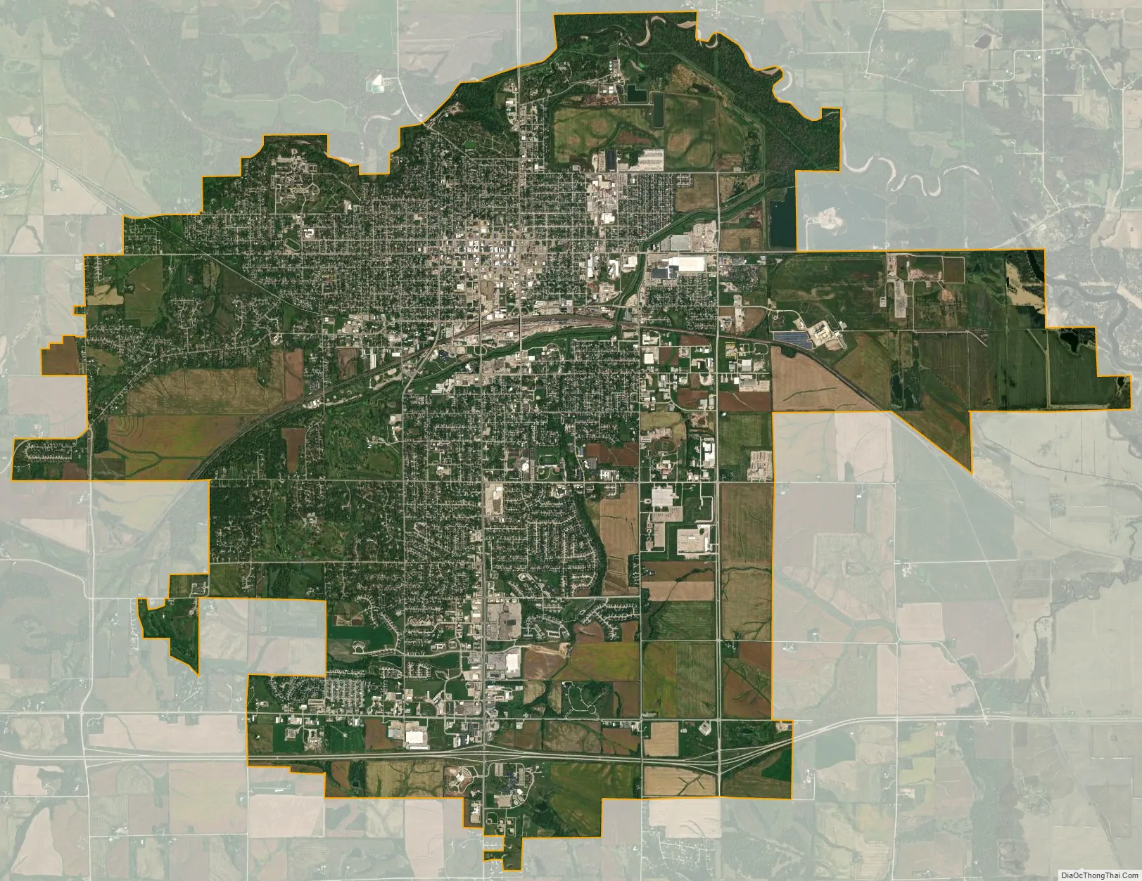
Marshalltown city Satellite Map
Geography
According to the United States Census Bureau, the city has a total area of 19.31 square miles (50.01 km), of which 19.28 square miles (49.93 km) is land and 0.03 square miles (0.08 km) is water. Neighboring counties include Hardin and Grundy to the north, Tama to the east, Jasper to the south, and Story to the west.
Climate
According to the Köppen Climate Classification system, Marshalltown has a hot-summer humid continental climate, abbreviated “Dfa” on climate maps.
See also
Map of Iowa State and its subdivision:- Adair
- Adams
- Allamakee
- Appanoose
- Audubon
- Benton
- Black Hawk
- Boone
- Bremer
- Buchanan
- Buena Vista
- Butler
- Calhoun
- Carroll
- Cass
- Cedar
- Cerro Gordo
- Cherokee
- Chickasaw
- Clarke
- Clay
- Clayton
- Clinton
- Crawford
- Dallas
- Davis
- Decatur
- Delaware
- Des Moines
- Dickinson
- Dubuque
- Emmet
- Fayette
- Floyd
- Franklin
- Fremont
- Greene
- Grundy
- Guthrie
- Hamilton
- Hancock
- Hardin
- Harrison
- Henry
- Howard
- Humboldt
- Ida
- Iowa
- Jackson
- Jasper
- Jefferson
- Johnson
- Jones
- Keokuk
- Kossuth
- Lee
- Linn
- Louisa
- Lucas
- Lyon
- Madison
- Mahaska
- Marion
- Marshall
- Mills
- Mitchell
- Monona
- Monroe
- Montgomery
- Muscatine
- O'Brien
- Osceola
- Page
- Palo Alto
- Plymouth
- Pocahontas
- Polk
- Pottawattamie
- Poweshiek
- Ringgold
- Sac
- Scott
- Shelby
- Sioux
- Story
- Tama
- Taylor
- Union
- Van Buren
- Wapello
- Warren
- Washington
- Wayne
- Webster
- Winnebago
- Winneshiek
- Woodbury
- Worth
- Wright
- Alabama
- Alaska
- Arizona
- Arkansas
- California
- Colorado
- Connecticut
- Delaware
- District of Columbia
- Florida
- Georgia
- Hawaii
- Idaho
- Illinois
- Indiana
- Iowa
- Kansas
- Kentucky
- Louisiana
- Maine
- Maryland
- Massachusetts
- Michigan
- Minnesota
- Mississippi
- Missouri
- Montana
- Nebraska
- Nevada
- New Hampshire
- New Jersey
- New Mexico
- New York
- North Carolina
- North Dakota
- Ohio
- Oklahoma
- Oregon
- Pennsylvania
- Rhode Island
- South Carolina
- South Dakota
- Tennessee
- Texas
- Utah
- Vermont
- Virginia
- Washington
- West Virginia
- Wisconsin
- Wyoming