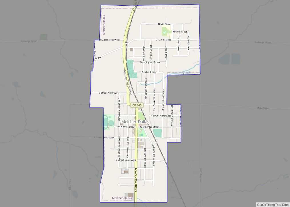
Melcher-Dallas is a city in Marion County, Iowa, United States. The population was 1,195 at the time of the 2020 census.
| Name: | Melcher-Dallas city |
|---|---|
| LSAD Code: | 25 |
| LSAD Description: | city (suffix) |
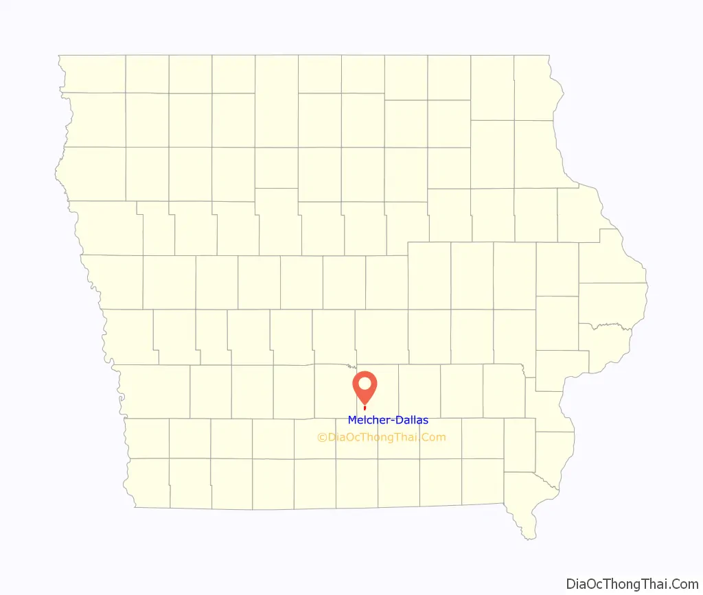
| State: | Iowa |
| County: | Marion County |
| Elevation: | 948 ft (289 m) |
| Total Area: | 1.04 sq mi (2.69 km²) |
| Land Area: | 1.04 sq mi (2.69 km²) |
| Water Area: | 0.00 sq mi (0.00 km²) |
| Total Population: | 1,195 |
| Population Density: | 1,149.04/sq mi (443.75/km²) |
| ZIP code: | 50163 |
| Area code: | 641 |
| FIPS code: | 1950935 |
| GNISfeature ID: | 0458955 |
| Website: | http://melcherdallasiowa.org |
Online Interactive Map
Click on ![]() to view map in "full screen" mode.
to view map in "full screen" mode.
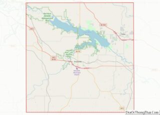
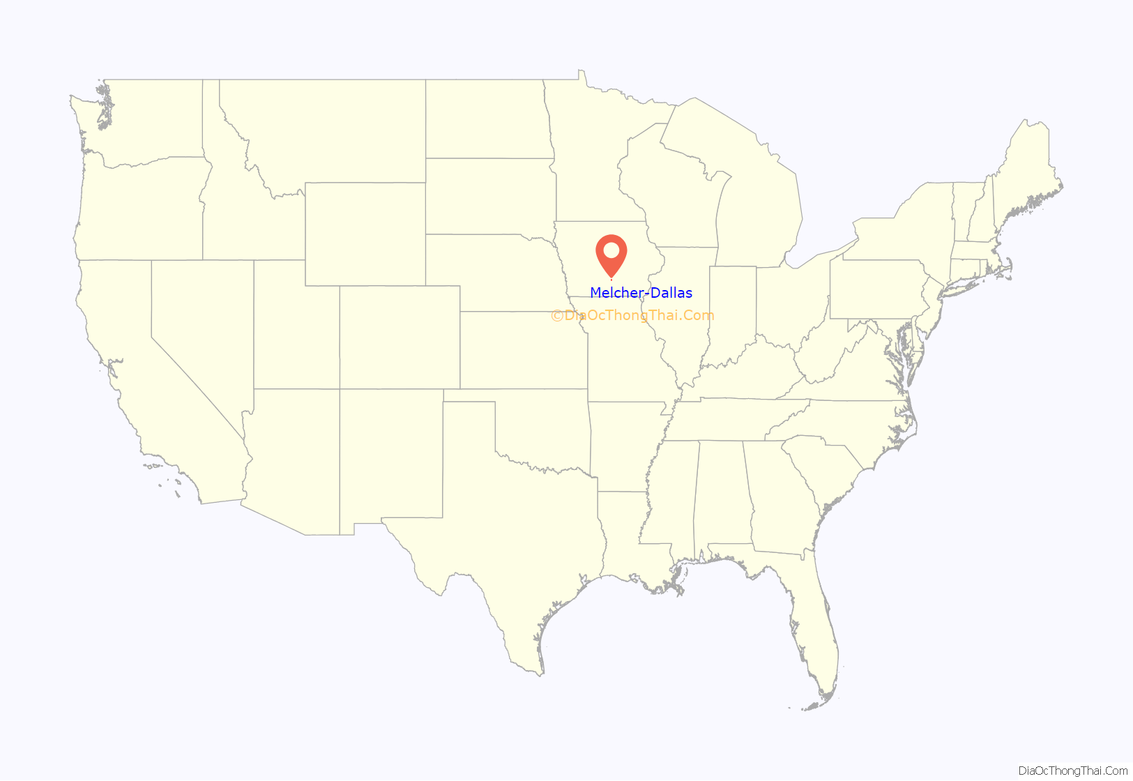
Melcher-Dallas location map. Where is Melcher-Dallas city?
History
In 1919, the Red Rock Coal Company’s mine near Melcher was the third largest coal mine in the state. This mine produced 187,427 tons of coal that year and employed 345 men. Melcher and Dallas were separate cities until they merged into one city in 1986.
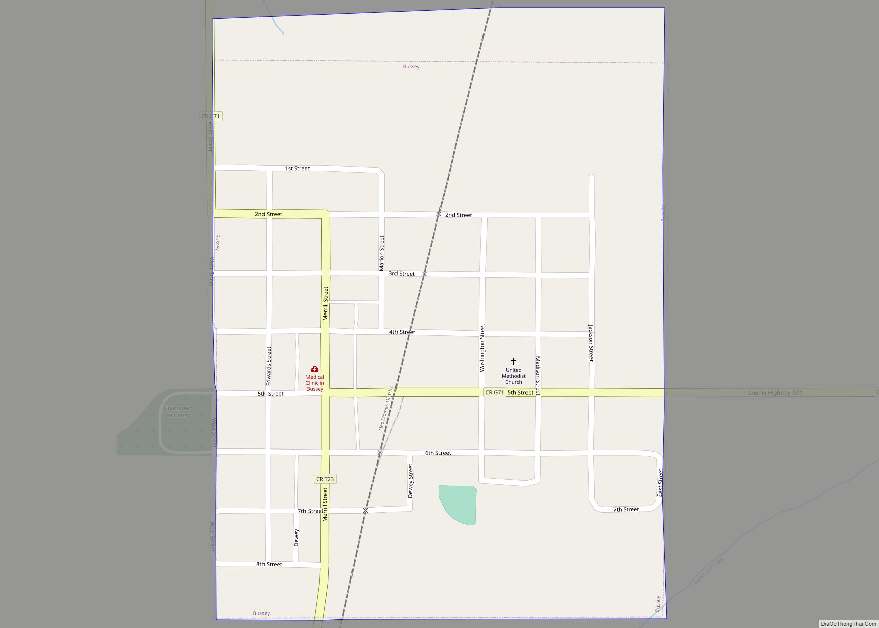
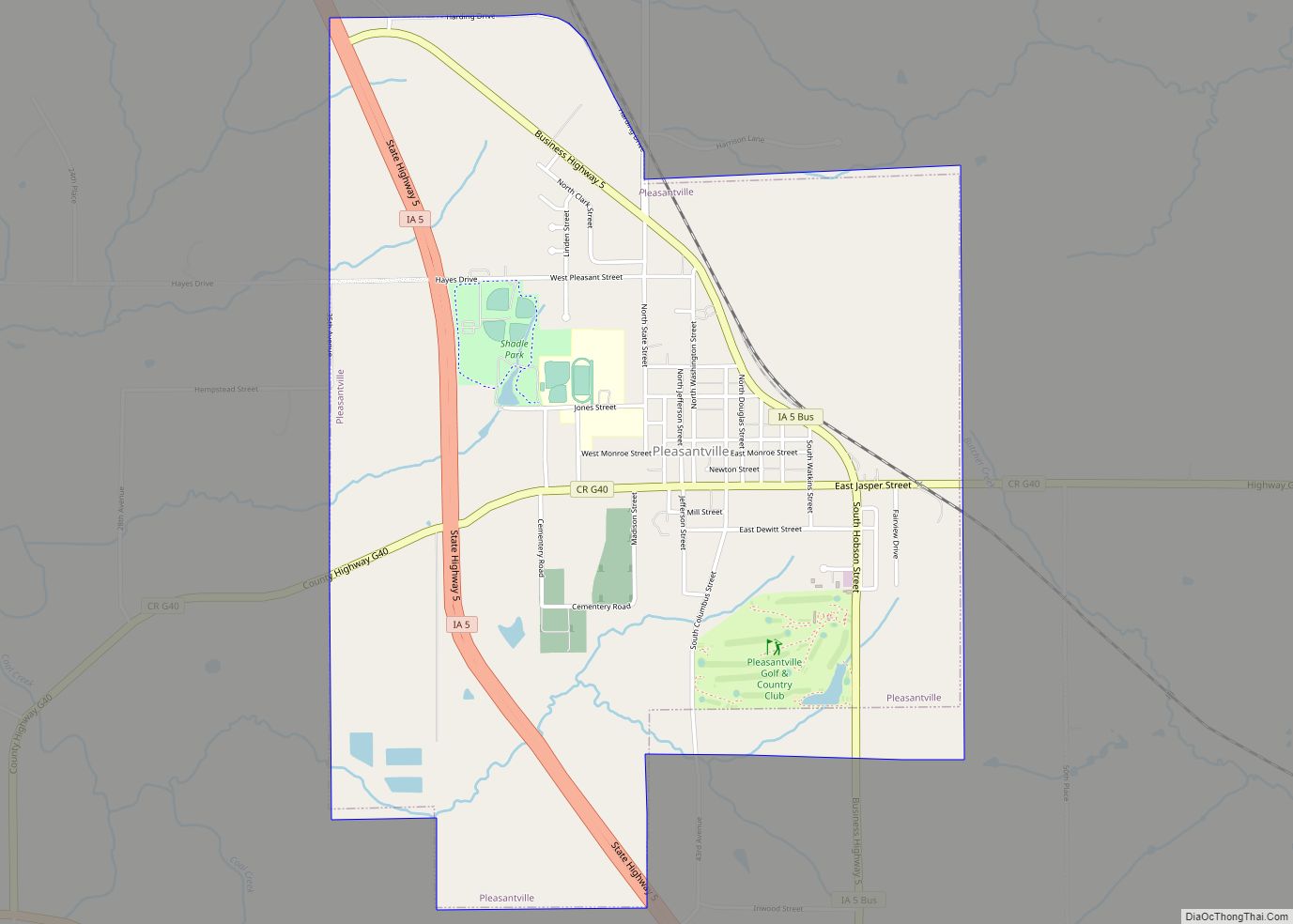
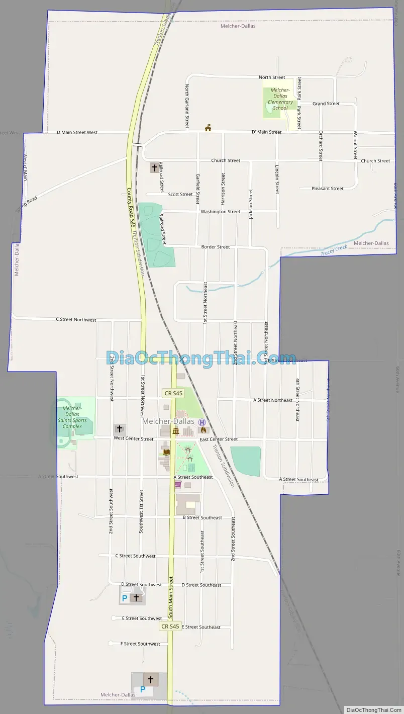
Melcher-Dallas Road Map
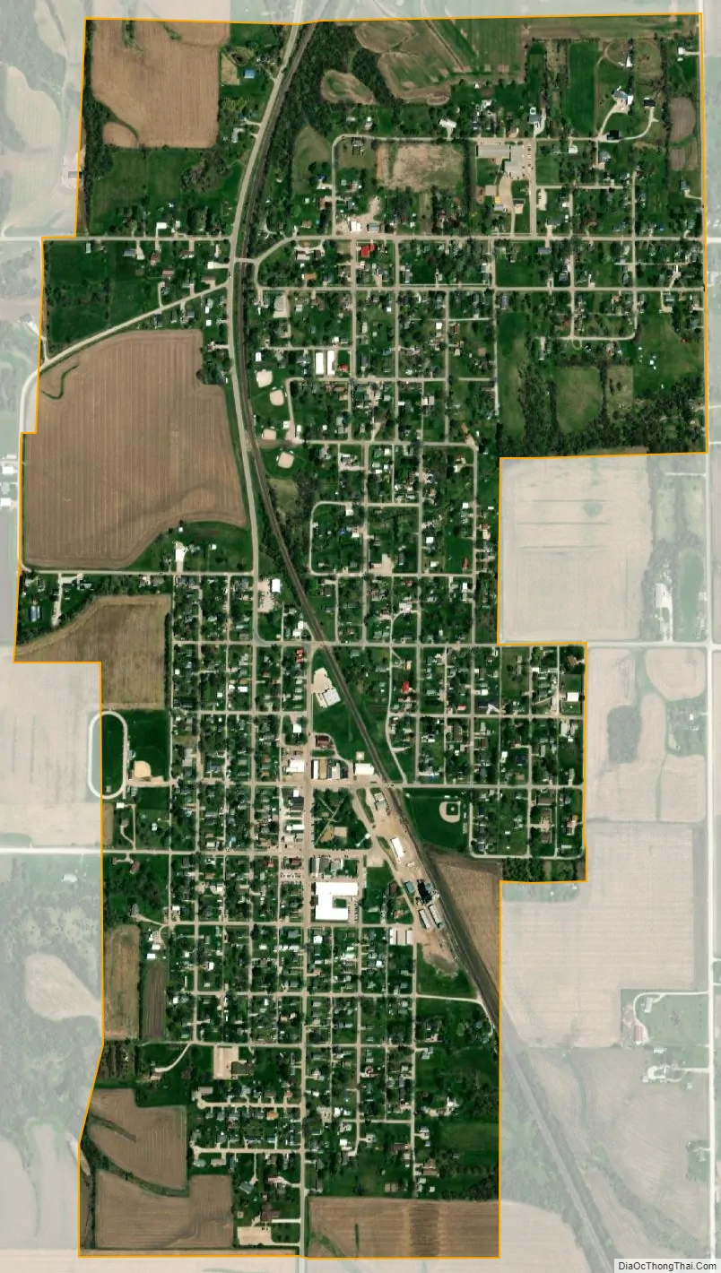
Melcher-Dallas city Satellite Map
Geography
Melcher-Dallas is located at 41°13′36″N 93°14′23″W / 41.22667°N 93.23972°W / 41.22667; -93.23972 (41.226718, -93.239777).
According to the United States Census Bureau, the city has a total area of 1.00 square mile (2.59 km), all of it land.
See also
Map of Iowa State and its subdivision:- Adair
- Adams
- Allamakee
- Appanoose
- Audubon
- Benton
- Black Hawk
- Boone
- Bremer
- Buchanan
- Buena Vista
- Butler
- Calhoun
- Carroll
- Cass
- Cedar
- Cerro Gordo
- Cherokee
- Chickasaw
- Clarke
- Clay
- Clayton
- Clinton
- Crawford
- Dallas
- Davis
- Decatur
- Delaware
- Des Moines
- Dickinson
- Dubuque
- Emmet
- Fayette
- Floyd
- Franklin
- Fremont
- Greene
- Grundy
- Guthrie
- Hamilton
- Hancock
- Hardin
- Harrison
- Henry
- Howard
- Humboldt
- Ida
- Iowa
- Jackson
- Jasper
- Jefferson
- Johnson
- Jones
- Keokuk
- Kossuth
- Lee
- Linn
- Louisa
- Lucas
- Lyon
- Madison
- Mahaska
- Marion
- Marshall
- Mills
- Mitchell
- Monona
- Monroe
- Montgomery
- Muscatine
- O'Brien
- Osceola
- Page
- Palo Alto
- Plymouth
- Pocahontas
- Polk
- Pottawattamie
- Poweshiek
- Ringgold
- Sac
- Scott
- Shelby
- Sioux
- Story
- Tama
- Taylor
- Union
- Van Buren
- Wapello
- Warren
- Washington
- Wayne
- Webster
- Winnebago
- Winneshiek
- Woodbury
- Worth
- Wright
- Alabama
- Alaska
- Arizona
- Arkansas
- California
- Colorado
- Connecticut
- Delaware
- District of Columbia
- Florida
- Georgia
- Hawaii
- Idaho
- Illinois
- Indiana
- Iowa
- Kansas
- Kentucky
- Louisiana
- Maine
- Maryland
- Massachusetts
- Michigan
- Minnesota
- Mississippi
- Missouri
- Montana
- Nebraska
- Nevada
- New Hampshire
- New Jersey
- New Mexico
- New York
- North Carolina
- North Dakota
- Ohio
- Oklahoma
- Oregon
- Pennsylvania
- Rhode Island
- South Carolina
- South Dakota
- Tennessee
- Texas
- Utah
- Vermont
- Virginia
- Washington
- West Virginia
- Wisconsin
- Wyoming