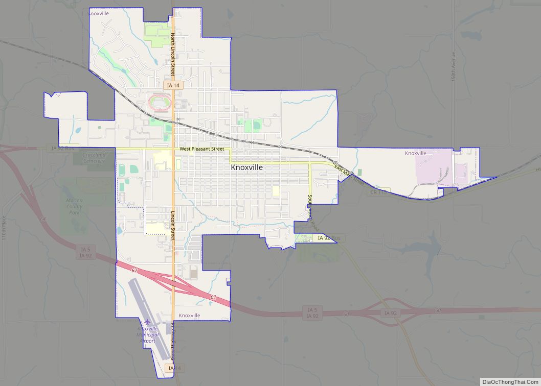
Knoxville is a city in Marion County, Iowa, United States. The population was 7,595 at the time of the 2020 census, an increase from 7,313 in the 2010 census. It is the county seat of Marion County. Knoxville is home of the National Sprint Car Hall of Fame & Museum, located next to the famous Knoxville Raceway dirt track.
| Name: | Knoxville city |
|---|---|
| LSAD Code: | 25 |
| LSAD Description: | city (suffix) |
| State: | Iowa |
| County: | Marion County |
| Elevation: | 909 ft (277 m) |
| Total Area: | 4.62 sq mi (11.97 km²) |
| Land Area: | 4.62 sq mi (11.96 km²) |
| Water Area: | 0.00 sq mi (0.01 km²) |
| Total Population: | 7,595 |
| Population Density: | 1,644.65/sq mi (635.03/km²) |
| ZIP code: | 50138, 50197, 50198 |
| Area code: | 641 |
| FIPS code: | 1942015 |
| GNISfeature ID: | 0458137 |
| Website: | www.knoxvilleia.gov |
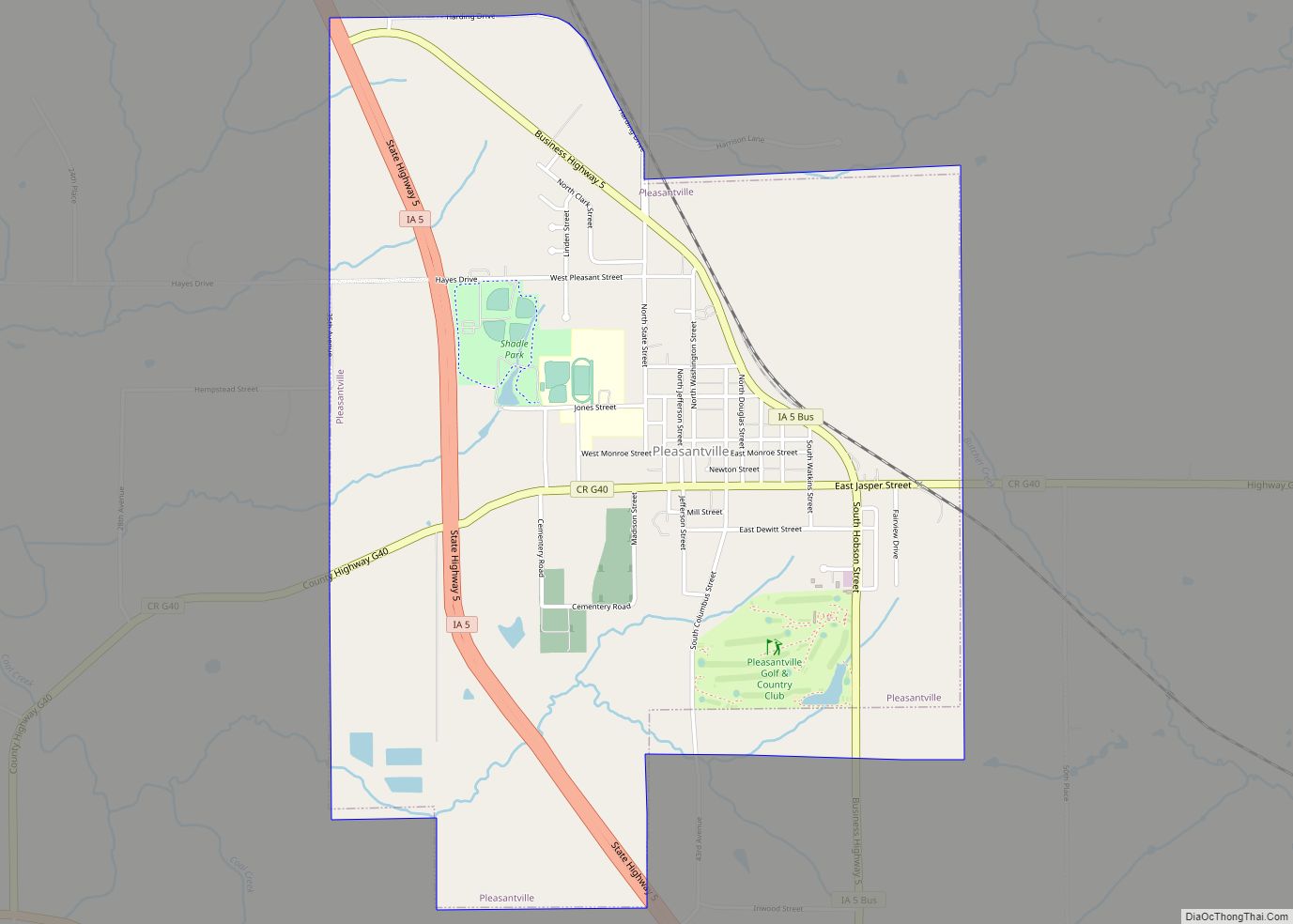
Online Interactive Map
Click on ![]() to view map in "full screen" mode.
to view map in "full screen" mode.
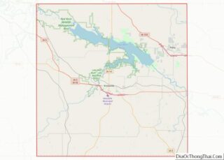
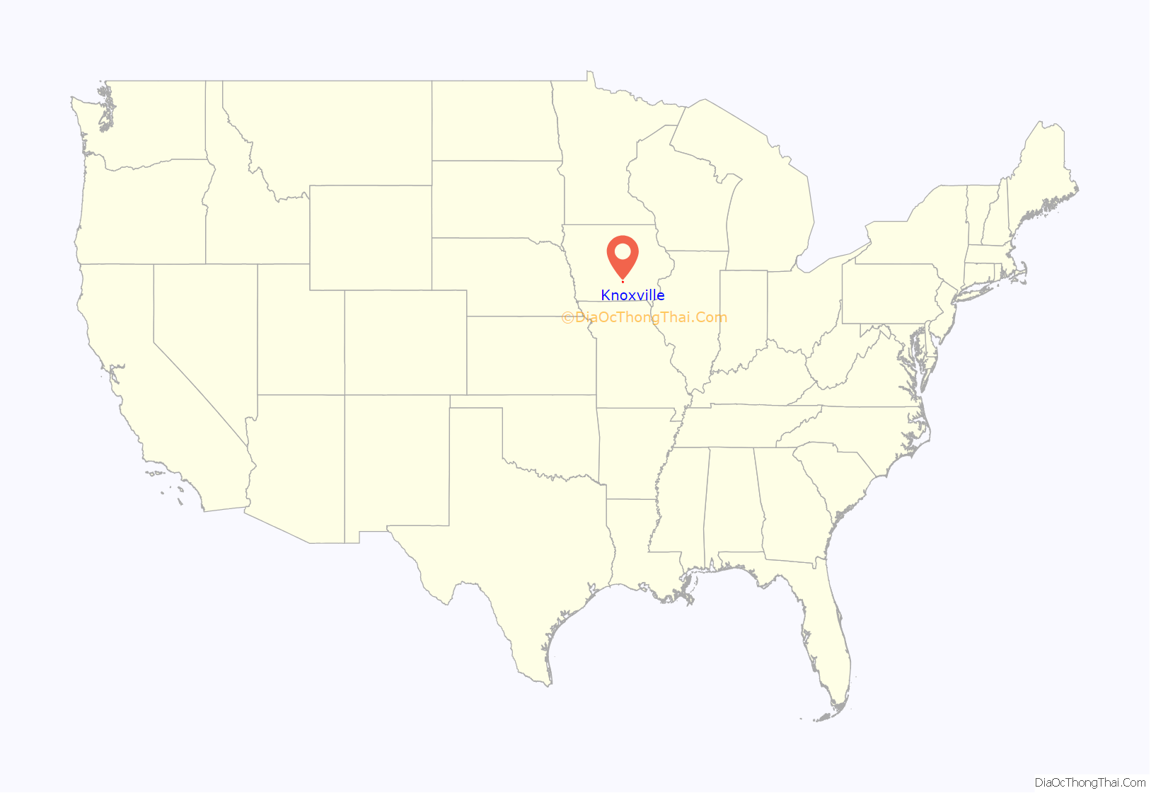
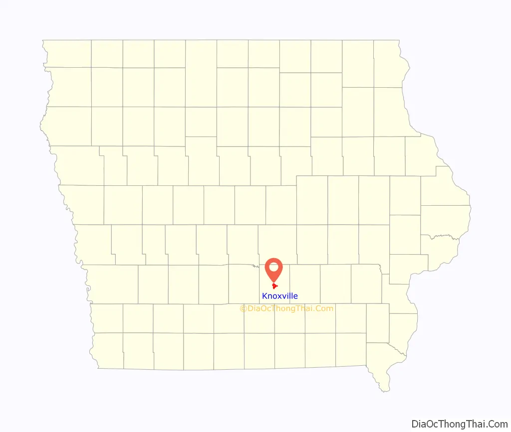
Knoxville location map. Where is Knoxville city?
History
The site for the future county seat of Marion County was selected because it was within a mile of the county’s geographic center, reasonably level, and near a good source of timber.
Knoxville is in south-central Iowa, 35 miles southeast of Des Moines. The area was originally inhabited by Native Americans of the Sac and Fox tribes. At that time, prairie grass covered the countryside at heights of 8 to 10 feet. In 1835, Dragoons first explored the Des Moines River valley through this area. In 1842, the Sac and Fox Indians signed a treaty to sell lands in central Iowa to the new settlers known as the New Purchase of 1842. By 1843, settlers began moving here. The first Marion County Courthouse was erected three years later.
Knoxville was founded in 1845 when Joseph Robinson and James Montgomery, Commissioners from Scott and Wapello County, selected the site for Knoxville and designated it as the county seat. They named Knoxville in honor of General Henry Knox, hero of the Revolutionary War. The city’s main streets are named after Robinson and Montgomery.
County surveyor Isaac B. Powers platted part of the town in September 1845, shortly after it was founded. Clairborne Hall laid out the remainder of the town in the winter of 1846–47. Additional surveys were made in December 1849 and September 1852.
The first sale of lots on October 21, 1845, saw the best sites in town go for $15 to $65. The first survey made the streets 80 feet wide, alleys 10 feet wide, and lots 120’ x 60’, but the third survey changed the width of the streets to 50 feet, and made the blocks 265’ x 240’.
The first Marion County courthouse was built on a lot owned by L.C. Corny. Contractor Lewis M. Pearch started work on May 29, 1846, at a cost of approximately $80,000.
Knoxville remained an unincorporated village until 1853, when a movement for incorporation began. A judicial order was issued after an election in which 64 votes were cast in favor of incorporation, with 4 votes against. Knoxville was duly incorporated as a City in 1855.
In early 1853, the citizens of Marion County created a committee to attract railroad development to the county and to Knoxville, promising to buy shares in any railroad that reached town. The first contender was the Muscatine, Oskaloosa & Council Bluffs, proposing an east–west line that would pass through Knoxville, the line being suggested in January 1868 by the proposed Muscatine, Oskaloosa & Council Bluffs. By 1875, when this line reached Knoxville, it was the Chicago, Burlington & Quincy Railroad. The second railroad to reach Knoxville was the Chicago, Rock Island & Pacific, which completed a line from Oskaloosa in 1876.
Systematic coal mining in Marion County began with the Union Coal Company’s mine in Flagler, 4 miles (6.4 km) east of Knoxville, around 1874 or 1875. For several years, the Number 5 mine in Flagler was one of Iowa’s most productive, employing around 150 men and working a coal vein over 8 feet (2.5 m) thick. The Oak Hill coal company also had mines in Flagler.
Shortly after the railroad reached Knoxville, J. T. James opened a coal mine in town eight blocks north of the courthouse. This mine continued in operation until 1890. A second mine nearby was operated by W. A. Gamble. In the 1880s, the White Breast Fuel Company opened the Number 11 mine at Flagler. This mine operated in a coal vein that was locally up to 14 feet thick, but only locally. The mine continued operating until 1892, working in progressively thinner coal as it expanded.
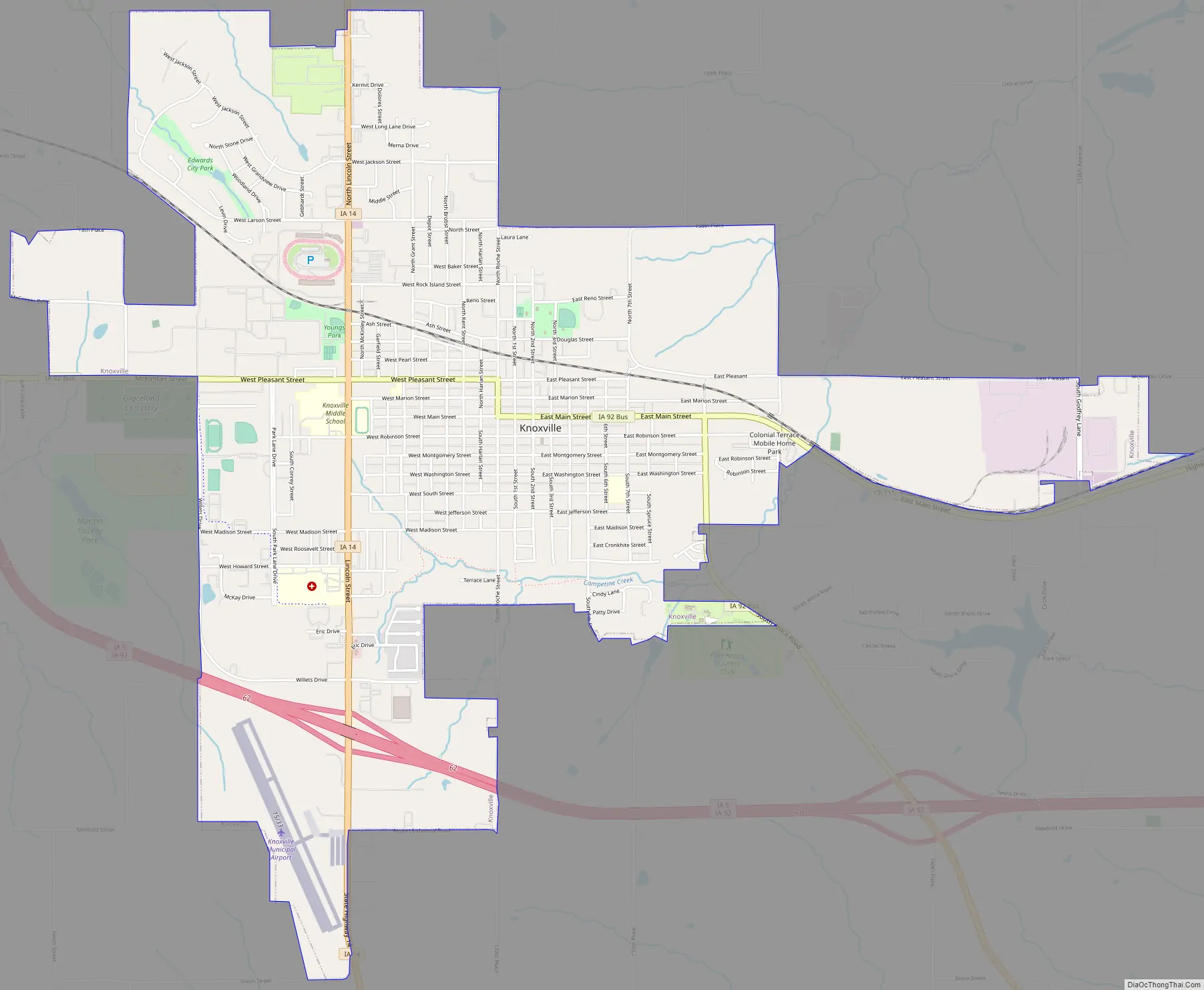
Knoxville Road Map
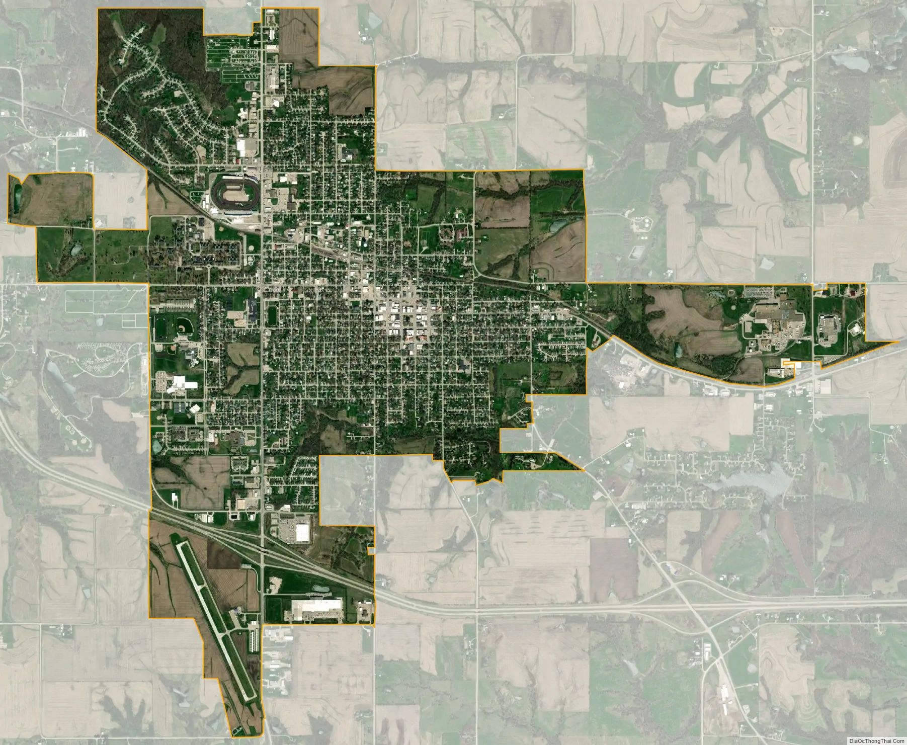
Knoxville city Satellite Map
Geography
Knoxville is in the south-central Iowa. It is 2 miles (3.2 km) east of White Breast Creek and 6 miles southwest of the confluence of White Breast Creek and the Des Moines River in Lake Red Rock, at 41°19′9″N 93°6′5″W / 41.31917°N 93.10139°W / 41.31917; -93.10139 (41.319096, -93.101509).
According to the United States Census Bureau, the city has an area of 4.63 square miles (11.99 km), all land.
See also
Map of Iowa State and its subdivision:- Adair
- Adams
- Allamakee
- Appanoose
- Audubon
- Benton
- Black Hawk
- Boone
- Bremer
- Buchanan
- Buena Vista
- Butler
- Calhoun
- Carroll
- Cass
- Cedar
- Cerro Gordo
- Cherokee
- Chickasaw
- Clarke
- Clay
- Clayton
- Clinton
- Crawford
- Dallas
- Davis
- Decatur
- Delaware
- Des Moines
- Dickinson
- Dubuque
- Emmet
- Fayette
- Floyd
- Franklin
- Fremont
- Greene
- Grundy
- Guthrie
- Hamilton
- Hancock
- Hardin
- Harrison
- Henry
- Howard
- Humboldt
- Ida
- Iowa
- Jackson
- Jasper
- Jefferson
- Johnson
- Jones
- Keokuk
- Kossuth
- Lee
- Linn
- Louisa
- Lucas
- Lyon
- Madison
- Mahaska
- Marion
- Marshall
- Mills
- Mitchell
- Monona
- Monroe
- Montgomery
- Muscatine
- O'Brien
- Osceola
- Page
- Palo Alto
- Plymouth
- Pocahontas
- Polk
- Pottawattamie
- Poweshiek
- Ringgold
- Sac
- Scott
- Shelby
- Sioux
- Story
- Tama
- Taylor
- Union
- Van Buren
- Wapello
- Warren
- Washington
- Wayne
- Webster
- Winnebago
- Winneshiek
- Woodbury
- Worth
- Wright
- Alabama
- Alaska
- Arizona
- Arkansas
- California
- Colorado
- Connecticut
- Delaware
- District of Columbia
- Florida
- Georgia
- Hawaii
- Idaho
- Illinois
- Indiana
- Iowa
- Kansas
- Kentucky
- Louisiana
- Maine
- Maryland
- Massachusetts
- Michigan
- Minnesota
- Mississippi
- Missouri
- Montana
- Nebraska
- Nevada
- New Hampshire
- New Jersey
- New Mexico
- New York
- North Carolina
- North Dakota
- Ohio
- Oklahoma
- Oregon
- Pennsylvania
- Rhode Island
- South Carolina
- South Dakota
- Tennessee
- Texas
- Utah
- Vermont
- Virginia
- Washington
- West Virginia
- Wisconsin
- Wyoming