Montrose is a city in Lee County, Iowa. The population was 738 at the time of the 2020 census. The town is located on the Mississippi River. It is part of the Fort Madison–Keokuk, IA-IL-MO Micropolitan Statistical Area.
| Name: | Montrose city |
|---|---|
| LSAD Code: | 25 |
| LSAD Description: | city (suffix) |
| State: | Iowa |
| County: | Lee County |
| Elevation: | 531 ft (162 m) |
| Total Area: | 1.23 sq mi (3.18 km²) |
| Land Area: | 1.21 sq mi (3.13 km²) |
| Water Area: | 0.02 sq mi (0.04 km²) |
| Total Population: | 738 |
| Population Density: | 610.42/sq mi (235.60/km²) |
| ZIP code: | 52639 |
| Area code: | 319 |
| FIPS code: | 1953760 |
| GNISfeature ID: | 0459199 |
Online Interactive Map
Click on ![]() to view map in "full screen" mode.
to view map in "full screen" mode.
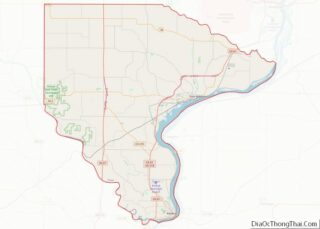
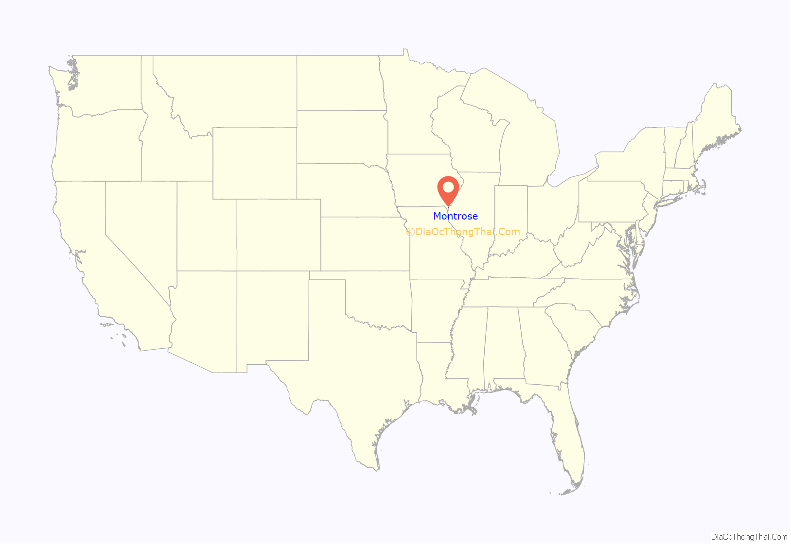
Montrose location map. Where is Montrose city?

History
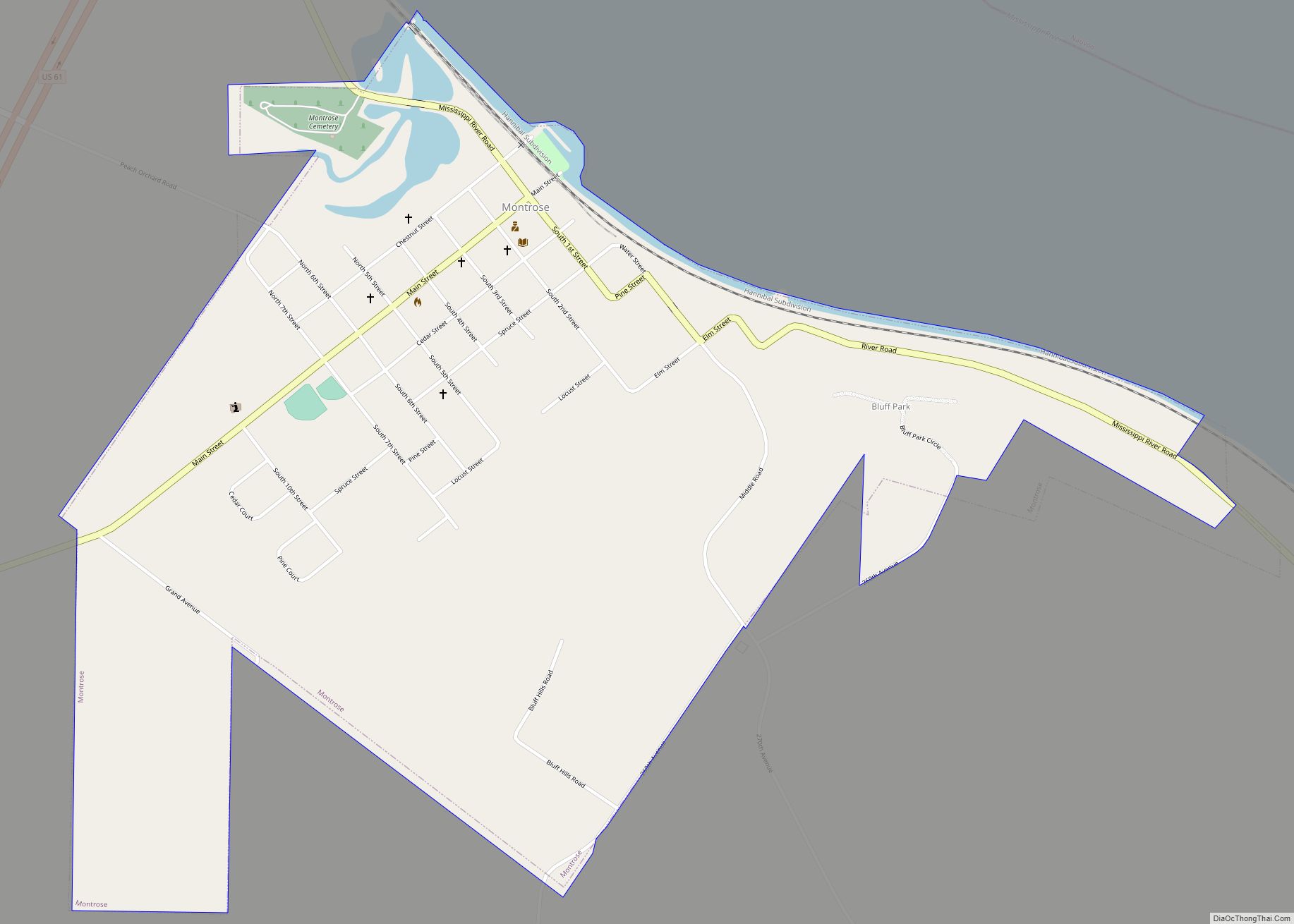
The area around Montrose has been occupied continuously since at least the 1780s, when Quashquame’s village was established nearby. The area was strategically important because it is at the head of the Des Moines Rapids, a major impediment to river traffic that caused large boats to land in this area and transfer freight overland to avoid the rapids. Montrose was the location of Fort Des Moines No. 1, a military post from 1834 to 1837. From 1839 to 1846 Montrose was the home of many members of the Church of Jesus Christ of Latter Day Saints. This was especially true in 1839 when many people lived in an abandoned barracks at Montrose that served as a good short term residence while homes were being built in Nauvoo. Among Montrose’s residents at this time were Brigham Young, Wilford Woodruff and Erastus Snow. Despite legends that the streets of Montrose were aligned to allow a direct view of the Nauvoo Temple across the Mississippi River in Illinois, the streets actually align with the 1834 layout of Fort Des Moines.
Montrose Road Map
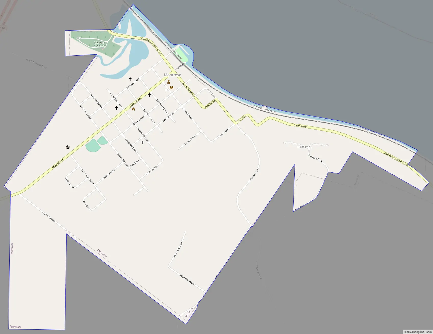
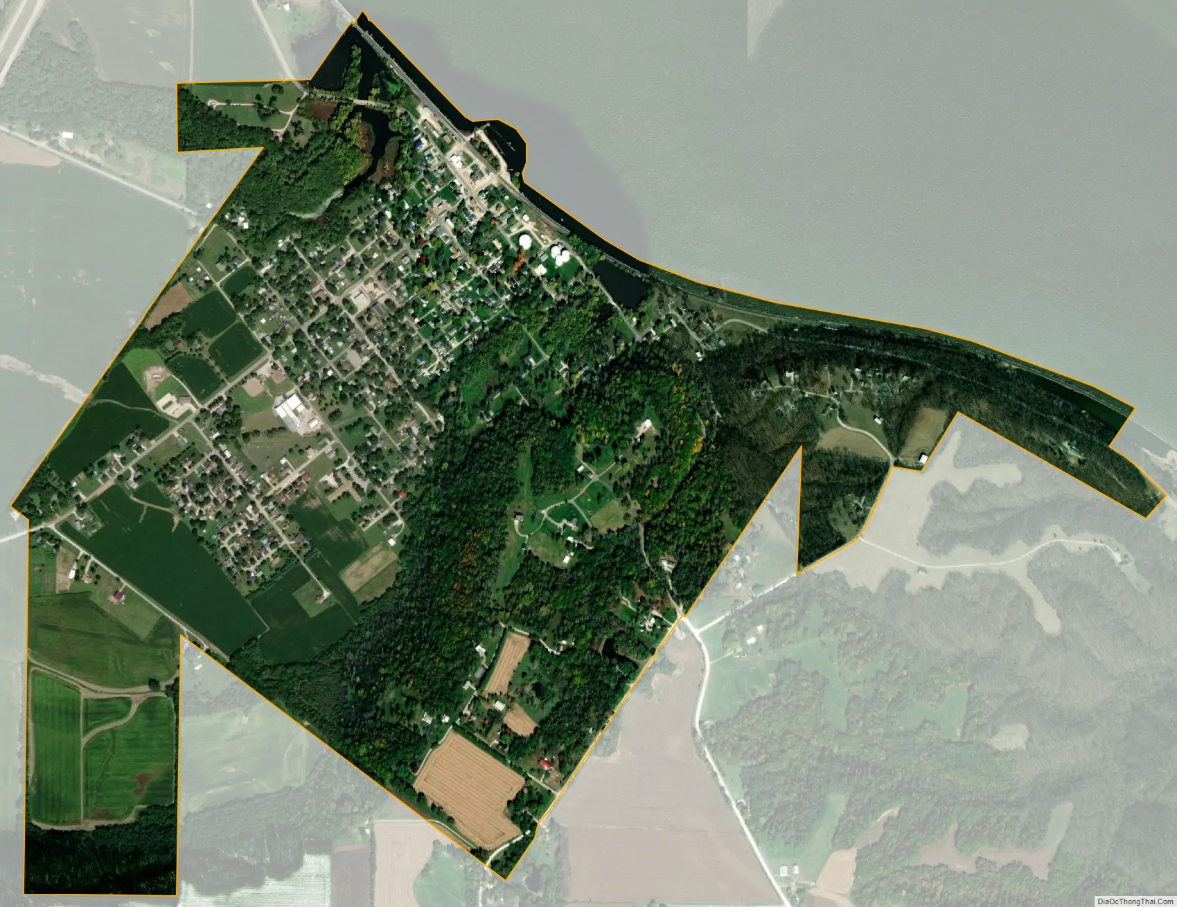
Montrose city Satellite Map
Geography
Montrose’s longitude and latitude coordinates
in decimal form are 40.529532, -91.415995.
According to the United States Census Bureau, the city has a total area of 1.14 square miles (2.95 km), of which 1.12 square miles (2.90 km) is land and 0.02 square miles (0.05 km) is water.
See also
Map of Iowa State and its subdivision:- Adair
- Adams
- Allamakee
- Appanoose
- Audubon
- Benton
- Black Hawk
- Boone
- Bremer
- Buchanan
- Buena Vista
- Butler
- Calhoun
- Carroll
- Cass
- Cedar
- Cerro Gordo
- Cherokee
- Chickasaw
- Clarke
- Clay
- Clayton
- Clinton
- Crawford
- Dallas
- Davis
- Decatur
- Delaware
- Des Moines
- Dickinson
- Dubuque
- Emmet
- Fayette
- Floyd
- Franklin
- Fremont
- Greene
- Grundy
- Guthrie
- Hamilton
- Hancock
- Hardin
- Harrison
- Henry
- Howard
- Humboldt
- Ida
- Iowa
- Jackson
- Jasper
- Jefferson
- Johnson
- Jones
- Keokuk
- Kossuth
- Lee
- Linn
- Louisa
- Lucas
- Lyon
- Madison
- Mahaska
- Marion
- Marshall
- Mills
- Mitchell
- Monona
- Monroe
- Montgomery
- Muscatine
- O'Brien
- Osceola
- Page
- Palo Alto
- Plymouth
- Pocahontas
- Polk
- Pottawattamie
- Poweshiek
- Ringgold
- Sac
- Scott
- Shelby
- Sioux
- Story
- Tama
- Taylor
- Union
- Van Buren
- Wapello
- Warren
- Washington
- Wayne
- Webster
- Winnebago
- Winneshiek
- Woodbury
- Worth
- Wright
- Alabama
- Alaska
- Arizona
- Arkansas
- California
- Colorado
- Connecticut
- Delaware
- District of Columbia
- Florida
- Georgia
- Hawaii
- Idaho
- Illinois
- Indiana
- Iowa
- Kansas
- Kentucky
- Louisiana
- Maine
- Maryland
- Massachusetts
- Michigan
- Minnesota
- Mississippi
- Missouri
- Montana
- Nebraska
- Nevada
- New Hampshire
- New Jersey
- New Mexico
- New York
- North Carolina
- North Dakota
- Ohio
- Oklahoma
- Oregon
- Pennsylvania
- Rhode Island
- South Carolina
- South Dakota
- Tennessee
- Texas
- Utah
- Vermont
- Virginia
- Washington
- West Virginia
- Wisconsin
- Wyoming