Twin Lakes is an unincorporated community and census-designated place (CDP) in Twin Lakes and Sherman townships in Calhoun County, Iowa, United States. As of the 2010 census it had a population of 334.
| Name: | Twin Lakes CDP |
|---|---|
| LSAD Code: | 57 |
| LSAD Description: | CDP (suffix) |
| State: | Iowa |
| County: | Calhoun County |
| Elevation: | 1,214 ft (370 m) |
| Total Area: | 2.82 sq mi (7.31 km²) |
| Land Area: | 1.32 sq mi (3.42 km²) |
| Water Area: | 1.50 sq mi (3.89 km²) |
| Total Population: | 316 |
| Population Density: | 239.03/sq mi (92.31/km²) |
| FIPS code: | 1979335 |
| GNISfeature ID: | 2631657 |
Online Interactive Map
Click on ![]() to view map in "full screen" mode.
to view map in "full screen" mode.
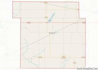
Twin Lakes location map. Where is Twin Lakes CDP?
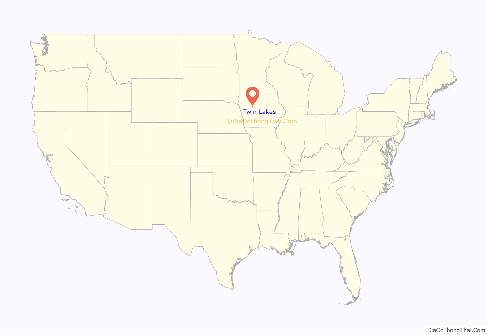
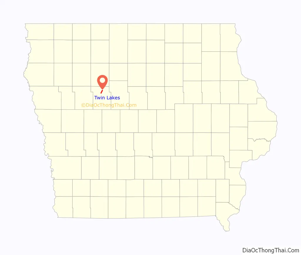
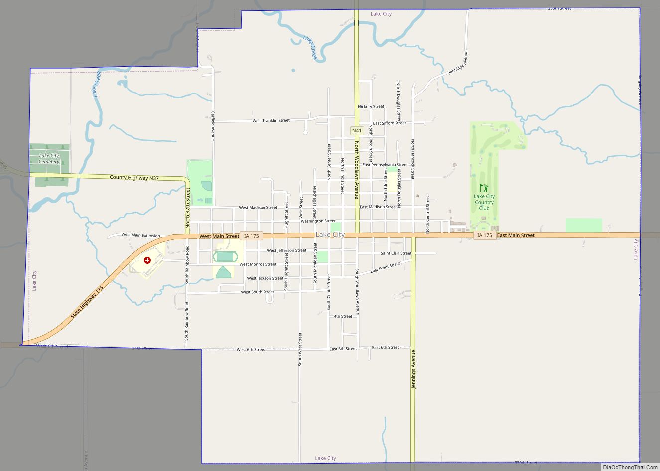
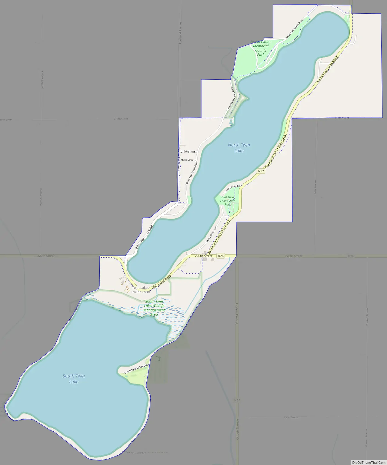
Twin Lakes Road Map
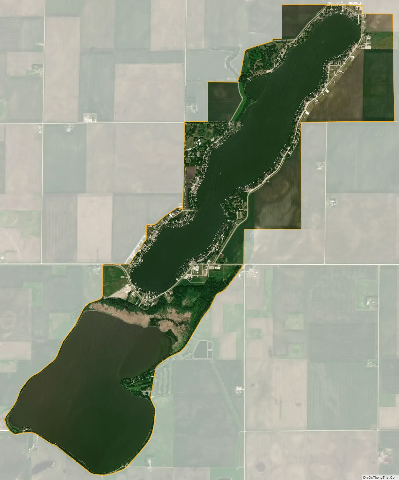
Twin Lakes city Satellite Map
Geography
The CDP consists of lakefront communities surrounding two lakes, North Twin Lake and South Twin Lake. The lakes, which do not have a discernible surface outlet, are part of the North Raccoon River watershed, a tributary of the Des Moines River. Twin Lakes State Park occupies the surface area of the two lakes plus small portions of the shoreline.
U.S. Route 20 runs just south of the southern edge of the CDP, leading east 26 miles (42 km) to Fort Dodge and west 90 miles (140 km) to Sioux City. Rockwell City, the Calhoun County seat, is 6 miles (10 km) to the south.
See also
Map of Iowa State and its subdivision:- Adair
- Adams
- Allamakee
- Appanoose
- Audubon
- Benton
- Black Hawk
- Boone
- Bremer
- Buchanan
- Buena Vista
- Butler
- Calhoun
- Carroll
- Cass
- Cedar
- Cerro Gordo
- Cherokee
- Chickasaw
- Clarke
- Clay
- Clayton
- Clinton
- Crawford
- Dallas
- Davis
- Decatur
- Delaware
- Des Moines
- Dickinson
- Dubuque
- Emmet
- Fayette
- Floyd
- Franklin
- Fremont
- Greene
- Grundy
- Guthrie
- Hamilton
- Hancock
- Hardin
- Harrison
- Henry
- Howard
- Humboldt
- Ida
- Iowa
- Jackson
- Jasper
- Jefferson
- Johnson
- Jones
- Keokuk
- Kossuth
- Lee
- Linn
- Louisa
- Lucas
- Lyon
- Madison
- Mahaska
- Marion
- Marshall
- Mills
- Mitchell
- Monona
- Monroe
- Montgomery
- Muscatine
- O'Brien
- Osceola
- Page
- Palo Alto
- Plymouth
- Pocahontas
- Polk
- Pottawattamie
- Poweshiek
- Ringgold
- Sac
- Scott
- Shelby
- Sioux
- Story
- Tama
- Taylor
- Union
- Van Buren
- Wapello
- Warren
- Washington
- Wayne
- Webster
- Winnebago
- Winneshiek
- Woodbury
- Worth
- Wright
- Alabama
- Alaska
- Arizona
- Arkansas
- California
- Colorado
- Connecticut
- Delaware
- District of Columbia
- Florida
- Georgia
- Hawaii
- Idaho
- Illinois
- Indiana
- Iowa
- Kansas
- Kentucky
- Louisiana
- Maine
- Maryland
- Massachusetts
- Michigan
- Minnesota
- Mississippi
- Missouri
- Montana
- Nebraska
- Nevada
- New Hampshire
- New Jersey
- New Mexico
- New York
- North Carolina
- North Dakota
- Ohio
- Oklahoma
- Oregon
- Pennsylvania
- Rhode Island
- South Carolina
- South Dakota
- Tennessee
- Texas
- Utah
- Vermont
- Virginia
- Washington
- West Virginia
- Wisconsin
- Wyoming