Wadena is a city in Fayette County, Iowa, United States. The population was 209 at the time of the 2020 census.
Wadena’s electricity is supplied by Alliant Energy. Its land-line phone and DSL internet service is provided by Windstream. Cellular phone service is mainly provided by U.S. Cellular, as they have a tower located just east of town. Wadena is located in a valley and other cellular phone providers have spotty coverage in town. Wadena no longer has a cable television provider. Any cable television services must be obtained through satellite service providers such as Dish Network or DirecTV.
Wadena is remembered in Iowa for the Woodstock-like rock festival held on a nearby farm, August 1–3, 1970. It also held a second rock-fest in late July 1995, which met with less success and notoriety than the original event.
Wadena is also known for its lighted cross, which is located on the hill south of town. The cross overlooks Wadena and was erected during the bi-centennial celebrations in 1976. The lighted cross is maintained entirely by donations. Further, the Barney Burger is a popular attraction in Wadena.
Wadena is one of the towns that make up the North Fayette Valley School System. In 2013, the Valley Community School District entered a Whole-Grade Sharing Agreement with neighboring North Fayette CSD to become North Fayette Valley. The new mascot is the Tigerhawk, a combination of both schools’ former mascots, the Valley Tigers and the North Fayette Hawks. Grades 9-12 are located in West Union at the North Fayette Valley High School. Grades 7-8 are located at the North Fayette Valley Middle School between Elgin and Clermont. Unless open enrolled out, all elementary students in Wadena will attend Valley Elementary, located in the same building as the NFV Middle School.
| Name: | Wadena city |
|---|---|
| LSAD Code: | 25 |
| LSAD Description: | city (suffix) |
| State: | Iowa |
| County: | Fayette County |
| Elevation: | 883 ft (269 m) |
| Total Area: | 0.75 sq mi (1.95 km²) |
| Land Area: | 0.75 sq mi (1.95 km²) |
| Water Area: | 0.00 sq mi (0.00 km²) |
| Total Population: | 209 |
| Population Density: | 277.93/sq mi (107.31/km²) |
| ZIP code: | 52169 |
| Area code: | 563 |
| FIPS code: | 1981570 |
| GNISfeature ID: | 0462599 |
| Website: | www.wadenaiowa.com |
Online Interactive Map
Click on ![]() to view map in "full screen" mode.
to view map in "full screen" mode.
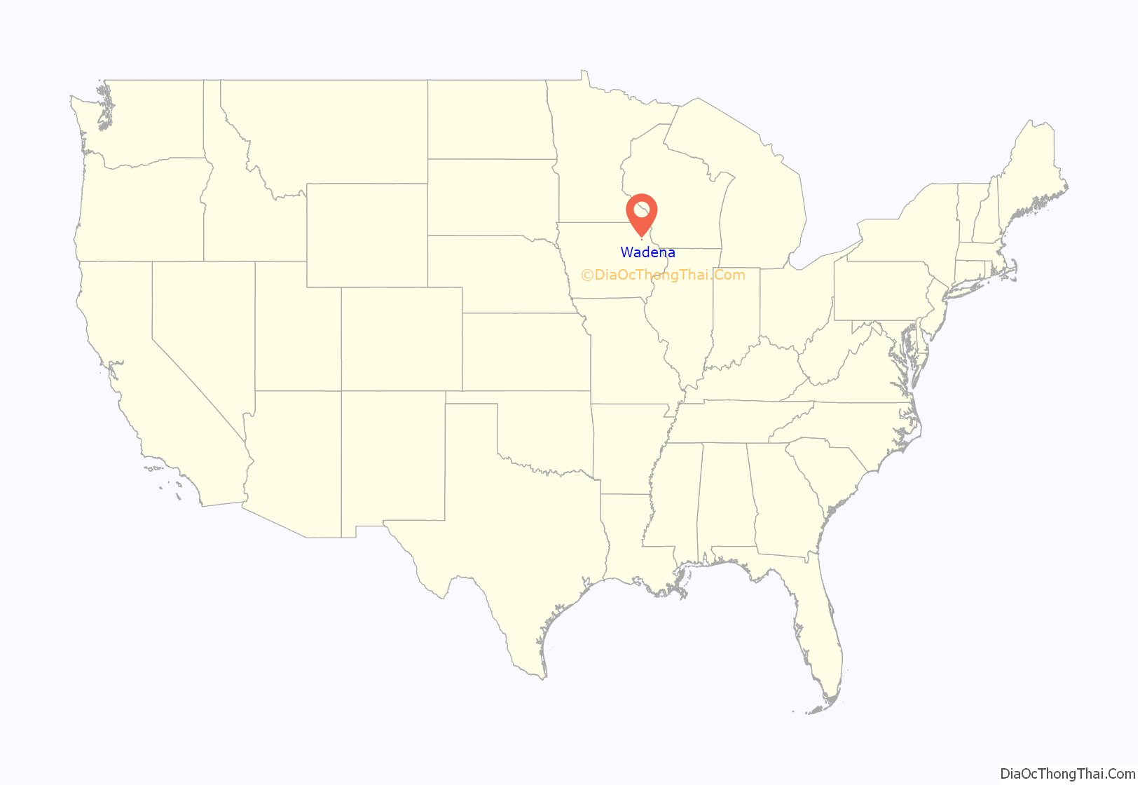
Wadena location map. Where is Wadena city?

Wadena Road Map
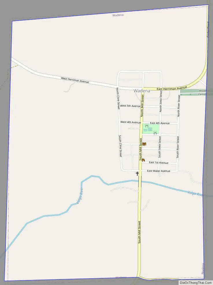
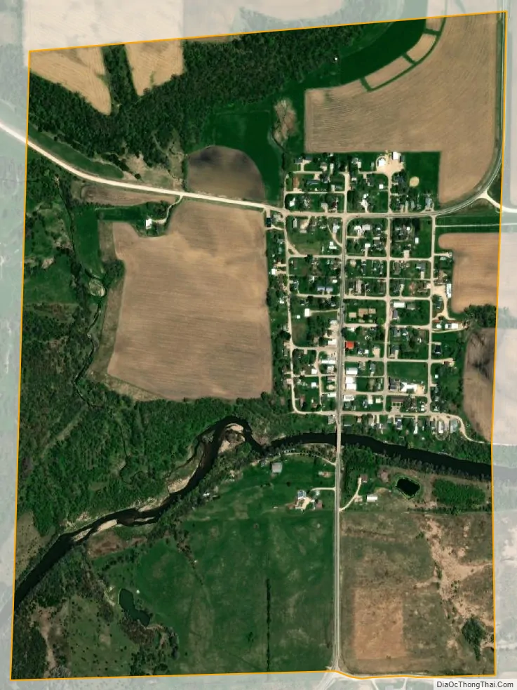
Wadena city Satellite Map
Geography
Wadena is located at 42°50′26″N 91°39′23″W / 42.84056°N 91.65639°W / 42.84056; -91.65639 (42.840464, -91.656473).
Wadena is located along Iowa County Road W51, two miles south of Iowa State Route 56. It is located in Iowa’s Driftless Area.
According to the United States Census Bureau, the city has a total area of 0.74 square miles (1.92 km), all land.
The Volga River is located on the south side of the city.
See also
Map of Iowa State and its subdivision:- Adair
- Adams
- Allamakee
- Appanoose
- Audubon
- Benton
- Black Hawk
- Boone
- Bremer
- Buchanan
- Buena Vista
- Butler
- Calhoun
- Carroll
- Cass
- Cedar
- Cerro Gordo
- Cherokee
- Chickasaw
- Clarke
- Clay
- Clayton
- Clinton
- Crawford
- Dallas
- Davis
- Decatur
- Delaware
- Des Moines
- Dickinson
- Dubuque
- Emmet
- Fayette
- Floyd
- Franklin
- Fremont
- Greene
- Grundy
- Guthrie
- Hamilton
- Hancock
- Hardin
- Harrison
- Henry
- Howard
- Humboldt
- Ida
- Iowa
- Jackson
- Jasper
- Jefferson
- Johnson
- Jones
- Keokuk
- Kossuth
- Lee
- Linn
- Louisa
- Lucas
- Lyon
- Madison
- Mahaska
- Marion
- Marshall
- Mills
- Mitchell
- Monona
- Monroe
- Montgomery
- Muscatine
- O'Brien
- Osceola
- Page
- Palo Alto
- Plymouth
- Pocahontas
- Polk
- Pottawattamie
- Poweshiek
- Ringgold
- Sac
- Scott
- Shelby
- Sioux
- Story
- Tama
- Taylor
- Union
- Van Buren
- Wapello
- Warren
- Washington
- Wayne
- Webster
- Winnebago
- Winneshiek
- Woodbury
- Worth
- Wright
- Alabama
- Alaska
- Arizona
- Arkansas
- California
- Colorado
- Connecticut
- Delaware
- District of Columbia
- Florida
- Georgia
- Hawaii
- Idaho
- Illinois
- Indiana
- Iowa
- Kansas
- Kentucky
- Louisiana
- Maine
- Maryland
- Massachusetts
- Michigan
- Minnesota
- Mississippi
- Missouri
- Montana
- Nebraska
- Nevada
- New Hampshire
- New Jersey
- New Mexico
- New York
- North Carolina
- North Dakota
- Ohio
- Oklahoma
- Oregon
- Pennsylvania
- Rhode Island
- South Carolina
- South Dakota
- Tennessee
- Texas
- Utah
- Vermont
- Virginia
- Washington
- West Virginia
- Wisconsin
- Wyoming