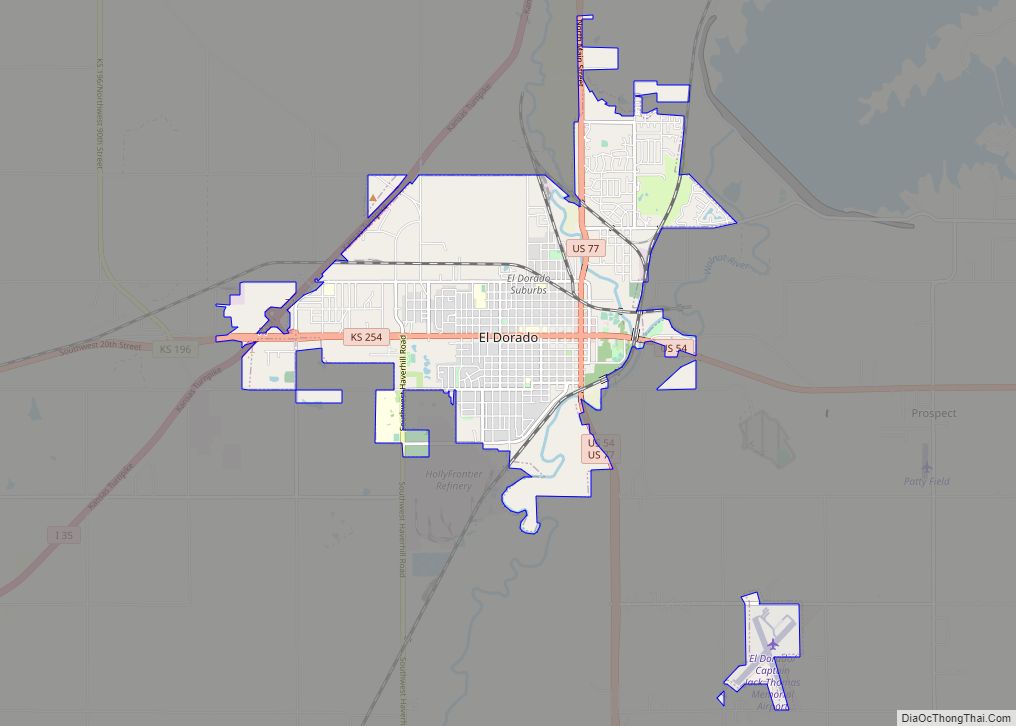
El Dorado (/ˌɛldəˈreɪdoʊ/ EL-də-RAY-doh) is city and county seat of Butler County, Kansas, United States. It is situated along the Walnut River in the central part of Butler County and located in south-central Kansas. As of the 2020 census, the population of the city was 12,870. It is home to Butler Community College.
| Name: | El Dorado city |
|---|---|
| LSAD Code: | 25 |
| LSAD Description: | city (suffix) |
| State: | Kansas |
| County: | Butler County |
| Founded: | 1860s |
| Incorporated: | 1871 |
| Elevation: | 1,342 ft (409 m) |
| Total Area: | 9.20 sq mi (23.82 km²) |
| Land Area: | 9.16 sq mi (23.72 km²) |
| Water Area: | 0.04 sq mi (0.09 km²) 0.67% |
| Total Population: | 12,870 |
| Population Density: | 1,400/sq mi (540/km²) |
| ZIP code: | 67042 |
| Area code: | 316 |
| FIPS code: | 2020075 |
| Website: | eldoks.com |
Online Interactive Map
Click on ![]() to view map in "full screen" mode.
to view map in "full screen" mode.
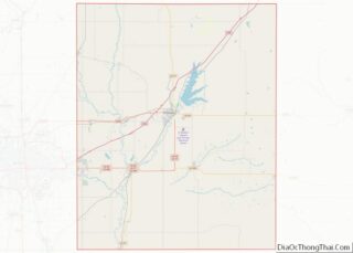
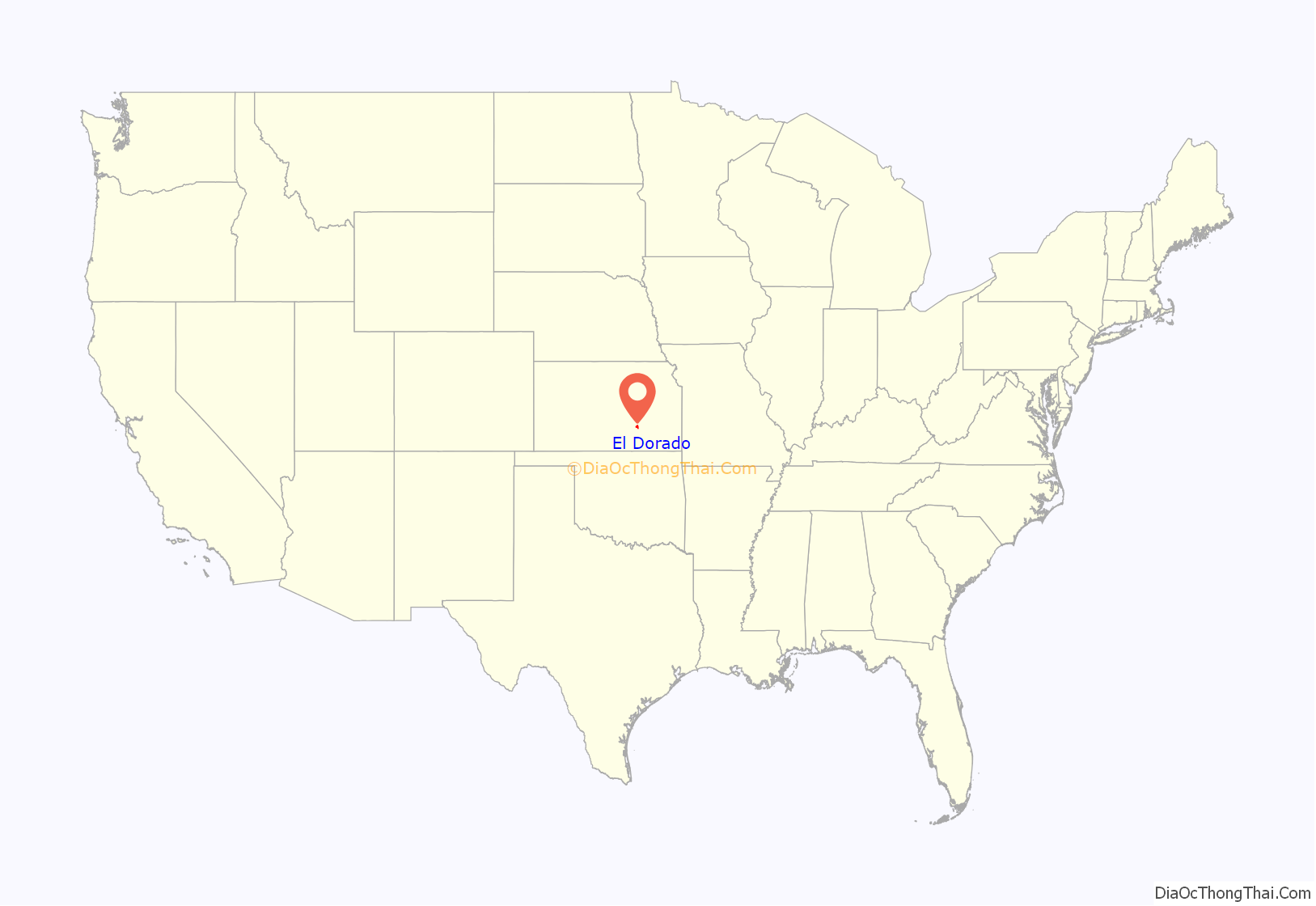
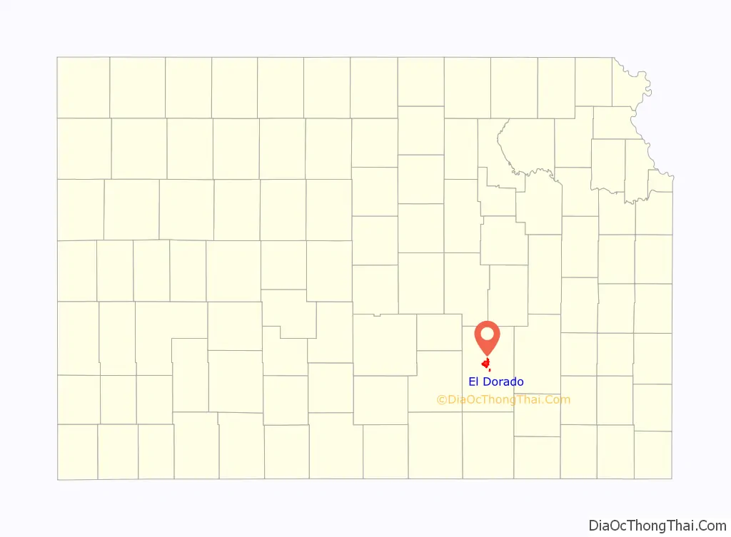
El Dorado location map. Where is El Dorado city?
History
El Dorado was laid out and platted in 1868. The name is of Spanish origin meaning “golden land”. El Dorado was incorporated in 1870.
In 1877, the Florence, El Dorado, and Walnut Valley Railroad Company built a branch line from Florence to El Dorado; in 1881 it was extended to Douglass, and later to Arkansas City. The line was leased and operated by the Atchison, Topeka and Santa Fe Railway. The line from Florence to El Dorado was abandoned in 1942. The original branch line connected Florence, Burns, De Graff, El Dorado, Augusta, Douglass, Rock, Akron, Winfield, and Arkansas City.
In 1915, the El Dorado Oil Field was the first oil field that was found using science/geologic mapping, and part of the Mid-Continent oil province. By 1918, the El Dorado Oil Field was the largest single field producer in the United States, and was responsible for 12.8% of national oil production and 9% of the world production. It was deemed by some as “the oil field that won World War I”.
In 1916, there was an anti-black race riot in El Dorado after an incident between a black shoe shiner and a white oil worker. Large numbers of black families removed their household goods and moved out of El Dorado.
In 1943, German and Italian prisoners of World War II were brought to Kansas and other Midwest states as a means of solving the labor shortage caused by American men serving in the war effort. Large internment camps were established in Kansas: Camp Concordia, Camp Funston (at Fort Riley), Camp Phillips (at Salina under Fort Riley). Fort Riley established 12 smaller branch camps, including El Dorado. Prisoners commonly volunteered to help work on local farms; this enabled them to spend time outside the camp, socialize and eat better food than that provided by prison guards. In some cases, smaller structures constructed by the work details still stand.
On June 10, 1958, a tornado hit El Dorado and killed 13 people. In 2008, the city built a memorial at Graham Park in remembrance of the dead.
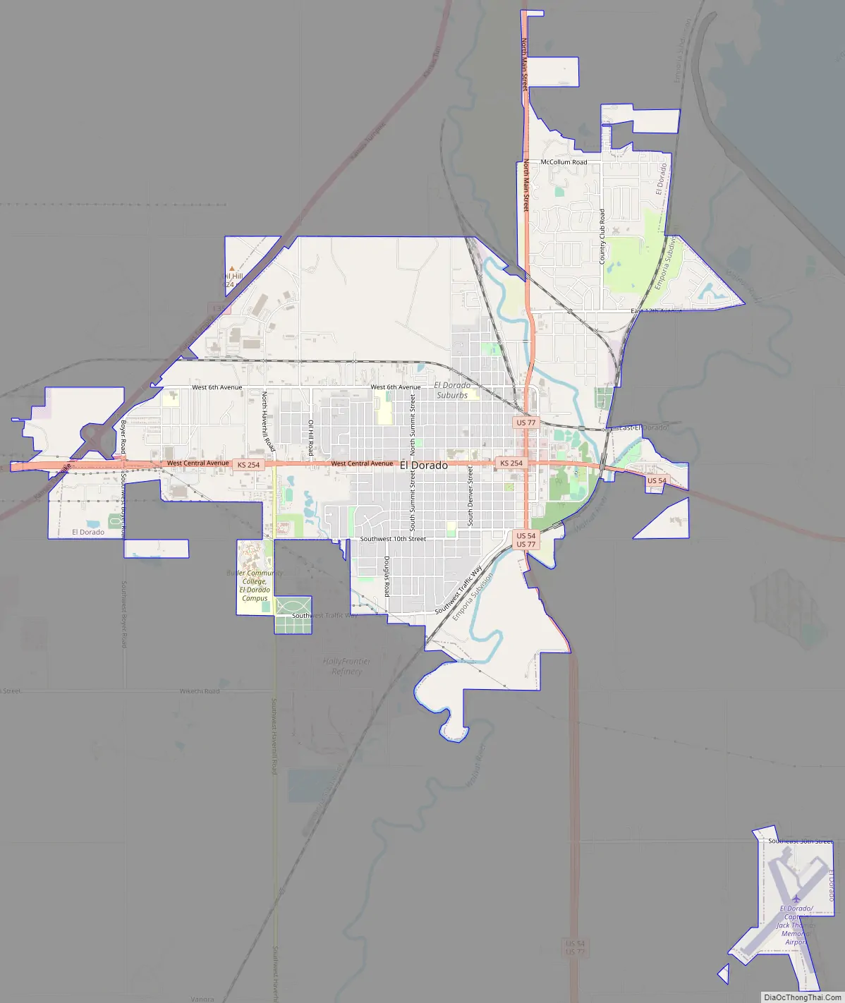
El Dorado Road Map
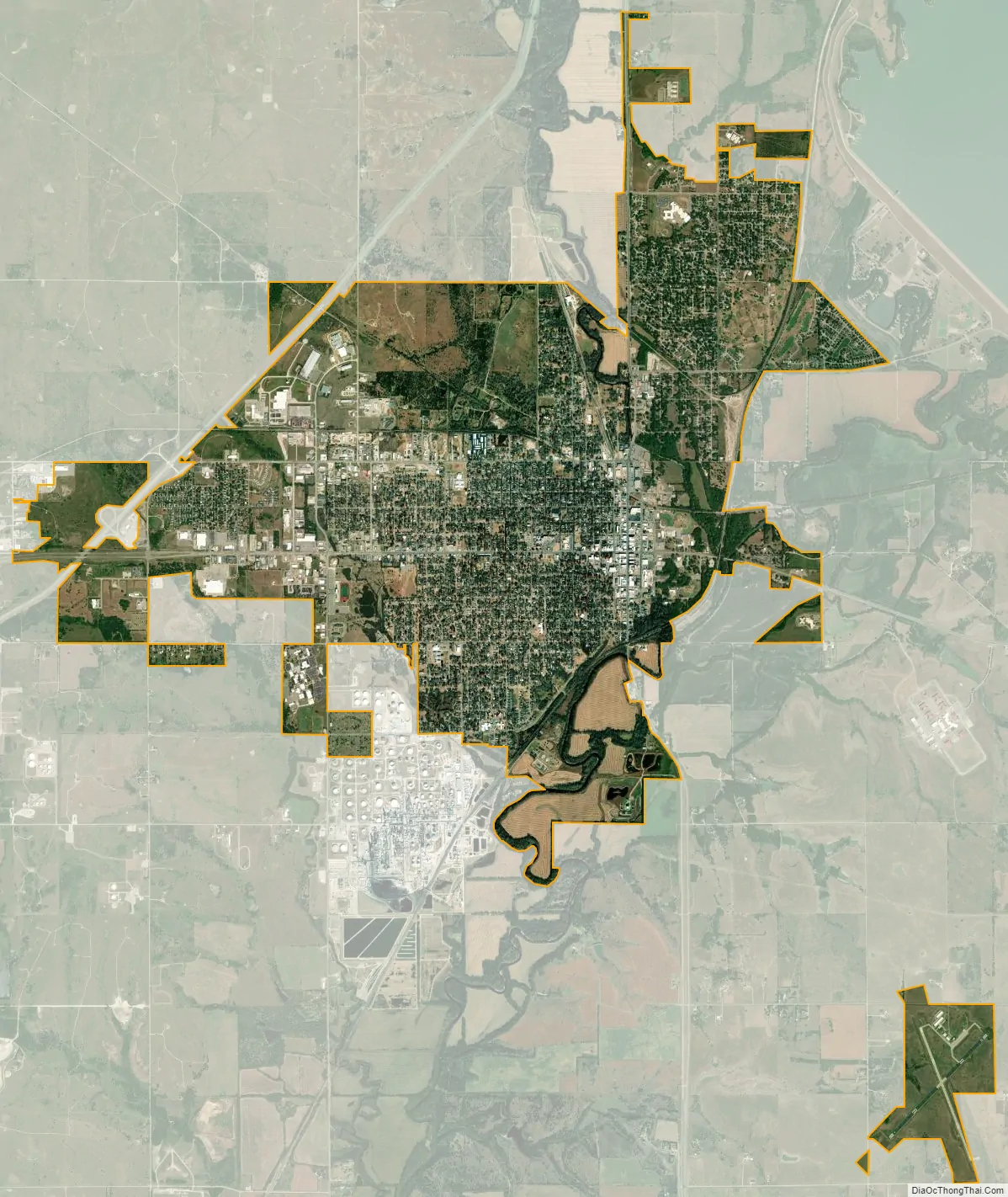
El Dorado city Satellite Map
Geography
El Dorado is located at 37°49′16″N 96°51′30″W / 37.82111°N 96.85833°W / 37.82111; -96.85833 (37.821117, −96.858281). The city is situated along the western bank of the Walnut River, southwest of El Dorado Lake. It is located 30 miles (48 km) east-northeast of Wichita at the junction of U.S. Routes 54 and 77 and K-254. The Kansas Turnpike, designated as Interstate 35, bypasses northwest of the city.
According to the United States Census Bureau, the city has a total area of 8.92 square miles (23.10 km), of which 8.86 square miles (22.95 km) is land and 0.06 square miles (0.16 km) is water.
Climate
The climate in this area is characterized by hot, humid summers and generally mild to cool winters. According to the Köppen Climate Classification system, El Dorado has a humid subtropical climate, abbreviated “Cfa” on climate maps.
See also
Map of Kansas State and its subdivision:- Allen
- Anderson
- Atchison
- Barber
- Barton
- Bourbon
- Brown
- Butler
- Chase
- Chautauqua
- Cherokee
- Cheyenne
- Clark
- Clay
- Cloud
- Coffey
- Comanche
- Cowley
- Crawford
- Decatur
- Dickinson
- Doniphan
- Douglas
- Edwards
- Elk
- Ellis
- Ellsworth
- Finney
- Ford
- Franklin
- Geary
- Gove
- Graham
- Grant
- Gray
- Greeley
- Greenwood
- Hamilton
- Harper
- Harvey
- Haskell
- Hodgeman
- Jackson
- Jefferson
- Jewell
- Johnson
- Kearny
- Kingman
- Kiowa
- Labette
- Lane
- Leavenworth
- Lincoln
- Linn
- Logan
- Lyon
- Marion
- Marshall
- McPherson
- Meade
- Miami
- Mitchell
- Montgomery
- Morris
- Morton
- Nemaha
- Neosho
- Ness
- Norton
- Osage
- Osborne
- Ottawa
- Pawnee
- Phillips
- Pottawatomie
- Pratt
- Rawlins
- Reno
- Republic
- Rice
- Riley
- Rooks
- Rush
- Russell
- Saline
- Scott
- Sedgwick
- Seward
- Shawnee
- Sheridan
- Sherman
- Smith
- Stafford
- Stanton
- Stevens
- Sumner
- Thomas
- Trego
- Wabaunsee
- Wallace
- Washington
- Wichita
- Wilson
- Woodson
- Wyandotte
- Alabama
- Alaska
- Arizona
- Arkansas
- California
- Colorado
- Connecticut
- Delaware
- District of Columbia
- Florida
- Georgia
- Hawaii
- Idaho
- Illinois
- Indiana
- Iowa
- Kansas
- Kentucky
- Louisiana
- Maine
- Maryland
- Massachusetts
- Michigan
- Minnesota
- Mississippi
- Missouri
- Montana
- Nebraska
- Nevada
- New Hampshire
- New Jersey
- New Mexico
- New York
- North Carolina
- North Dakota
- Ohio
- Oklahoma
- Oregon
- Pennsylvania
- Rhode Island
- South Carolina
- South Dakota
- Tennessee
- Texas
- Utah
- Vermont
- Virginia
- Washington
- West Virginia
- Wisconsin
- Wyoming