Chisago City (/ʃɪˈsɑːɡoʊ/ shi-SAH-goh) is a city in Chisago County, Minnesota, United States, approximately 35 miles northeast of downtown Minneapolis–Saint Paul. The population was 4,967 at the 2010 census.
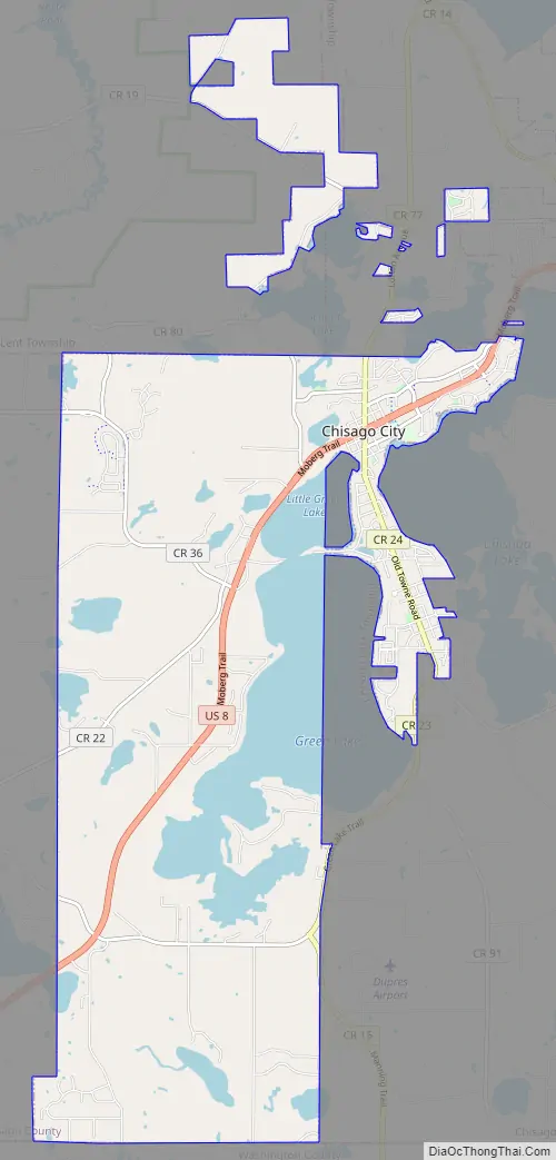
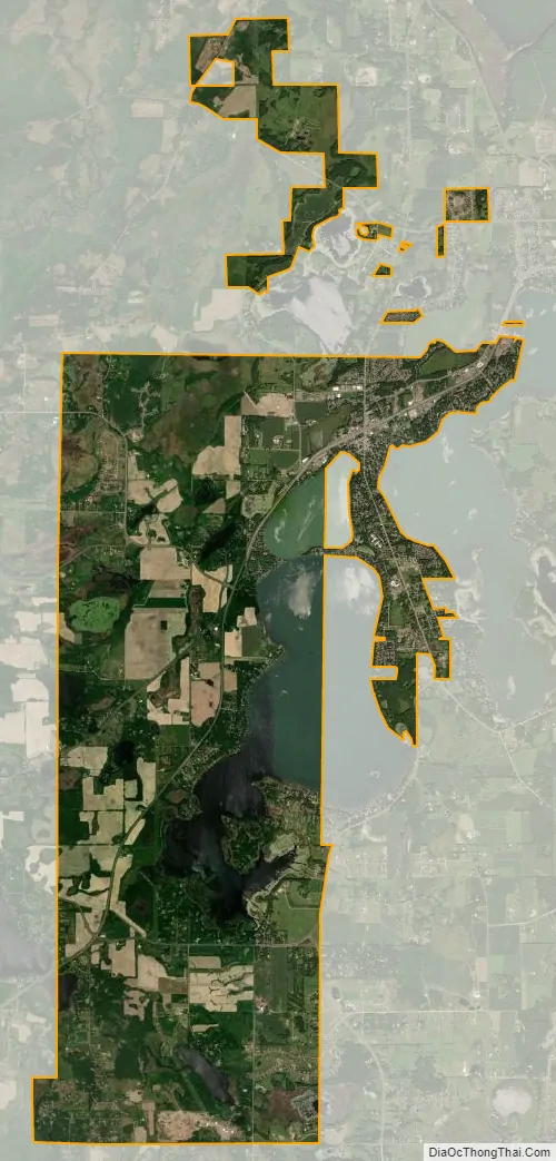
The city is between the twin lakes of Chisago Lake and Green Lake, and is part of the Chisago lakes region.
| Name: | Chisago City city |
|---|---|
| LSAD Code: | 25 |
| LSAD Description: | city (suffix) |
| State: | Minnesota |
| County: | Chisago County |
| Elevation: | 919 ft (280 m) |
| Total Area: | 14.78 sq mi (38.28 km²) |
| Land Area: | 12.56 sq mi (32.53 km²) |
| Water Area: | 2.22 sq mi (5.75 km²) |
| Total Population: | 5,558 |
| Population Density: | 442.52/sq mi (170.85/km²) |
| ZIP code: | 55013 |
| Area code: | 651 |
| FIPS code: | 2711350 |
| GNISfeature ID: | 663797 |
| Website: | www.ci.chisago.mn.us |
Online Interactive Map
Click on ![]() to view map in "full screen" mode.
to view map in "full screen" mode.
Chisago City location map. Where is Chisago City city?


History
Chisago City was founded in May 1857 by Anders Swenson, a Swedish immigrant from Småland. He was born in 1817 and came to America in 1850. The city took its name from Chisago Lake.
During 1852 only a few settlers arrived. John Smith came from Örtofta in the spring of that year. Ahead of him, he declared, were only five settlers at Chisago Lake.
During 1853-54 a substantial number of Swedish immigrants arrived, most of them from Kronoberg County. Most of the land around the lake was taken up and settled During the settlement’s first three or four years. Later-arriving immigrants had to go farther into the country to secure homesteads.
Chisago City was originally settled one mile south, but when the railroad bypassed the town in 1880, the city moved closer to the railroad, as often happened during that time.
Chisago City Road Map
Chisago City city Satellite Map
Geography
According to the United States Census Bureau, the city has a total area of 14.99 square miles (38.82 km), of which 12.53 square miles (32.45 km) is land and 2.46 square miles (6.37 km) is water.
See also
Map of Minnesota State and its subdivision:- Aitkin
- Anoka
- Becker
- Beltrami
- Benton
- Big Stone
- Blue Earth
- Brown
- Carlton
- Carver
- Cass
- Chippewa
- Chisago
- Clay
- Clearwater
- Cook
- Cottonwood
- Crow Wing
- Dakota
- Dodge
- Douglas
- Faribault
- Fillmore
- Freeborn
- Goodhue
- Grant
- Hennepin
- Houston
- Hubbard
- Isanti
- Itasca
- Jackson
- Kanabec
- Kandiyohi
- Kittson
- Koochiching
- Lac qui Parle
- Lake
- Lake of the Woods
- Lake Superior
- Le Sueur
- Lincoln
- Lyon
- Mahnomen
- Marshall
- Martin
- McLeod
- Meeker
- Mille Lacs
- Morrison
- Mower
- Murray
- Nicollet
- Nobles
- Norman
- Olmsted
- Otter Tail
- Pennington
- Pine
- Pipestone
- Polk
- Pope
- Ramsey
- Red Lake
- Redwood
- Renville
- Rice
- Rock
- Roseau
- Saint Louis
- Scott
- Sherburne
- Sibley
- Stearns
- Steele
- Stevens
- Swift
- Todd
- Traverse
- Wabasha
- Wadena
- Waseca
- Washington
- Watonwan
- Wilkin
- Winona
- Wright
- Yellow Medicine
- Alabama
- Alaska
- Arizona
- Arkansas
- California
- Colorado
- Connecticut
- Delaware
- District of Columbia
- Florida
- Georgia
- Hawaii
- Idaho
- Illinois
- Indiana
- Iowa
- Kansas
- Kentucky
- Louisiana
- Maine
- Maryland
- Massachusetts
- Michigan
- Minnesota
- Mississippi
- Missouri
- Montana
- Nebraska
- Nevada
- New Hampshire
- New Jersey
- New Mexico
- New York
- North Carolina
- North Dakota
- Ohio
- Oklahoma
- Oregon
- Pennsylvania
- Rhode Island
- South Carolina
- South Dakota
- Tennessee
- Texas
- Utah
- Vermont
- Virginia
- Washington
- West Virginia
- Wisconsin
- Wyoming


