Lafayette is a city in Nicollet County, Minnesota, United States. The population was 492 at the 2020 census. It is a farming community just outside the larger town of New Ulm.
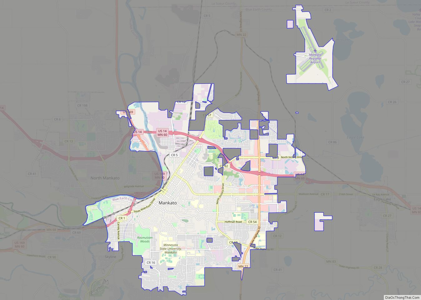
Lafayette is part of the Mankato—North Mankato Metropolitan Statistical Area.
| Name: | Lafayette city |
|---|---|
| LSAD Code: | 25 |
| LSAD Description: | city (suffix) |
| State: | Minnesota |
| County: | Nicollet County |
| Elevation: | 1,010 ft (308 m) |
| Total Area: | 1.26 sq mi (3.26 km²) |
| Land Area: | 1.26 sq mi (3.26 km²) |
| Water Area: | 0.00 sq mi (0.00 km²) |
| Total Population: | 492 |
| Population Density: | 391.10/sq mi (151.05/km²) |
| ZIP code: | 56054 |
| Area code: | 507 |
| FIPS code: | 2733920 |
| GNISfeature ID: | 0646312 |
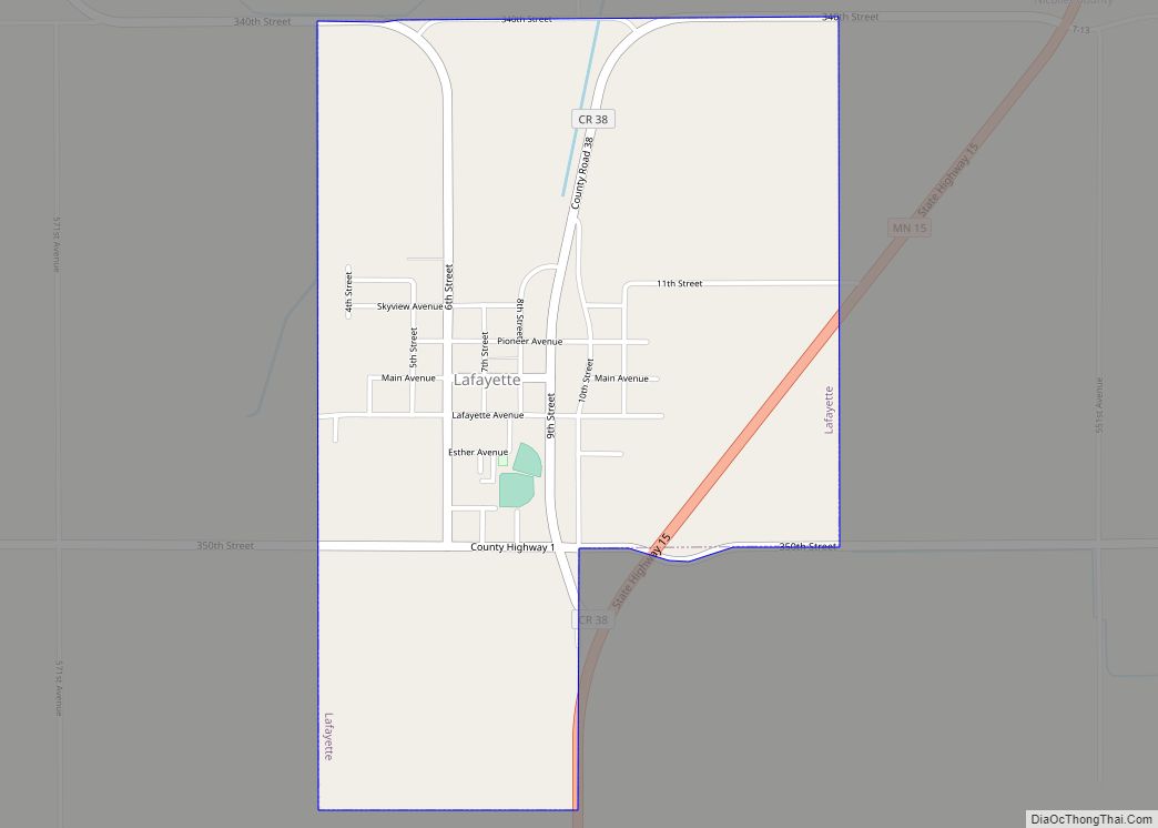
Online Interactive Map
Click on ![]() to view map in "full screen" mode.
to view map in "full screen" mode.
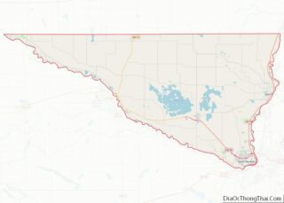
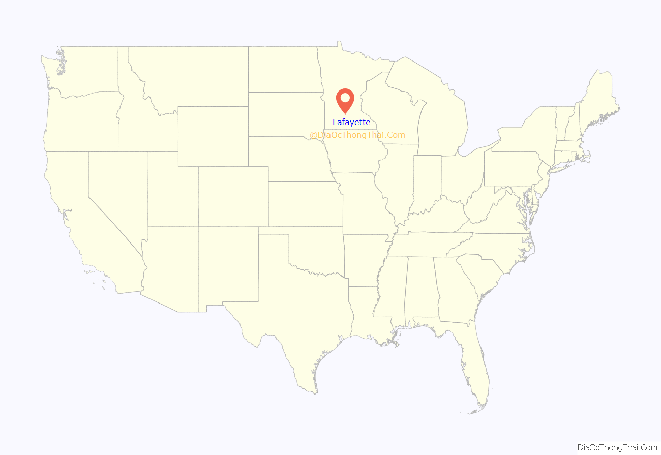
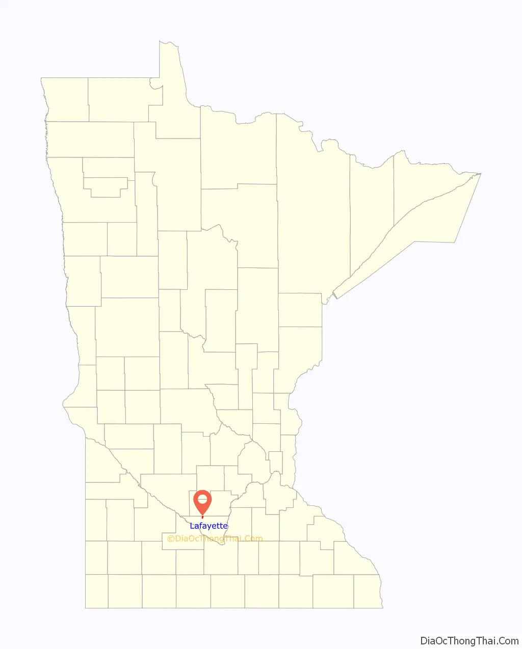
Lafayette location map. Where is Lafayette city?
History
Lafayette was platted in 1897, and named for Gilbert du Motier, Marquis de Lafayette (1757–1834), a French and American Revolutionary War general.
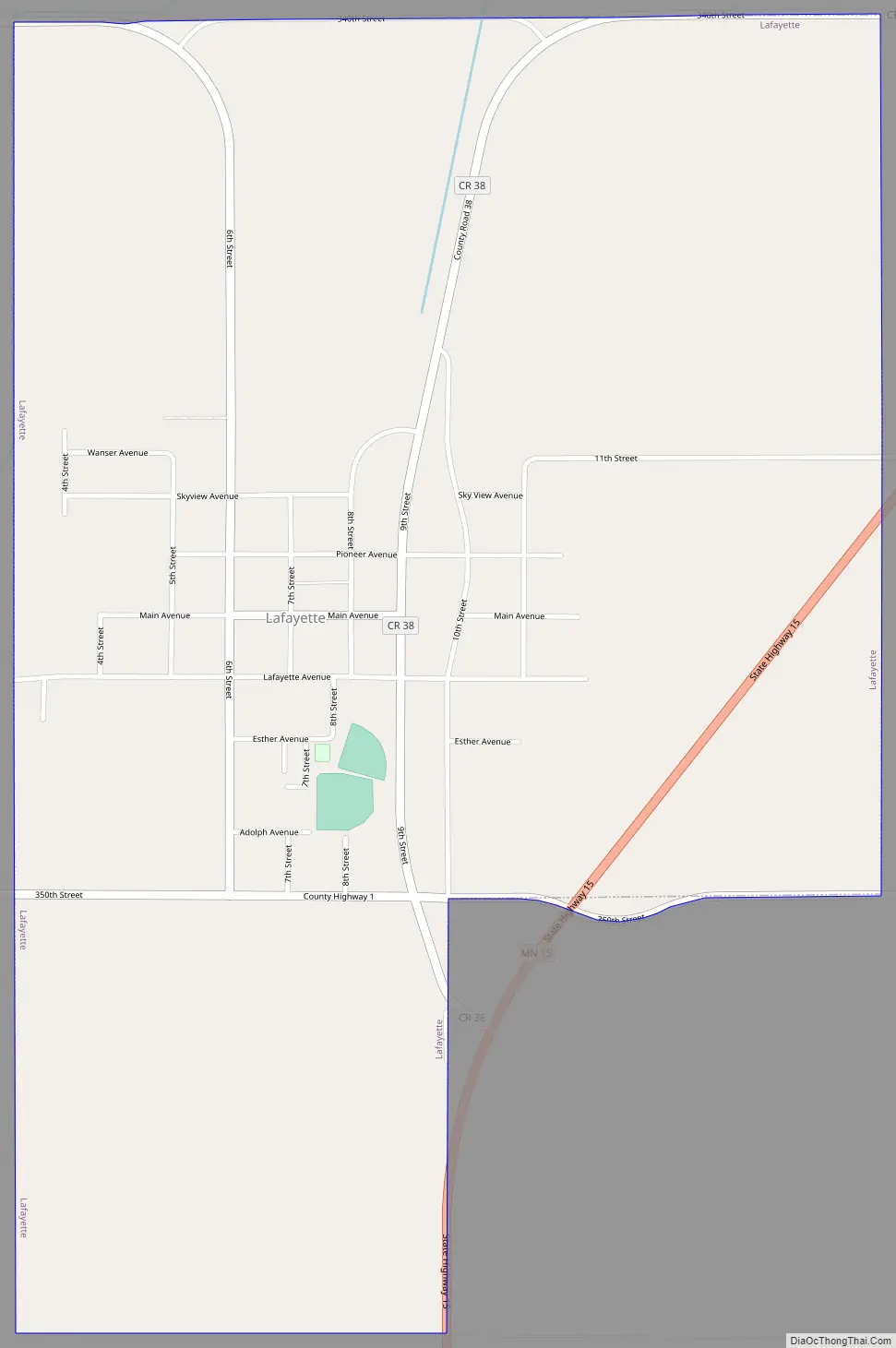
Lafayette Road Map
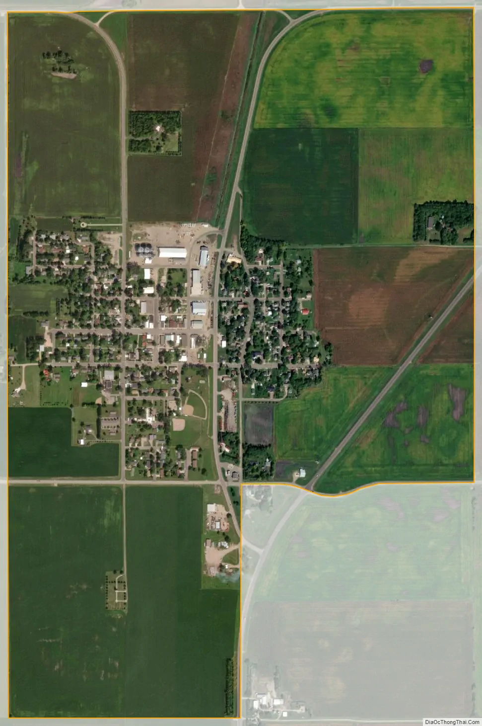
Lafayette city Satellite Map
Geography
According to the U.S. Census Bureau, the city has a total area of 1.15 square miles (2.98 km), all land. The South Branch Rush River starts near Lafayette.
Minnesota State Highway 15 serves as a main route in the community.
See also
Map of Minnesota State and its subdivision:- Aitkin
- Anoka
- Becker
- Beltrami
- Benton
- Big Stone
- Blue Earth
- Brown
- Carlton
- Carver
- Cass
- Chippewa
- Chisago
- Clay
- Clearwater
- Cook
- Cottonwood
- Crow Wing
- Dakota
- Dodge
- Douglas
- Faribault
- Fillmore
- Freeborn
- Goodhue
- Grant
- Hennepin
- Houston
- Hubbard
- Isanti
- Itasca
- Jackson
- Kanabec
- Kandiyohi
- Kittson
- Koochiching
- Lac qui Parle
- Lake
- Lake of the Woods
- Lake Superior
- Le Sueur
- Lincoln
- Lyon
- Mahnomen
- Marshall
- Martin
- McLeod
- Meeker
- Mille Lacs
- Morrison
- Mower
- Murray
- Nicollet
- Nobles
- Norman
- Olmsted
- Otter Tail
- Pennington
- Pine
- Pipestone
- Polk
- Pope
- Ramsey
- Red Lake
- Redwood
- Renville
- Rice
- Rock
- Roseau
- Saint Louis
- Scott
- Sherburne
- Sibley
- Stearns
- Steele
- Stevens
- Swift
- Todd
- Traverse
- Wabasha
- Wadena
- Waseca
- Washington
- Watonwan
- Wilkin
- Winona
- Wright
- Yellow Medicine
- Alabama
- Alaska
- Arizona
- Arkansas
- California
- Colorado
- Connecticut
- Delaware
- District of Columbia
- Florida
- Georgia
- Hawaii
- Idaho
- Illinois
- Indiana
- Iowa
- Kansas
- Kentucky
- Louisiana
- Maine
- Maryland
- Massachusetts
- Michigan
- Minnesota
- Mississippi
- Missouri
- Montana
- Nebraska
- Nevada
- New Hampshire
- New Jersey
- New Mexico
- New York
- North Carolina
- North Dakota
- Ohio
- Oklahoma
- Oregon
- Pennsylvania
- Rhode Island
- South Carolina
- South Dakota
- Tennessee
- Texas
- Utah
- Vermont
- Virginia
- Washington
- West Virginia
- Wisconsin
- Wyoming