Maplewood is a city in Ramsey County, Minnesota, United States. The population was 42,088 at the 2020 census. Maplewood is ten minutes’ drive from downtown Saint Paul. It stretches along the northern and eastern borders of Saint Paul.
Maplewood is home to the corporate headquarters and main campus of 3M Corporation. The city is also home to the Maplewood Mall and St. John’s Hospital.
| Name: | Maplewood city |
|---|---|
| LSAD Code: | 25 |
| LSAD Description: | city (suffix) |
| State: | Minnesota |
| County: | Ramsey County |
| Elevation: | 978 ft (298 m) |
| Total Area: | 18.05 sq mi (46.74 km²) |
| Land Area: | 17.04 sq mi (44.14 km²) |
| Water Area: | 1.00 sq mi (2.60 km²) |
| Total Population: | 42,088 |
| Population Density: | 2,469.52/sq mi (953.51/km²) |
| ZIP code: | 55106, 55109, 55117, 55119 |
| Area code: | 651 |
| FIPS code: | 2740382 |
| GNISfeature ID: | 0647503 |
| Website: | maplewoodmn.gov |
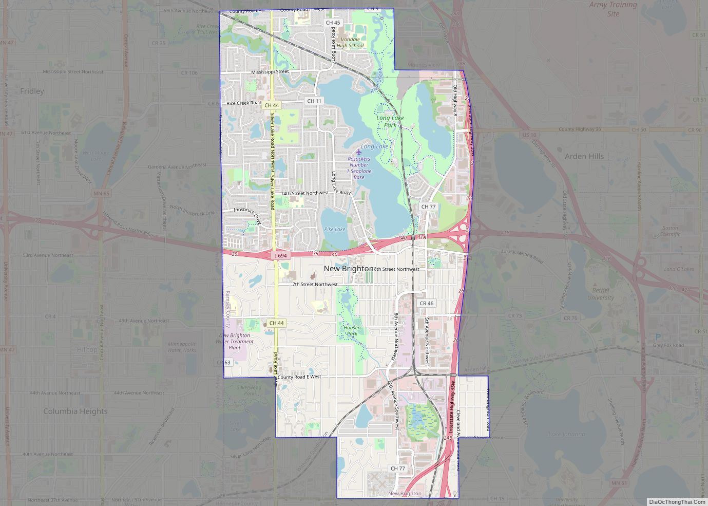
Online Interactive Map
Click on ![]() to view map in "full screen" mode.
to view map in "full screen" mode.
Maplewood location map. Where is Maplewood city?


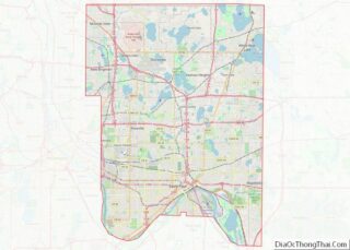
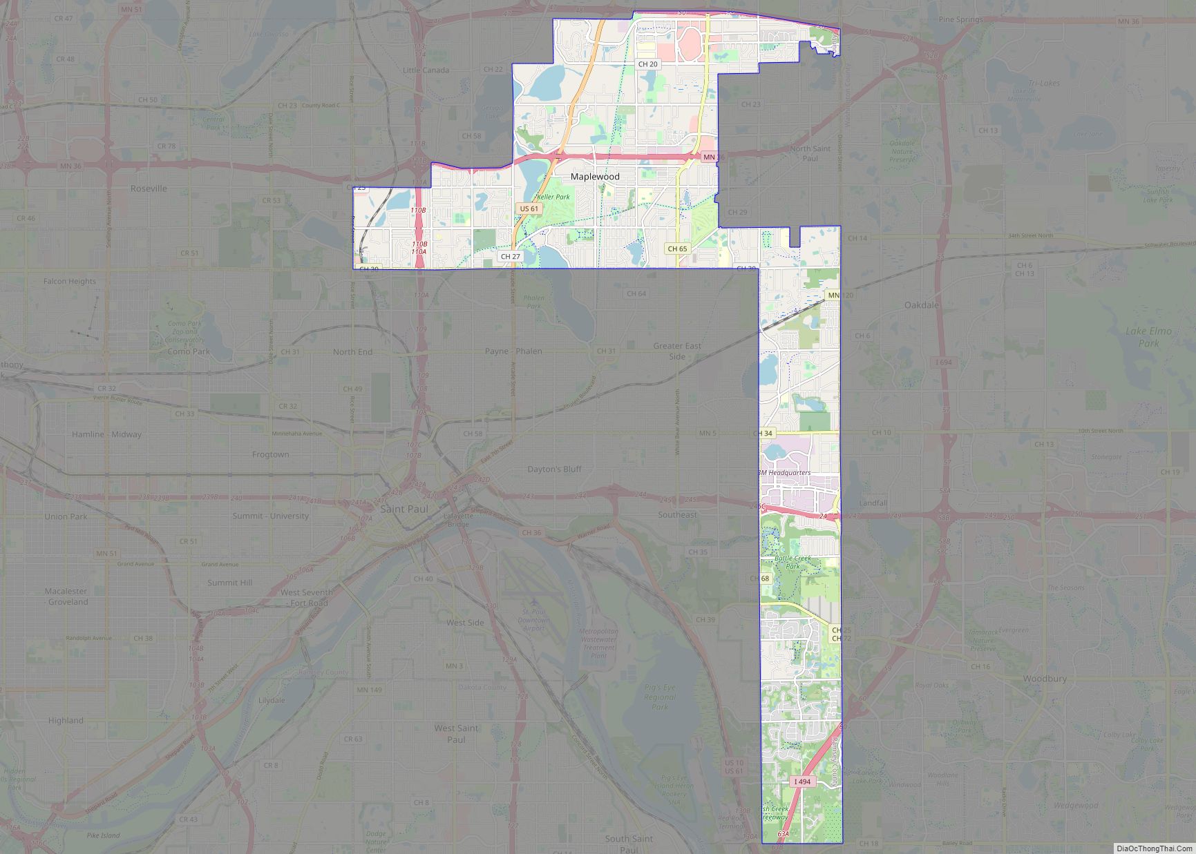
Maplewood Road Map

Maplewood city Satellite Map

Geography
According to the United States Census Bureau, the city has a total area of 17.99 square miles (46.59 km), of which 16.98 square miles (43.98 km) is land and 1.01 square miles (2.62 km) is water.
U.S. Highway 61, Minnesota Highway 36, and Interstate Highways 35E, 94, 694, and 494 are six of the main routes in the city.
The city is noteworthy for its unique shape, extending 5.9 miles east to west and 10 miles north to south with a 7.5 mile long nearly 1 mile wide southern leg.
See also
Map of Minnesota State and its subdivision:- Aitkin
- Anoka
- Becker
- Beltrami
- Benton
- Big Stone
- Blue Earth
- Brown
- Carlton
- Carver
- Cass
- Chippewa
- Chisago
- Clay
- Clearwater
- Cook
- Cottonwood
- Crow Wing
- Dakota
- Dodge
- Douglas
- Faribault
- Fillmore
- Freeborn
- Goodhue
- Grant
- Hennepin
- Houston
- Hubbard
- Isanti
- Itasca
- Jackson
- Kanabec
- Kandiyohi
- Kittson
- Koochiching
- Lac qui Parle
- Lake
- Lake of the Woods
- Lake Superior
- Le Sueur
- Lincoln
- Lyon
- Mahnomen
- Marshall
- Martin
- McLeod
- Meeker
- Mille Lacs
- Morrison
- Mower
- Murray
- Nicollet
- Nobles
- Norman
- Olmsted
- Otter Tail
- Pennington
- Pine
- Pipestone
- Polk
- Pope
- Ramsey
- Red Lake
- Redwood
- Renville
- Rice
- Rock
- Roseau
- Saint Louis
- Scott
- Sherburne
- Sibley
- Stearns
- Steele
- Stevens
- Swift
- Todd
- Traverse
- Wabasha
- Wadena
- Waseca
- Washington
- Watonwan
- Wilkin
- Winona
- Wright
- Yellow Medicine
- Alabama
- Alaska
- Arizona
- Arkansas
- California
- Colorado
- Connecticut
- Delaware
- District of Columbia
- Florida
- Georgia
- Hawaii
- Idaho
- Illinois
- Indiana
- Iowa
- Kansas
- Kentucky
- Louisiana
- Maine
- Maryland
- Massachusetts
- Michigan
- Minnesota
- Mississippi
- Missouri
- Montana
- Nebraska
- Nevada
- New Hampshire
- New Jersey
- New Mexico
- New York
- North Carolina
- North Dakota
- Ohio
- Oklahoma
- Oregon
- Pennsylvania
- Rhode Island
- South Carolina
- South Dakota
- Tennessee
- Texas
- Utah
- Vermont
- Virginia
- Washington
- West Virginia
- Wisconsin
- Wyoming