Mounds View is a city in Ramsey County, Minnesota, United States. The population was 12,155 at the 2010 census. It is part of the Twin Cities Metropolitan Area.
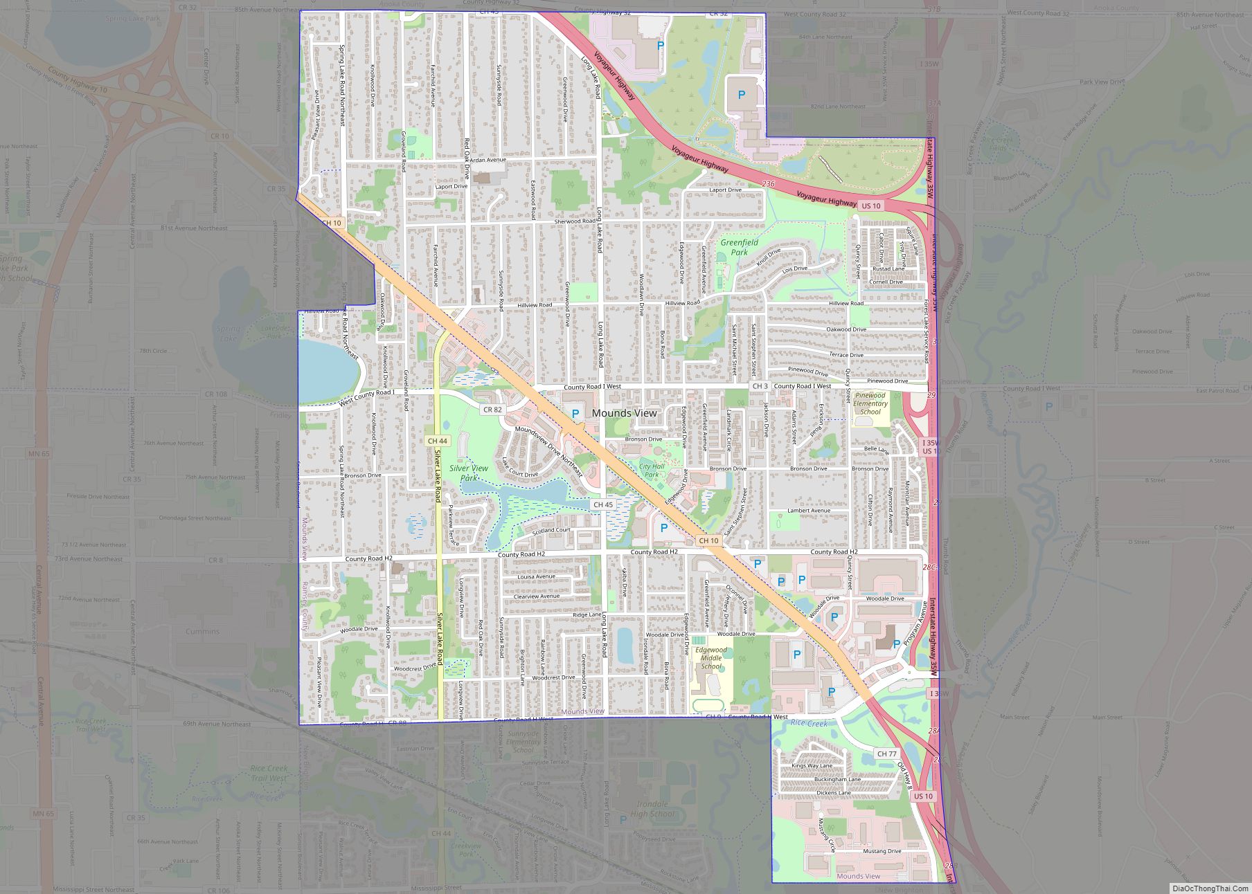
U.S. Highway 10, County Road 10, and Interstate Highway 35W are three of the main routes in the city.
| Name: | Mounds View city |
|---|---|
| LSAD Code: | 25 |
| LSAD Description: | city (suffix) |
| State: | Minnesota |
| County: | Ramsey County |
| Elevation: | 912 ft (278 m) |
| Total Area: | 4.15 sq mi (10.75 km²) |
| Land Area: | 4.06 sq mi (10.51 km²) |
| Water Area: | 0.10 sq mi (0.25 km²) |
| Total Population: | 13,249 |
| Population Density: | 3,265.71/sq mi (1,260.94/km²) |
| ZIP code: | 55112 |
| Area code: | 763 |
| FIPS code: | 2744530 |
| GNISfeature ID: | 0648158 |
| Website: | www.ci.mounds-view.mn.us |
Online Interactive Map
Click on ![]() to view map in "full screen" mode.
to view map in "full screen" mode.
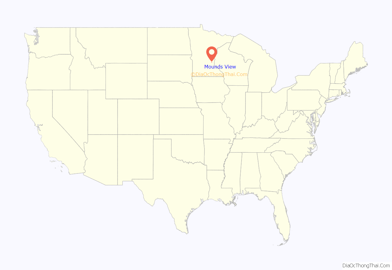
Mounds View location map. Where is Mounds View city?

History
The city of Mounds View was located in the former Mounds View Township, which was organized in 1858. In 1958, 100 years after Minnesota became a state, the village of Mounds View was incorporated. Post-World War II growth was partially fueled by the proximity of the Twin Cities Arsenal. Calvin Academy relocated to the area in 1999.
The city is primarily residential, with several business parks and businesses located in Mounds View. The bulk of businesses are located along the County Road 10 corridor, with most residential areas flanking it to the north and south. Some of the businesses include Multitech’s headquarters, Liberty Checks and Sysco Distributing.
A petroleum pipeline exploded in Mounds View on July 8, 1986. Two-hundred people had to evacuate their homes and two people, a mother and her young daughter, were killed. The Office of Pipeline Safety was created in response to the tragedy.
In 2005, the Mounds View City Council voted to sell the city-owned golf course, “The Bridges of Mounds View”, to Medtronic, Inc., to become its new campus. The new campus is located in the north east corner of the city and opened Fall of 2007.
In June 2016, the Mounds View city council voted to change the name of County Road 10 to Mounds View Blvd for the city’s portion of the road.
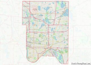
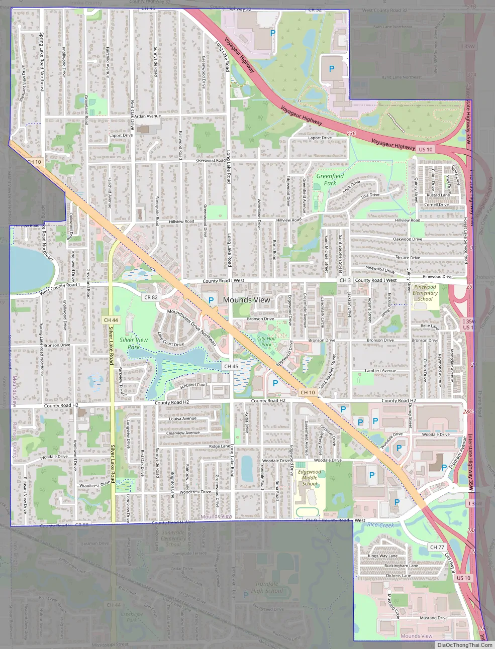
Mounds View Road Map
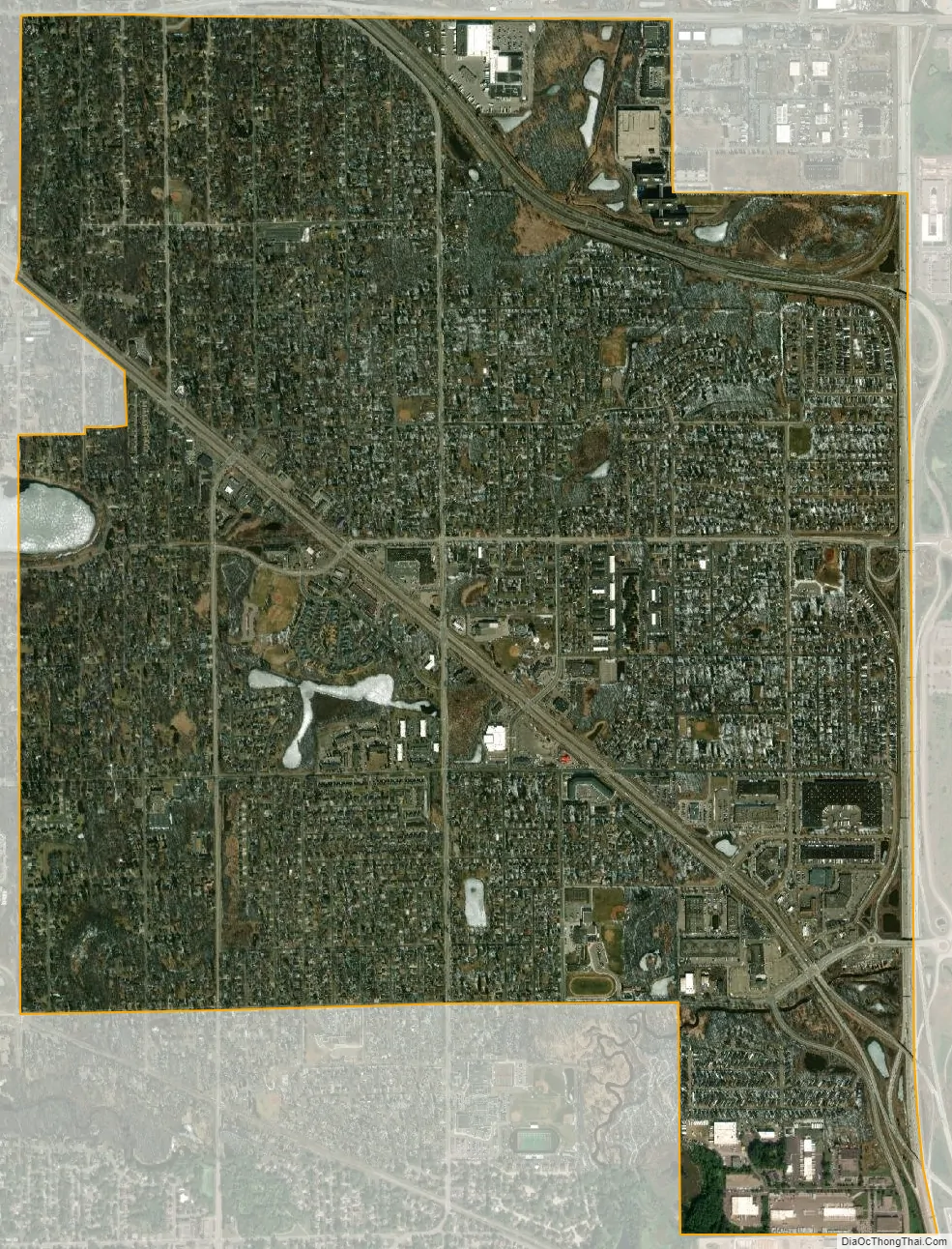
Mounds View city Satellite Map
Geography
According to the United States Census Bureau, the city has a total area of 4.12 square miles (10.67 km), of which 4.03 square miles (10.44 km) is land and 0.09 square miles (0.23 km) is water.
Rice Creek flows through the southeast part of Mounds View.
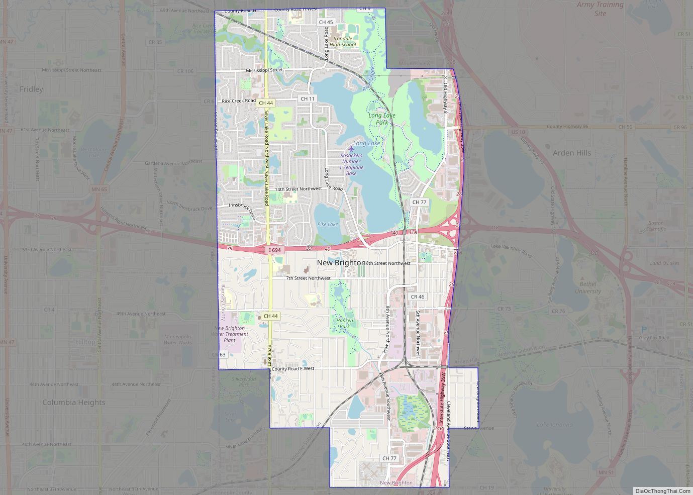
Nearby places include Shoreview, Arden Hills, New Brighton, Fridley, Spring Lake Park, and Blaine. The boundary line between Ramsey and Anoka counties is nearby.
See also
Map of Minnesota State and its subdivision:- Aitkin
- Anoka
- Becker
- Beltrami
- Benton
- Big Stone
- Blue Earth
- Brown
- Carlton
- Carver
- Cass
- Chippewa
- Chisago
- Clay
- Clearwater
- Cook
- Cottonwood
- Crow Wing
- Dakota
- Dodge
- Douglas
- Faribault
- Fillmore
- Freeborn
- Goodhue
- Grant
- Hennepin
- Houston
- Hubbard
- Isanti
- Itasca
- Jackson
- Kanabec
- Kandiyohi
- Kittson
- Koochiching
- Lac qui Parle
- Lake
- Lake of the Woods
- Lake Superior
- Le Sueur
- Lincoln
- Lyon
- Mahnomen
- Marshall
- Martin
- McLeod
- Meeker
- Mille Lacs
- Morrison
- Mower
- Murray
- Nicollet
- Nobles
- Norman
- Olmsted
- Otter Tail
- Pennington
- Pine
- Pipestone
- Polk
- Pope
- Ramsey
- Red Lake
- Redwood
- Renville
- Rice
- Rock
- Roseau
- Saint Louis
- Scott
- Sherburne
- Sibley
- Stearns
- Steele
- Stevens
- Swift
- Todd
- Traverse
- Wabasha
- Wadena
- Waseca
- Washington
- Watonwan
- Wilkin
- Winona
- Wright
- Yellow Medicine
- Alabama
- Alaska
- Arizona
- Arkansas
- California
- Colorado
- Connecticut
- Delaware
- District of Columbia
- Florida
- Georgia
- Hawaii
- Idaho
- Illinois
- Indiana
- Iowa
- Kansas
- Kentucky
- Louisiana
- Maine
- Maryland
- Massachusetts
- Michigan
- Minnesota
- Mississippi
- Missouri
- Montana
- Nebraska
- Nevada
- New Hampshire
- New Jersey
- New Mexico
- New York
- North Carolina
- North Dakota
- Ohio
- Oklahoma
- Oregon
- Pennsylvania
- Rhode Island
- South Carolina
- South Dakota
- Tennessee
- Texas
- Utah
- Vermont
- Virginia
- Washington
- West Virginia
- Wisconsin
- Wyoming