Monticello (/ˌmɒntɪˈsɛloʊ/ (listen) MON-tiss-EL-oh) is a city next to the Mississippi River in Wright County, Minnesota, United States. The population was 14,455 at the 2020 census.
| Name: | Monticello city |
|---|---|
| LSAD Code: | 25 |
| LSAD Description: | city (suffix) |
| State: | Minnesota |
| County: | Wright County |
| Founded: | March 1, 1856 |
| Elevation: | 925 ft (282 m) |
| Total Area: | 9.33 sq mi (24.17 km²) |
| Land Area: | 9.00 sq mi (23.32 km²) |
| Water Area: | 0.33 sq mi (0.86 km²) |
| Total Population: | 14,455 |
| Population Density: | 1,605.75/sq mi (619.97/km²) |
| ZIP code: | 55362 |
| Area code: | 763 |
| FIPS code: | 2743774 |
| GNISfeature ID: | 0648048 |
| Website: | ci.monticello.mn.us |
Online Interactive Map
Click on ![]() to view map in "full screen" mode.
to view map in "full screen" mode.
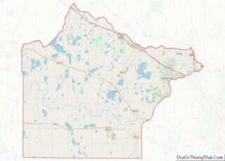
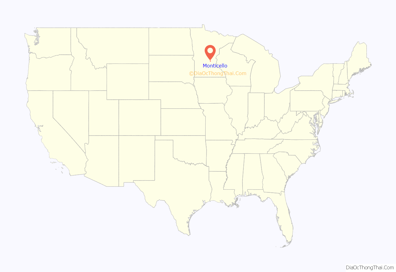
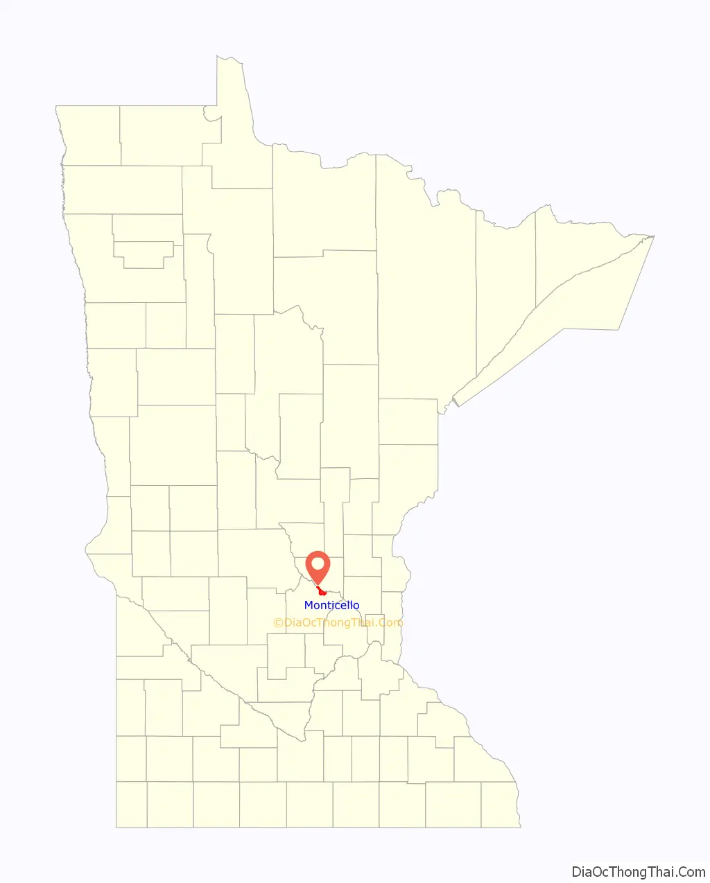
Monticello location map. Where is Monticello city?
History
Monticello was platted in 1854. A post office has been in operation at Monticello since 1855. Monticello was incorporated in 1856. The nearby village of Moritzious merged with Monticello in 1891.
On May 3, 2006, the Monticello Middle School had an electrical fire from the large amount of rain settling on the roof. The smoke damage to the school caused the school to be closed for the rest of the school year. As a result, middle school and high school students had to share usage of the high school building on an alternate-day schedule. The school year did not get extended, and the clean-up was completed in time for the 2006–07 school year. [1] [2]
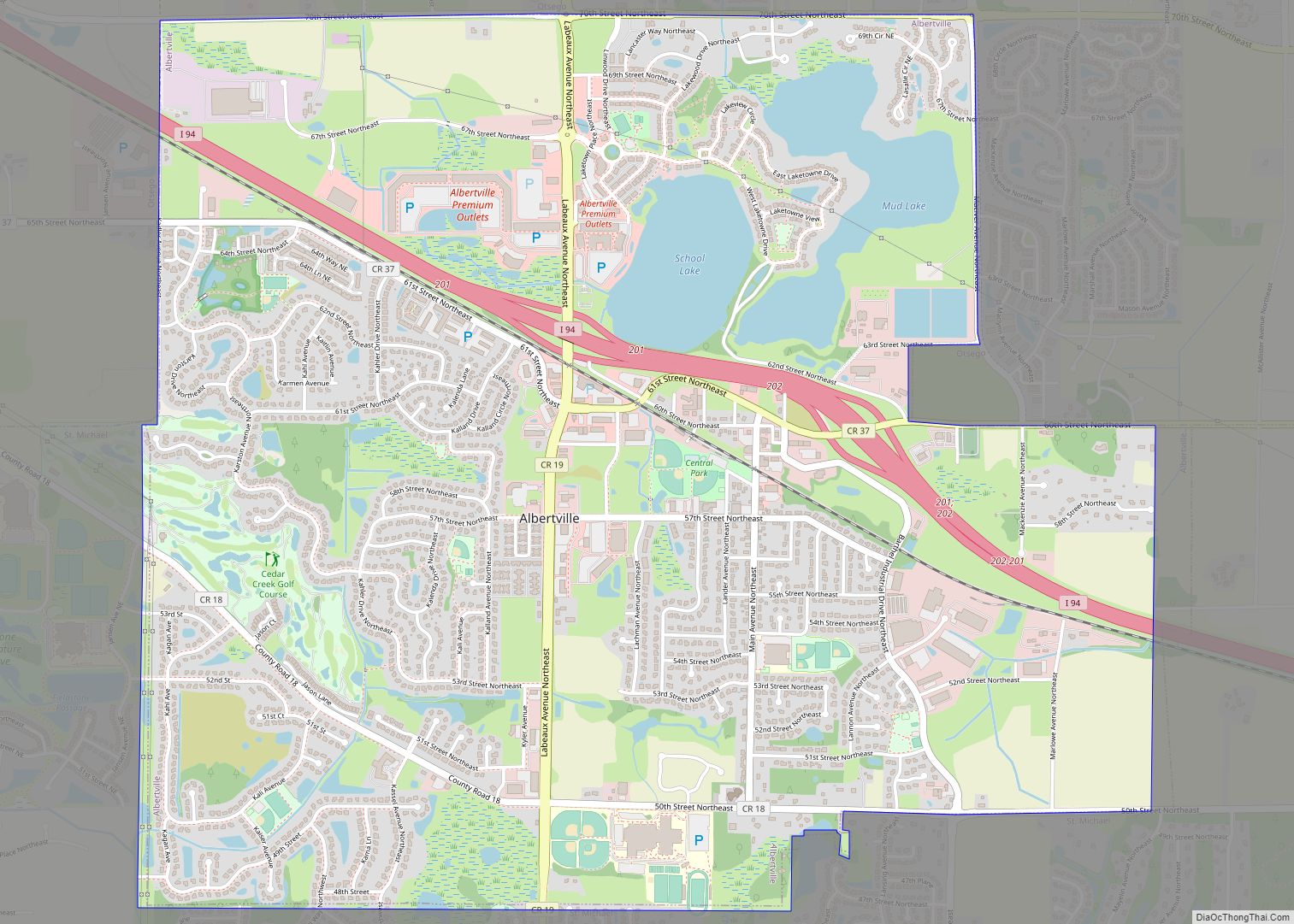
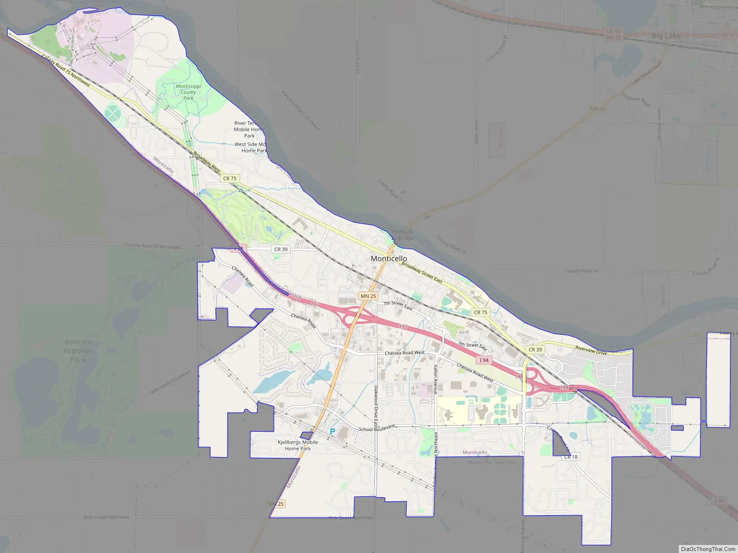
Monticello Road Map
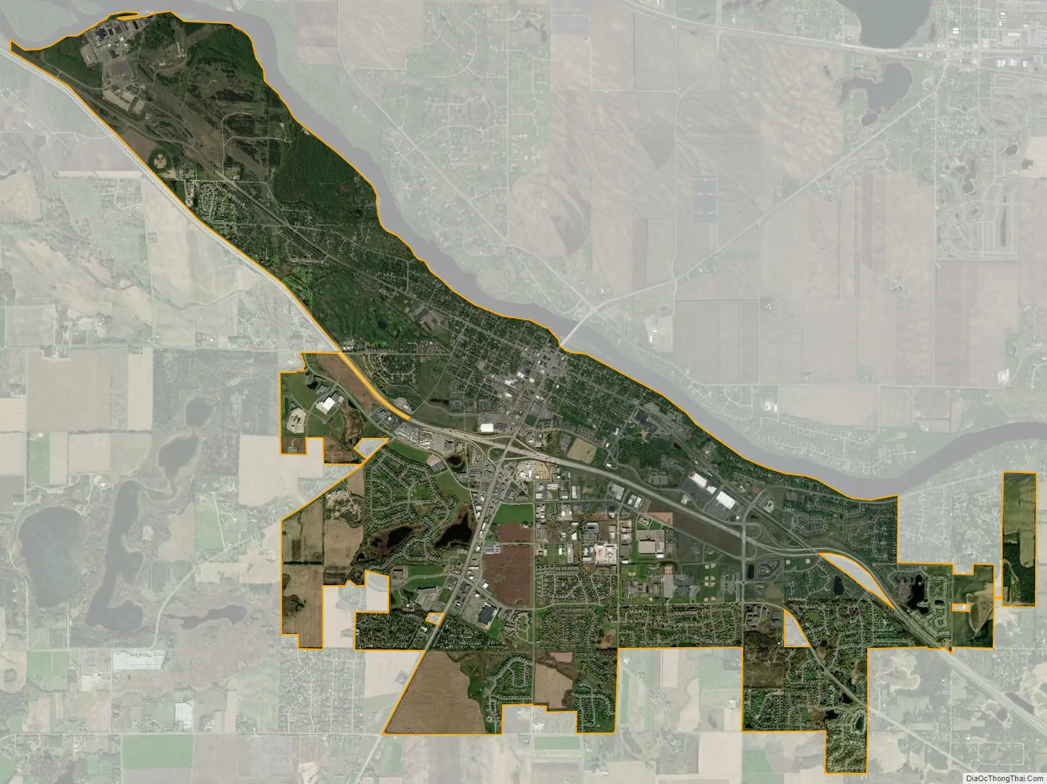
Monticello city Satellite Map
Geography
According to the United States Census Bureau, the city has a total area of 8.94 square miles (23.15 km), all land. The city’s latitude is 45.305 degrees North and its longitude is 93.793 degrees West. Its elevation is 922 feet. Monticello is in the Central time zone.
Parks
Monticello has an extensive parks and pathway system, including 28 city-owned parks and miles of winding trails. Lake Maria State Park, Montissippi Regional Park and the Harry Larsen Memorial Park are three of the largest. At Swan Park, each winter between December and March, as many as 2,700 trumpeter swans nest near Mississippi Drive in Monticello, as the Mississippi River is heated from warm water discharged by the Monticello Nuclear Generating Plant.
The City of Monticello and Wright County partnered and acquired 1,200 acres of open space in Wright County, known as the Bertram Chain of Lakes. The Bertram Chain includes four lakes and acres of undisturbed shoreline, natural habitat, and oak forest, 812 of which are open for public enjoyment. It provides users access to 4 miles of hiking trails, 10 miles of single-track mountain biking trails, beach at Bertram Lake for swimming, and carry-in access to Long Lake, which allow the opportunity to paddle Long, Mud and First Lakes. Winter activities include fat-biking, snowshoeing, and cross-country skiing. Summer activities include paddleboard classes, canoeing excursions, kids fishing programs, and guided moonlight hiking.
See also
Map of Minnesota State and its subdivision:- Aitkin
- Anoka
- Becker
- Beltrami
- Benton
- Big Stone
- Blue Earth
- Brown
- Carlton
- Carver
- Cass
- Chippewa
- Chisago
- Clay
- Clearwater
- Cook
- Cottonwood
- Crow Wing
- Dakota
- Dodge
- Douglas
- Faribault
- Fillmore
- Freeborn
- Goodhue
- Grant
- Hennepin
- Houston
- Hubbard
- Isanti
- Itasca
- Jackson
- Kanabec
- Kandiyohi
- Kittson
- Koochiching
- Lac qui Parle
- Lake
- Lake of the Woods
- Lake Superior
- Le Sueur
- Lincoln
- Lyon
- Mahnomen
- Marshall
- Martin
- McLeod
- Meeker
- Mille Lacs
- Morrison
- Mower
- Murray
- Nicollet
- Nobles
- Norman
- Olmsted
- Otter Tail
- Pennington
- Pine
- Pipestone
- Polk
- Pope
- Ramsey
- Red Lake
- Redwood
- Renville
- Rice
- Rock
- Roseau
- Saint Louis
- Scott
- Sherburne
- Sibley
- Stearns
- Steele
- Stevens
- Swift
- Todd
- Traverse
- Wabasha
- Wadena
- Waseca
- Washington
- Watonwan
- Wilkin
- Winona
- Wright
- Yellow Medicine
- Alabama
- Alaska
- Arizona
- Arkansas
- California
- Colorado
- Connecticut
- Delaware
- District of Columbia
- Florida
- Georgia
- Hawaii
- Idaho
- Illinois
- Indiana
- Iowa
- Kansas
- Kentucky
- Louisiana
- Maine
- Maryland
- Massachusetts
- Michigan
- Minnesota
- Mississippi
- Missouri
- Montana
- Nebraska
- Nevada
- New Hampshire
- New Jersey
- New Mexico
- New York
- North Carolina
- North Dakota
- Ohio
- Oklahoma
- Oregon
- Pennsylvania
- Rhode Island
- South Carolina
- South Dakota
- Tennessee
- Texas
- Utah
- Vermont
- Virginia
- Washington
- West Virginia
- Wisconsin
- Wyoming