Osseo (/ˈɑːsiˌoʊ/ AH-see-oh) is a small city in Hennepin County, Minnesota, United States. As of the 2020 census it had a population of 2,688.
It is said that “Osseo” derives from the Ojibwe name waaseyaa meaning “there is light” (more commonly translated as “Son of the Evening Star”). Henry Wadsworth Longfellow mentions Osseo in his poem The Song of Hiawatha.
| Name: | Osseo city |
|---|---|
| LSAD Code: | 25 |
| LSAD Description: | city (suffix) |
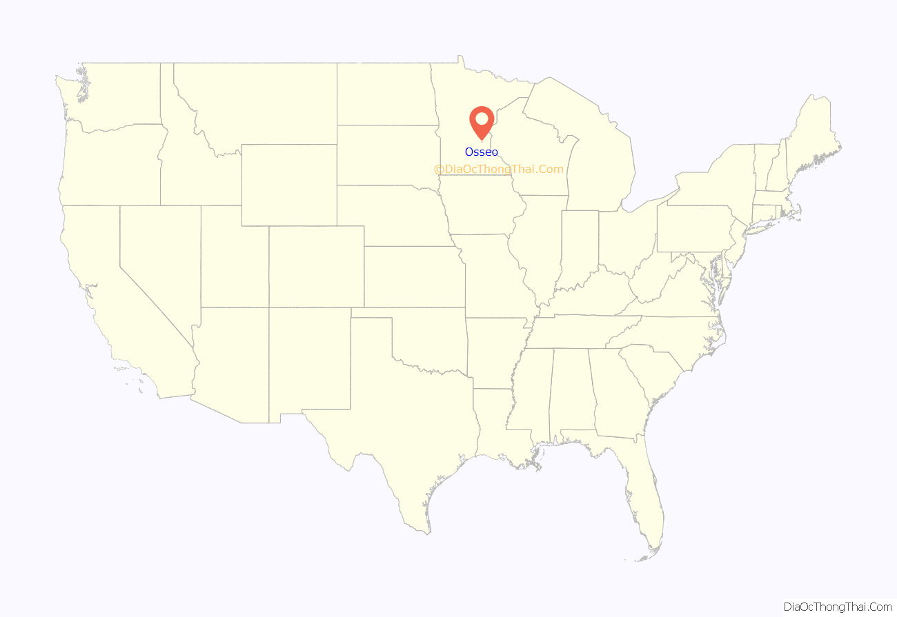
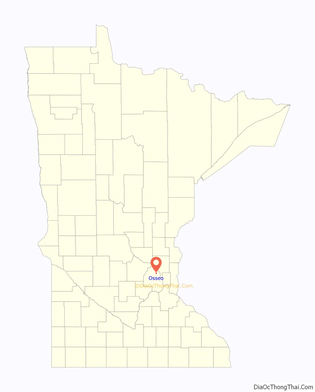
| State: | Minnesota |
| County: | Hennepin County |
| Founded: | 1875 |
| Elevation: | 886 ft (270 m) |
| Total Area: | 0.74 sq mi (1.92 km²) |
| Land Area: | 0.74 sq mi (1.92 km²) |
| Water Area: | 0.00 sq mi (0.00 km²) |
| Total Population: | 2,688 |
| Population Density: | 3,622.64/sq mi (1,398.08/km²) |
| Area code: | 763 |
| FIPS code: | 2749012 |
| GNISfeature ID: | 0649024 |
| Website: | www.discoverosseo.com |
Online Interactive Map
Click on ![]() to view map in "full screen" mode.
to view map in "full screen" mode.
Osseo location map. Where is Osseo city?
History
The area that is now Osseo was settled before organized local government. It was on what Pierre Bottineau named Bottineau Prairie in 1852; the community was called Palestine. In 1856 part of the town was platted as Osseo and another part as “City of Attraction”. Official Minnesota Territory surveys placed the settlement on the border of two townships. When Brooklyn Township and Maple Grove Township organized, Osseo (and City of Attraction, which later merged) was governed by those two governments. Osseo incorporated on March 17, 1875.
The ethnic groups that moved in after Native tribes were removed were mostly French Canadians, New Englanders, Swiss and Germans. The pioneers’ businesses included blacksmiths, wagonmakers, general merchandise stores, boots & shoemakers, harness makers, tin shops, cordwood suppliers, teamsters, saloons, and hotels (Niggler Hotel, 1867; International Hotel, 1874; Great Northern Hotel, 1907). There was also a Catholic church (1858), a physician, school, post office, and calaboose (jail). Methodists and Lutherans were served in their homes until the 20th century.
In 1882 the Great Northern Railroad “came steaming through town”, and in 1893 a telephone station appeared. A town hall was built in 1901. The city water system and fire department began in 1915. The original Indian trail—extending from St. Paul to St. Cloud—was the town’s main street, and was paved in 1918 (Territorial Road). Osseo Lutheran Church was built around 1915; the Methodist Church was built in 1922. The first Osseo High School was built in 1924. 1928 was the peak when “Osseo had one of the largest potato markets in the Northwest.”
A newspaper article written upon the death of John Hechtman, “The Father of Osseo”, informs the reader of Osseo’s opportunities and social organizations of his time.
Opposite today’s City Hall are memorials to US military veterans from Osseo. In 1937 a large granite monument was erected in memory of Civil War soldiers. On Memorial Day 1945 another Honor Roll was constructed of granite with a bronze plate engraved with names of those who served during the Spanish–American War, World War I and World War II. In 1957 the memorial area was named Father Boerboom Park, after a pastor of St. Vincent Rectory and the principal of its parochial school who had served since 1917.
The Osseo Water Tower, built in 1915, was listed on the National Register of Historic Places in 2017.
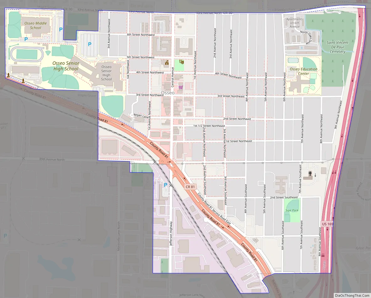
Osseo Road Map
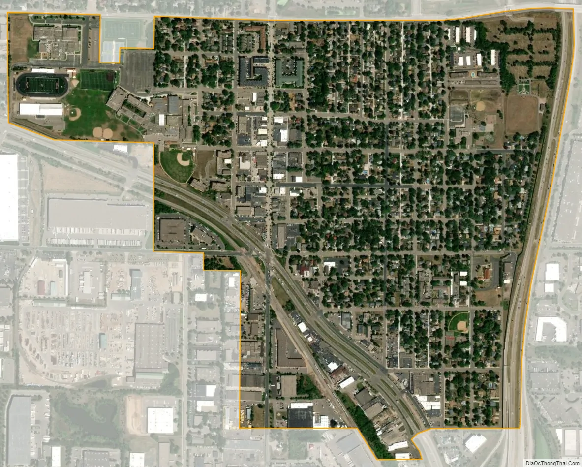
Osseo city Satellite Map
Geography
Osseo is in northeastern Hennepin County, bordered by Brooklyn Park to the east and Maple Grove to the west. It has an area of 0.73 square miles (1.9 km), all land.
There are three main transportation routes in the city. Jefferson Highway runs straight north/south through the city; the business stretch is Central Avenue. U.S. Highway 169 follows the eastern boundary. Bottineau Boulevard (County Road 81) runs northwest through the city.
See also
Map of Minnesota State and its subdivision:- Aitkin
- Anoka
- Becker
- Beltrami
- Benton
- Big Stone
- Blue Earth
- Brown
- Carlton
- Carver
- Cass
- Chippewa
- Chisago
- Clay
- Clearwater
- Cook
- Cottonwood
- Crow Wing
- Dakota
- Dodge
- Douglas
- Faribault
- Fillmore
- Freeborn
- Goodhue
- Grant
- Hennepin
- Houston
- Hubbard
- Isanti
- Itasca
- Jackson
- Kanabec
- Kandiyohi
- Kittson
- Koochiching
- Lac qui Parle
- Lake
- Lake of the Woods
- Lake Superior
- Le Sueur
- Lincoln
- Lyon
- Mahnomen
- Marshall
- Martin
- McLeod
- Meeker
- Mille Lacs
- Morrison
- Mower
- Murray
- Nicollet
- Nobles
- Norman
- Olmsted
- Otter Tail
- Pennington
- Pine
- Pipestone
- Polk
- Pope
- Ramsey
- Red Lake
- Redwood
- Renville
- Rice
- Rock
- Roseau
- Saint Louis
- Scott
- Sherburne
- Sibley
- Stearns
- Steele
- Stevens
- Swift
- Todd
- Traverse
- Wabasha
- Wadena
- Waseca
- Washington
- Watonwan
- Wilkin
- Winona
- Wright
- Yellow Medicine
- Alabama
- Alaska
- Arizona
- Arkansas
- California
- Colorado
- Connecticut
- Delaware
- District of Columbia
- Florida
- Georgia
- Hawaii
- Idaho
- Illinois
- Indiana
- Iowa
- Kansas
- Kentucky
- Louisiana
- Maine
- Maryland
- Massachusetts
- Michigan
- Minnesota
- Mississippi
- Missouri
- Montana
- Nebraska
- Nevada
- New Hampshire
- New Jersey
- New Mexico
- New York
- North Carolina
- North Dakota
- Ohio
- Oklahoma
- Oregon
- Pennsylvania
- Rhode Island
- South Carolina
- South Dakota
- Tennessee
- Texas
- Utah
- Vermont
- Virginia
- Washington
- West Virginia
- Wisconsin
- Wyoming


