Woodbury is a city in Washington County, Minnesota, United States, eight miles (13 km) east of Saint Paul along Interstate 94. It is part of the Minneapolis–Saint Paul metropolitan area. The population was 75,102 at the 2020 census, making it Minnesota’s eighth most populous city.
| Name: | Woodbury city |
|---|---|
| LSAD Code: | 25 |
| LSAD Description: | city (suffix) |
| State: | Minnesota |
| County: | Washington County |
| Founded: | 1858 |
| Incorporated: | 1967 |
| Elevation: | 978 ft (298 m) |
| Land Area: | 34.89 sq mi (90.38 km²) |
| Water Area: | 0.83 sq mi (2.14 km²) 2.33% |
| Population Density: | 2,152.29/sq mi (831.00/km²) |
| ZIP code: | 55125, 55129 |
| Area code: | 651 |
| FIPS code: | 2771428 |
| GNISfeature ID: | 2397369 |
| Website: | ci.woodbury.mn.us |
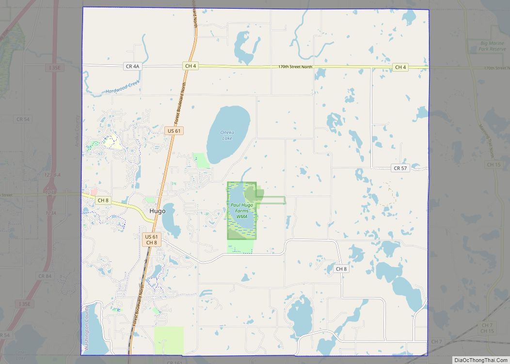
Online Interactive Map
Click on ![]() to view map in "full screen" mode.
to view map in "full screen" mode.
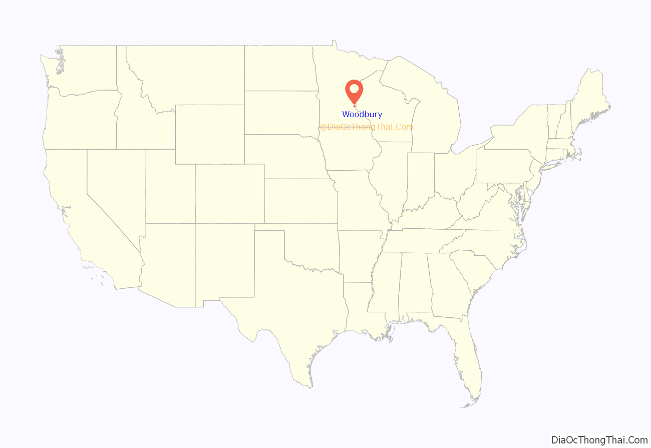
Woodbury location map. Where is Woodbury city?

History
At almost 36 square miles, Woodbury is a direct descendant of one of the congressional townships into which Minnesota Territory when the Native Americans of the United States ceded the territory and opened it to “settlement”. Woodbury was originally named Red Rock, but was renamed after Levi Woodbury, the first justice of the Supreme Court of the United States to attend law school, after it was realized that another Red Rock Township existed in Minnesota. When first settled in 1844, the land was mostly wood, but it was converted to farmland. The township government was organized in 1858. One of the city’s few surviving 19th-century farms, the Charles Spangenberg Farmstead, is on the National Register of Historic Places.
In 1955, the first suburban development broke ground in Woodbury: Woodbury Heights. After some years of growth, the town government could not adequately provide services for new developments, and it became clear that Woodbury needed the government of a village with extra privileges. The earliest proposal for incorporation officially came in 1963 after two years of debate.
The Minnesota Municipal Commission had recently found that the fragmented way in which the Minneapolis suburbs and the suburbs around White Bear Lake had developed was disadvantageous, as it made coordinating sewers, public water systems, and other utilities difficult. Thus, the Commission had been encouraging towns to incorporate in full whenever possible.
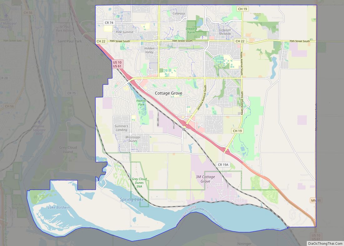
Since 1961, the Town of Cottage Grove had been petitioning to become a village, and the Minnesota Municipal Commission took it upon itself to push for a joint incorporation of Woodbury and Cottage Grove as the Village of Washington. The two town commissions agreed to the idea, and the issue was put up for a vote during the general election of 1963. It lost with 662 votes for joint incorporation, and 1,284 against. Cottage Grove incorporated on its own in 1965.
In 1966, a series of meetings took place setting up the incorporation of the Village of Woodbury. A vote was conducted on February 14, 1967, with 543 voting for incorporation, and 164 against. The Village was officially incorporated on March 7, 1967.
Woodbury Road Map

Woodbury city Satellite Map

Geography
According to the United States Census Bureau, the city has an area of 35.56 square miles (92.10 km), of which 34.73 square miles (89.95 km) is land and 0.83 square miles (2.15 km) is water.
The city is bounded on the northern side by Interstate 94, the south by the plane of 60th Street South, the west by Century Avenue, and the east by Manning Avenue. The adjoining cities in these directions are, respectively, Oakdale, Landfall, Lake Elmo, Cottage Grove, Maplewood, Newport and Afton.
Woodbury is composed of upland between the valleys of the Mississippi River and St. Croix River. Its northeast corner lies within the watershed of Valley Creek, one of the few remaining trout streams in the Twin Cities area. Valley Creek flows eastward to the St. Croix River at Afton. Woodbury also contains several small lakes, including Powers, Wilmes, Colby, Carver, and Battle Creek. Battle Creek Lake is the source of Battle Creek, which flows westward to the Mississippi River in Saint Paul.
Climate
See also
Map of Minnesota State and its subdivision:- Aitkin
- Anoka
- Becker
- Beltrami
- Benton
- Big Stone
- Blue Earth
- Brown
- Carlton
- Carver
- Cass
- Chippewa
- Chisago
- Clay
- Clearwater
- Cook
- Cottonwood
- Crow Wing
- Dakota
- Dodge
- Douglas
- Faribault
- Fillmore
- Freeborn
- Goodhue
- Grant
- Hennepin
- Houston
- Hubbard
- Isanti
- Itasca
- Jackson
- Kanabec
- Kandiyohi
- Kittson
- Koochiching
- Lac qui Parle
- Lake
- Lake of the Woods
- Lake Superior
- Le Sueur
- Lincoln
- Lyon
- Mahnomen
- Marshall
- Martin
- McLeod
- Meeker
- Mille Lacs
- Morrison
- Mower
- Murray
- Nicollet
- Nobles
- Norman
- Olmsted
- Otter Tail
- Pennington
- Pine
- Pipestone
- Polk
- Pope
- Ramsey
- Red Lake
- Redwood
- Renville
- Rice
- Rock
- Roseau
- Saint Louis
- Scott
- Sherburne
- Sibley
- Stearns
- Steele
- Stevens
- Swift
- Todd
- Traverse
- Wabasha
- Wadena
- Waseca
- Washington
- Watonwan
- Wilkin
- Winona
- Wright
- Yellow Medicine
- Alabama
- Alaska
- Arizona
- Arkansas
- California
- Colorado
- Connecticut
- Delaware
- District of Columbia
- Florida
- Georgia
- Hawaii
- Idaho
- Illinois
- Indiana
- Iowa
- Kansas
- Kentucky
- Louisiana
- Maine
- Maryland
- Massachusetts
- Michigan
- Minnesota
- Mississippi
- Missouri
- Montana
- Nebraska
- Nevada
- New Hampshire
- New Jersey
- New Mexico
- New York
- North Carolina
- North Dakota
- Ohio
- Oklahoma
- Oregon
- Pennsylvania
- Rhode Island
- South Carolina
- South Dakota
- Tennessee
- Texas
- Utah
- Vermont
- Virginia
- Washington
- West Virginia
- Wisconsin
- Wyoming