Aristes is a census-designated place (CDP) in Conyngham Township, Columbia County, Pennsylvania, United States. It is part of Northeastern Pennsylvania. The population was 311 at the 2010 census. It is part of the Bloomsburg-Berwick micropolitan area. Aristes is located adjacent to the famous “ghost town” of Centralia.
| Name: | Aristes CDP |
|---|---|
| LSAD Code: | 57 |
| LSAD Description: | CDP (suffix) |
| State: | Pennsylvania |
| County: | Columbia County |
| Elevation: | 1,750 ft (530 m) |
| Total Area: | 0.37 sq mi (0.97 km²) |
| Land Area: | 0.37 sq mi (0.96 km²) |
| Water Area: | 0.00 sq mi (0.00 km²) |
| Total Population: | 256 |
| Population Density: | 688.17/sq mi (265.56/km²) |
| ZIP code: | 17920 |
| Area code: | 570 |
| FIPS code: | 4202968 |
| GNISfeature ID: | 1168385 |
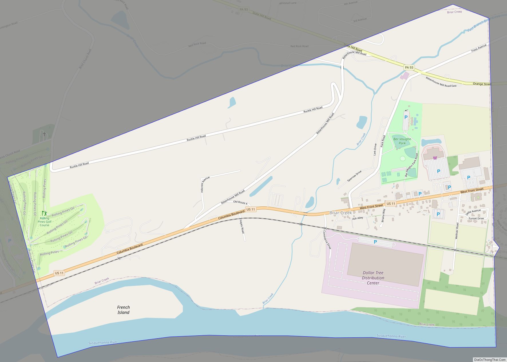
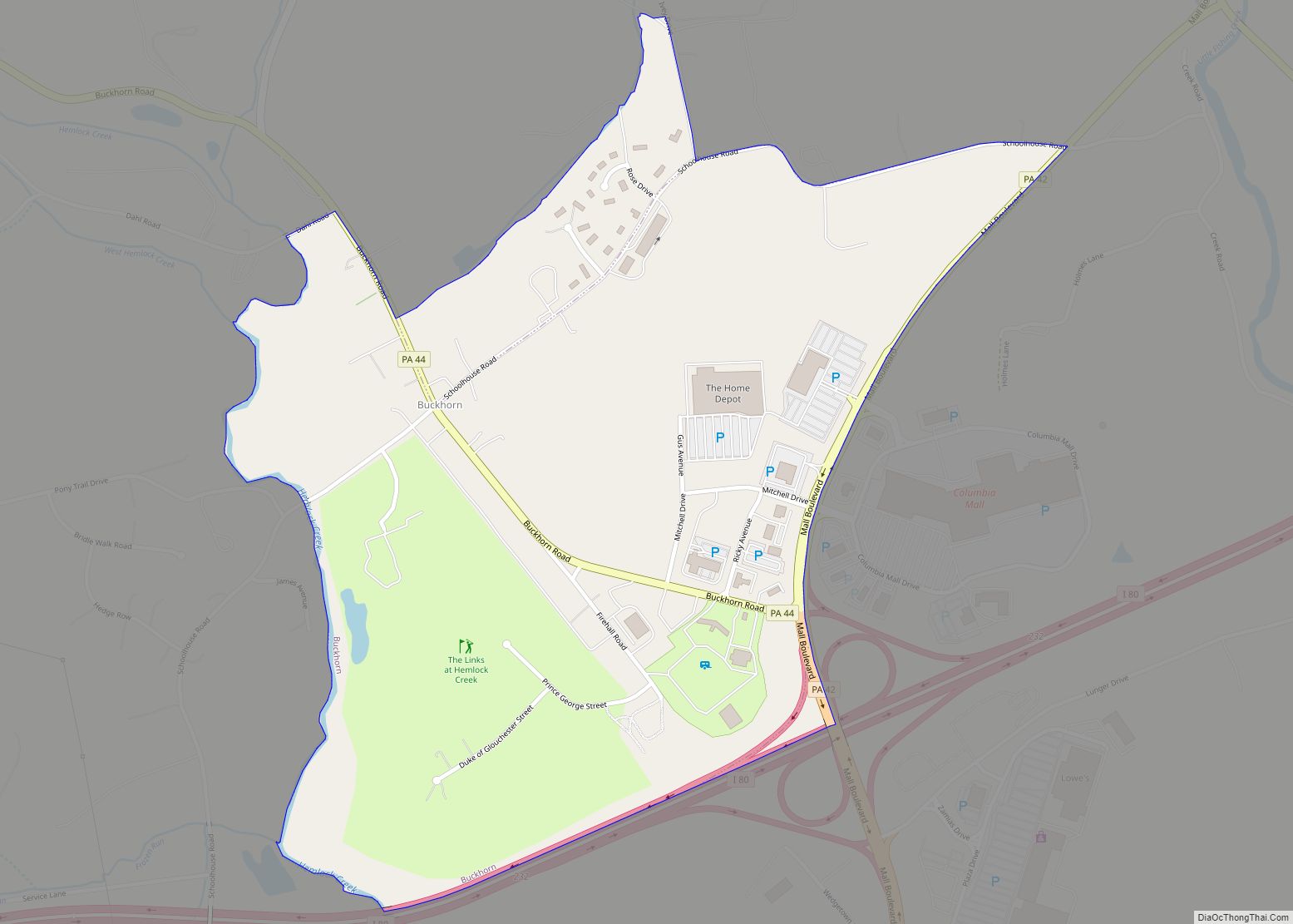
Online Interactive Map
Click on ![]() to view map in "full screen" mode.
to view map in "full screen" mode.
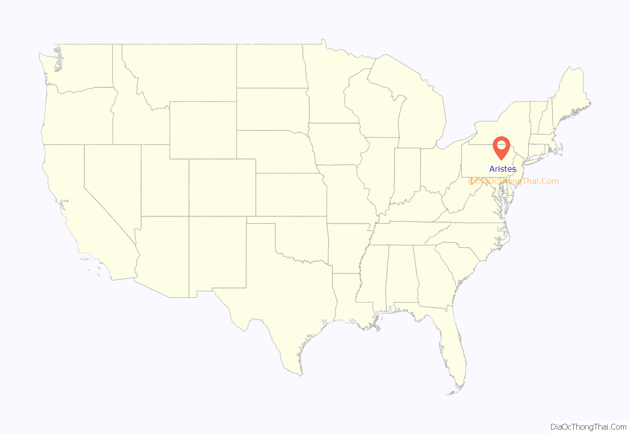
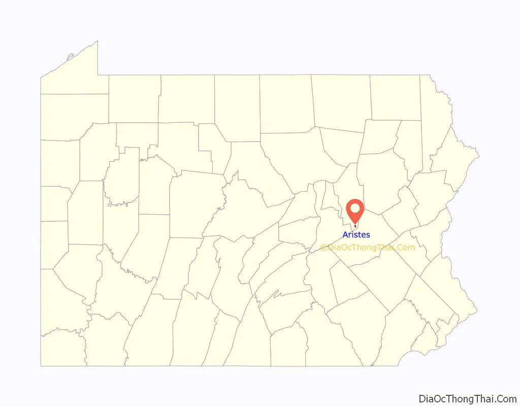
Aristes location map. Where is Aristes CDP?
History
Around the year 1800, the Red Tavern was built along the Old Reading Road, which ran from Catawissa to Reading. In 1865, the owner of the Red Tavern laid out a village which he called “Montana”. When a post office was established here in 1897, the name of the town was changed to “Aristes”, a contraction of the name Aristides, a Greek statesman.
In 1948, United Airlines Flight 624 hit a high-voltage powerline and crashed in Aristes. Notable victims of the crash included Broadway theatre impresario Earl Carroll and his girlfriend, actress Beryl Wallace; Henry L. Jackson, men’s fashion editor of Collier’s Weekly magazine and co-founder of Esquire magazine; and Venita Varden Oakie, the former wife of actor Jack Oakie.
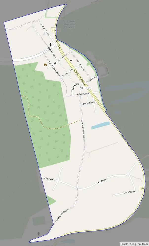
Aristes Road Map
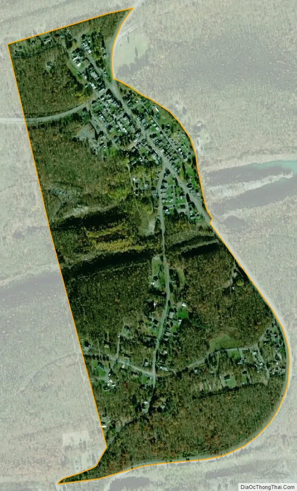
Aristes city Satellite Map
Geography
Aristes is located in southern Columbia County at 40°49′8″N 76°20′22″W / 40.81889°N 76.33944°W / 40.81889; -76.33944 (40.818984, -76.339374), east of the center of Conyngham Township and northeast of Centralia. According to the United States Census Bureau, the Aristes CDP has a total area of 0.37 square miles (0.96 km), all land. Aristes is served by Pennsylvania Route 42. The CDP’s southern half is mostly forested.
See also
Map of Pennsylvania State and its subdivision:- Adams
- Allegheny
- Armstrong
- Beaver
- Bedford
- Berks
- Blair
- Bradford
- Bucks
- Butler
- Cambria
- Cameron
- Carbon
- Centre
- Chester
- Clarion
- Clearfield
- Clinton
- Columbia
- Crawford
- Cumberland
- Dauphin
- Delaware
- Elk
- Erie
- Fayette
- Forest
- Franklin
- Fulton
- Greene
- Huntingdon
- Indiana
- Jefferson
- Juniata
- Lackawanna
- Lancaster
- Lawrence
- Lebanon
- Lehigh
- Luzerne
- Lycoming
- Mc Kean
- Mercer
- Mifflin
- Monroe
- Montgomery
- Montour
- Northampton
- Northumberland
- Perry
- Philadelphia
- Pike
- Potter
- Schuylkill
- Snyder
- Somerset
- Sullivan
- Susquehanna
- Tioga
- Union
- Venango
- Warren
- Washington
- Wayne
- Westmoreland
- Wyoming
- York
- Alabama
- Alaska
- Arizona
- Arkansas
- California
- Colorado
- Connecticut
- Delaware
- District of Columbia
- Florida
- Georgia
- Hawaii
- Idaho
- Illinois
- Indiana
- Iowa
- Kansas
- Kentucky
- Louisiana
- Maine
- Maryland
- Massachusetts
- Michigan
- Minnesota
- Mississippi
- Missouri
- Montana
- Nebraska
- Nevada
- New Hampshire
- New Jersey
- New Mexico
- New York
- North Carolina
- North Dakota
- Ohio
- Oklahoma
- Oregon
- Pennsylvania
- Rhode Island
- South Carolina
- South Dakota
- Tennessee
- Texas
- Utah
- Vermont
- Virginia
- Washington
- West Virginia
- Wisconsin
- Wyoming