Cetronia is a census-designated place (CDP) in South Whitehall Township in Lehigh County, Pennsylvania, located near Allentown. As of the 2020 census, its population was 2,421.
Cetronia is part of the Lehigh Valley metropolitan area, which had a population of 861,899 and was the 68th-most populous metropolitan area in the U.S. as of the 2020 census.
| Name: | Cetronia CDP |
|---|---|
| LSAD Code: | 57 |
| LSAD Description: | CDP (suffix) |
| State: | Pennsylvania |
| County: | Lehigh County |
| Elevation: | 363 ft (111 m) |
| Land Area: | 0.81 sq mi (2.10 km²) |
| Water Area: | 0.00 sq mi (0.00 km²) |
| Population Density: | 2,985.20/sq mi (1,152.43/km²) |
| ZIP code: | 18104 |
| Area code: | 610 and 484 |
| FIPS code: | 4212424 |
| GNISfeature ID: | 2628811 |
Online Interactive Map
Click on ![]() to view map in "full screen" mode.
to view map in "full screen" mode.
Cetronia location map. Where is Cetronia CDP?

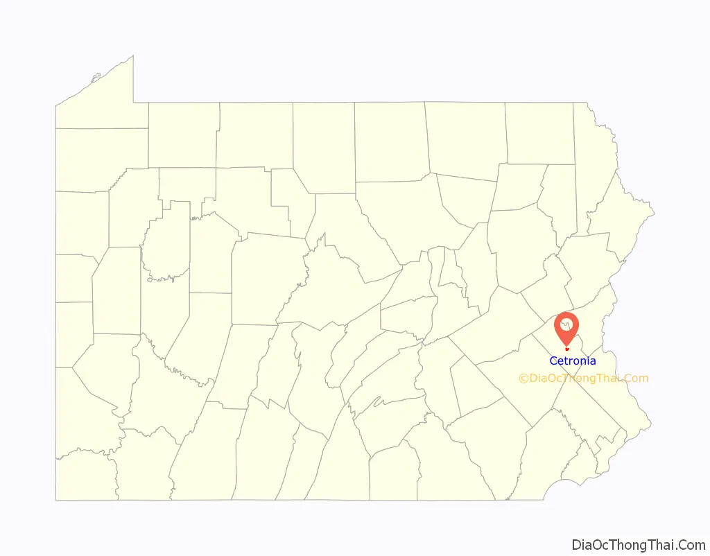
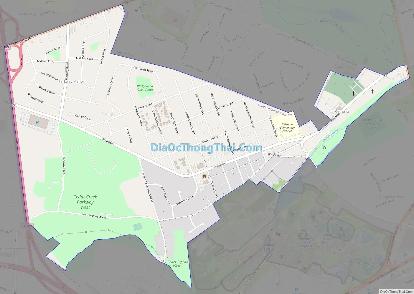
Cetronia Road Map
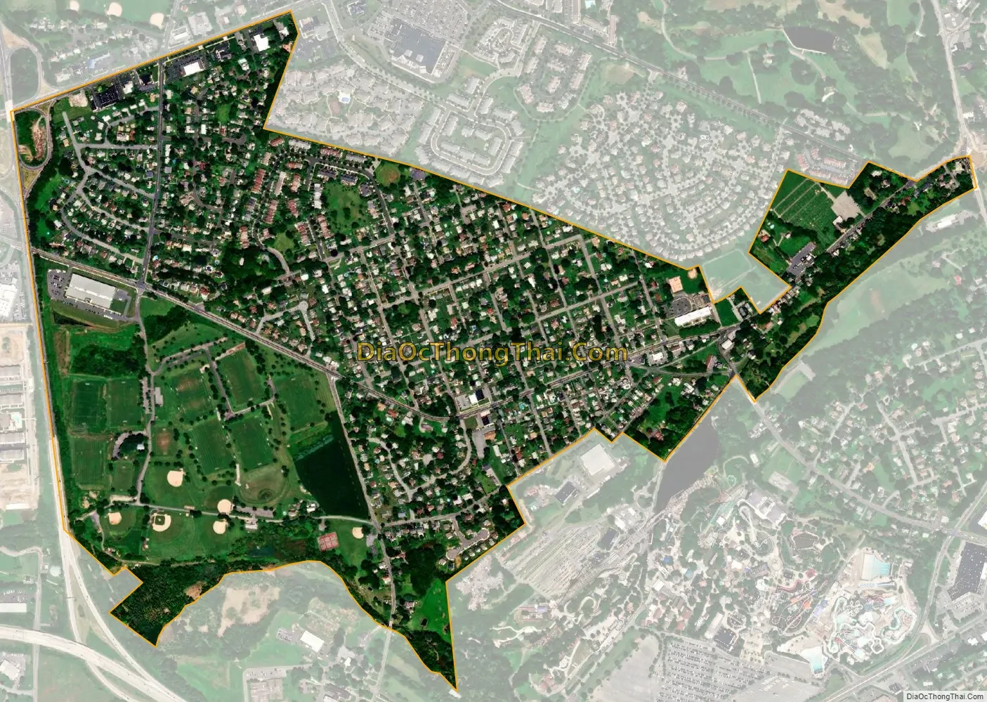
Cetronia city Satellite Map
Geography
Cetronia is in central Lehigh County in the southern part of South Whitehall Township. It is bordered to the north by Allentown and to the southeast by Dorneyville and Dorney Park & Wildwater Kingdom. State Route 1002, also known as Tilghman Street, runs through Cetronia. Pennsylvania Route 309 forms the western boundary of the community, and Cedar Crest Boulevard borders its far eastern end.
Interstate 78 runs southwest of Cetronia prior to its merge with PA Route 309. Interstate 476, the Northeast Extension of the Pennsylvania Turnpike, runs just west of Cetronia, separating it from Krocksville, Kuhnsville, and Ruppsville. US 22, the Lehigh Valley Thruway, passes 1 mile (1.6 km) north of Cetronia, separating it from the Crackersport and Walbert area. I-476 has an interchange with US 22 at the western edge of Cetronia, which uses the Allentown ZIP code of 18104.
According to the U.S. Census Bureau, Cetronia has an area of 0.77 square miles (2.0 km), all land. Cedar Creek, an eastward-flowing tributary of Little Lehigh Creek, forms part of the southern boundary of the CDP. The community is part of the watershed of the Lehigh River, flowing to the Delaware River.
Tilghman Square Shopping Center and a number of restaurants, medical offices, and car dealerships are located in the Cetronia area. The Census Bureau uses PA Route 309 and Tilghman Street as the western and northern boundaries of the CDP respectively, however, and therefore most of these businesses are excluded from the CDP definition and totals.
Cetronia Ambulance Corps and the volunteer Cetronia Fire Department provide first responder services to Cetronia and the surrounding area.
See also
Map of Pennsylvania State and its subdivision:- Adams
- Allegheny
- Armstrong
- Beaver
- Bedford
- Berks
- Blair
- Bradford
- Bucks
- Butler
- Cambria
- Cameron
- Carbon
- Centre
- Chester
- Clarion
- Clearfield
- Clinton
- Columbia
- Crawford
- Cumberland
- Dauphin
- Delaware
- Elk
- Erie
- Fayette
- Forest
- Franklin
- Fulton
- Greene
- Huntingdon
- Indiana
- Jefferson
- Juniata
- Lackawanna
- Lancaster
- Lawrence
- Lebanon
- Lehigh
- Luzerne
- Lycoming
- Mc Kean
- Mercer
- Mifflin
- Monroe
- Montgomery
- Montour
- Northampton
- Northumberland
- Perry
- Philadelphia
- Pike
- Potter
- Schuylkill
- Snyder
- Somerset
- Sullivan
- Susquehanna
- Tioga
- Union
- Venango
- Warren
- Washington
- Wayne
- Westmoreland
- Wyoming
- York
- Alabama
- Alaska
- Arizona
- Arkansas
- California
- Colorado
- Connecticut
- Delaware
- District of Columbia
- Florida
- Georgia
- Hawaii
- Idaho
- Illinois
- Indiana
- Iowa
- Kansas
- Kentucky
- Louisiana
- Maine
- Maryland
- Massachusetts
- Michigan
- Minnesota
- Mississippi
- Missouri
- Montana
- Nebraska
- Nevada
- New Hampshire
- New Jersey
- New Mexico
- New York
- North Carolina
- North Dakota
- Ohio
- Oklahoma
- Oregon
- Pennsylvania
- Rhode Island
- South Carolina
- South Dakota
- Tennessee
- Texas
- Utah
- Vermont
- Virginia
- Washington
- West Virginia
- Wisconsin
- Wyoming