Falmouth is an unincorporated community and census-designated place (CDP) in Conoy Township, Lancaster County, Pennsylvania, United States. As of the 2010 census the population was 420, but the 2020 census shows that the population has decreased to 397.
| Name: | Falmouth CDP |
|---|---|
| LSAD Code: | 57 |
| LSAD Description: | CDP (suffix) |
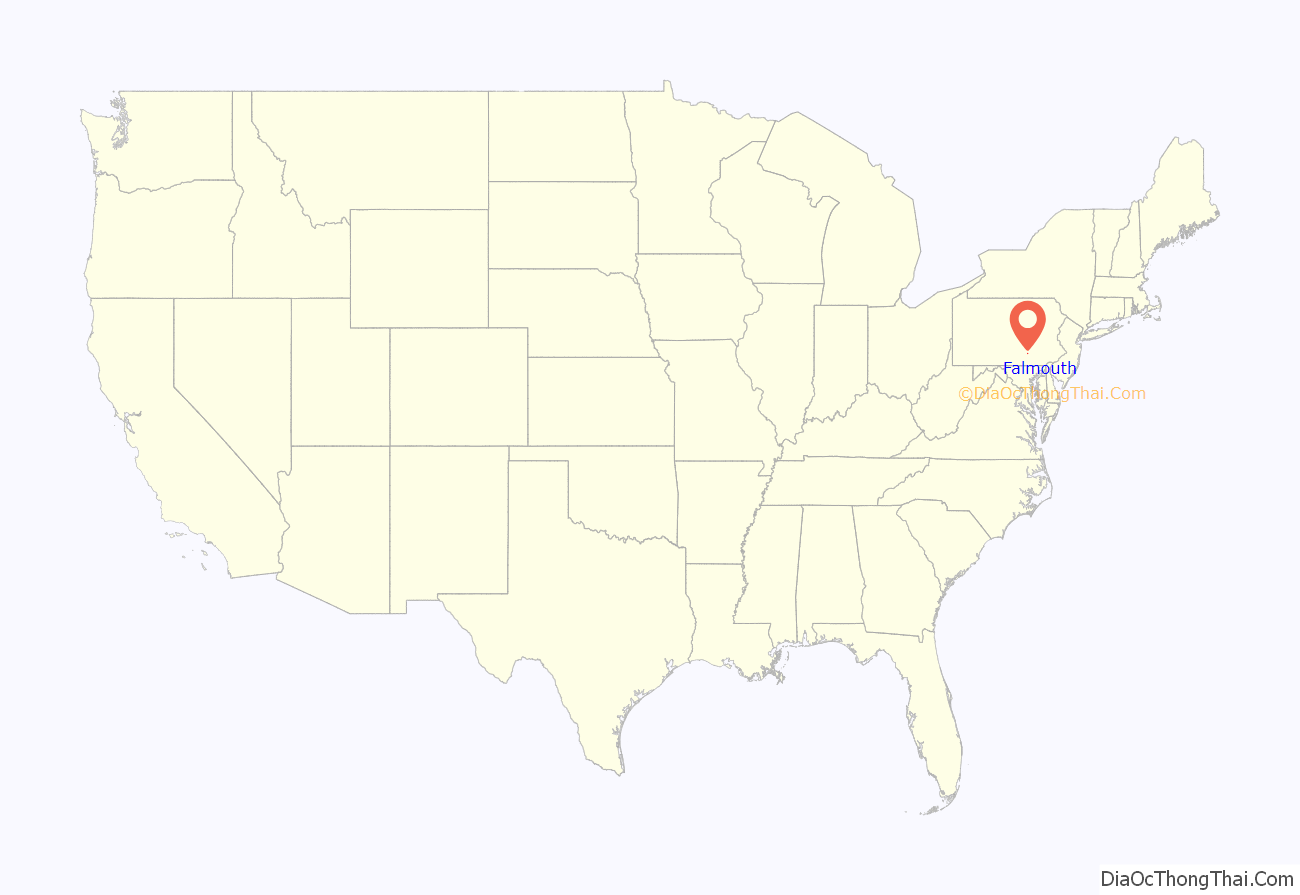
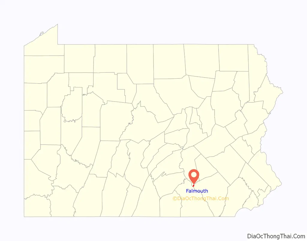
| State: | Pennsylvania |
| County: | Lancaster County |
| Elevation: | 360 ft (110 m) |
| Total Area: | 0.99 sq mi (2.56 km²) |
| Land Area: | 0.99 sq mi (2.55 km²) |
| Water Area: | 0.00 sq mi (0.00 km²) |
| Total Population: | 397 |
| Population Density: | 402.64/sq mi (155.45/km²) |
| FIPS code: | 4225168 |
| GNISfeature ID: | 1174610 |
Online Interactive Map
Click on ![]() to view map in "full screen" mode.
to view map in "full screen" mode.
Falmouth location map. Where is Falmouth CDP?
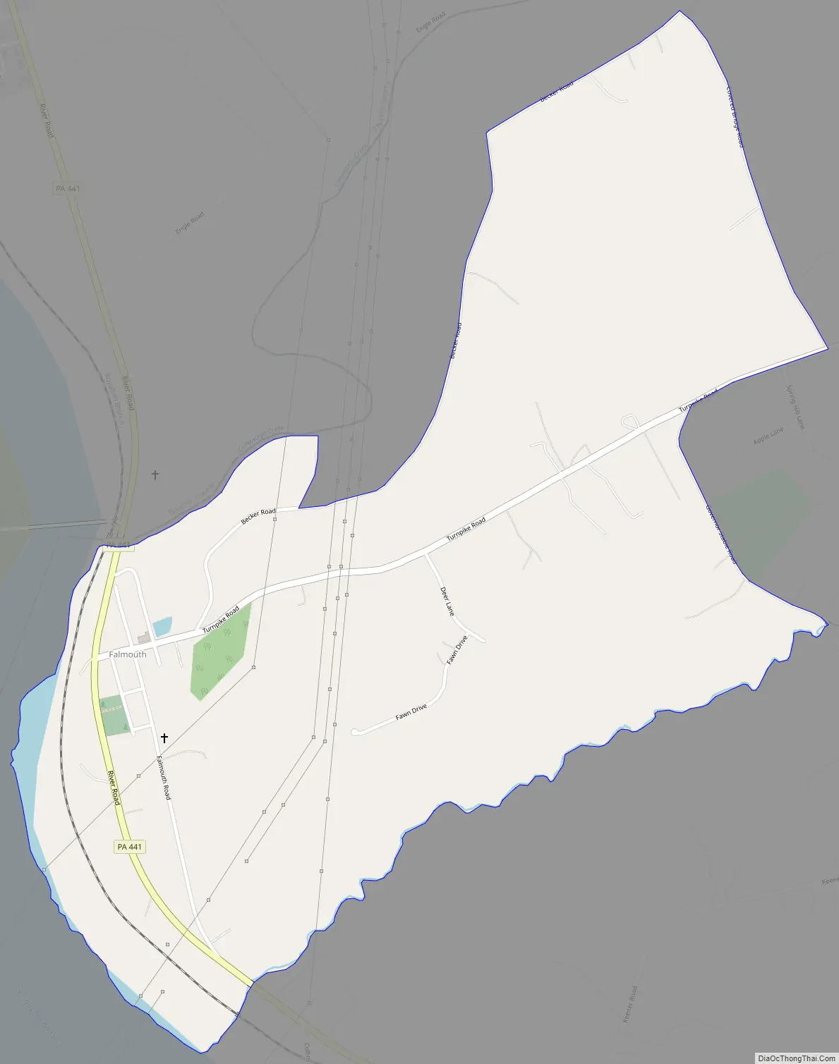
Falmouth Road Map
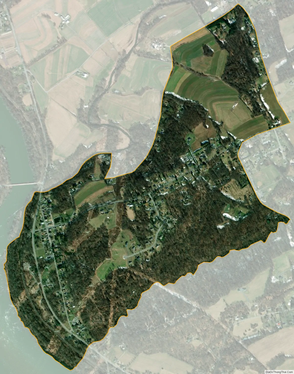
Falmouth city Satellite Map
Geography
Falmouth is in the northwestern corner of Lancaster County, at the confluence of Conewago Creek with the Susquehanna River. It is bordered to the northwest, across Conewago Creek, by Londonderry Township in Dauphin County. To the southwest, across the Susquehanna River, is the borough of York Haven in York County. Falmouth is 2 miles (3 km) south of the closed Three Mile Island Nuclear Generating Station.
Pennsylvania Route 441 (River Road) passes through Falmouth, leading north (up the Susquehanna) 5 miles (8 km) to Middletown and southeast (downriver) 4 miles (6 km) to Bainbridge and 14 miles (23 km) to Columbia. Lancaster, the county seat, is 25 miles (40 km) southeast of Falmouth.
According to the U.S. Census Bureau, the Falmouth CDP has a total area of 1.0 square mile (2.6 km), of which 0.4 acres (1,599 m), or 0.06%, is water.
See also
Map of Pennsylvania State and its subdivision:- Adams
- Allegheny
- Armstrong
- Beaver
- Bedford
- Berks
- Blair
- Bradford
- Bucks
- Butler
- Cambria
- Cameron
- Carbon
- Centre
- Chester
- Clarion
- Clearfield
- Clinton
- Columbia
- Crawford
- Cumberland
- Dauphin
- Delaware
- Elk
- Erie
- Fayette
- Forest
- Franklin
- Fulton
- Greene
- Huntingdon
- Indiana
- Jefferson
- Juniata
- Lackawanna
- Lancaster
- Lawrence
- Lebanon
- Lehigh
- Luzerne
- Lycoming
- Mc Kean
- Mercer
- Mifflin
- Monroe
- Montgomery
- Montour
- Northampton
- Northumberland
- Perry
- Philadelphia
- Pike
- Potter
- Schuylkill
- Snyder
- Somerset
- Sullivan
- Susquehanna
- Tioga
- Union
- Venango
- Warren
- Washington
- Wayne
- Westmoreland
- Wyoming
- York
- Alabama
- Alaska
- Arizona
- Arkansas
- California
- Colorado
- Connecticut
- Delaware
- District of Columbia
- Florida
- Georgia
- Hawaii
- Idaho
- Illinois
- Indiana
- Iowa
- Kansas
- Kentucky
- Louisiana
- Maine
- Maryland
- Massachusetts
- Michigan
- Minnesota
- Mississippi
- Missouri
- Montana
- Nebraska
- Nevada
- New Hampshire
- New Jersey
- New Mexico
- New York
- North Carolina
- North Dakota
- Ohio
- Oklahoma
- Oregon
- Pennsylvania
- Rhode Island
- South Carolina
- South Dakota
- Tennessee
- Texas
- Utah
- Vermont
- Virginia
- Washington
- West Virginia
- Wisconsin
- Wyoming


