Christiana is a borough in Lancaster County, Pennsylvania, United States. The population was 1,100 at the time of the 2020 census.
In 1851, it was the site of the Battle of Christiana, also called the Christiana riot.
| Name: | Christiana borough |
|---|---|
| LSAD Code: | 21 |
| LSAD Description: | borough (suffix) |
| State: | Pennsylvania |
| County: | Lancaster County |
| Incorporated: | 1894 |
| Elevation: | 489 ft (149 m) |
| Total Area: | 0.53 sq mi (1.37 km²) |
| Land Area: | 0.53 sq mi (1.37 km²) |
| Water Area: | 0.00 sq mi (0.01 km²) |
| Total Population: | 1,112 |
| Population Density: | 2,110.06/sq mi (814.29/km²) |
| ZIP code: | 17509 |
| Area code: | 610 |
| FIPS code: | 4213512 |
| Website: | www.christianaboro.com |
Online Interactive Map
Click on ![]() to view map in "full screen" mode.
to view map in "full screen" mode.
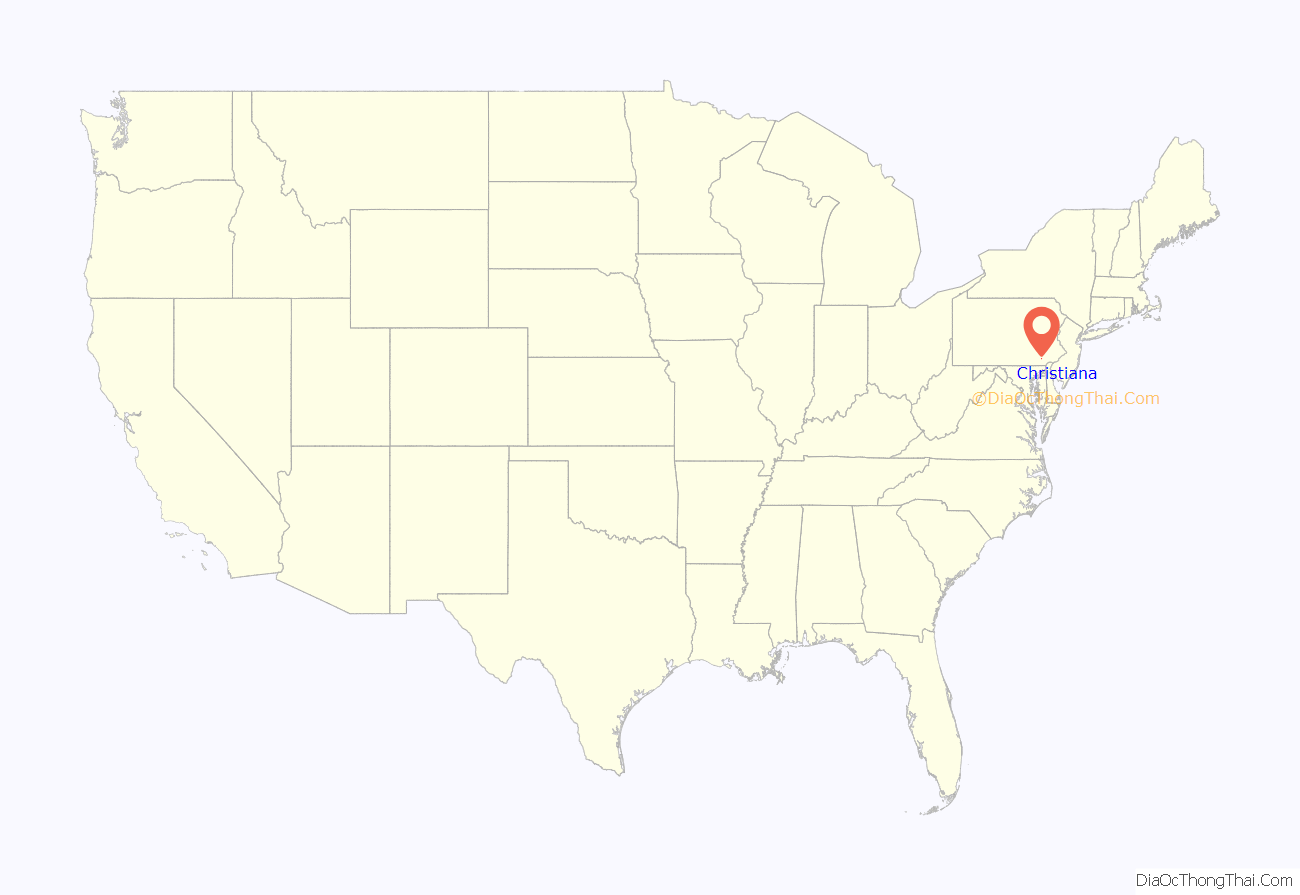
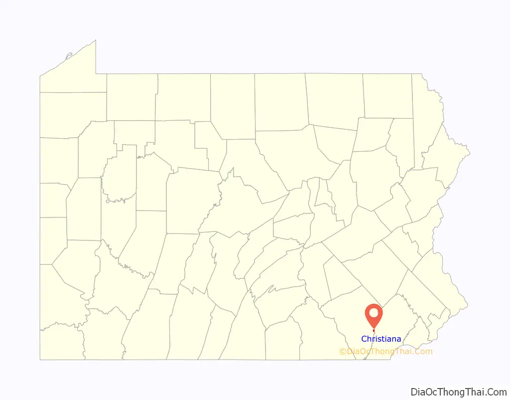
Christiana location map. Where is Christiana borough?
History
Present-day Christiana was once known as Nobleville. The present name is after Christiana Noble, the wife of a first settler.
On September 11, 1851, Christiana was the site of the Battle of Christiana (also called the Christiana Riot), in which the local residents defended with firearms a fugitive slave, killing the slaveowner. Southerners demanded the hanging of those responsible, who were accused of treason and making war on the United States, but after the first defendant was acquitted, the government dropped the case. The trial was the first nationally covered challenge to the Fugitive Slave Act of 1850.
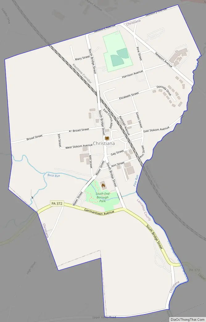
Christiana Road Map
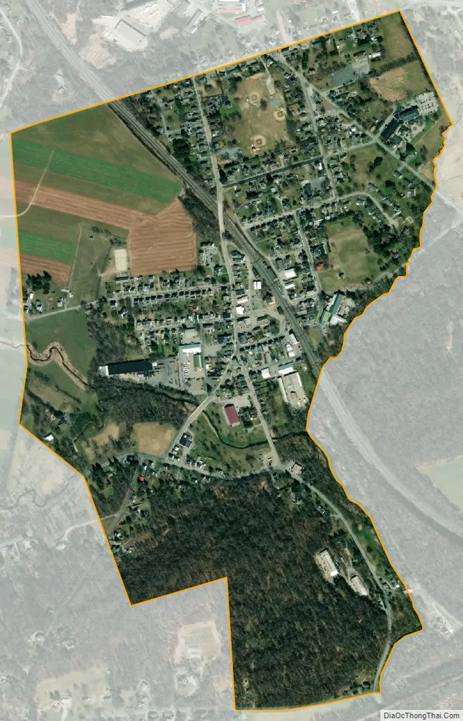
Christiana city Satellite Map
Geography
Christiana is located in eastern Lancaster County at 39°57′19″N 75°59′46″W / 39.95528°N 75.99611°W / 39.95528; -75.99611 (39.955262, -75.996208).
It is bordered to the north, west, and south by Sadsbury Township and to the east by West Sadsbury Township in Chester County.
Pennsylvania Route 372 passes through the center of the borough, leading east 5 miles (8 km) to Parkesburg and west 11 miles (18 km) to Quarryville. Lancaster is 19 miles (31 km) to the northwest via Pennsylvania Route 41, and U.S. Route 30.
According to the U.S. Census Bureau, the borough has a total area of 0.53 square miles (1.37 km), all land.
The borough is in the valley of Pine Creek, which forms the Lancaster County/Chester County line, and which flows south to form Octoraro Creek, a southward-flowing tributary of the Susquehanna River.
See also
Map of Pennsylvania State and its subdivision:- Adams
- Allegheny
- Armstrong
- Beaver
- Bedford
- Berks
- Blair
- Bradford
- Bucks
- Butler
- Cambria
- Cameron
- Carbon
- Centre
- Chester
- Clarion
- Clearfield
- Clinton
- Columbia
- Crawford
- Cumberland
- Dauphin
- Delaware
- Elk
- Erie
- Fayette
- Forest
- Franklin
- Fulton
- Greene
- Huntingdon
- Indiana
- Jefferson
- Juniata
- Lackawanna
- Lancaster
- Lawrence
- Lebanon
- Lehigh
- Luzerne
- Lycoming
- Mc Kean
- Mercer
- Mifflin
- Monroe
- Montgomery
- Montour
- Northampton
- Northumberland
- Perry
- Philadelphia
- Pike
- Potter
- Schuylkill
- Snyder
- Somerset
- Sullivan
- Susquehanna
- Tioga
- Union
- Venango
- Warren
- Washington
- Wayne
- Westmoreland
- Wyoming
- York
- Alabama
- Alaska
- Arizona
- Arkansas
- California
- Colorado
- Connecticut
- Delaware
- District of Columbia
- Florida
- Georgia
- Hawaii
- Idaho
- Illinois
- Indiana
- Iowa
- Kansas
- Kentucky
- Louisiana
- Maine
- Maryland
- Massachusetts
- Michigan
- Minnesota
- Mississippi
- Missouri
- Montana
- Nebraska
- Nevada
- New Hampshire
- New Jersey
- New Mexico
- New York
- North Carolina
- North Dakota
- Ohio
- Oklahoma
- Oregon
- Pennsylvania
- Rhode Island
- South Carolina
- South Dakota
- Tennessee
- Texas
- Utah
- Vermont
- Virginia
- Washington
- West Virginia
- Wisconsin
- Wyoming


