Akron is a borough in Lancaster County, Pennsylvania, United States. As of the 2020 census, it had a population of 4,169,
| Name: | Akron borough |
|---|---|
| LSAD Code: | 21 |
| LSAD Description: | borough (suffix) |
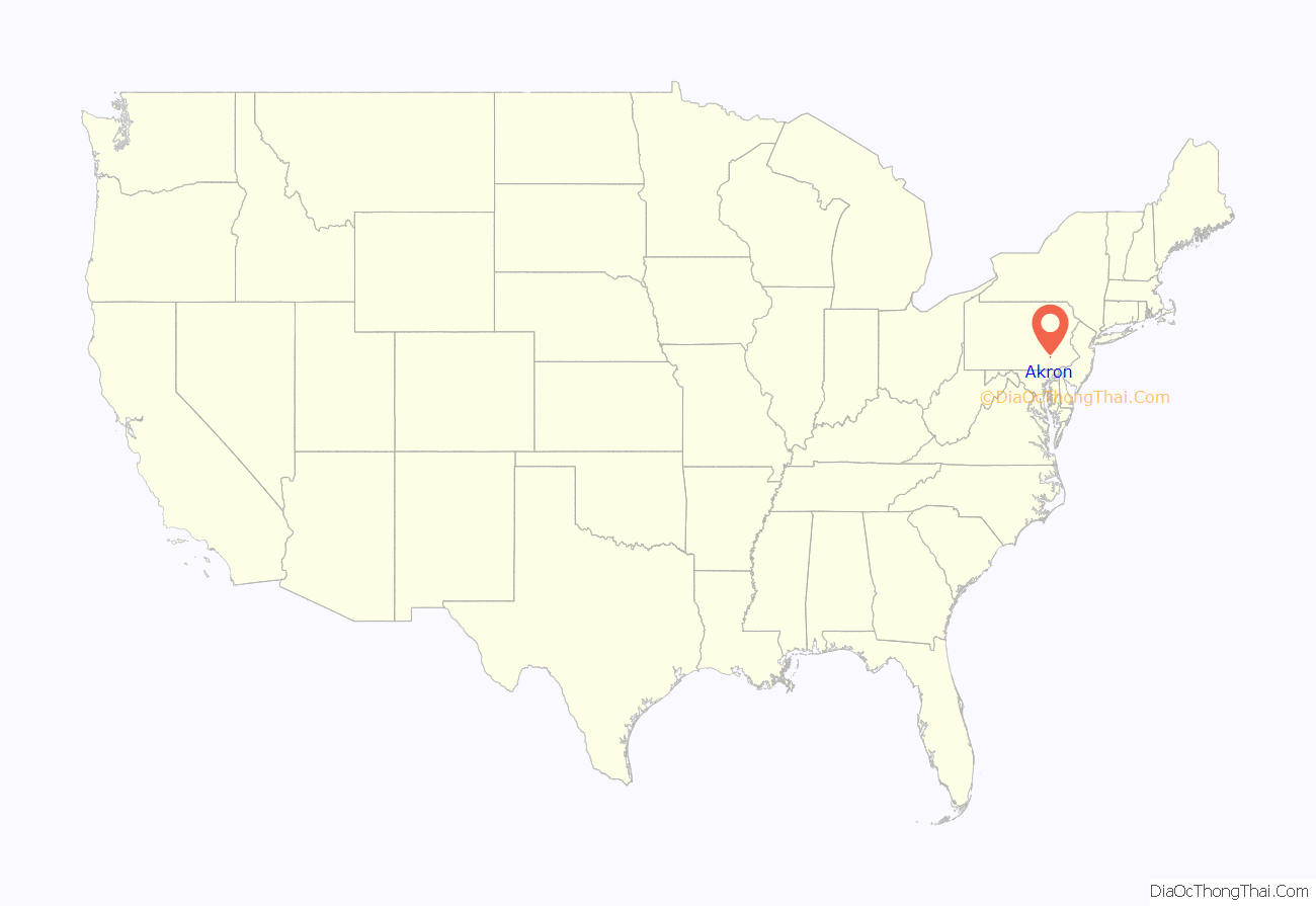
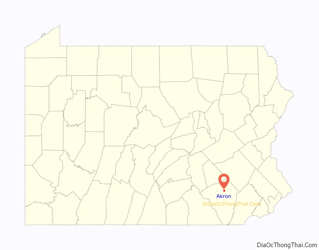
| State: | Pennsylvania |
| County: | Lancaster County |
| Elevation: | 509 ft (155 m) |
| Total Area: | 1.23 sq mi (3.19 km²) |
| Land Area: | 1.23 sq mi (3.18 km²) |
| Water Area: | 0.01 sq mi (0.02 km²) |
| Total Population: | 4,152 |
| Population Density: | 3,383.86/sq mi (1,307.03/km²) |
| ZIP code: | 17501 |
| Area code: | 717 |
| FIPS code: | 4200540 |
| Website: | www.akron-pa.com |
Online Interactive Map
Click on ![]() to view map in "full screen" mode.
to view map in "full screen" mode.
Akron location map. Where is Akron borough?
History
Akron was incorporated as a borough in 1895. Before this point, a small village called New Berlin sat at the center of the borough. A railroad used to run through Akron and served a railroad station in the town. A trolley also used to run in parts of the borough. The railroad has since been abandoned and is now the Warwick to Ephrata Rail Trail.
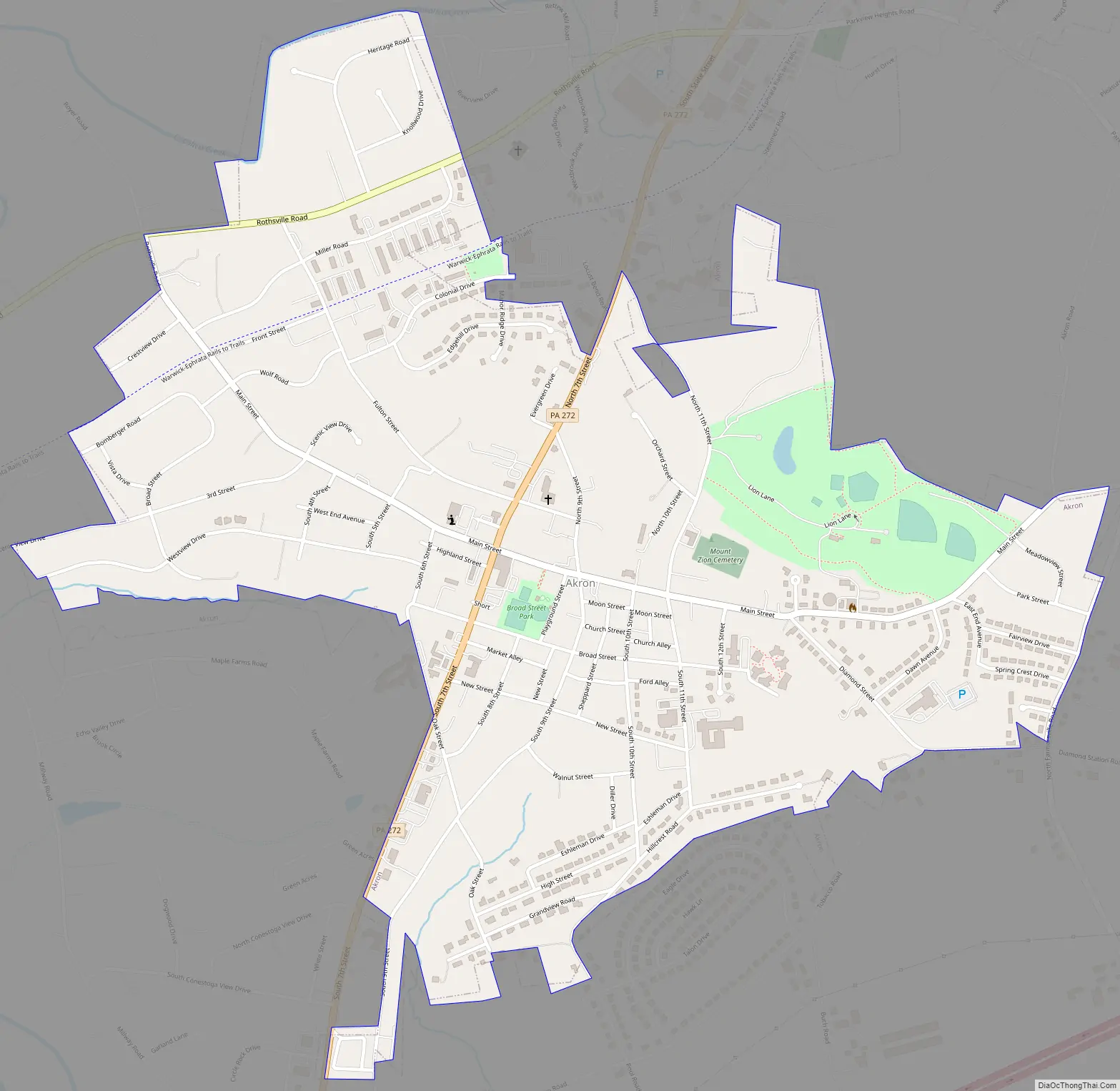
Akron Road Map
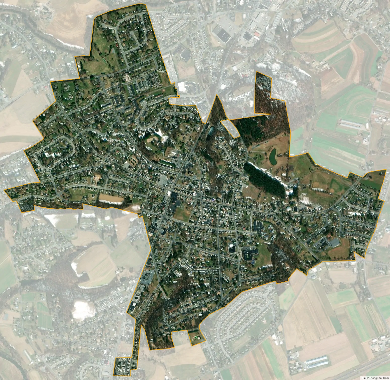
Akron city Satellite Map
Geography
Akron is located in northern Lancaster County at 40°9′23″N 76°12′14″W / 40.15639°N 76.20389°W / 40.15639; -76.20389 (40.156472, -76.204000). It is bordered to the north by the borough of Ephrata. Two main roads pass through the borough: Main Street and 7th Street (Pennsylvania Route 272). Lancaster, the county seat, is 11 miles (18 km) to the southwest, and Reading is 21 miles (34 km) to the northeast.
The borough is located on a hill. According to the United States Census Bureau, the borough has a total area of 1.23 square miles (3.19 km), all land. Cocalico Creek forms part of the northern border of the borough and loops past the west side of the borough, leading to the Conestoga River, a tributary of the Susquehanna.
See also
Map of Pennsylvania State and its subdivision:- Adams
- Allegheny
- Armstrong
- Beaver
- Bedford
- Berks
- Blair
- Bradford
- Bucks
- Butler
- Cambria
- Cameron
- Carbon
- Centre
- Chester
- Clarion
- Clearfield
- Clinton
- Columbia
- Crawford
- Cumberland
- Dauphin
- Delaware
- Elk
- Erie
- Fayette
- Forest
- Franklin
- Fulton
- Greene
- Huntingdon
- Indiana
- Jefferson
- Juniata
- Lackawanna
- Lancaster
- Lawrence
- Lebanon
- Lehigh
- Luzerne
- Lycoming
- Mc Kean
- Mercer
- Mifflin
- Monroe
- Montgomery
- Montour
- Northampton
- Northumberland
- Perry
- Philadelphia
- Pike
- Potter
- Schuylkill
- Snyder
- Somerset
- Sullivan
- Susquehanna
- Tioga
- Union
- Venango
- Warren
- Washington
- Wayne
- Westmoreland
- Wyoming
- York
- Alabama
- Alaska
- Arizona
- Arkansas
- California
- Colorado
- Connecticut
- Delaware
- District of Columbia
- Florida
- Georgia
- Hawaii
- Idaho
- Illinois
- Indiana
- Iowa
- Kansas
- Kentucky
- Louisiana
- Maine
- Maryland
- Massachusetts
- Michigan
- Minnesota
- Mississippi
- Missouri
- Montana
- Nebraska
- Nevada
- New Hampshire
- New Jersey
- New Mexico
- New York
- North Carolina
- North Dakota
- Ohio
- Oklahoma
- Oregon
- Pennsylvania
- Rhode Island
- South Carolina
- South Dakota
- Tennessee
- Texas
- Utah
- Vermont
- Virginia
- Washington
- West Virginia
- Wisconsin
- Wyoming


