Foundryville is a census-designated place (CDP) in Columbia County, Pennsylvania, United States. It is part of Northeastern Pennsylvania. The population was 256 at the 2010 census. It is part of the Bloomsburg-Berwick micropolitan area.
| Name: | Foundryville CDP |
|---|---|
| LSAD Code: | 57 |
| LSAD Description: | CDP (suffix) |
| State: | Pennsylvania |
| County: | Columbia County |
| Elevation: | 636 ft (194 m) |
| Total Area: | 0.55 sq mi (1.42 km²) |
| Land Area: | 0.54 sq mi (1.40 km²) |
| Water Area: | 0.01 sq mi (0.02 km²) |
| Total Population: | 260 |
| Population Density: | 481.48/sq mi (185.91/km²) |
| FIPS code: | 4226984 |
| GNISfeature ID: | 1175048 |
Online Interactive Map
Click on ![]() to view map in "full screen" mode.
to view map in "full screen" mode.
Foundryville location map. Where is Foundryville CDP?


History
A distillery was built in Foundryville in 1800. A school was built in Foundryville in 1810. A charcoal iron furnace was built in the community in 1835. A foundry was built there in 1847, providing the current name for the community.
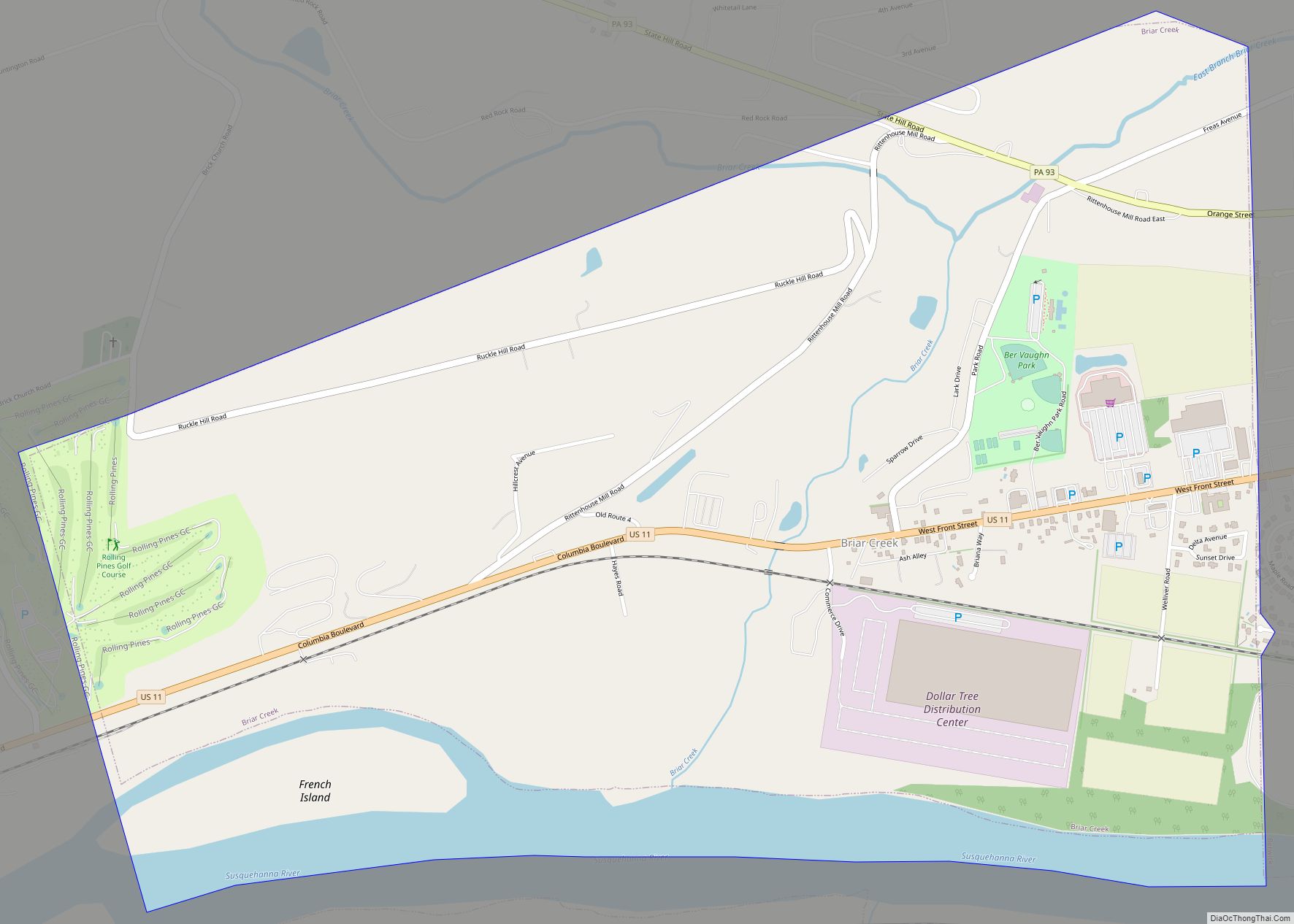
Foundryville Road Map

Foundryville city Satellite Map

Geography
Foundryville is located in eastern Columbia County at 41°4′37″N 76°14′7″W / 41.07694°N 76.23528°W / 41.07694; -76.23528 (41.076851, -76.235386). It is in the southeastern corner of Briar Creek Township and is bordered by Berwick to the south, Salem Township in Luzerne County to the east, and rural parts of Briar Creek Township to the north and west. The village is situated around Glen Brook, a southward-flowing tributary of Briar Creek and thence the Susquehanna River.
According to the United States Census Bureau, the CDP has a total area of 0.54 square miles (1.4 km), of which 0.01 square miles (0.02 km), or 1.40%, is water.
The Berwick Run for the Diamonds passes through Foundryville.
See also
Map of Pennsylvania State and its subdivision:- Adams
- Allegheny
- Armstrong
- Beaver
- Bedford
- Berks
- Blair
- Bradford
- Bucks
- Butler
- Cambria
- Cameron
- Carbon
- Centre
- Chester
- Clarion
- Clearfield
- Clinton
- Columbia
- Crawford
- Cumberland
- Dauphin
- Delaware
- Elk
- Erie
- Fayette
- Forest
- Franklin
- Fulton
- Greene
- Huntingdon
- Indiana
- Jefferson
- Juniata
- Lackawanna
- Lancaster
- Lawrence
- Lebanon
- Lehigh
- Luzerne
- Lycoming
- Mc Kean
- Mercer
- Mifflin
- Monroe
- Montgomery
- Montour
- Northampton
- Northumberland
- Perry
- Philadelphia
- Pike
- Potter
- Schuylkill
- Snyder
- Somerset
- Sullivan
- Susquehanna
- Tioga
- Union
- Venango
- Warren
- Washington
- Wayne
- Westmoreland
- Wyoming
- York
- Alabama
- Alaska
- Arizona
- Arkansas
- California
- Colorado
- Connecticut
- Delaware
- District of Columbia
- Florida
- Georgia
- Hawaii
- Idaho
- Illinois
- Indiana
- Iowa
- Kansas
- Kentucky
- Louisiana
- Maine
- Maryland
- Massachusetts
- Michigan
- Minnesota
- Mississippi
- Missouri
- Montana
- Nebraska
- Nevada
- New Hampshire
- New Jersey
- New Mexico
- New York
- North Carolina
- North Dakota
- Ohio
- Oklahoma
- Oregon
- Pennsylvania
- Rhode Island
- South Carolina
- South Dakota
- Tennessee
- Texas
- Utah
- Vermont
- Virginia
- Washington
- West Virginia
- Wisconsin
- Wyoming