Linwood is a census-designated place (CDP) in Delaware County, Pennsylvania, United States. The population was 3,281 at the 2010 census.
| Name: | Linwood CDP |
|---|---|
| LSAD Code: | 57 |
| LSAD Description: | CDP (suffix) |
| State: | Pennsylvania |
| County: | Delaware County |
| Elevation: | 102 ft (31 m) |
| Total Area: | 0.65 sq mi (1.68 km²) |
| Land Area: | 0.65 sq mi (1.68 km²) |
| Water Area: | 0.00 sq mi (0.00 km²) |
| Total Population: | 3,949 |
| Population Density: | 6,075.38/sq mi (2,347.07/km²) |
| ZIP code: | 19061 |
| FIPS code: | 4243720 |
| GNISfeature ID: | 1179441 |
Online Interactive Map
Click on ![]() to view map in "full screen" mode.
to view map in "full screen" mode.
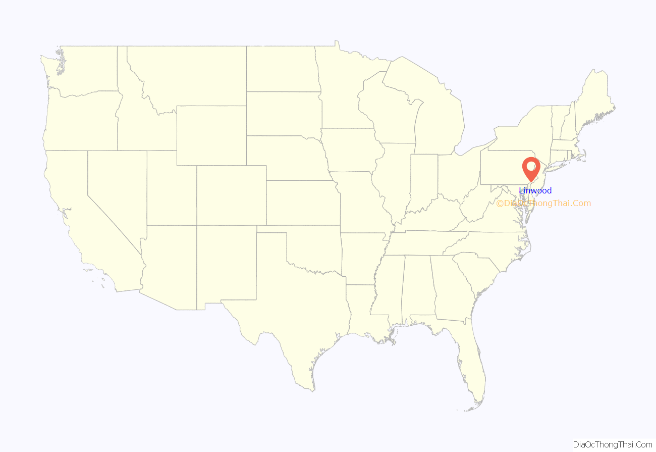
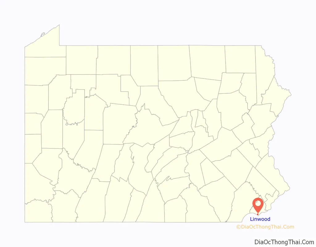
Linwood location map. Where is Linwood CDP?
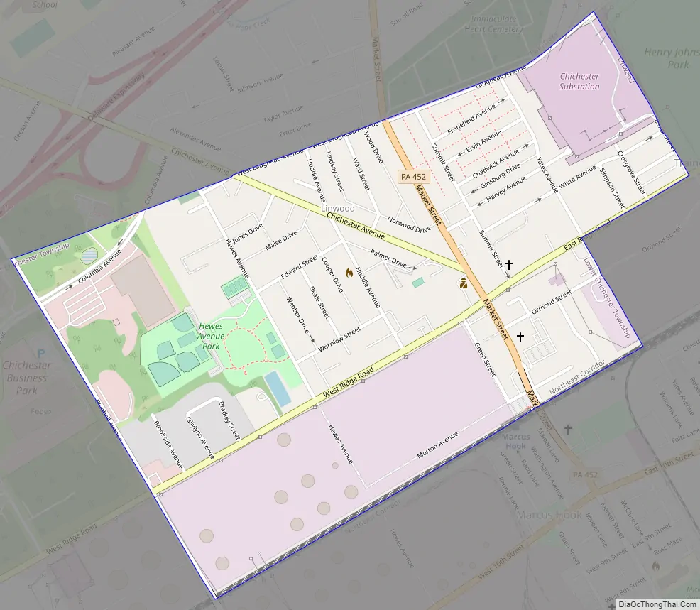
Linwood Road Map
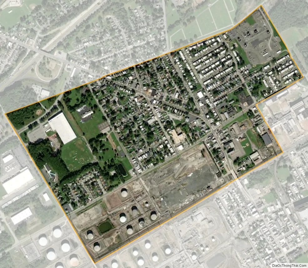
Linwood city Satellite Map
Geography
Linwood is located in southern Delaware County at 39°49′33″N 75°25′22″W / 39.82583°N 75.42278°W / 39.82583; -75.42278 (39.825945, -75.422808). It occupies the eastern half of Lower Chichester and is home to more than 90% of the township’s population. It is bordered to the south by the borough of Marcus Hook and to the east by the borough of Trainer. The northern border is with Upper Chichester Township.
According to the United States Census Bureau, the Linwood CDP has a total area of 0.50 square miles (1.3 km), all land.
See also
Map of Pennsylvania State and its subdivision:- Adams
- Allegheny
- Armstrong
- Beaver
- Bedford
- Berks
- Blair
- Bradford
- Bucks
- Butler
- Cambria
- Cameron
- Carbon
- Centre
- Chester
- Clarion
- Clearfield
- Clinton
- Columbia
- Crawford
- Cumberland
- Dauphin
- Delaware
- Elk
- Erie
- Fayette
- Forest
- Franklin
- Fulton
- Greene
- Huntingdon
- Indiana
- Jefferson
- Juniata
- Lackawanna
- Lancaster
- Lawrence
- Lebanon
- Lehigh
- Luzerne
- Lycoming
- Mc Kean
- Mercer
- Mifflin
- Monroe
- Montgomery
- Montour
- Northampton
- Northumberland
- Perry
- Philadelphia
- Pike
- Potter
- Schuylkill
- Snyder
- Somerset
- Sullivan
- Susquehanna
- Tioga
- Union
- Venango
- Warren
- Washington
- Wayne
- Westmoreland
- Wyoming
- York
- Alabama
- Alaska
- Arizona
- Arkansas
- California
- Colorado
- Connecticut
- Delaware
- District of Columbia
- Florida
- Georgia
- Hawaii
- Idaho
- Illinois
- Indiana
- Iowa
- Kansas
- Kentucky
- Louisiana
- Maine
- Maryland
- Massachusetts
- Michigan
- Minnesota
- Mississippi
- Missouri
- Montana
- Nebraska
- Nevada
- New Hampshire
- New Jersey
- New Mexico
- New York
- North Carolina
- North Dakota
- Ohio
- Oklahoma
- Oregon
- Pennsylvania
- Rhode Island
- South Carolina
- South Dakota
- Tennessee
- Texas
- Utah
- Vermont
- Virginia
- Washington
- West Virginia
- Wisconsin
- Wyoming


