Macungie /məˈkʌndʒiː/ is the second oldest borough in Lehigh County, Pennsylvania. As of the 2020 census, Macungie had a population of 3,257.
Macungie is a suburb of Allentown, and part of the Lehigh Valley metropolitan area, which had a population of 861,899 and was the 68th-most populous metropolitan area in the U.S. as of the 2020 census.
| Name: | Macungie borough |
|---|---|
| LSAD Code: | 21 |
| LSAD Description: | borough (suffix) |
| State: | Pennsylvania |
| County: | Lehigh County |
| Elevation: | 400 ft (100 m) |
| Land Area: | 0.99 sq mi (2.56 km²) |
| Water Area: | 0.00 sq mi (0.00 km²) |
| Population Density: | 3,293.23/sq mi (1,271.17/km²) |
| ZIP code: | 18062 |
| FIPS code: | 4246392 |
| Website: | www.macungie.pa.us |
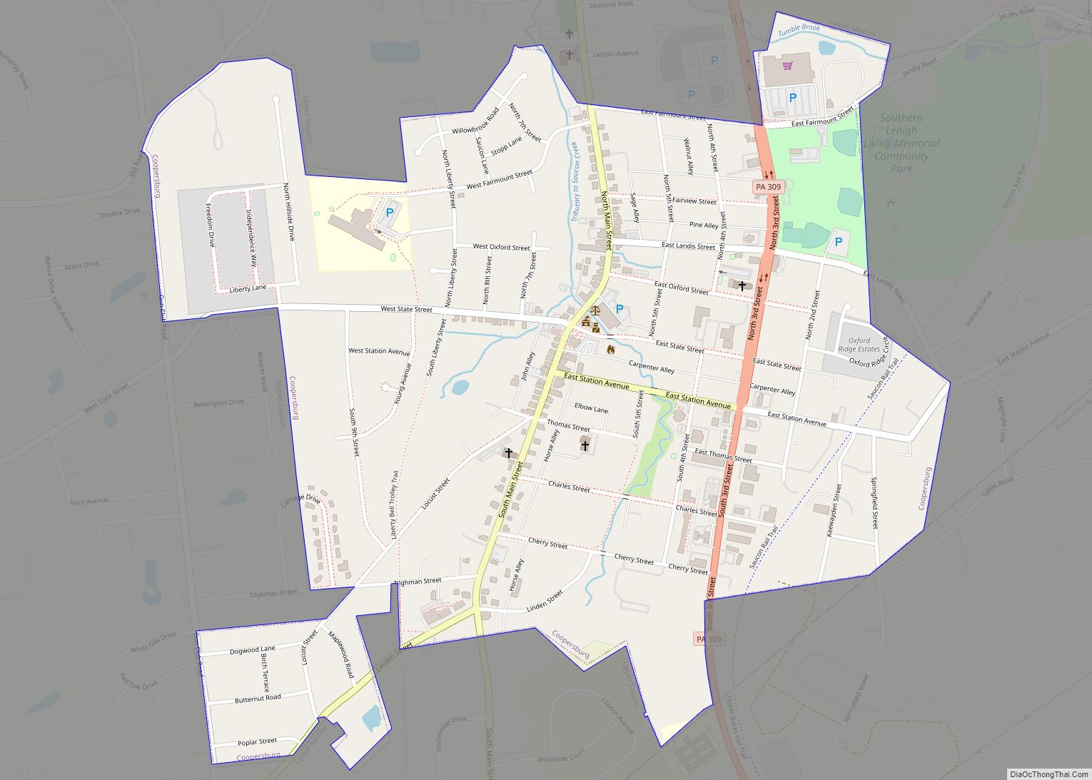
Online Interactive Map
Click on ![]() to view map in "full screen" mode.
to view map in "full screen" mode.
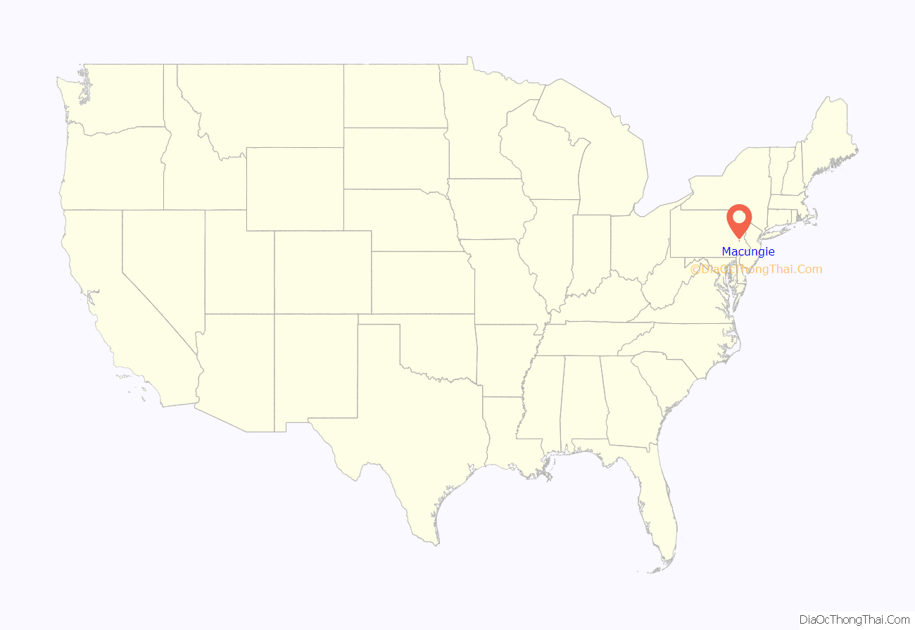
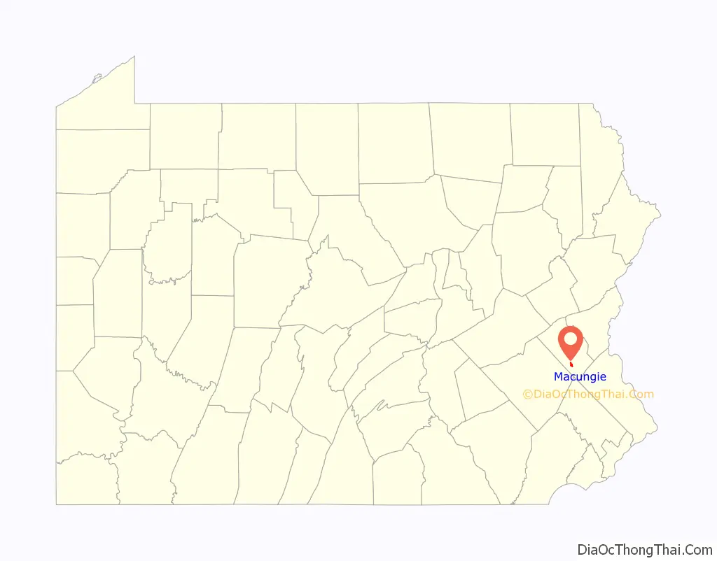
Macungie location map. Where is Macungie borough?
History
Macungie was founded as Millerstown in 1776 by Peter Miller. On November 15, 1857, the village of Millerstown was incorporated as a borough.
During Fries’s Rebellion in 1800, the United States Marshals Service began arresting people for tax resistance, and arrests were made without much incident until the marshal reached Millerstown, where a crowd formed to protect a man from arrest. Failing to make that arrest, the marshal arrested a few others and returned to Bethlehem, Pennsylvania, with his prisoners. Two separate groups of rebels independently vowed to liberate the prisoners and marched on Bethlehem. The militia prevailed, and John Fries, leader of the rebellion, and others were arrested. In 1875, the borough was renamed Macungie to avoid confusion with another town by the same name: Millerstown in Perry County, Pennsylvania.
Macungie is derived from “Maguntsche”, a place name used as early as 1730 to describe the region that is now Macungie and Emmaus, Pennsylvania. “Maguntsche” is a Lenape word, meaning either “bear swamp” or “feeding place of the bears”. The borough’s current seal depicts a bear coming to drink at water near some cattails. The Valentine Weaver House in Macungie was added to the National Register of Historic Places in 1984.
Macungie Road Map
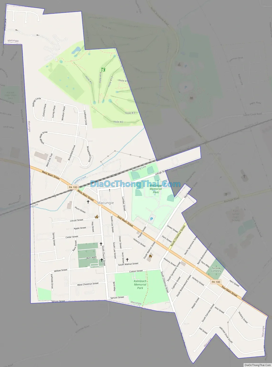
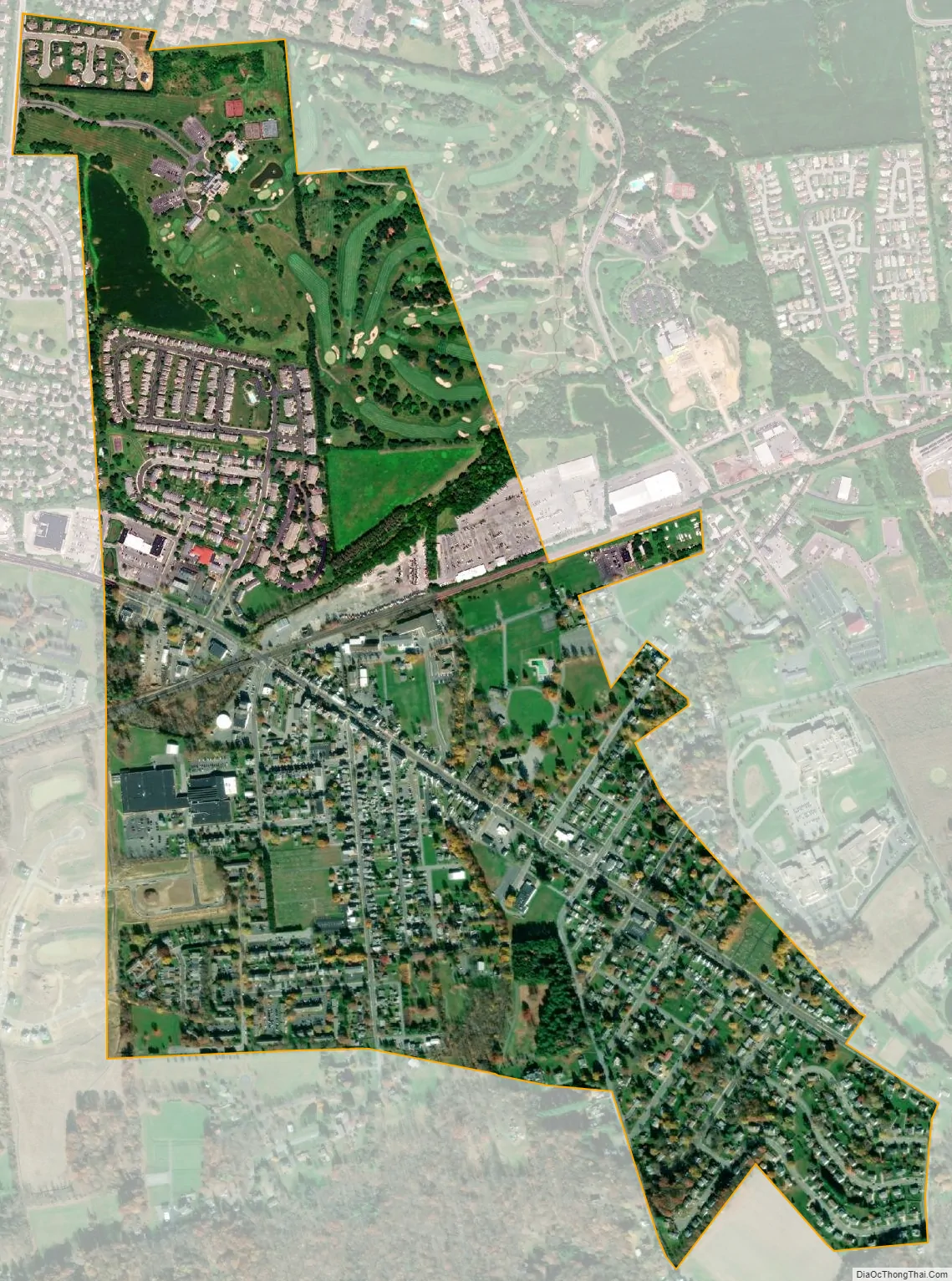
Macungie city Satellite Map
Geography
Macungie is located at 40°30′50″N 75°33′9″W / 40.51389°N 75.55250°W / 40.51389; -75.55250 (40.513945, -75.552491). According to the U.S. Census Bureau, the borough has a total area of 1.0 square mile (2.6 km), all land. Macungie is almost completely surrounded by Lower Macungie Township, except for a very small area in the southeast that neighbors Upper Milford Township. Swabia Creek flows from the west through the borough, receives Mountain Creek, and flows out of the borough to the northeast before draining into the Little Lehigh Creek.
Macungie has a hot-summer humid continental climate (Dfa) and is in hardiness zone 6b. Average monthly temperatures range from 29.2 °F (−1.6 °C) in January to 73.8 °F (23.2 °C) in July.
See also
Map of Pennsylvania State and its subdivision:- Adams
- Allegheny
- Armstrong
- Beaver
- Bedford
- Berks
- Blair
- Bradford
- Bucks
- Butler
- Cambria
- Cameron
- Carbon
- Centre
- Chester
- Clarion
- Clearfield
- Clinton
- Columbia
- Crawford
- Cumberland
- Dauphin
- Delaware
- Elk
- Erie
- Fayette
- Forest
- Franklin
- Fulton
- Greene
- Huntingdon
- Indiana
- Jefferson
- Juniata
- Lackawanna
- Lancaster
- Lawrence
- Lebanon
- Lehigh
- Luzerne
- Lycoming
- Mc Kean
- Mercer
- Mifflin
- Monroe
- Montgomery
- Montour
- Northampton
- Northumberland
- Perry
- Philadelphia
- Pike
- Potter
- Schuylkill
- Snyder
- Somerset
- Sullivan
- Susquehanna
- Tioga
- Union
- Venango
- Warren
- Washington
- Wayne
- Westmoreland
- Wyoming
- York
- Alabama
- Alaska
- Arizona
- Arkansas
- California
- Colorado
- Connecticut
- Delaware
- District of Columbia
- Florida
- Georgia
- Hawaii
- Idaho
- Illinois
- Indiana
- Iowa
- Kansas
- Kentucky
- Louisiana
- Maine
- Maryland
- Massachusetts
- Michigan
- Minnesota
- Mississippi
- Missouri
- Montana
- Nebraska
- Nevada
- New Hampshire
- New Jersey
- New Mexico
- New York
- North Carolina
- North Dakota
- Ohio
- Oklahoma
- Oregon
- Pennsylvania
- Rhode Island
- South Carolina
- South Dakota
- Tennessee
- Texas
- Utah
- Vermont
- Virginia
- Washington
- West Virginia
- Wisconsin
- Wyoming