Mahanoy City (pronounced MAHA-noy, also MA-noy locally) is a borough located 38 miles (61 km) southwest of Wilkes-Barre and 13 miles southwest of Hazleton, in northern Schuylkill County, Pennsylvania, United States. It is part of the Coal Region of Pennsylvania and is located entirely within, but is not part of, Mahanoy Township.
The name Mahanoy is believed to be a variation of the Native American word Maghonioy, or “the salt deposits”.
| Name: | Mahanoy City borough |
|---|---|
| LSAD Code: | 21 |
| LSAD Description: | borough (suffix) |
| State: | Pennsylvania |
| County: | Schuylkill County |
| Incorporated: | December 16, 1863 |
| Elevation: | 1,240 ft (380 m) |
| Total Area: | 0.51 sq mi (1.32 km²) |
| Land Area: | 0.51 sq mi (1.32 km²) |
| Water Area: | 0.00 sq mi (0.00 km²) |
| Total Population: | 3,499 |
| Population Density: | 6,860.78/sq mi (2,650.51/km²) |
| ZIP code: | 17948 |
| Area code: | 570 |
| FIPS code: | 4246592 |
Online Interactive Map
Click on ![]() to view map in "full screen" mode.
to view map in "full screen" mode.
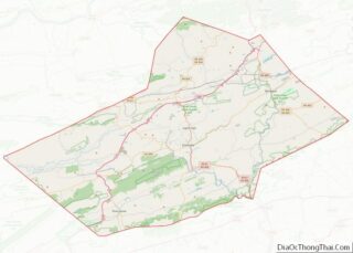
Mahanoy City location map. Where is Mahanoy City borough?
History
Mahanoy City, originally a part of Mahanoy township, was settled in 1859 and incorporated as a borough by decree of the Court of Quarter Sessions of Schuylkill County on December 16, 1863. It was served by branches of the Lehigh Valley and the Philadelphia & Reading railways.
Mahanoy City lies in a valley in the Pennsylvania Coal Region and was a major center of anthracite production; the area was embroiled in the Molly Maguires incidents. In 2010, the borough erected the Molly Maguire Historic Park, which features a Zenos Frudakis statue of a hooded miner on a gallows about to be hanged.
The borough’s principal industries remain the mining and shipping of coal, although the demand for it has steadily declined since its peak in the late nineteenth and early twentieth centuries. In 1930 the St. Nicholas Coal Breaker was built and went into operation in 1932. A controlled explosion destroyed the breaker in March 2018.
Fire clay abounds locally. The manufacturing of shirts, bedding and foundry products is also fairly prominent.
In 1948, Mahanoy City became the first municipality in the country to have cable TV.
Mahanoy City Road Map
Mahanoy City city Satellite Map
Geography
Mahanoy City is located at 40°48′45″N 76°8′25″W / 40.81250°N 76.14028°W / 40.81250; -76.14028 (40.812413, -76.140223), with PA 54 as a main thoroughfare and through road, serving as a main street named Centre Street. To the west it connects to Shenandoah thence to the Susquehanna Valley and to the east reaches through several unincorporated villages then passes through Barnesville as Pine Creek Dr. and then serves Hometown as a main road, intersecting PA 309 (N-S) before passing into Tamaqua and Nesquehoning. The borough is situated in the valley of Mahanoy Creek, approximately 4 miles (6.4 km) southeast of Shenandoah and 11 miles (18 km) west-northwest of Tamaqua, both of which are reached via Route 54. Mahanoy City lies at an elevation of 1,240 feet (380 m) above sea level; Broad Mountain (1,795 feet (547 m)), a ridge extending through Schuylkill County, overlooks it on the southeast.
According to the United States Census Bureau, the borough has a total area of 0.5 square miles (1.3 km), all land. It has a warm-summer humid continental climate (Dfb) and average temperatures range from 24.3 °F in January to 69.3 °F in July. The hardiness zone is borderline between 5b and 6a, meaning that the approximate average annual absolute minimum temperature is -10° F.
See also
Map of Pennsylvania State and its subdivision:- Adams
- Allegheny
- Armstrong
- Beaver
- Bedford
- Berks
- Blair
- Bradford
- Bucks
- Butler
- Cambria
- Cameron
- Carbon
- Centre
- Chester
- Clarion
- Clearfield
- Clinton
- Columbia
- Crawford
- Cumberland
- Dauphin
- Delaware
- Elk
- Erie
- Fayette
- Forest
- Franklin
- Fulton
- Greene
- Huntingdon
- Indiana
- Jefferson
- Juniata
- Lackawanna
- Lancaster
- Lawrence
- Lebanon
- Lehigh
- Luzerne
- Lycoming
- Mc Kean
- Mercer
- Mifflin
- Monroe
- Montgomery
- Montour
- Northampton
- Northumberland
- Perry
- Philadelphia
- Pike
- Potter
- Schuylkill
- Snyder
- Somerset
- Sullivan
- Susquehanna
- Tioga
- Union
- Venango
- Warren
- Washington
- Wayne
- Westmoreland
- Wyoming
- York
- Alabama
- Alaska
- Arizona
- Arkansas
- California
- Colorado
- Connecticut
- Delaware
- District of Columbia
- Florida
- Georgia
- Hawaii
- Idaho
- Illinois
- Indiana
- Iowa
- Kansas
- Kentucky
- Louisiana
- Maine
- Maryland
- Massachusetts
- Michigan
- Minnesota
- Mississippi
- Missouri
- Montana
- Nebraska
- Nevada
- New Hampshire
- New Jersey
- New Mexico
- New York
- North Carolina
- North Dakota
- Ohio
- Oklahoma
- Oregon
- Pennsylvania
- Rhode Island
- South Carolina
- South Dakota
- Tennessee
- Texas
- Utah
- Vermont
- Virginia
- Washington
- West Virginia
- Wisconsin
- Wyoming


