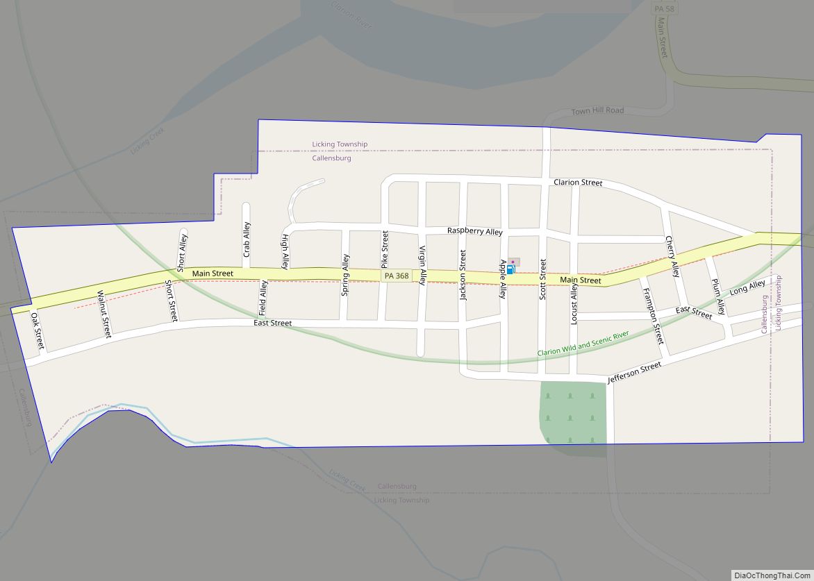
New Bethlehem (/nuːˈbɛθ.lʌm/ new-BETH-lum) is a borough in Clarion County, Pennsylvania, United States. The population was 979 at the 2020 census. The borough is situated at the southwestern corner of the Pennsylvania Wilds Conservation Landscape. Its main street, PA Route 28-66, is a major thoroughfare between the Pittsburgh metropolitan region and northcentral Pennsylvania.
| Name: | New Bethlehem borough |
|---|---|
| LSAD Code: | 21 |
| LSAD Description: | borough (suffix) |
| State: | Pennsylvania |
| County: | Clarion County |
| Incorporated: | 1853 |
| Elevation: | 1,070 ft (330 m) |
| Total Area: | 0.52 sq mi (1.34 km²) |
| Land Area: | 0.47 sq mi (1.21 km²) |
| Water Area: | 0.05 sq mi (0.13 km²) |
| Total Population: | 978 |
| Population Density: | 2,098.71/sq mi (809.92/km²) |
| ZIP code: | 16242 |
| FIPS code: | 4253248 |
| Website: | www.newbethlehemboro.com |
Online Interactive Map
Click on ![]() to view map in "full screen" mode.
to view map in "full screen" mode.
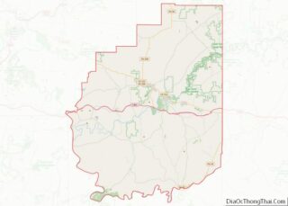
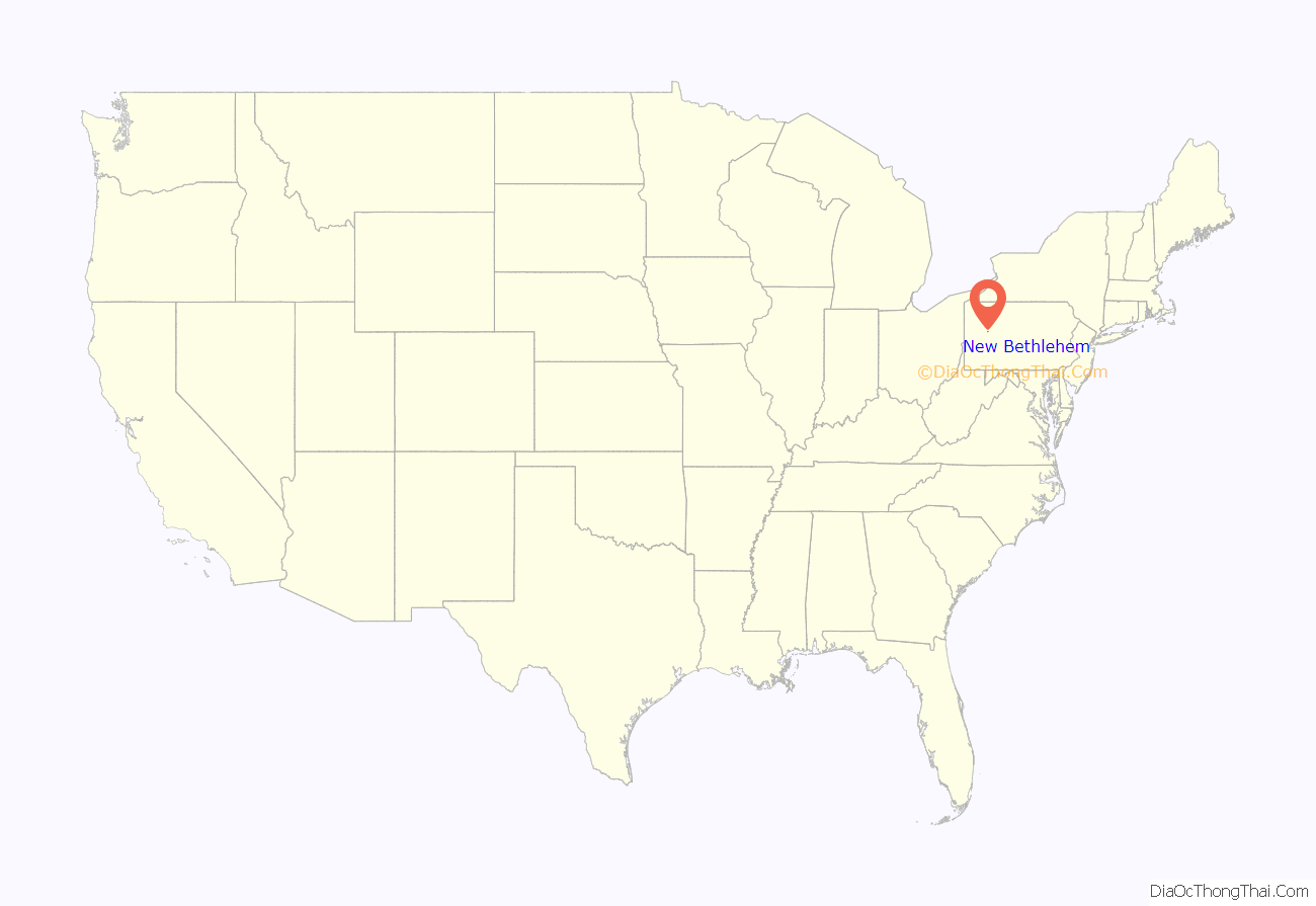
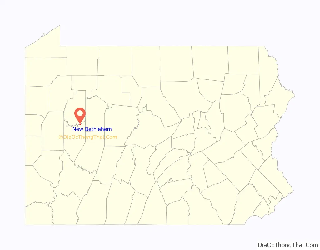
New Bethlehem location map. Where is New Bethlehem borough?
History
One of the prominent early settlers of the borough was Henry “Gum” Nolf (alternative spellings include Nulph), who built the first store, grist-, and saw-mill. The town was first referred to as “Gumtown” in honor of Nolf, but subsequently was named “Bethlehem”, and later “New Bethlehem” to distinguish it from Bethlehem, Pennsylvania, in the eastern part of the state.
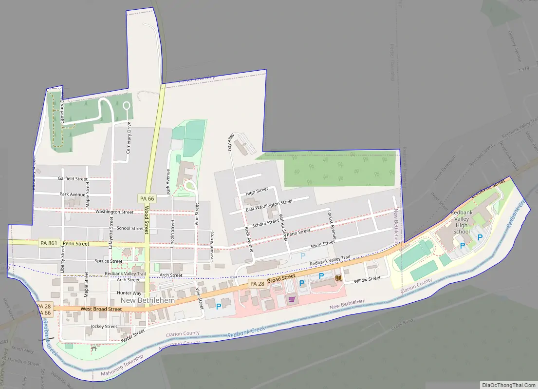
New Bethlehem Road Map
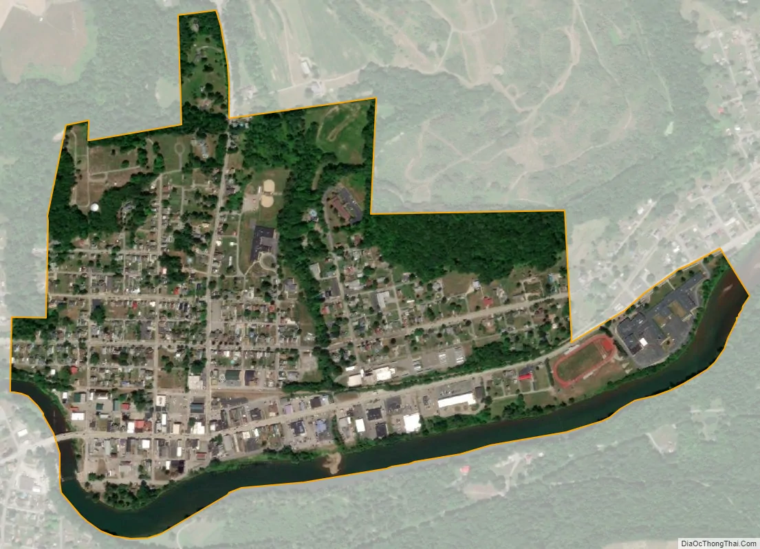
New Bethlehem city Satellite Map
Geography
New Bethlehem is located along the southern border of Clarion County at 41°0′12″N 79°19′51″W / 41.00333°N 79.33083°W / 41.00333; -79.33083 (41.003302, -79.330935). It is in the valley of Redbank Creek, which separates the borough from South Bethlehem, Armstrong County to the south.
Pennsylvania Route 28 passes through the borough, crossing Redbank Creek into South Bethlehem, then leading southwest 20 miles (32 km) to Kittanning on the Allegheny River. To the northeast, PA 28 leads 20 miles (32 km) to Brookville and Interstate 80. Pennsylvania Route 66 intersects PA 28 in the center of New Bethlehem and leads north 13 miles (21 km) to I-80 and 16 miles (26 km) to Clarion, the county seat. PA 66 travels with PA 28 southwest to Kittanning. Pennsylvania Route 861 leads west from New Bethlehem 12 miles (19 km) to Rimersburg.
According to the United States Census Bureau, the borough of New Bethlehem has a total area of 0.50 square miles (1.3 km), of which 0.46 square miles (1.2 km) is land and 0.04 square miles (0.1 km), or 9.92%, is water.
See also
Map of Pennsylvania State and its subdivision:- Adams
- Allegheny
- Armstrong
- Beaver
- Bedford
- Berks
- Blair
- Bradford
- Bucks
- Butler
- Cambria
- Cameron
- Carbon
- Centre
- Chester
- Clarion
- Clearfield
- Clinton
- Columbia
- Crawford
- Cumberland
- Dauphin
- Delaware
- Elk
- Erie
- Fayette
- Forest
- Franklin
- Fulton
- Greene
- Huntingdon
- Indiana
- Jefferson
- Juniata
- Lackawanna
- Lancaster
- Lawrence
- Lebanon
- Lehigh
- Luzerne
- Lycoming
- Mc Kean
- Mercer
- Mifflin
- Monroe
- Montgomery
- Montour
- Northampton
- Northumberland
- Perry
- Philadelphia
- Pike
- Potter
- Schuylkill
- Snyder
- Somerset
- Sullivan
- Susquehanna
- Tioga
- Union
- Venango
- Warren
- Washington
- Wayne
- Westmoreland
- Wyoming
- York
- Alabama
- Alaska
- Arizona
- Arkansas
- California
- Colorado
- Connecticut
- Delaware
- District of Columbia
- Florida
- Georgia
- Hawaii
- Idaho
- Illinois
- Indiana
- Iowa
- Kansas
- Kentucky
- Louisiana
- Maine
- Maryland
- Massachusetts
- Michigan
- Minnesota
- Mississippi
- Missouri
- Montana
- Nebraska
- Nevada
- New Hampshire
- New Jersey
- New Mexico
- New York
- North Carolina
- North Dakota
- Ohio
- Oklahoma
- Oregon
- Pennsylvania
- Rhode Island
- South Carolina
- South Dakota
- Tennessee
- Texas
- Utah
- Vermont
- Virginia
- Washington
- West Virginia
- Wisconsin
- Wyoming