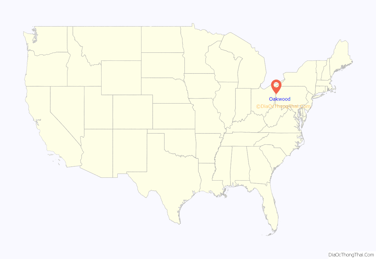
Oakwood is an unincorporated area and census-designated place (CDP) in Lawrence County, Pennsylvania, United States. The population was 2,270 at the 2010 census.
| Name: | Oakwood CDP |
|---|---|
| LSAD Code: | 57 |
| LSAD Description: | CDP (suffix) |
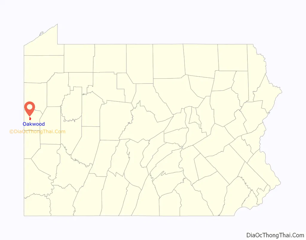
| State: | Pennsylvania |
| County: | Lawrence County |
| Elevation: | 1,025 ft (312 m) |
| Total Area: | 2.64 sq mi (6.84 km²) |
| Land Area: | 2.59 sq mi (6.70 km²) |
| Water Area: | 0.05 sq mi (0.14 km²) |
| Total Population: | 2,215 |
| Population Density: | 856.54/sq mi (330.67/km²) |
| Area code: | 724 |
| FIPS code: | 4256232 |
| GNISfeature ID: | 2389607 |
Online Interactive Map
Click on ![]() to view map in "full screen" mode.
to view map in "full screen" mode.
Oakwood location map. Where is Oakwood CDP?
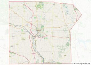
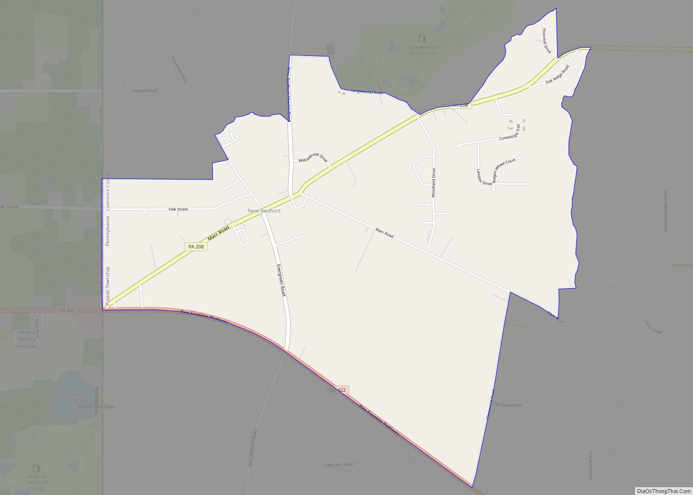
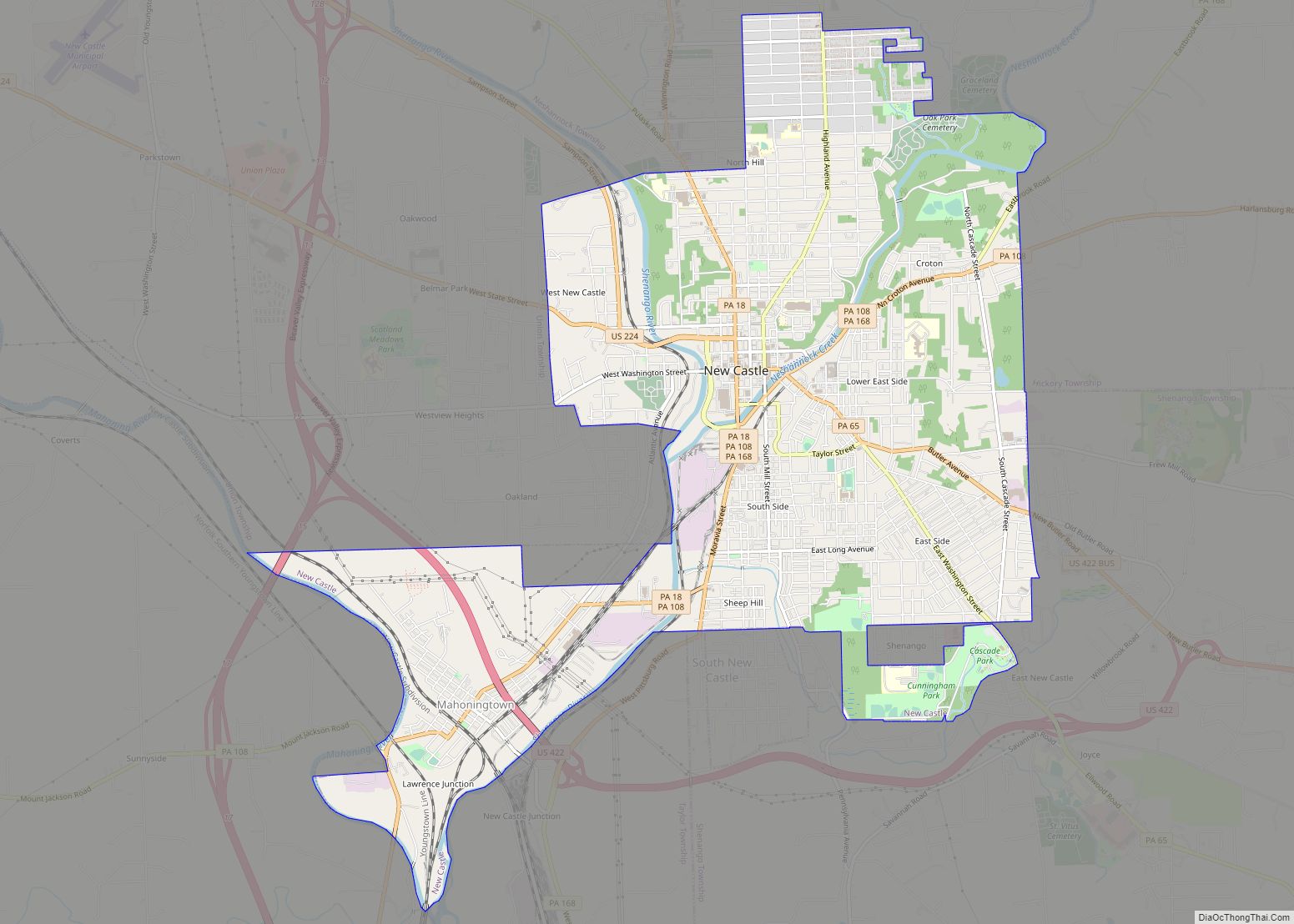
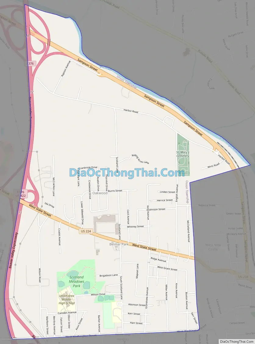
Oakwood Road Map
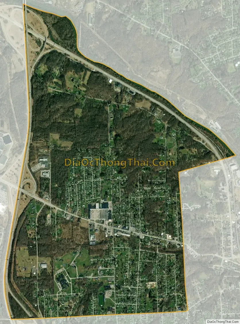
Oakwood city Satellite Map
Geography
Oakwood is located in central Lawrence County at 41°0′25″N 80°22′35″W / 41.00694°N 80.37639°W / 41.00694; -80.37639 (41.007064, -80.376461), in the eastern part of Union Township. It is bordered to the east by the city of New Castle, to the northeast by Neshannock Township, to the west by Interstate 376, and to the south by the Oakland CDP in Union Township.
I-376 leads north 13 miles (21 km) to Interstate 80 near Sharon and south the same distance to the Pennsylvania Turnpike in Big Beaver. U.S. Route 224 (West State Street) is the main road through the center of Oakwood, leading east to its terminus in the center of New Castle and west 16 miles (26 km) to Boardman, Ohio, on the southern outskirts of Youngstown. U.S. Route 422 (Sampson Street) runs up the Shenango River valley along the northeastern edge of the community, leading southeast into New Castle and northwest 16 miles (26 km) to Youngstown, Ohio.
According to the United States Census Bureau, the Oakwood CDP has a total area of 2.7 square miles (6.9 km), of which 2.6 square miles (6.8 km) are land and 0.04 square miles (0.1 km), of 2.01%, are water. The Shenango River forms the northeastern border of the community and of Union Township. The Shenango is a southeastward-flowing tributary of the Beaver River, part of the Ohio River watershed.
See also
Map of Pennsylvania State and its subdivision:- Adams
- Allegheny
- Armstrong
- Beaver
- Bedford
- Berks
- Blair
- Bradford
- Bucks
- Butler
- Cambria
- Cameron
- Carbon
- Centre
- Chester
- Clarion
- Clearfield
- Clinton
- Columbia
- Crawford
- Cumberland
- Dauphin
- Delaware
- Elk
- Erie
- Fayette
- Forest
- Franklin
- Fulton
- Greene
- Huntingdon
- Indiana
- Jefferson
- Juniata
- Lackawanna
- Lancaster
- Lawrence
- Lebanon
- Lehigh
- Luzerne
- Lycoming
- Mc Kean
- Mercer
- Mifflin
- Monroe
- Montgomery
- Montour
- Northampton
- Northumberland
- Perry
- Philadelphia
- Pike
- Potter
- Schuylkill
- Snyder
- Somerset
- Sullivan
- Susquehanna
- Tioga
- Union
- Venango
- Warren
- Washington
- Wayne
- Westmoreland
- Wyoming
- York
- Alabama
- Alaska
- Arizona
- Arkansas
- California
- Colorado
- Connecticut
- Delaware
- District of Columbia
- Florida
- Georgia
- Hawaii
- Idaho
- Illinois
- Indiana
- Iowa
- Kansas
- Kentucky
- Louisiana
- Maine
- Maryland
- Massachusetts
- Michigan
- Minnesota
- Mississippi
- Missouri
- Montana
- Nebraska
- Nevada
- New Hampshire
- New Jersey
- New Mexico
- New York
- North Carolina
- North Dakota
- Ohio
- Oklahoma
- Oregon
- Pennsylvania
- Rhode Island
- South Carolina
- South Dakota
- Tennessee
- Texas
- Utah
- Vermont
- Virginia
- Washington
- West Virginia
- Wisconsin
- Wyoming