Port Carbon is a borough of Schuylkill County, Pennsylvania, United States, located two miles (3 km) northeast of Pottsville. It is in a coal-mining area. In the past, ironworks had been a feature of the borough. In 1900, 2,168 people lived here and, in 1910, 2,678. The population was 1,815 at the 2020 census.
| Name: | Port Carbon borough |
|---|---|
| LSAD Code: | 21 |
| LSAD Description: | borough (suffix) |
| State: | Pennsylvania |
| County: | Schuylkill County |
| Incorporated: | 1852 |
| Total Area: | 0.75 sq mi (1.95 km²) |
| Land Area: | 0.75 sq mi (1.95 km²) |
| Water Area: | 0.00 sq mi (0.00 km²) |
| Total Population: | 1,806 |
| Population Density: | 2,395.23/sq mi (924.60/km²) |
| Area code: | 570 |
| FIPS code: | 4262128 |
Online Interactive Map
Click on ![]() to view map in "full screen" mode.
to view map in "full screen" mode.
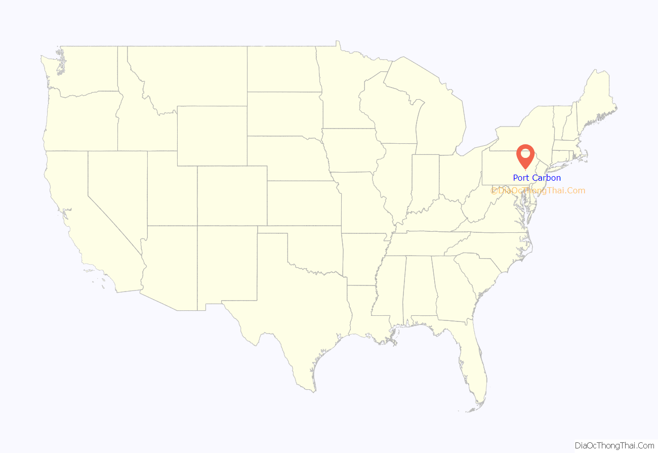
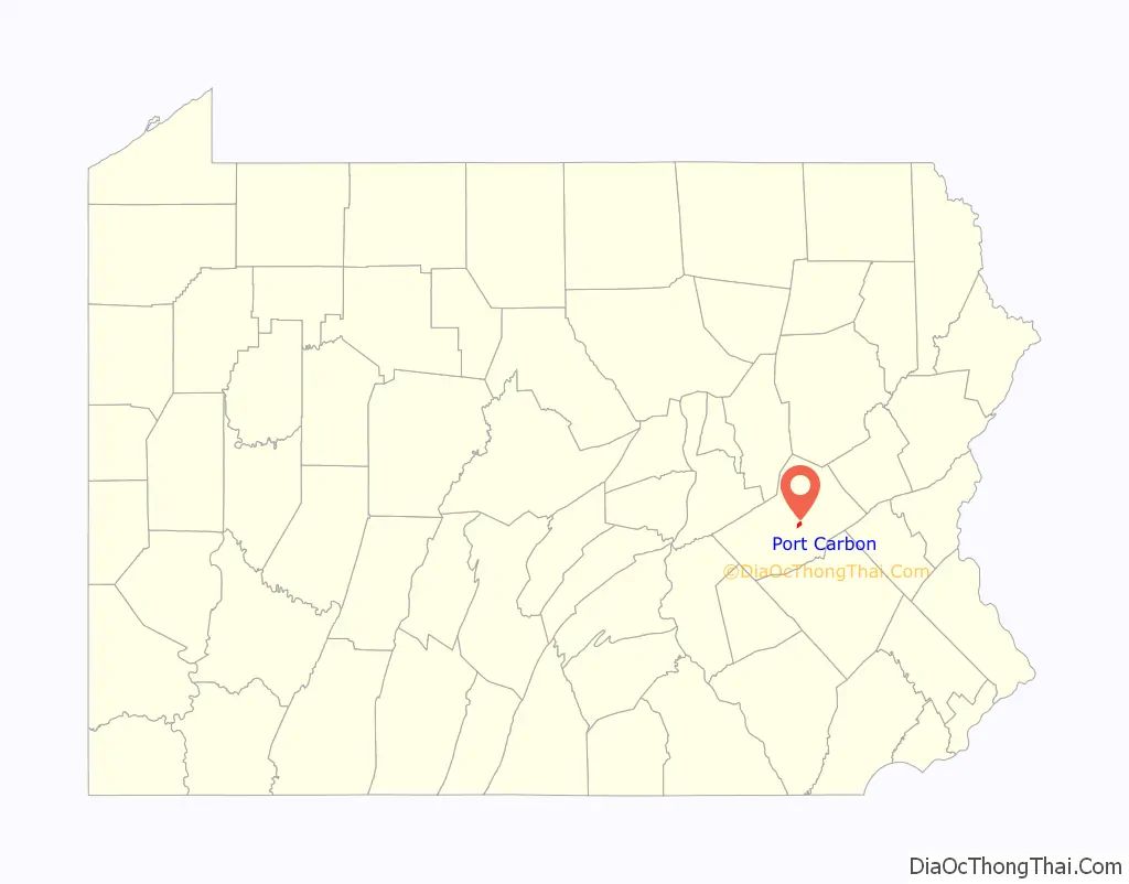
Port Carbon location map. Where is Port Carbon borough?
History
Port Carbon was founded by Abraham Pott, a son of John Pott who founded Pottsville in 1806.
Port Carbon was the site of the first lock on the Schuylkill Canal, on its route for transport of coal mined in the region to Philadelphia. Robert Allison, a local industrialist, purchased the first commercially manufactured automobile, a Winton.
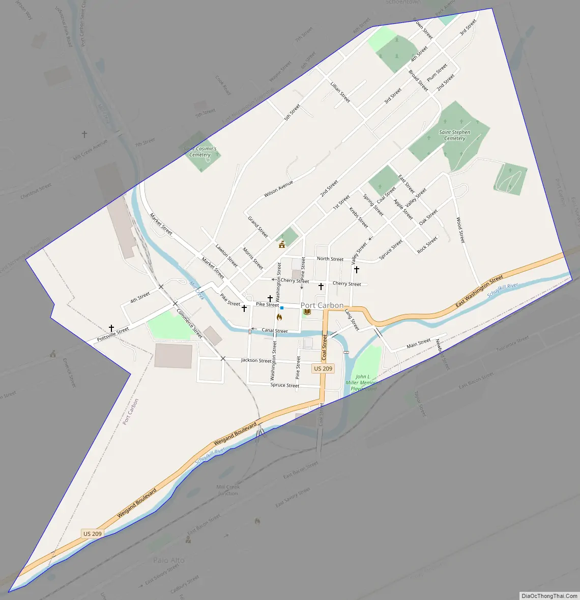
Port Carbon Road Map
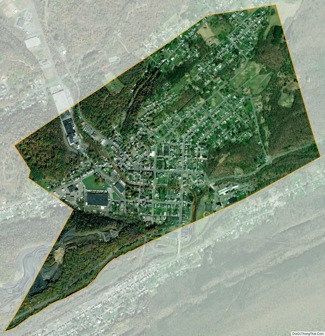
Port Carbon city Satellite Map
Geography
Port Carbon is located at 40°41′50″N 76°10′0″W / 40.69722°N 76.16667°W / 40.69722; -76.16667 (40.697210, -76.166734).
According to the United States Census Bureau, the borough has a total area of 0.8 square miles (2.1 km), all land.
See also
Map of Pennsylvania State and its subdivision:- Adams
- Allegheny
- Armstrong
- Beaver
- Bedford
- Berks
- Blair
- Bradford
- Bucks
- Butler
- Cambria
- Cameron
- Carbon
- Centre
- Chester
- Clarion
- Clearfield
- Clinton
- Columbia
- Crawford
- Cumberland
- Dauphin
- Delaware
- Elk
- Erie
- Fayette
- Forest
- Franklin
- Fulton
- Greene
- Huntingdon
- Indiana
- Jefferson
- Juniata
- Lackawanna
- Lancaster
- Lawrence
- Lebanon
- Lehigh
- Luzerne
- Lycoming
- Mc Kean
- Mercer
- Mifflin
- Monroe
- Montgomery
- Montour
- Northampton
- Northumberland
- Perry
- Philadelphia
- Pike
- Potter
- Schuylkill
- Snyder
- Somerset
- Sullivan
- Susquehanna
- Tioga
- Union
- Venango
- Warren
- Washington
- Wayne
- Westmoreland
- Wyoming
- York
- Alabama
- Alaska
- Arizona
- Arkansas
- California
- Colorado
- Connecticut
- Delaware
- District of Columbia
- Florida
- Georgia
- Hawaii
- Idaho
- Illinois
- Indiana
- Iowa
- Kansas
- Kentucky
- Louisiana
- Maine
- Maryland
- Massachusetts
- Michigan
- Minnesota
- Mississippi
- Missouri
- Montana
- Nebraska
- Nevada
- New Hampshire
- New Jersey
- New Mexico
- New York
- North Carolina
- North Dakota
- Ohio
- Oklahoma
- Oregon
- Pennsylvania
- Rhode Island
- South Carolina
- South Dakota
- Tennessee
- Texas
- Utah
- Vermont
- Virginia
- Washington
- West Virginia
- Wisconsin
- Wyoming


