Port Matilda is a borough in Centre County, Pennsylvania. It is part of the State College, Pennsylvania metropolitan statistical area and is located approximately halfway between State College and Altoona. The population was 606 at the 2010 census.
| Name: | Port Matilda borough |
|---|---|
| LSAD Code: | 21 |
| LSAD Description: | borough (suffix) |
| State: | Pennsylvania |
| County: | Centre County |
| Elevation: | 1,053 ft (321 m) |
| Total Area: | 0.60 sq mi (1.55 km²) |
| Land Area: | 0.60 sq mi (1.55 km²) |
| Water Area: | 0.00 sq mi (0.00 km²) |
| Total Population: | 578 |
| Population Density: | 963.33/sq mi (371.90/km²) |
| Area code: | 814 |
| FIPS code: | 4262280 |
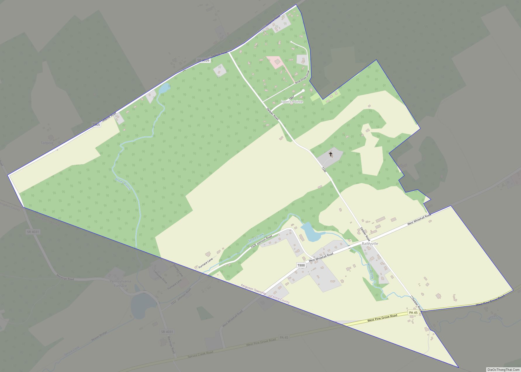
Online Interactive Map
Click on ![]() to view map in "full screen" mode.
to view map in "full screen" mode.
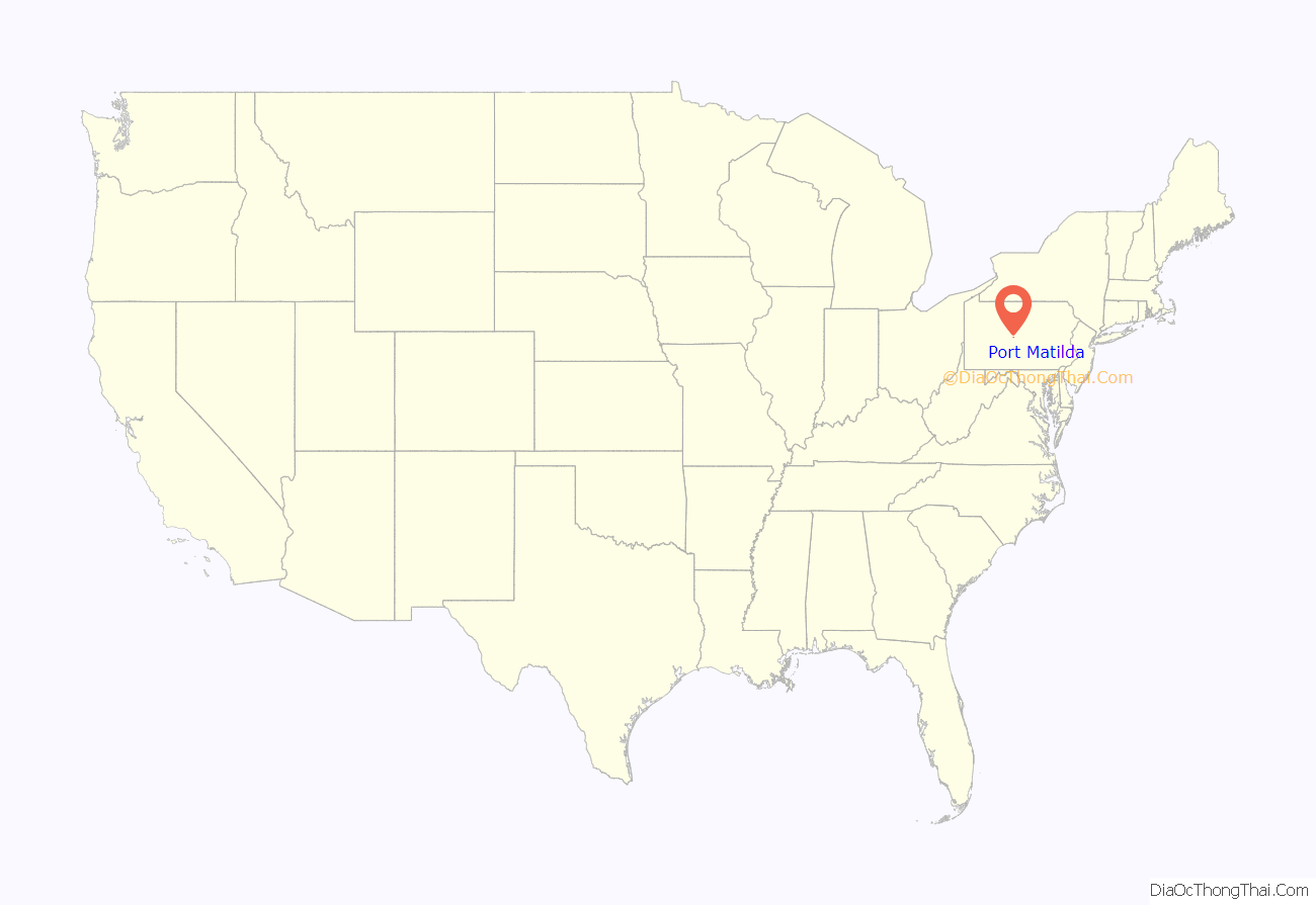
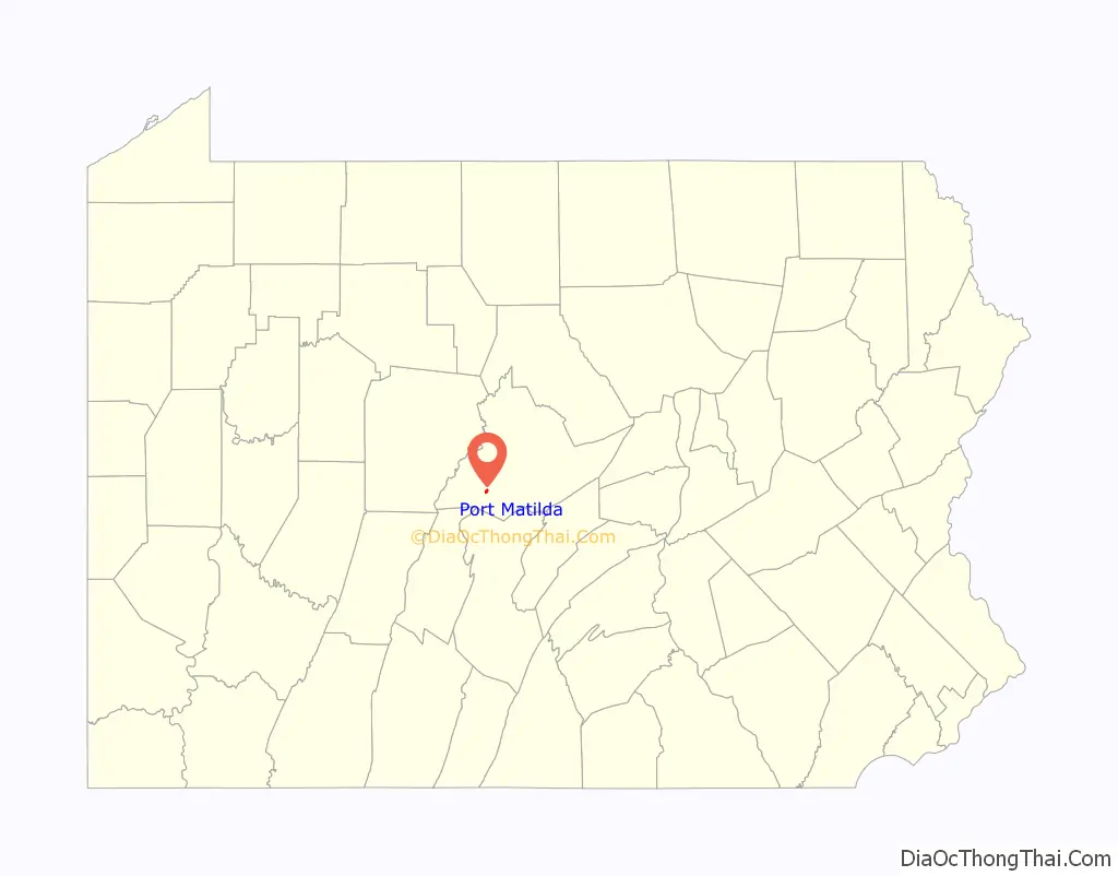
Port Matilda location map. Where is Port Matilda borough?
History
Squire Clement Beckwith laid out the town in 1850 and named it to honor his daughter, Matilda. Why he chose to call it Port Matilda is not clear, but the name may have reflected his hope that the town would eventually be connected to the Bald Eagle and Spring Creek Branch of the Pennsylvania Canal. While the canal did not reach Port Matilda, the Bald Eagle Railroad did, and the community became a market center in the Bald Eagle Valley for agricultural and lumber products.
Industrial history
Port Matilda was home to McFeely Brick Co., located on Brick St. at the east end of the town adjacent to the railroad. The company was based in Latrobe, Pennsylvania and founded by Fred McFeely, the grandfather of children’s television personality Fred Rogers. The company was later owned by General Refractories, which closed the Port Matilda plant in 1959. Its primary product was silica fire brick made from ganister rock, using beehive kilns. Its bricks were typically stamped “Vulcan”.
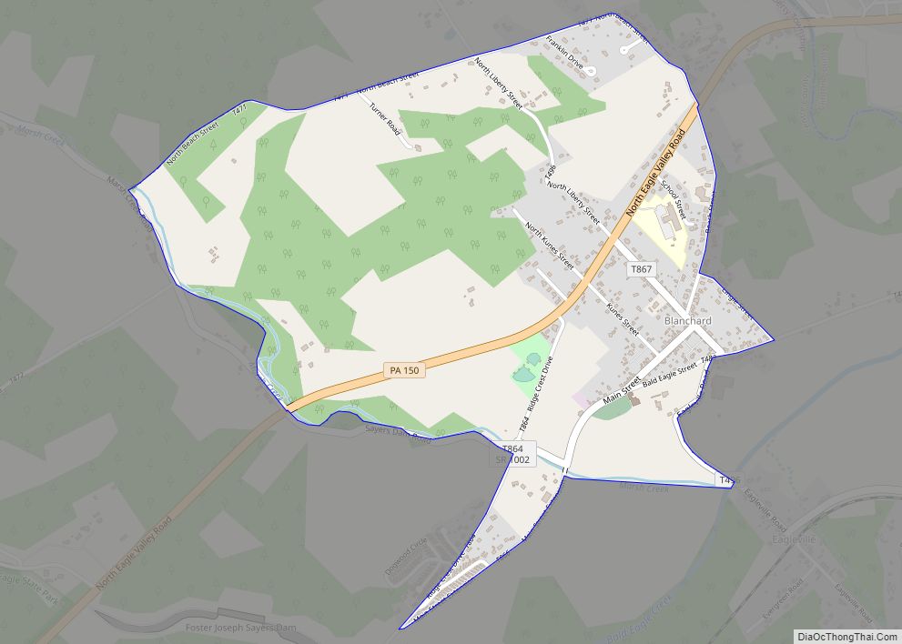
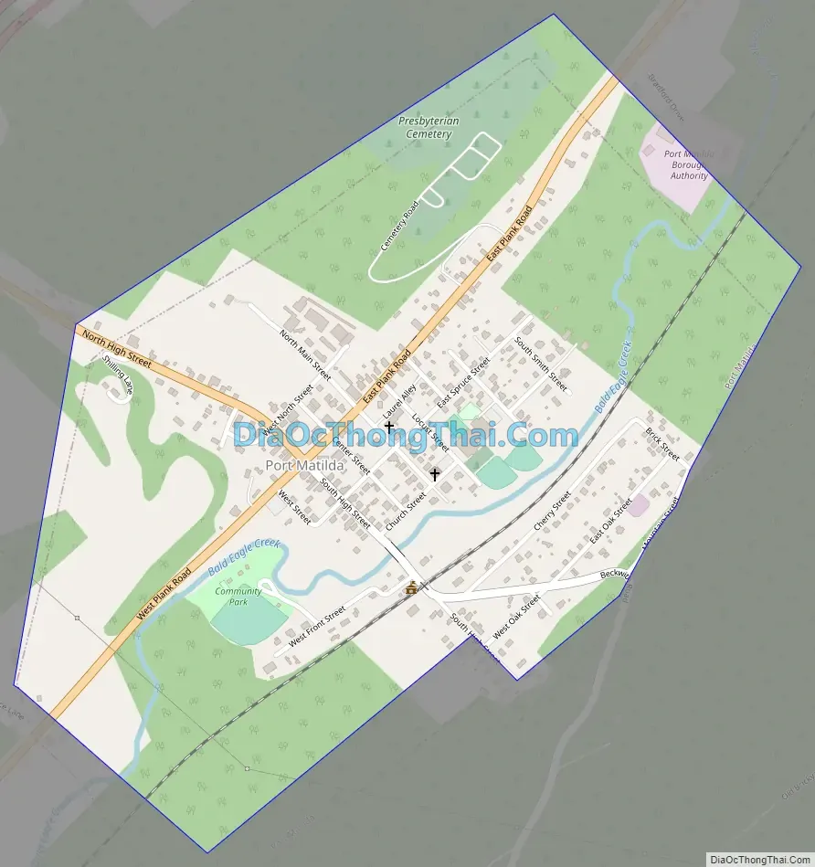
Port Matilda Road Map
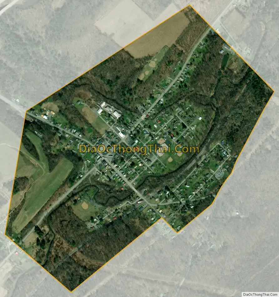
Port Matilda city Satellite Map
Geography
Port Matilda is located at 40°48′0″N 78°3′4″W / 40.80000°N 78.05111°W / 40.80000; -78.05111 (40.800056, -78.051119). According to the U.S. Census Bureau, the borough has a total area of 0.6 square miles (1.6 km), all land.
See also
Map of Pennsylvania State and its subdivision:- Adams
- Allegheny
- Armstrong
- Beaver
- Bedford
- Berks
- Blair
- Bradford
- Bucks
- Butler
- Cambria
- Cameron
- Carbon
- Centre
- Chester
- Clarion
- Clearfield
- Clinton
- Columbia
- Crawford
- Cumberland
- Dauphin
- Delaware
- Elk
- Erie
- Fayette
- Forest
- Franklin
- Fulton
- Greene
- Huntingdon
- Indiana
- Jefferson
- Juniata
- Lackawanna
- Lancaster
- Lawrence
- Lebanon
- Lehigh
- Luzerne
- Lycoming
- Mc Kean
- Mercer
- Mifflin
- Monroe
- Montgomery
- Montour
- Northampton
- Northumberland
- Perry
- Philadelphia
- Pike
- Potter
- Schuylkill
- Snyder
- Somerset
- Sullivan
- Susquehanna
- Tioga
- Union
- Venango
- Warren
- Washington
- Wayne
- Westmoreland
- Wyoming
- York
- Alabama
- Alaska
- Arizona
- Arkansas
- California
- Colorado
- Connecticut
- Delaware
- District of Columbia
- Florida
- Georgia
- Hawaii
- Idaho
- Illinois
- Indiana
- Iowa
- Kansas
- Kentucky
- Louisiana
- Maine
- Maryland
- Massachusetts
- Michigan
- Minnesota
- Mississippi
- Missouri
- Montana
- Nebraska
- Nevada
- New Hampshire
- New Jersey
- New Mexico
- New York
- North Carolina
- North Dakota
- Ohio
- Oklahoma
- Oregon
- Pennsylvania
- Rhode Island
- South Carolina
- South Dakota
- Tennessee
- Texas
- Utah
- Vermont
- Virginia
- Washington
- West Virginia
- Wisconsin
- Wyoming