Portersville is a borough in Butler County, Pennsylvania, United States. The population was 235 at the 2010 census.
| Name: | Portersville borough |
|---|---|
| LSAD Code: | 21 |
| LSAD Description: | borough (suffix) |
| State: | Pennsylvania |
| County: | Butler County |
| Incorporated: | 1844 |
| Total Area: | 0.80 sq mi (2.06 km²) |
| Land Area: | 0.80 sq mi (2.06 km²) |
| Water Area: | 0.00 sq mi (0.00 km²) |
| Total Population: | 231 |
| Population Density: | 290.57/sq mi (112.12/km²) |
| FIPS code: | 4262224 |
Online Interactive Map
Click on ![]() to view map in "full screen" mode.
to view map in "full screen" mode.
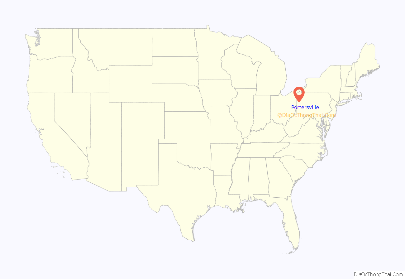
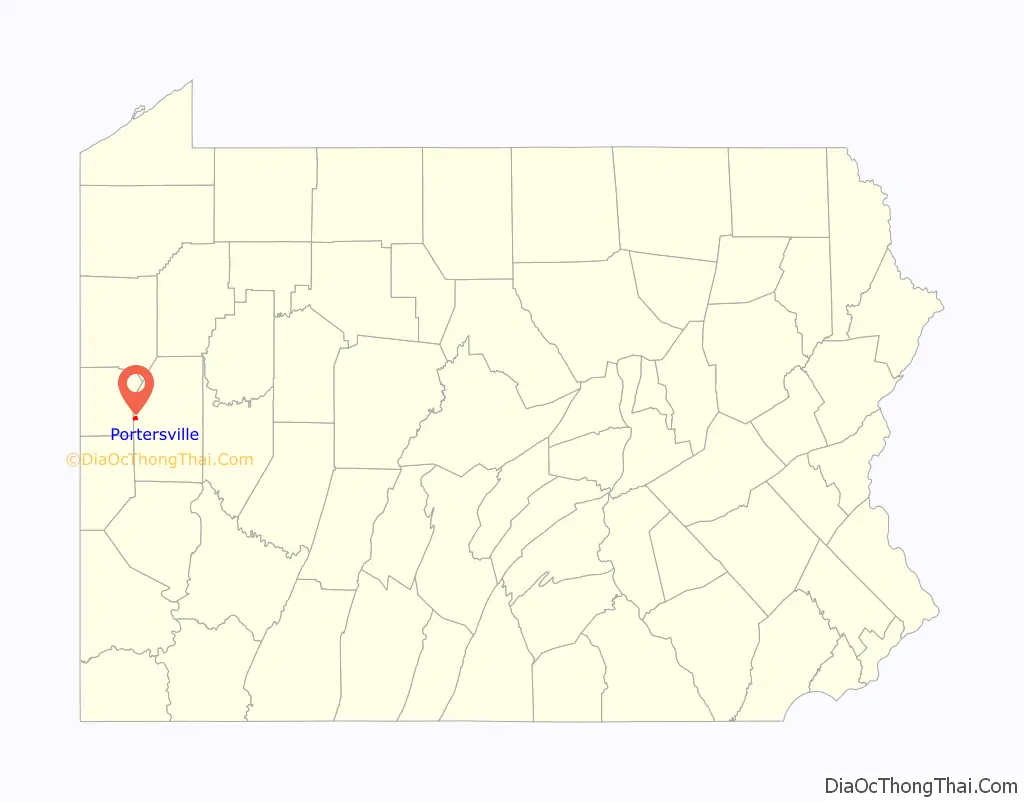
Portersville location map. Where is Portersville borough?
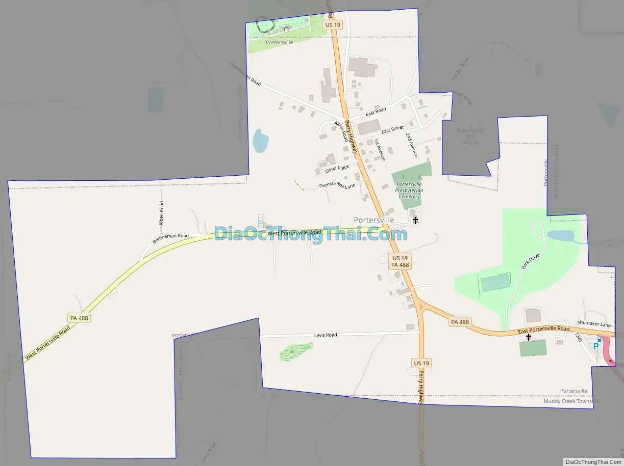
Portersville Road Map
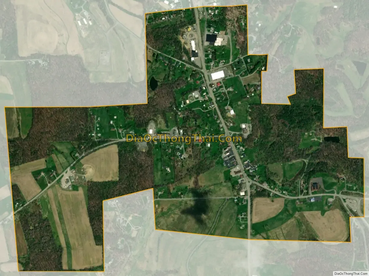
Portersville city Satellite Map
Geography
Portersville is located near the western border of Butler County at 40°55′31″N 80°8′39″W / 40.92528°N 80.14417°W / 40.92528; -80.14417 (40.925285, -80.144229). It is surrounded by Muddy Creek Township, though the borough’s western border comes within 660 feet (200 m) of the Lawrence County line.
U.S. Route 19, Perry Highway, passes through the center of the borough, leading north 22 miles (35 km) to Mercer and south 9.5 miles (15.3 km) to Zelienople. Interstate 79 passes just east of the borough, with access from Exit 96 (PA 488). I-79 leads south 38 miles (61 km) to Pittsburgh and north 90 miles (140 km) to Erie. Moraine State Park, situated around Lake Arthur, is a short distance east of I-79. Portersville lies between the cities of Butler 15 miles (24 km) east and New Castle 14 miles (23 km) to the west.
According to the United States Census Bureau, the borough has a total area of 0.81 square miles (2.1 km), all land.
See also
Map of Pennsylvania State and its subdivision:- Adams
- Allegheny
- Armstrong
- Beaver
- Bedford
- Berks
- Blair
- Bradford
- Bucks
- Butler
- Cambria
- Cameron
- Carbon
- Centre
- Chester
- Clarion
- Clearfield
- Clinton
- Columbia
- Crawford
- Cumberland
- Dauphin
- Delaware
- Elk
- Erie
- Fayette
- Forest
- Franklin
- Fulton
- Greene
- Huntingdon
- Indiana
- Jefferson
- Juniata
- Lackawanna
- Lancaster
- Lawrence
- Lebanon
- Lehigh
- Luzerne
- Lycoming
- Mc Kean
- Mercer
- Mifflin
- Monroe
- Montgomery
- Montour
- Northampton
- Northumberland
- Perry
- Philadelphia
- Pike
- Potter
- Schuylkill
- Snyder
- Somerset
- Sullivan
- Susquehanna
- Tioga
- Union
- Venango
- Warren
- Washington
- Wayne
- Westmoreland
- Wyoming
- York
- Alabama
- Alaska
- Arizona
- Arkansas
- California
- Colorado
- Connecticut
- Delaware
- District of Columbia
- Florida
- Georgia
- Hawaii
- Idaho
- Illinois
- Indiana
- Iowa
- Kansas
- Kentucky
- Louisiana
- Maine
- Maryland
- Massachusetts
- Michigan
- Minnesota
- Mississippi
- Missouri
- Montana
- Nebraska
- Nevada
- New Hampshire
- New Jersey
- New Mexico
- New York
- North Carolina
- North Dakota
- Ohio
- Oklahoma
- Oregon
- Pennsylvania
- Rhode Island
- South Carolina
- South Dakota
- Tennessee
- Texas
- Utah
- Vermont
- Virginia
- Washington
- West Virginia
- Wisconsin
- Wyoming


