Zelienople /ˌziːliəˈnoʊpəl/ is a borough in Butler County, Pennsylvania, 28 miles (45 km) north of Pittsburgh. The population was 3,812 at the 2010 census. It is part of the Pittsburgh metropolitan area.
| Name: | Zelienople borough |
|---|---|
| LSAD Code: | 21 |
| LSAD Description: | borough (suffix) |
| State: | Pennsylvania |
| County: | Butler County |
| Incorporated: | 1840 |
| Total Area: | 2.10 sq mi (5.44 km²) |
| Land Area: | 2.05 sq mi (5.32 km²) |
| Water Area: | 0.05 sq mi (0.12 km²) |
| Total Population: | 3,812 |
| Population Density: | 1,754.99/sq mi (677.65/km²) |
| ZIP code: | 16063 |
| Area code: | 724 |
| FIPS code: | 4287272 |
| Website: | zelieboro.org |
Online Interactive Map
Click on ![]() to view map in "full screen" mode.
to view map in "full screen" mode.
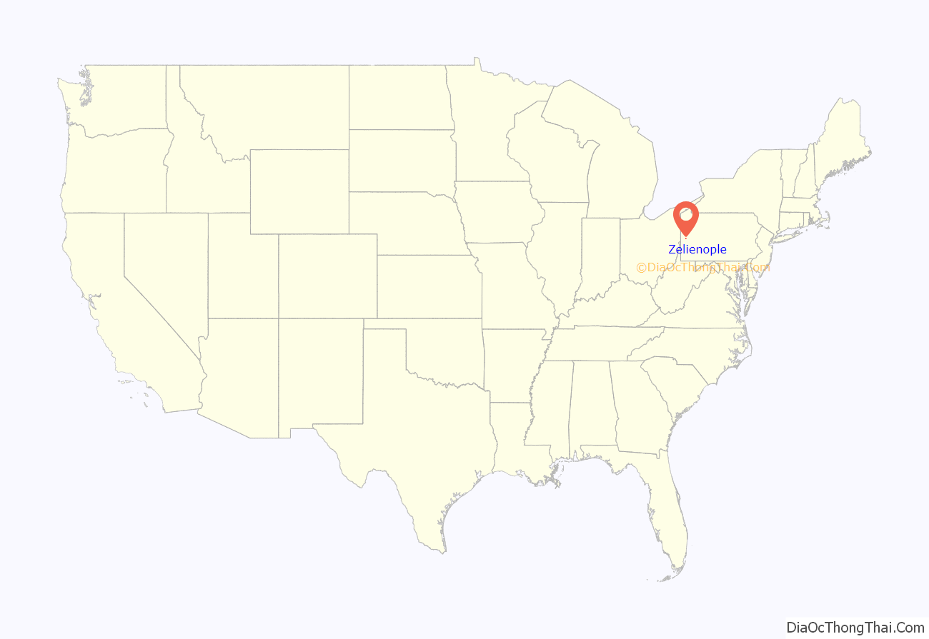
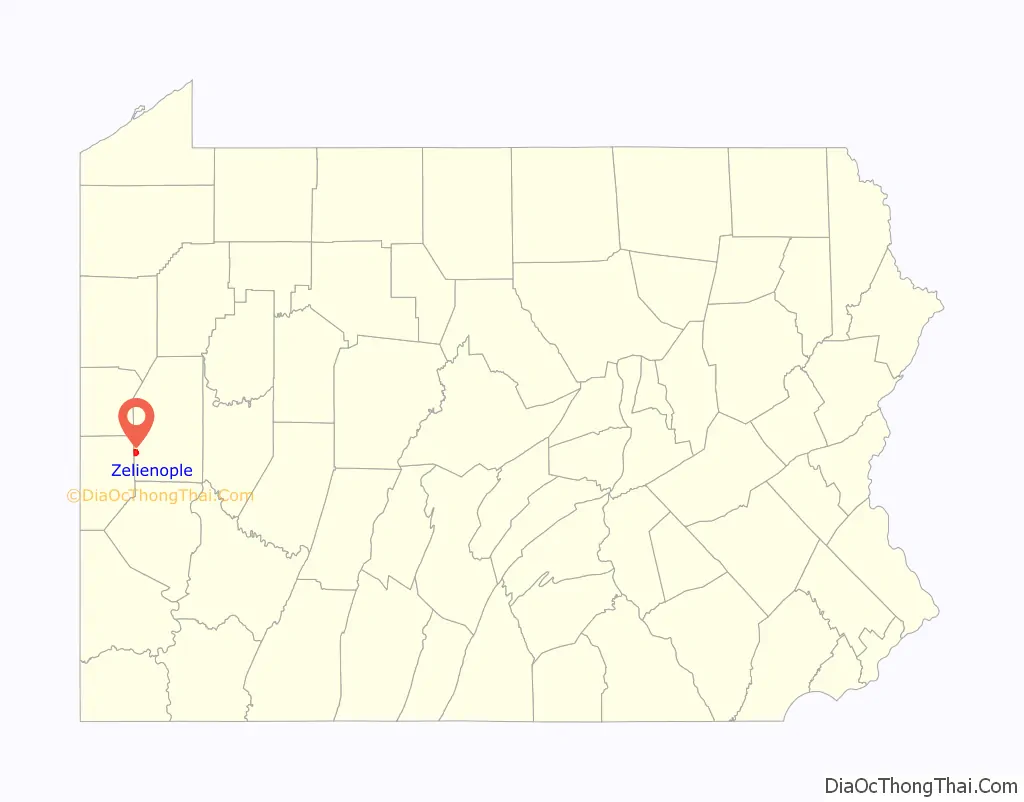
Zelienople location map. Where is Zelienople borough?
History
Zelienople was named for the eldest daughter of Baron Dettmar Basse (1762–1836), whose chosen name was Zelie (her given name was Fredericka) which she named herself after her favorite doll. Baron Basse arrived in 1802 from Frankfurt am Main, Germany, and purchased a tract of 10,000 acres (40 km) of land in Butler and Beaver counties.
He proceeded to lay out a village and build his own private residence, a three-story castle, complete with towers, turrets and battlements, named “The Bassenheim”, which was destroyed by fire on July 29, 1841. At the time, Zelie was betrothed to Philip Louis Passavant, and was still in Germany. Extensive preparations were made by Baron Basse to establish the new home and town in America and prepare it for his daughter’s arrival in September 1807.
Baron Basse sold 5,000 acres (20 km) of his land to George Rapp, a Bavarian pietist religious leader, who founded the village of Harmony. Baron Basse came to be known as “Dr. Muller”. Whether the title of “Doctor” was given to him due to a knowledge of medicine, or conferred upon him as a degree, is unknown. He was regarded as an intelligent man, and during the Napoleonic era represented Frankfurt as an ambassador to Paris. Basse returned to Germany in 1818, leaving his business to his son-in-law, Philipp Passavant.
Philip Passavant opened the first store in 1807, and managed it for 41 years, until he gave it to his son, C. S. Passavant. By 1826, there were fifty houses in Zelienople, and three churches. The population in 1870 was 387, and in 1890, it had grown to 639. In 1879, the first passenger train arrived to the town, substantially increasing the growth and commerce. In 1880, the American Union Telegraph Company established an office in Zelienople. The Federalists appointed Andrew McClure, a local tavern-keeper, as the first postmaster of Zelienople in the first decade of 1800. Christian Buhl was named the first justice of the peace in 1840.
Early Zelienople commerce supported the local agriculture community, as there was no viable means of transportation. In 1840 Zelienople was incorporated as a borough. In 1878 a railroad was built through Zelienople. From this time there has been moderate expansion of industry, residences, and local government. There has been a volunteer fire department since about 1850. A full-time Borough Manager was hired in 1994. The growth of Pittsburgh to the south, along with the building of Interstate 79, provides a challenge to Zelienople in coping with these changes through the 21st century.
Zelienople was linked to Ellwood City, Evans City and Pittsburgh in 1908 by the Pittsburgh, Harmony, Butler and New Castle Railway, an interurban trolley line. The line closed on 15 June 1931, and the trolleys were replaced by buses. Zelienople is also known for its historical Eichholtz Building. The Eichholtz family played a historical and transformational role in Zelienople.
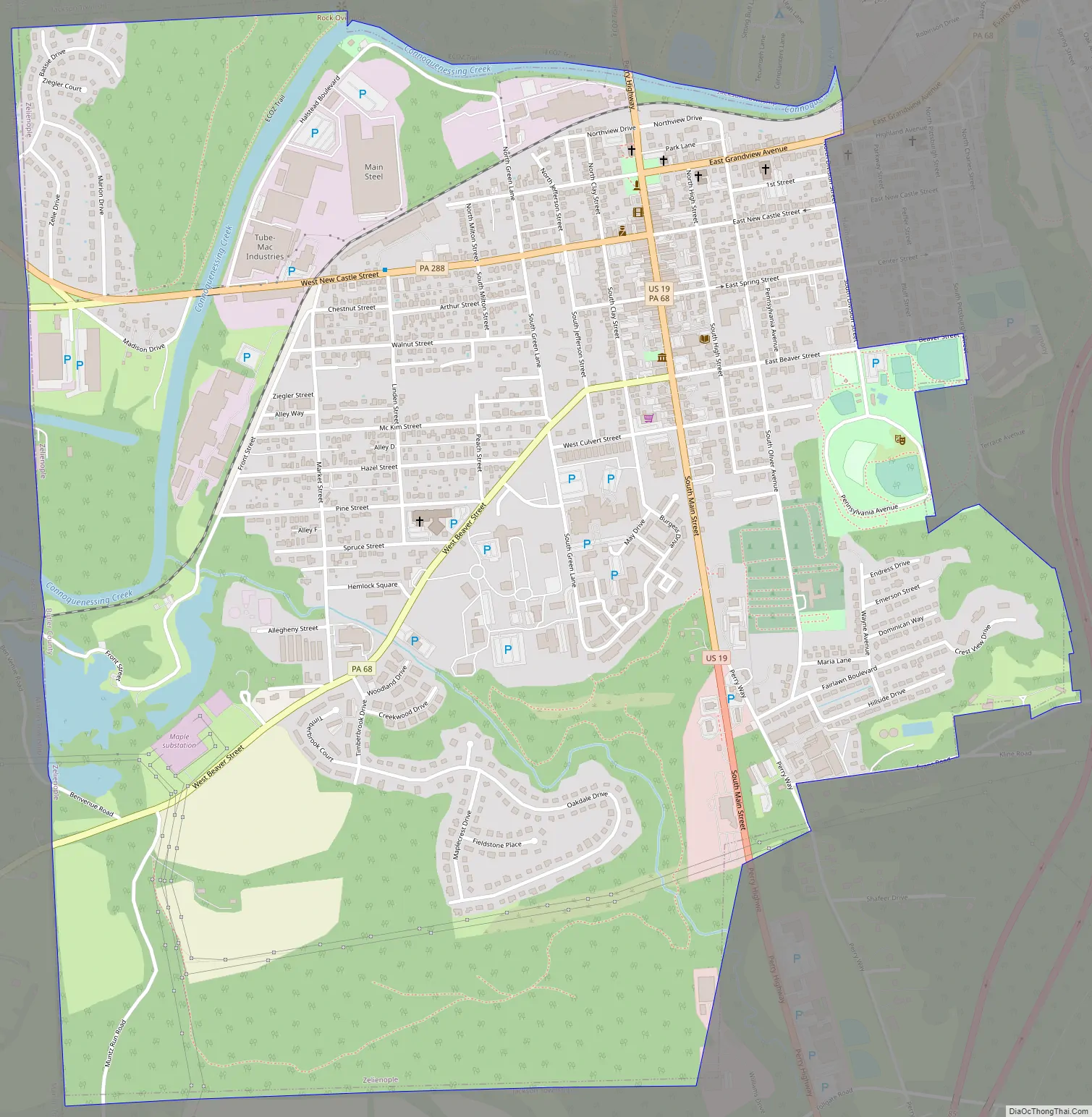
Zelienople Road Map
Zelienople city Satellite Map

Geography
Zelienople is located in southwestern Butler County, situated on the south bank of Connoquenessing Creek, in an area that is rich with coal and iron ore. The elevation is 935 feet (285 m) above sea level. The borough is bordered by Jackson Township on the north, southeast, and south, and by the borough of Harmony on the northeast. The western border of Zelienople is the Beaver County line.
U.S. Route 19 (Perry Highway) is the main north–south road through the center of town. Interstate 79, running generally parallel to US 19, passes just to the east of the borough, with access from Exits 85, 87, and 88. Via I-79 and I-279 it is 28 miles (45 km) south to downtown Pittsburgh. To the north I-79 leads 100 miles (160 km) to Erie. Pennsylvania Route 68 runs east from US 19 as East Grandview Avenue and southwest as West Beaver Street. Via PA 68 it is 17 miles (27 km) east to Butler, the county seat, and 12 miles (19 km) southwest to Rochester on the Ohio River. Routes 288 and 588 lead west from town on West New Castle Street, PA 288 turning northwest to lead 10 miles (16 km) to Ellwood City, and PA 588 leading 14 miles (23 km) west to Beaver Falls.
According to the United States Census Bureau, the borough has a total area of 2.1 square miles (5.4 km), of which 0.04 square miles (0.1 km), or 2.20%, is water.
See also
Map of Pennsylvania State and its subdivision:- Adams
- Allegheny
- Armstrong
- Beaver
- Bedford
- Berks
- Blair
- Bradford
- Bucks
- Butler
- Cambria
- Cameron
- Carbon
- Centre
- Chester
- Clarion
- Clearfield
- Clinton
- Columbia
- Crawford
- Cumberland
- Dauphin
- Delaware
- Elk
- Erie
- Fayette
- Forest
- Franklin
- Fulton
- Greene
- Huntingdon
- Indiana
- Jefferson
- Juniata
- Lackawanna
- Lancaster
- Lawrence
- Lebanon
- Lehigh
- Luzerne
- Lycoming
- Mc Kean
- Mercer
- Mifflin
- Monroe
- Montgomery
- Montour
- Northampton
- Northumberland
- Perry
- Philadelphia
- Pike
- Potter
- Schuylkill
- Snyder
- Somerset
- Sullivan
- Susquehanna
- Tioga
- Union
- Venango
- Warren
- Washington
- Wayne
- Westmoreland
- Wyoming
- York
- Alabama
- Alaska
- Arizona
- Arkansas
- California
- Colorado
- Connecticut
- Delaware
- District of Columbia
- Florida
- Georgia
- Hawaii
- Idaho
- Illinois
- Indiana
- Iowa
- Kansas
- Kentucky
- Louisiana
- Maine
- Maryland
- Massachusetts
- Michigan
- Minnesota
- Mississippi
- Missouri
- Montana
- Nebraska
- Nevada
- New Hampshire
- New Jersey
- New Mexico
- New York
- North Carolina
- North Dakota
- Ohio
- Oklahoma
- Oregon
- Pennsylvania
- Rhode Island
- South Carolina
- South Dakota
- Tennessee
- Texas
- Utah
- Vermont
- Virginia
- Washington
- West Virginia
- Wisconsin
- Wyoming


