Pottstown is a borough in Montgomery County, Pennsylvania, United States. Pottstown was laid out in 1752–53 and named Pottsgrove in honor of its founder, John Potts. The old name was abandoned at the time of the incorporation as a borough in 1815. In 1888, the limits of the borough were considerably extended. Pottstown is the center of a productive farming and dairying region.
Pottstown is located on the Schuylkill River. It is 29.1 miles (46.8 km) south of Allentown and 40.4 miles (65.0 km) northwest of Philadelphia. It is generally considered part of the Delaware Valley or Philadelphia metropolitan area.
| Name: | Pottstown borough |
|---|---|
| LSAD Code: | 21 |
| LSAD Description: | borough (suffix) |
| State: | Pennsylvania |
| County: | Montgomery County |
| Founded: | 1752 |
| Incorporated: | February 6, 1815 |
| Elevation: | 203 ft (62 m) |
| Total Area: | 4.94 sq mi (12.79 km²) |
| Land Area: | 4.85 sq mi (12.57 km²) |
| Water Area: | 0.09 sq mi (0.22 km²) |
| Total Population: | 23,433 |
| Population Density: | 4,829.55/sq mi (1,864.88/km²) |
| FIPS code: | 4262416 |
| Website: | http://www.pottstown.org |
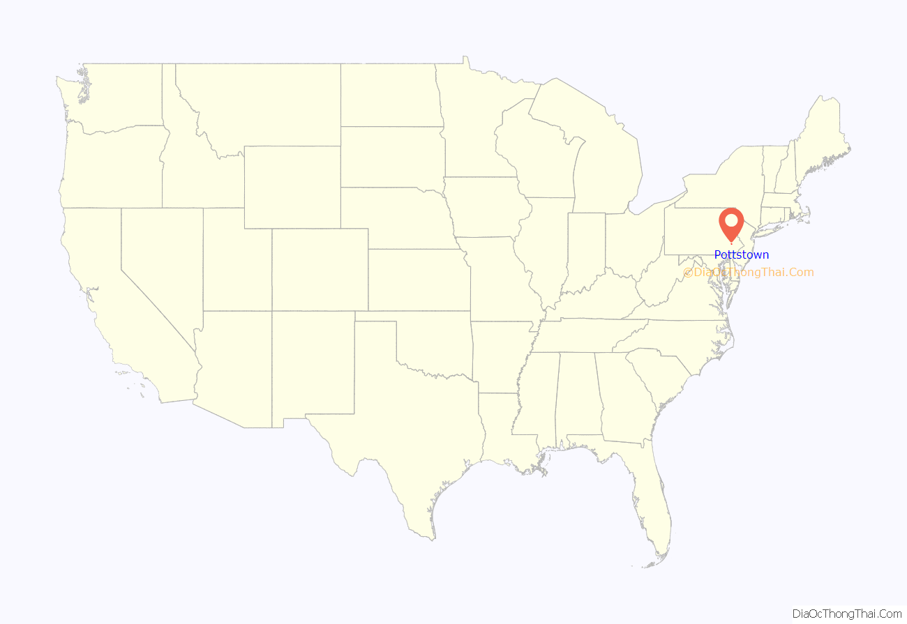
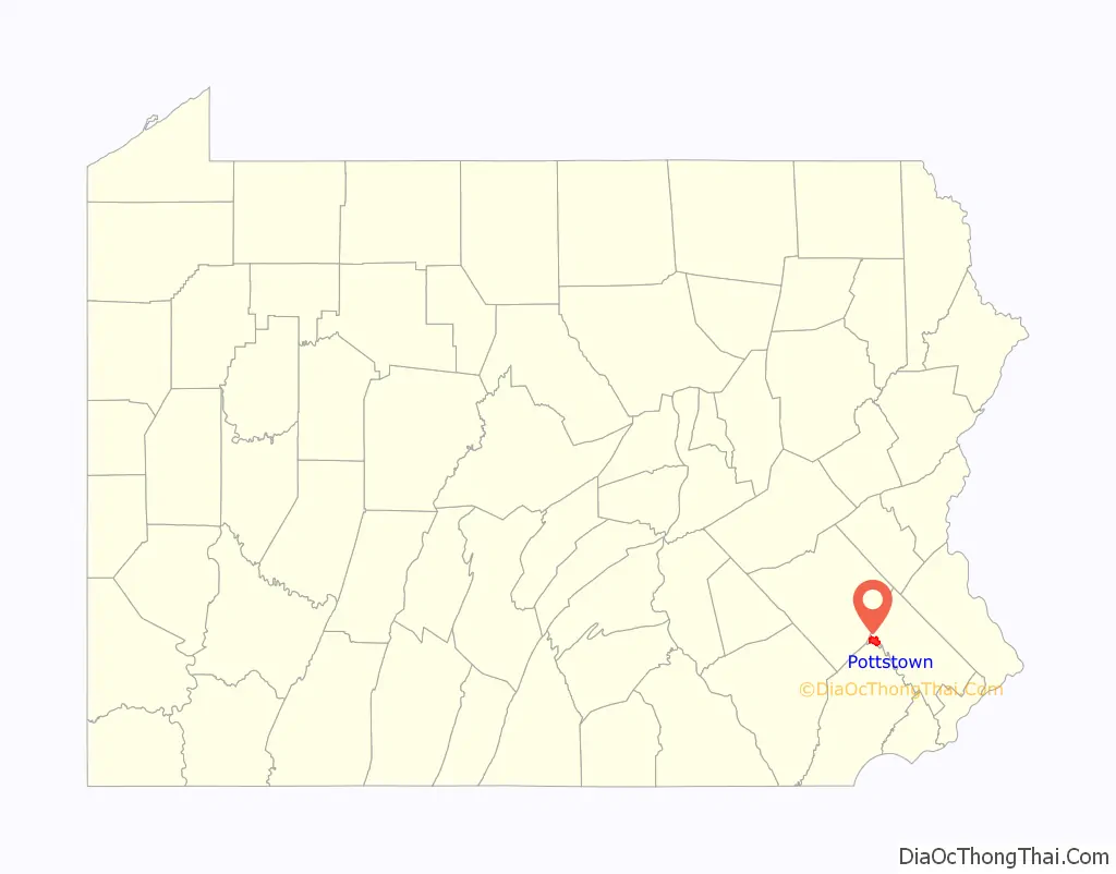
Online Interactive Map
Click on ![]() to view map in "full screen" mode.
to view map in "full screen" mode.
Pottstown location map. Where is Pottstown borough?
History
Modern-day Pottstown is on land originally deeded to William Penn. Germans, Swedes and English were among the area’s first European settlers. After establishment of the first iron forge in 1714, Pottstown’s fortunes became tied to the iron industry, and blast furnaces for production of iron and later steel eventually opened in the area.
Iron and steel production attracted the Potts family, iron masters by trade. They established a forge and built a large home just west of the Manatawny Creek. John Potts founded a town in 1761 on part of the 995 acres (4.03 km) that he owned. It is the home of the nation’s oldest mill, Pottstown Roller Mill.
Pottsgrove grew, and in 1815 it was incorporated under the name Pottstown, becoming the second borough in Pennsylvania, after Norristown.
The Philadelphia & Reading Railroad mainline reached Pottstown in 1838. The extension of the railroad to Mount Carbon in 1842 facilitated the movement of raw materials and finished goods that helped Pottstown’s economy grow. In a few years after the extension of the railroad, the population grew from 600 to 1,850. Pottstown’s metal production grew; steel from the borough was used in the Panama Canal and Golden Gate Bridge.
In 1944, the borough adopted a city manager form of government. By 1964, the borough saw the need to reorganize the municipal government. At the time, it had one of the largest borough councils in the state, with 20 members. This was reduced to seven members in redrawn wards.
The High Street Historic District, Old Pottstown Historic District, Pottsgrove Mansion, Grubb Mansion, Jefferson Elementary School, Pottstown Roller Mill, Reading Railroad Pottstown Station, and Henry Antes House are on the National Register of Historic Places.
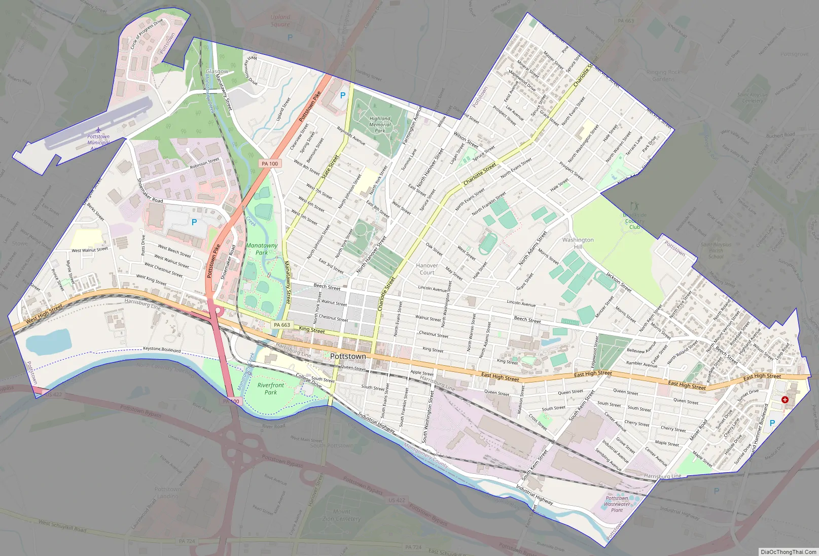
Pottstown Road Map
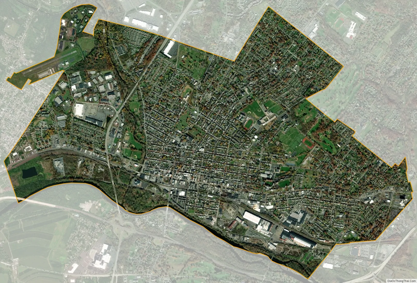
Pottstown city Satellite Map
Geography
Pottstown is located at 40°14′59″N 75°38′25″W / 40.24972°N 75.64028°W / 40.24972; -75.64028 (40.249690, -75.640262). According to the U.S. Census Bureau, the borough has a total area of 4.9 square miles (13 km), of which 4.8 square miles (12 km) is land and 0.1 square miles (0.26 km) or 1.83% is water.
Climate
The climate in this area is characterized by hot, humid summers and generally mild to cool winters. According to the Köppen Climate Classification system, Pottstown, Pennsylvania has a humid subtropical climate, abbreviated Cfa on climate maps. Using the freezing mark as a boundary (as is more common in the US), the climate was hot-summer humid continental (Dfa) with January averaging below freezing until the most recent temperature numbers. The hardiness zone is 7a. Despite global warming heavy snow remains occasionally possible.
See also
Map of Pennsylvania State and its subdivision:- Adams
- Allegheny
- Armstrong
- Beaver
- Bedford
- Berks
- Blair
- Bradford
- Bucks
- Butler
- Cambria
- Cameron
- Carbon
- Centre
- Chester
- Clarion
- Clearfield
- Clinton
- Columbia
- Crawford
- Cumberland
- Dauphin
- Delaware
- Elk
- Erie
- Fayette
- Forest
- Franklin
- Fulton
- Greene
- Huntingdon
- Indiana
- Jefferson
- Juniata
- Lackawanna
- Lancaster
- Lawrence
- Lebanon
- Lehigh
- Luzerne
- Lycoming
- Mc Kean
- Mercer
- Mifflin
- Monroe
- Montgomery
- Montour
- Northampton
- Northumberland
- Perry
- Philadelphia
- Pike
- Potter
- Schuylkill
- Snyder
- Somerset
- Sullivan
- Susquehanna
- Tioga
- Union
- Venango
- Warren
- Washington
- Wayne
- Westmoreland
- Wyoming
- York
- Alabama
- Alaska
- Arizona
- Arkansas
- California
- Colorado
- Connecticut
- Delaware
- District of Columbia
- Florida
- Georgia
- Hawaii
- Idaho
- Illinois
- Indiana
- Iowa
- Kansas
- Kentucky
- Louisiana
- Maine
- Maryland
- Massachusetts
- Michigan
- Minnesota
- Mississippi
- Missouri
- Montana
- Nebraska
- Nevada
- New Hampshire
- New Jersey
- New Mexico
- New York
- North Carolina
- North Dakota
- Ohio
- Oklahoma
- Oregon
- Pennsylvania
- Rhode Island
- South Carolina
- South Dakota
- Tennessee
- Texas
- Utah
- Vermont
- Virginia
- Washington
- West Virginia
- Wisconsin
- Wyoming


