Salladasburg is a borough in Lycoming County, Pennsylvania, United States. The population was 252 at the 2020 census, making it the smallest borough in Lycoming County. It is part of the Williamsport, Pennsylvania Metropolitan Statistical Area.
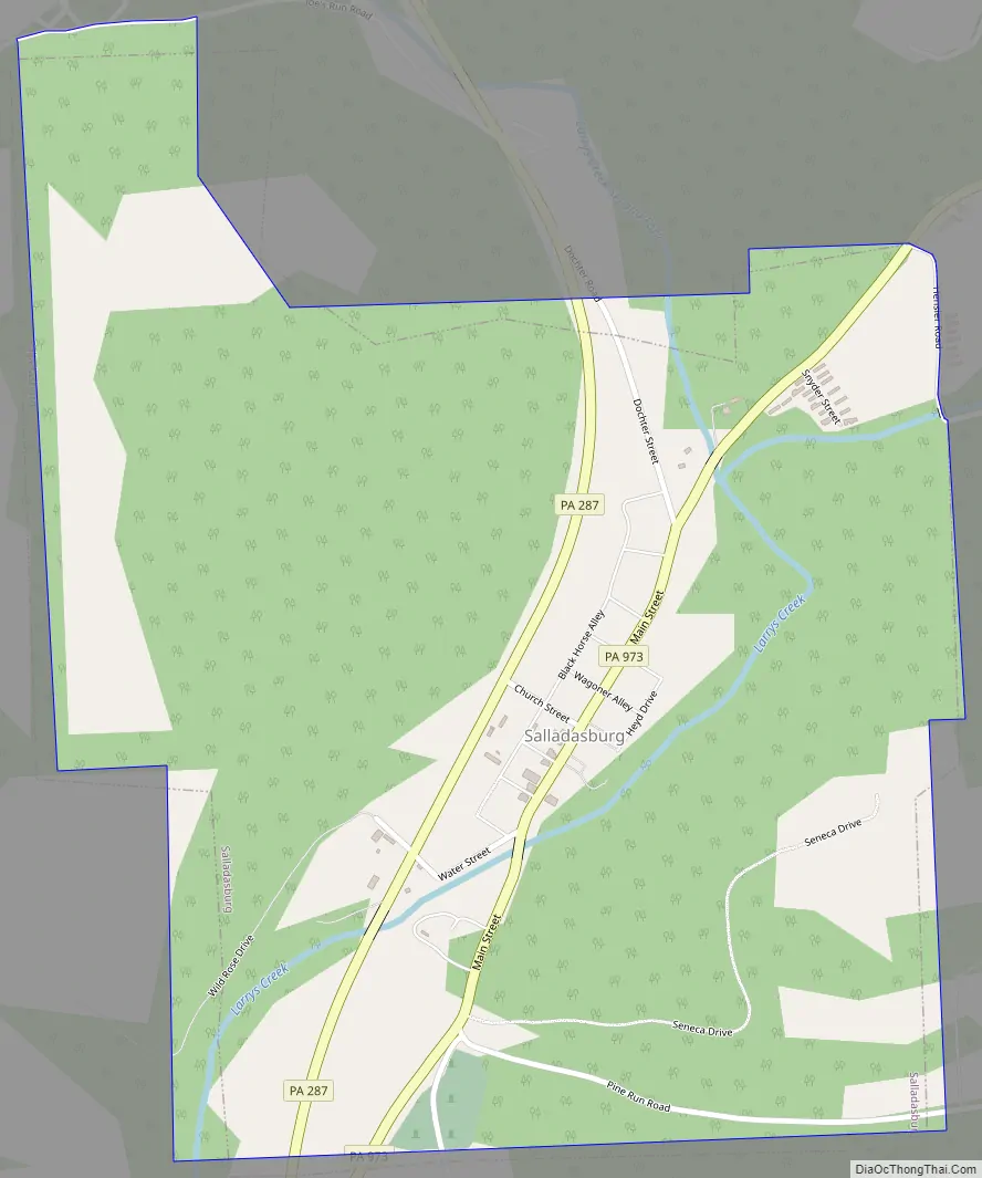
Salladasburg is located on Larrys Creek, at the confluence of the Second Fork of Larrys Creek. It is also located at the intersection of Pennsylvania Route 287 and Pennsylvania Route 973.
| Name: | Salladasburg borough |
|---|---|
| LSAD Code: | 21 |
| LSAD Description: | borough (suffix) |
| State: | Pennsylvania |
| County: | Lycoming County |
| Elevation: | 652 ft (199 m) |
| Total Area: | 0.79 sq mi (2.05 km²) |
| Land Area: | 0.78 sq mi (2.01 km²) |
| Water Area: | 0.01 sq mi (0.03 km²) |
| Total Population: | 254 |
| Population Density: | 289.58/sq mi (111.75/km²) |
| ZIP code: | 17740 |
| Area code: | 570 |
| FIPS code: | 4267616 |
| GNISfeature ID: | 1186873 |
Online Interactive Map
Click on ![]() to view map in "full screen" mode.
to view map in "full screen" mode.
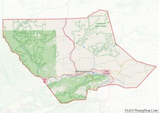
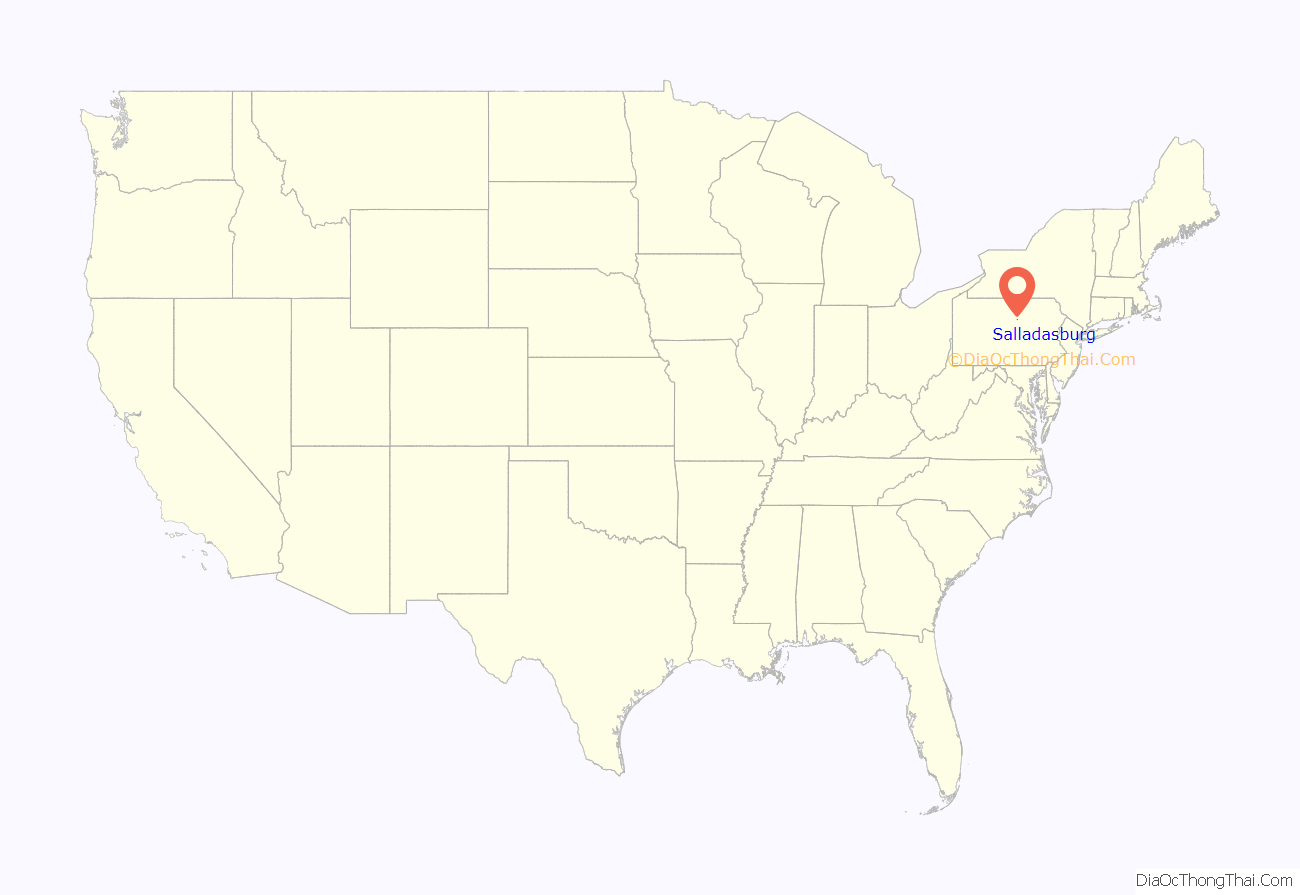
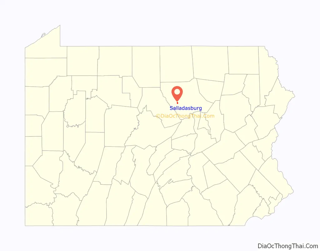
Salladasburg location map. Where is Salladasburg borough?
History
Salladasburg was laid out by Jacob P. Sallada in 1837. He started the town with lots for homes and built a church for use by Lutherans and Presbyterians only. The population of Salladasburg was 374 as of the 1890 census and is now set at just 238 residents. The borough had a number of stores and shops, one hotel, a gristmill, and tannery. There were two schools and three churches. Salladasburg was incorporated as a borough by the Court of Quarter Sessions of the Peace of Lycoming County, Pennsylvania on January 12, 1884.
Salladasburg Road Map
Salladasburg city Satellite Map

Geography
Salladasburg is located at 41°16′40″N 77°13′33″W / 41.27778°N 77.22583°W / 41.27778; -77.22583 (41.277733, -77.225907). It is surrounded by Mifflin Township. As the crow flies, Lycoming County is approximately 130 miles (209 km) northwest of Philadelphia and 165 miles (266 km) east-northeast of Pittsburgh.
According to the United States Census Bureau, the borough has a total area of 0.8 square miles (2.1 km), all land.
See also
Map of Pennsylvania State and its subdivision:- Adams
- Allegheny
- Armstrong
- Beaver
- Bedford
- Berks
- Blair
- Bradford
- Bucks
- Butler
- Cambria
- Cameron
- Carbon
- Centre
- Chester
- Clarion
- Clearfield
- Clinton
- Columbia
- Crawford
- Cumberland
- Dauphin
- Delaware
- Elk
- Erie
- Fayette
- Forest
- Franklin
- Fulton
- Greene
- Huntingdon
- Indiana
- Jefferson
- Juniata
- Lackawanna
- Lancaster
- Lawrence
- Lebanon
- Lehigh
- Luzerne
- Lycoming
- Mc Kean
- Mercer
- Mifflin
- Monroe
- Montgomery
- Montour
- Northampton
- Northumberland
- Perry
- Philadelphia
- Pike
- Potter
- Schuylkill
- Snyder
- Somerset
- Sullivan
- Susquehanna
- Tioga
- Union
- Venango
- Warren
- Washington
- Wayne
- Westmoreland
- Wyoming
- York
- Alabama
- Alaska
- Arizona
- Arkansas
- California
- Colorado
- Connecticut
- Delaware
- District of Columbia
- Florida
- Georgia
- Hawaii
- Idaho
- Illinois
- Indiana
- Iowa
- Kansas
- Kentucky
- Louisiana
- Maine
- Maryland
- Massachusetts
- Michigan
- Minnesota
- Mississippi
- Missouri
- Montana
- Nebraska
- Nevada
- New Hampshire
- New Jersey
- New Mexico
- New York
- North Carolina
- North Dakota
- Ohio
- Oklahoma
- Oregon
- Pennsylvania
- Rhode Island
- South Carolina
- South Dakota
- Tennessee
- Texas
- Utah
- Vermont
- Virginia
- Washington
- West Virginia
- Wisconsin
- Wyoming