Wilmore is a borough in Cambria County, Pennsylvania, United States. It is part of the Johnstown, Pennsylvania Metropolitan Statistical Area. The population was 225 at the 2010 census.
| Name: | Wilmore borough |
|---|---|
| LSAD Code: | 21 |
| LSAD Description: | borough (suffix) |
| State: | Pennsylvania |
| County: | Cambria County |
| Incorporated: | 1859 |
| Elevation: | 1,555 ft (474 m) |
| Total Area: | 0.33 sq mi (0.86 km²) |
| Land Area: | 0.33 sq mi (0.86 km²) |
| Water Area: | 0.00 sq mi (0.00 km²) |
| Total Population: | 225 |
| Population Density: | 617.47/sq mi (238.64/km²) |
| ZIP code: | 15962 |
| Area code: | 814 |
| FIPS code: | 4285528 |
| GNISfeature ID: | 1215039 |
Online Interactive Map
Click on ![]() to view map in "full screen" mode.
to view map in "full screen" mode.
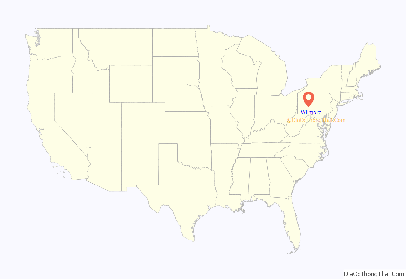
Wilmore location map. Where is Wilmore borough?
History
In the book Underground Railroad in Pennsylvania, author William J. Switala makes reference to Wilmore being a part of the Johnstown-Wilmore-Ebensburg-Burnside route. “From Johnstown, the fugitive slaves moved northeasterly through the heavily wooded valleys and gullies of the Appalachian Mountains. The more well known of the two routes … proceeds from Johnstown all the way to Ebensburg, following the trace that eventually became US-219. Blockson mentions a stop along the route at the hamlet of Wilmore, a small black community located about eight miles south of Ebensburg and near Portage. Godfrey Wilmore, a former slave from Maryland, is reported to have founded the community.”
Godfrey Wilmore was born 1751 in or near Cumberland, Allegheny County, Maryland [8] and died April 2, 1815, in Wilmore; he was buried at St. Michael’s Cemetery, Loretto, Pennsylvania. Godfrey married Mary Higgins, who was born 1747 in Ireland and died August 28, 1822, in Wilmore; buried St. Michael’s Cemetery, Loretto.
Godfrey was a freed slave of African descent. Mary was either an indentured servant or a redemptioner and was of Irish descent. Both his and Mary Higgins’ servitude were documented within Harford County, Maryland. Godfrey is said to have been a man of above average intellect, who could read and write. This is referenced numerous times within Cambria County documents by the notation that Godfrey Wilmore wrote the document and witnessed it by his signature, whereas the other parties sign by their mark “X”. In that he was a slave, the fact that he could read and write is remarkable and suggests that he may have been a “house slave” or a supervisory slave laborer. Even more remarkable is that it is further said that he was an energetic man who worked enough extra, outside of his servitude, that he was able to buy his freedom. Documents go on to say that he then bought the remaining time of indentured servitude of his white wife Mary Higgins. It is also noted that due to his education, Godfrey becomes the first teacher in the area that surrounds Wilmore.
According to the “Souvenir of St. Michael’s Parish, Loretto, Pa.” – On or about 1800 (?), this family traveled from Harford Co., Maryland, along the Conococheague Valley (pronounced by the early settlers “Con-eck e-jig”), westward through Cumberland, Maryland, and eventually coming to settle in a place then known as “Jimmy Rhey Place” (1909- John Mangus resides). This family was a charter pioneer in the formation of Summerhill Township (1810) and very likely a charter pioneer in the formation of Cambria County (1804). The family moved but once more, to a farm approx. 1 mile south of the town of Wilmore (1909- James H. White Farm). Godfrey built the first sawmill in this section of the county on the Little Conemaugh River, below the town of Wilmore, Pennsylvania. This water-driven sawmill was subsequently washed away and rebuilt about 800 yards east of the present (1910) Pennsylvania Railroad depot.
Mary (Higgins) Wilmore was a Catholic. Godfrey Wilmore, on the other hand, was a Baptist and well acquainted with the Sacred Scriptures. Father Demetrius Augustine Gallitzin, a Catholic priest, who was a former Russian prince, visited the Wilmore household with a view to reconciling the differences of religion within the family, and it was said that they had many earnest, controversial conversations, which eventually resulted in Godfrey’s conversion to Catholicism.
In 1829, Sylvester Welch’s Corps of Engineers was running the lines of the Allegheny Portage Railroad through Summerhill Township, and they came across “… a little village which they marked on their map ‘Guinea’, an appellation which the Irish laborers who built the road adopted until the matter was made a subject of complaint to Fr. Gallitzin, who from the altar denounced this insult to a family for whom he had the greatest respect. It was said that Father Gallitzin would chastise any person who would call the town by that opprobrious name and he declared that it should be known as Jefferson…” in honor of our third President. This is further referenced within the will of Bernard Wilmore, the oldest son of Godfrey and Mary Wilmore, that he lists the town of Jefferson as his home.
It was Bernard, with the help of his nephew Martin Wilmore (son of James and Catharine Wilmore) who laid out the town-site of then Guinea, changing the name, because of the promptings of Father Gallitzin, to Jefferson (June 4, 1831). On June 10, 1831, the contract was let for Section 15 of the Old Portage Railroad, which ran through Jefferson by the time of its completion in 1834.
Jefferson, as the name of the town, never caught on. The 6th post office in the county, established in Aug. 1832 along with the train depot, were forever referred to by the residents as “Wilmore’s Post Office” and “Wilmore’s Station” respectively. In 1859 the town was formally incorporated into a borough under the name of Wilmore and there were 20 homes.
Mary Wilmore, who was a daughter of Godfrey and Mary Wilmore, married James Young. He was educated, could read and write and was a contractor and the person who built St. Bartholomew’s Church- the present-day Gothic structure in Wilmore which replaced the small stone church. St. Bartholomew’s Church was built in 1854. Even though Bernard Wilmore at the time of his death (1844) had left a small parcel of land in the center of town to Father Gallitzin to be used as a church, Father Gallitzin’s executors sold the property and it is currently where the Evangelical Lutheran Church now stands.
Wilmore Road Map
Wilmore city Satellite Map
Geography
Wilmore is located in south-central Cambria County at 40°23′14″N 78°43′5″W / 40.38722°N 78.71806°W / 40.38722; -78.71806 (40.387311, -78.718118), in the valley of the Little Conemaugh River. It is 8 miles (13 km) south of Ebensburg, the county seat. Within the Little Conemaugh Valley, Portage is 3 miles (5 km) east (upstream), and Summerhill is 3 miles (5 km) to the west (downstream). Johnstown, the largest city in the county, is 16 miles (26 km) to the southwest.
According to the United States Census Bureau, the borough of Wilmore has a total area of 0.33 square miles (0.86 km), all land.
See also
Map of Pennsylvania State and its subdivision:- Adams
- Allegheny
- Armstrong
- Beaver
- Bedford
- Berks
- Blair
- Bradford
- Bucks
- Butler
- Cambria
- Cameron
- Carbon
- Centre
- Chester
- Clarion
- Clearfield
- Clinton
- Columbia
- Crawford
- Cumberland
- Dauphin
- Delaware
- Elk
- Erie
- Fayette
- Forest
- Franklin
- Fulton
- Greene
- Huntingdon
- Indiana
- Jefferson
- Juniata
- Lackawanna
- Lancaster
- Lawrence
- Lebanon
- Lehigh
- Luzerne
- Lycoming
- Mc Kean
- Mercer
- Mifflin
- Monroe
- Montgomery
- Montour
- Northampton
- Northumberland
- Perry
- Philadelphia
- Pike
- Potter
- Schuylkill
- Snyder
- Somerset
- Sullivan
- Susquehanna
- Tioga
- Union
- Venango
- Warren
- Washington
- Wayne
- Westmoreland
- Wyoming
- York
- Alabama
- Alaska
- Arizona
- Arkansas
- California
- Colorado
- Connecticut
- Delaware
- District of Columbia
- Florida
- Georgia
- Hawaii
- Idaho
- Illinois
- Indiana
- Iowa
- Kansas
- Kentucky
- Louisiana
- Maine
- Maryland
- Massachusetts
- Michigan
- Minnesota
- Mississippi
- Missouri
- Montana
- Nebraska
- Nevada
- New Hampshire
- New Jersey
- New Mexico
- New York
- North Carolina
- North Dakota
- Ohio
- Oklahoma
- Oregon
- Pennsylvania
- Rhode Island
- South Carolina
- South Dakota
- Tennessee
- Texas
- Utah
- Vermont
- Virginia
- Washington
- West Virginia
- Wisconsin
- Wyoming
