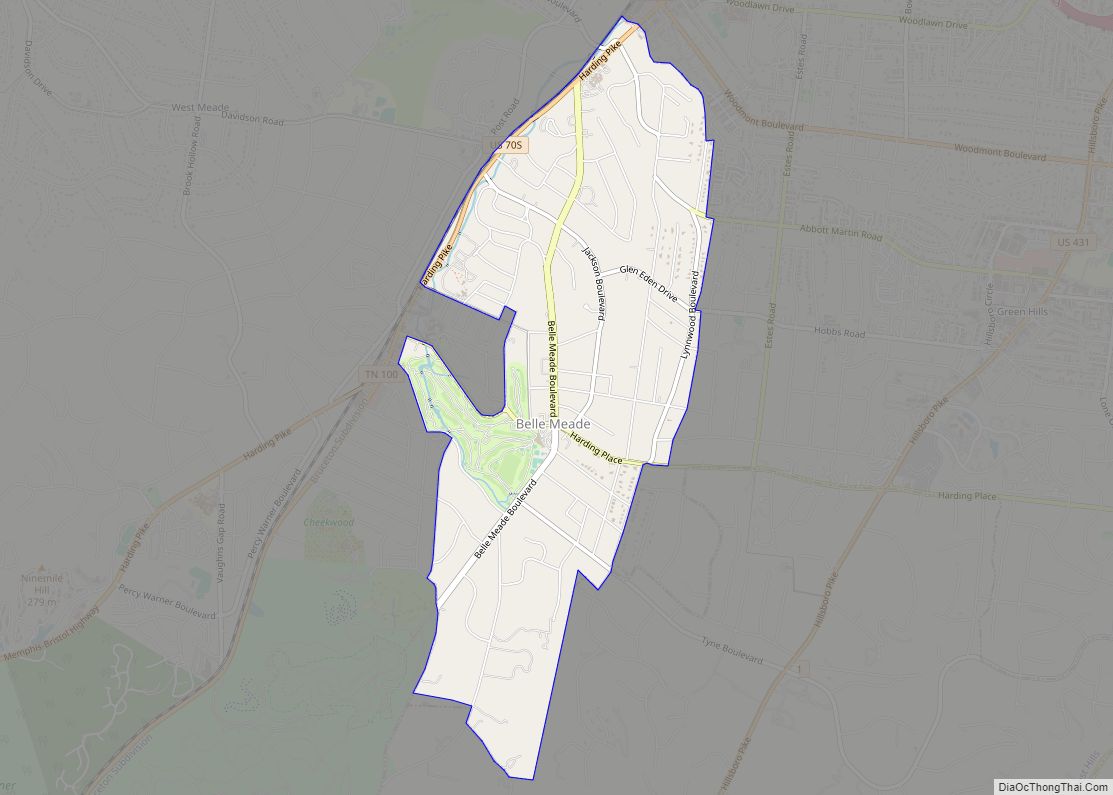
Belle Meade is a city in Davidson County, Tennessee. Its total land area is 3.1 square miles (8.0 km), and its population was 2,912 at the time of the 2010 census.
Belle Meade operates independently as a city, complete with its own regulations, a city hall, and police force, but it is also integrated with the Nashville government. Developed in part on the territory of the former Belle Meade plantations, residential areas are suburban with tree-lined streets and wooded areas. The median annual income of Belle Meade residents is $195,208, which exceeds the median annual income in the U.S. by more than three times.
The city’s history dates back to 1807, when John Harding of Virginia purchased the Dunham’s Station log cabin and 250 acres (100 ha) on the Natchez Trace near Richland Creek. He named the property Belle Meade, which is French for “beautiful meadow”. Over the next few decades, enslaved African Americans built Harding’s mansion, and established a thoroughbred breeding farm and cotton plantation. He conducted various service businesses on the property, including a grist and saw mill, a cotton gin, and a blacksmith shop – all primarily operated by enslaved African-Americans.
Harding’s son, William Giles Harding, inherited the estate in 1839. In 1866 his daughter Selene married brigadier general William Hicks Jackson, who controlled the land from 1883 and made the estate gain international recognition for its horses. In 1906, debt forced the Harding family to sell Belle Meade. Belle Meade Land Company built the first road and in 1938 developed the neighborhood that established the City of Belle Meade. The mansion was converted into a museum. On December 30, 1969, it was listed on the National Register of Historic Places (#69000177).
| Name: | Belle Meade city |
|---|---|
| LSAD Code: | 25 |
| LSAD Description: | city (suffix) |
| State: | Tennessee |
| County: | Davidson County |
| Elevation: | 560 ft (170 m) |
| Total Area: | 3.07 sq mi (7.95 km²) |
| Land Area: | 3.07 sq mi (7.95 km²) |
| Water Area: | 0.00 sq mi (0.00 km²) |
| Total Population: | 2,901 |
| Population Density: | 944.95/sq mi (364.83/km²) |
| FIPS code: | 4704620 |
| GNISfeature ID: | 1305087 |
| Website: | www.citybellemeade.org |
Online Interactive Map
Click on ![]() to view map in "full screen" mode.
to view map in "full screen" mode.
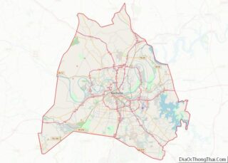
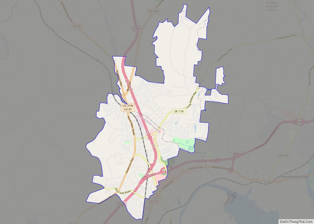
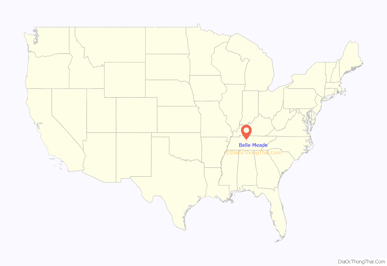
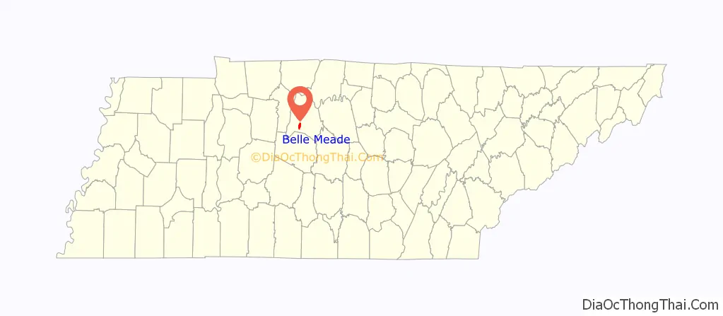
Belle Meade location map. Where is Belle Meade city?
History
The city of 3.1 square miles (8.0 km) takes its name from Belle Meade Plantation, which once encompassed 5,300 acres (2,100 ha). It was founded by planter John Harding and inherited at 1,200 acres by his son, William Giles Harding. Before the Civil War, the younger Harding more than doubled the property and built a new mansion, with the labor of the 136 enslaved African people.
His descendants founded the Belle Meade Country Club here in 1901.
Because of debt, the trustee of the Belle Meade Estate sold the mansion and 2,200 acres in May 1906 to Jacob McGavock Dickinson, the general counsel of the Illinois Central Railroad. He later served as the United States Secretary of War from 1909 to 1911.
In 1906 he co-founded the Belle Meade Land Company with J. M. Overton, Stuyvesant Fish, James Theodore Harahan, and J. C. Welling. They hired Ossian Cole Simonds to design the community. In 1910 Luke Lea, publisher of The Tennessean; Telfair Hodgson Jr. (the treasurer of Sewanee: The University of the South); and David Shepherd bought Belle Mead Company. They began the development of Belle Meade’s main streets, including Jackson Boulevard and Belle Meade Boulevard. Meanwhile, Johnson Bransford built Deer Park, Berkley Hills, Reservoir Hill, and the Belle Meade Golf Links.
Belle Meade was absorbed into the metropolitan government of Nashville-Davidson County in 1963, but it retained its independent city status. Residents pay taxes both to the Metro government and to the City of Belle Meade. Belle Meade streets have distinct signage, and the city has its own police force, mayor, and city hall. Many houses in the city have been listed on the National Register of Historic Places since July 7, 2004.
The vast majority of the Belle Meade area is designated as ZIP code 37205. A few homes are in ZIP code 37215. Rusty Moore is the current mayor. His term expires in November 2022.
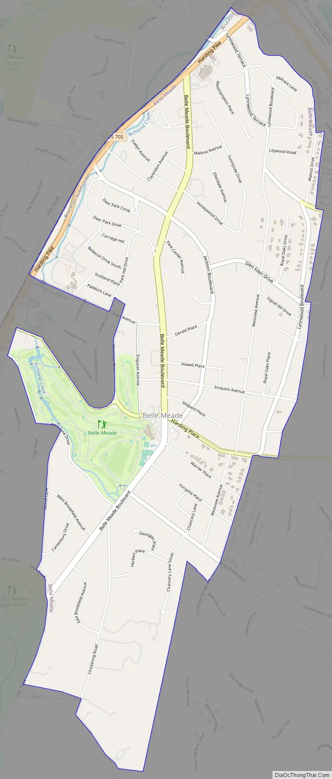
Belle Meade Road Map
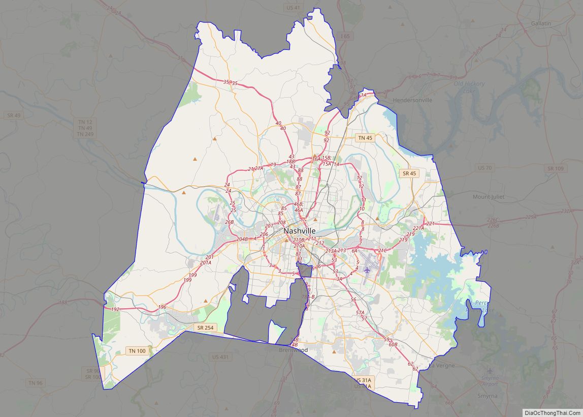
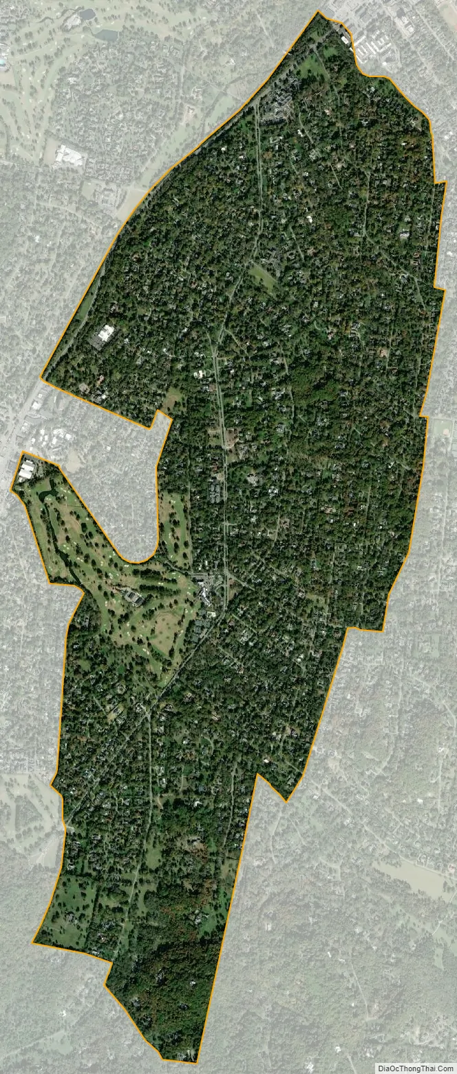
Belle Meade city Satellite Map
Geography
According to the United States Census Bureau, the city has a total area of 3.1 square miles (8.0 km), all land. Belle Meade Boulevard ends at the main historic entrance to Percy Warner Park, the city’s largest park, and Richland Creek flows through the neighborhood.
See also
Map of Tennessee State and its subdivision:- Anderson
- Bedford
- Benton
- Bledsoe
- Blount
- Bradley
- Campbell
- Cannon
- Carroll
- Carter
- Cheatham
- Chester
- Claiborne
- Clay
- Cocke
- Coffee
- Crockett
- Cumberland
- Davidson
- Decatur
- DeKalb
- Dickson
- Dyer
- Fayette
- Fentress
- Franklin
- Gibson
- Giles
- Grainger
- Greene
- Grundy
- Hamblen
- Hamilton
- Hancock
- Hardeman
- Hardin
- Hawkins
- Haywood
- Henderson
- Henry
- Hickman
- Houston
- Humphreys
- Jackson
- Jefferson
- Johnson
- Knox
- Lake
- Lauderdale
- Lawrence
- Lewis
- Lincoln
- Loudon
- Macon
- Madison
- Marion
- Marshall
- Maury
- McMinn
- McNairy
- Meigs
- Monroe
- Montgomery
- Moore
- Morgan
- Obion
- Overton
- Perry
- Pickett
- Polk
- Putnam
- Rhea
- Roane
- Robertson
- Rutherford
- Scott
- Sequatchie
- Sevier
- Shelby
- Smith
- Stewart
- Sullivan
- Sumner
- Tipton
- Trousdale
- Unicoi
- Union
- Van Buren
- Warren
- Washington
- Wayne
- Weakley
- White
- Williamson
- Wilson
- Alabama
- Alaska
- Arizona
- Arkansas
- California
- Colorado
- Connecticut
- Delaware
- District of Columbia
- Florida
- Georgia
- Hawaii
- Idaho
- Illinois
- Indiana
- Iowa
- Kansas
- Kentucky
- Louisiana
- Maine
- Maryland
- Massachusetts
- Michigan
- Minnesota
- Mississippi
- Missouri
- Montana
- Nebraska
- Nevada
- New Hampshire
- New Jersey
- New Mexico
- New York
- North Carolina
- North Dakota
- Ohio
- Oklahoma
- Oregon
- Pennsylvania
- Rhode Island
- South Carolina
- South Dakota
- Tennessee
- Texas
- Utah
- Vermont
- Virginia
- Washington
- West Virginia
- Wisconsin
- Wyoming