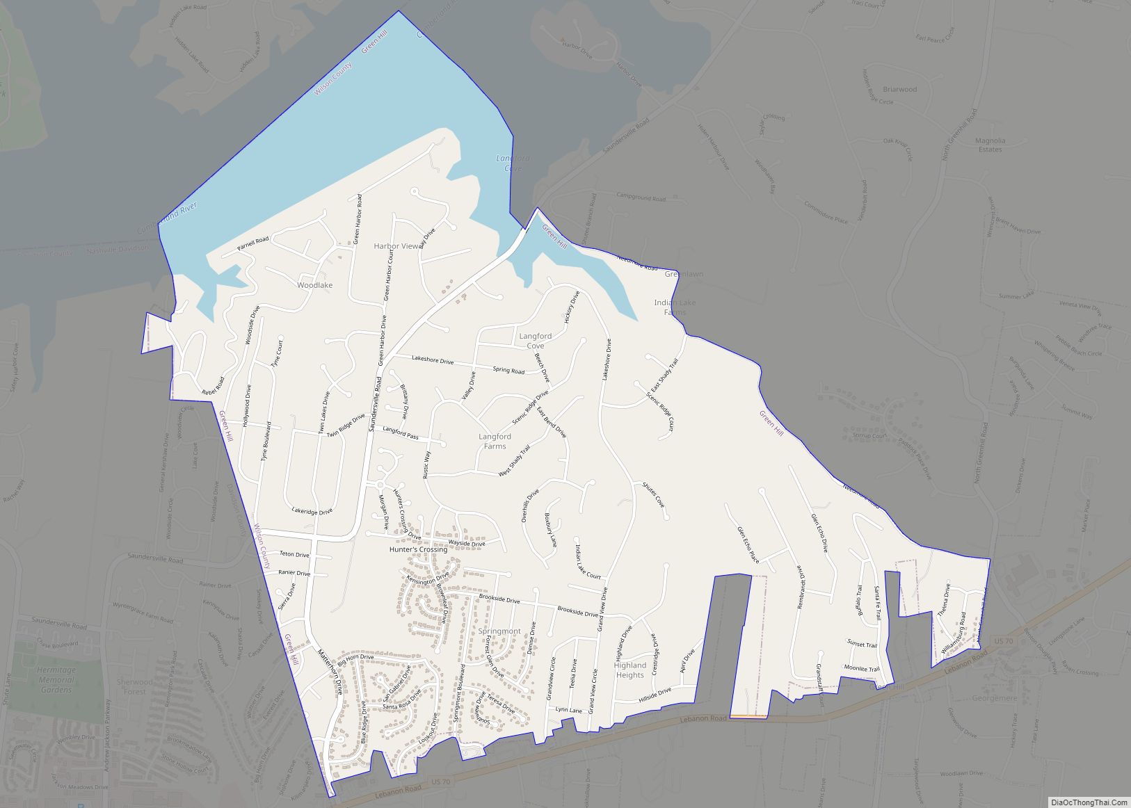
Green Hill is a census-designated place (CDP) in western Wilson County, Tennessee. The population was 6,618 at the 2010 census.
| Name: | Green Hill CDP |
|---|---|
| LSAD Code: | 57 |
| LSAD Description: | CDP (suffix) |
| State: | Tennessee |
| County: | Wilson County |
| Elevation: | 646 ft (197 m) |
| Total Area: | 3.70 sq mi (9.59 km²) |
| Land Area: | 3.48 sq mi (9.00 km²) |
| Water Area: | 0.23 sq mi (0.59 km²) |
| Total Population: | 6,518 |
| Population Density: | 1,875.68/sq mi (724.18/km²) |
| ZIP code: | 37122;37138 |
| Area code: | 615 |
| FIPS code: | 4731100 |
| GNISfeature ID: | 1286093 |
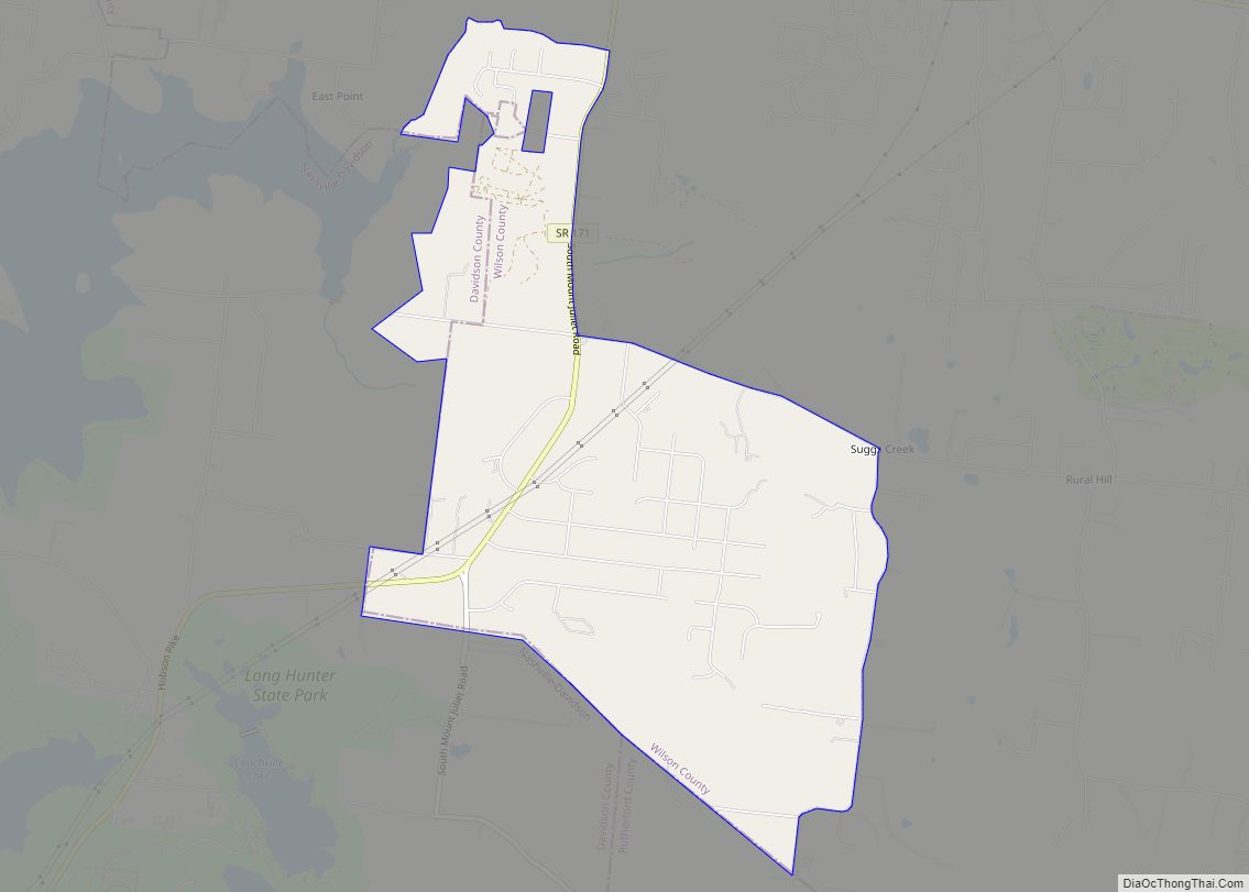
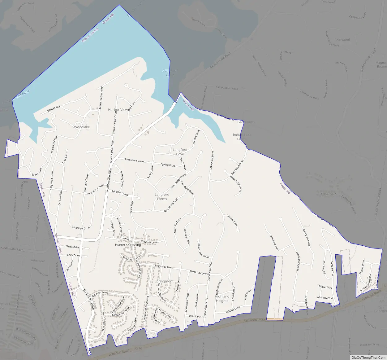
Online Interactive Map
Click on ![]() to view map in "full screen" mode.
to view map in "full screen" mode.
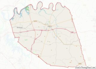
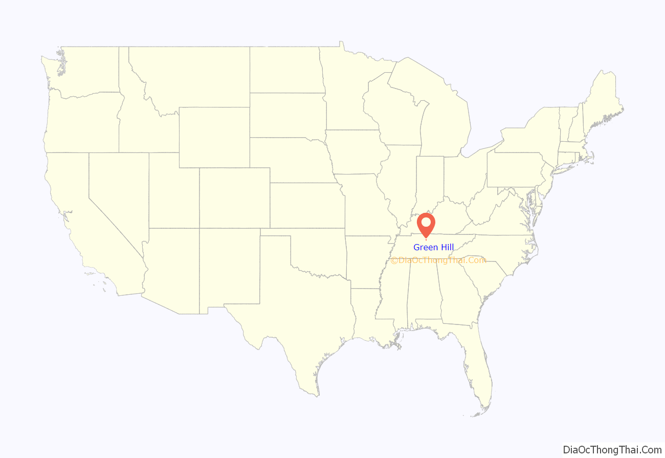
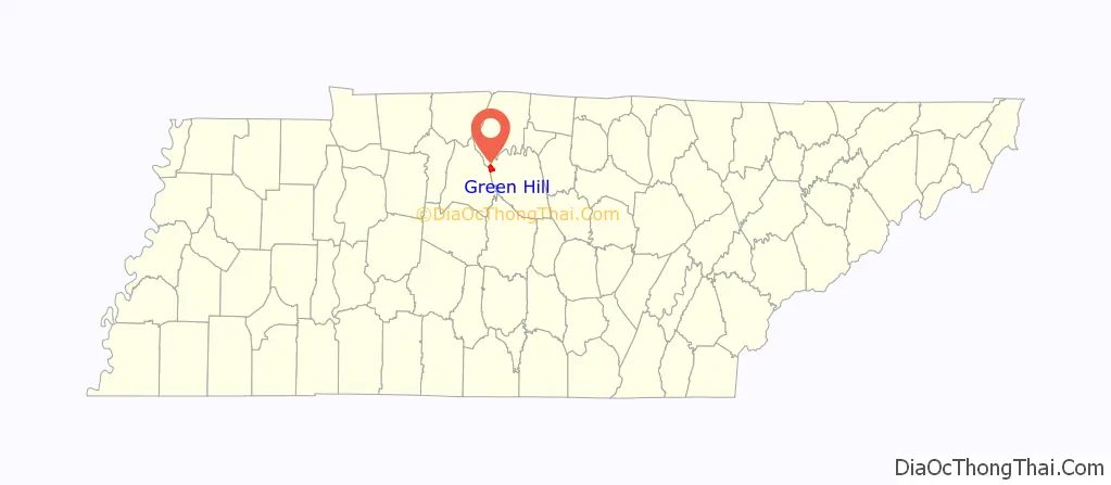
Green Hill location map. Where is Green Hill CDP?
History
Green Hill was first settled before 1800 by John Cloyd and John Williamson, who moved their families to the area from Nashville to escape a smallpox outbreak. Colonel John Donelson, Jr., later established a summer home at Green Hill. The community’s name may be a description of the location or may honor a former state treasurer of North Carolina.
During the 19th century, Green Hill was the site of a post office, established in 1834 or 1838 and closed in 1904.
Shortly before the outbreak of the Civil War, Green Hill supported a high school. Businesses included a general store, a hotel, a tobacco processor, a flour mill, and a carding machine. A high school was opened at the junction of Lebanon Road and North Greenhill Road in August 2020.
Green Hill Road Map
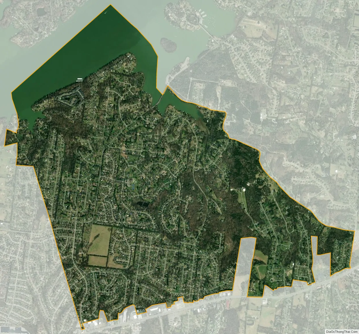
Green Hill city Satellite Map
Geography
Green Hill is located at 36°13′51″N 86°34′25″W / 36.23083°N 86.57361°W / 36.23083; -86.57361 (36.230879, -86.573623).
According to the United States Census Bureau, the CDP has a total area of 4.4 square miles (11 km), of which 3.9 square miles (10 km) is land and 0.5 square miles (1.3 km) (11.59%) is water.
See also
Map of Tennessee State and its subdivision:- Anderson
- Bedford
- Benton
- Bledsoe
- Blount
- Bradley
- Campbell
- Cannon
- Carroll
- Carter
- Cheatham
- Chester
- Claiborne
- Clay
- Cocke
- Coffee
- Crockett
- Cumberland
- Davidson
- Decatur
- DeKalb
- Dickson
- Dyer
- Fayette
- Fentress
- Franklin
- Gibson
- Giles
- Grainger
- Greene
- Grundy
- Hamblen
- Hamilton
- Hancock
- Hardeman
- Hardin
- Hawkins
- Haywood
- Henderson
- Henry
- Hickman
- Houston
- Humphreys
- Jackson
- Jefferson
- Johnson
- Knox
- Lake
- Lauderdale
- Lawrence
- Lewis
- Lincoln
- Loudon
- Macon
- Madison
- Marion
- Marshall
- Maury
- McMinn
- McNairy
- Meigs
- Monroe
- Montgomery
- Moore
- Morgan
- Obion
- Overton
- Perry
- Pickett
- Polk
- Putnam
- Rhea
- Roane
- Robertson
- Rutherford
- Scott
- Sequatchie
- Sevier
- Shelby
- Smith
- Stewart
- Sullivan
- Sumner
- Tipton
- Trousdale
- Unicoi
- Union
- Van Buren
- Warren
- Washington
- Wayne
- Weakley
- White
- Williamson
- Wilson
- Alabama
- Alaska
- Arizona
- Arkansas
- California
- Colorado
- Connecticut
- Delaware
- District of Columbia
- Florida
- Georgia
- Hawaii
- Idaho
- Illinois
- Indiana
- Iowa
- Kansas
- Kentucky
- Louisiana
- Maine
- Maryland
- Massachusetts
- Michigan
- Minnesota
- Mississippi
- Missouri
- Montana
- Nebraska
- Nevada
- New Hampshire
- New Jersey
- New Mexico
- New York
- North Carolina
- North Dakota
- Ohio
- Oklahoma
- Oregon
- Pennsylvania
- Rhode Island
- South Carolina
- South Dakota
- Tennessee
- Texas
- Utah
- Vermont
- Virginia
- Washington
- West Virginia
- Wisconsin
- Wyoming