Mt. Juliet (also referred to as Mount Juliet) is a city located in western Wilson County, Tennessee. A suburb of Nashville, it is approximately 17 miles (27 km) east of downtown Nashville. Mt. Juliet is located mostly between two major national east-west routes, Interstate 40 and U.S. Route 70. As of the 2020 United States census, Mount Juliet has a population of approximately 39,289 people. Mt. Juliet is the largest city in Wilson County. The official city charter has the name listed as Mt. Juliet; however, the United States Postal Service lists its name as Mount Juliet.
| Name: | Mount Juliet city |
|---|---|
| LSAD Code: | 25 |
| LSAD Description: | city (suffix) |
| State: | Tennessee |
| County: | Wilson County |
| Incorporated: | 1972 |
| Elevation: | 683 ft (208 m) |
| Total Area: | 26.08 sq mi (67.54 km²) |
| Land Area: | 25.76 sq mi (66.71 km²) |
| Water Area: | 0.32 sq mi (0.83 km²) |
| Total Population: | 39,289 |
| Population Density: | 1,525.37/sq mi (588.96/km²) |
| ZIP code: | 37121 (P.O. boxes) 37122 (gen. delivery) 37138 (northwestern gen. delivery) |
| Area code: | 615, 629 |
| FIPS code: | 4750780 |
| Website: | www.mtjuliet-tn.gov |
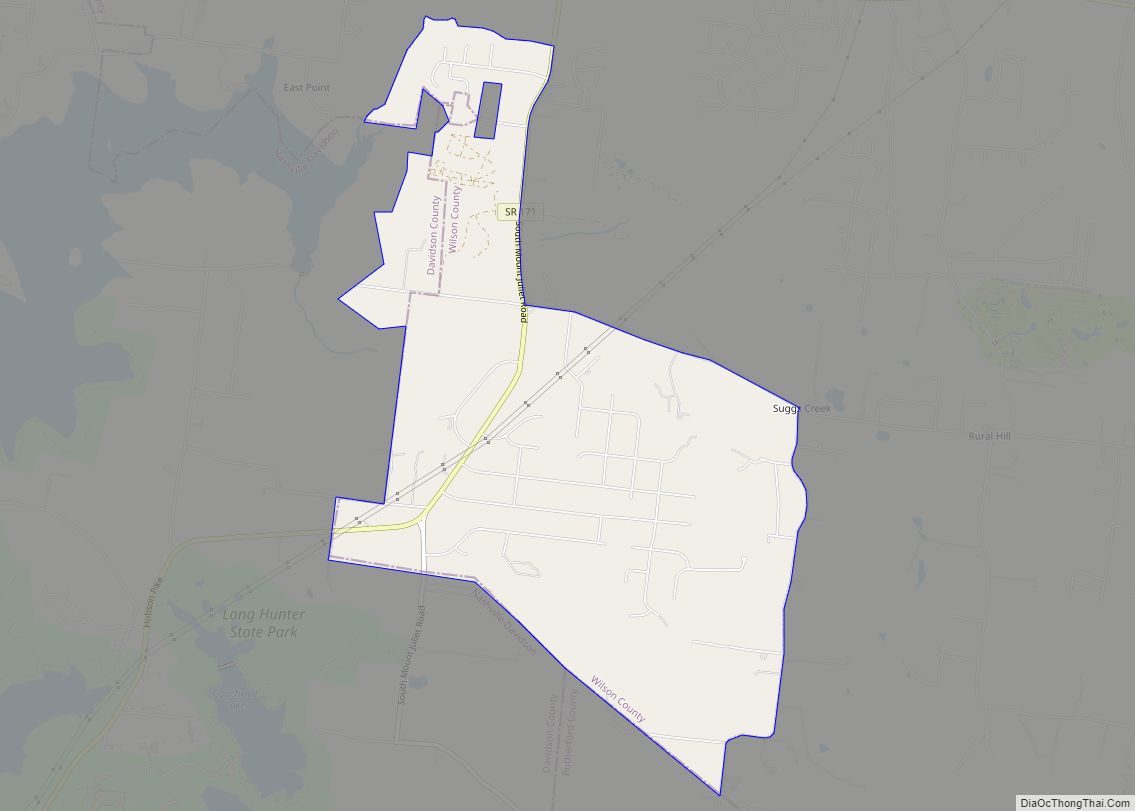
Online Interactive Map
Click on ![]() to view map in "full screen" mode.
to view map in "full screen" mode.
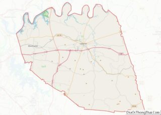
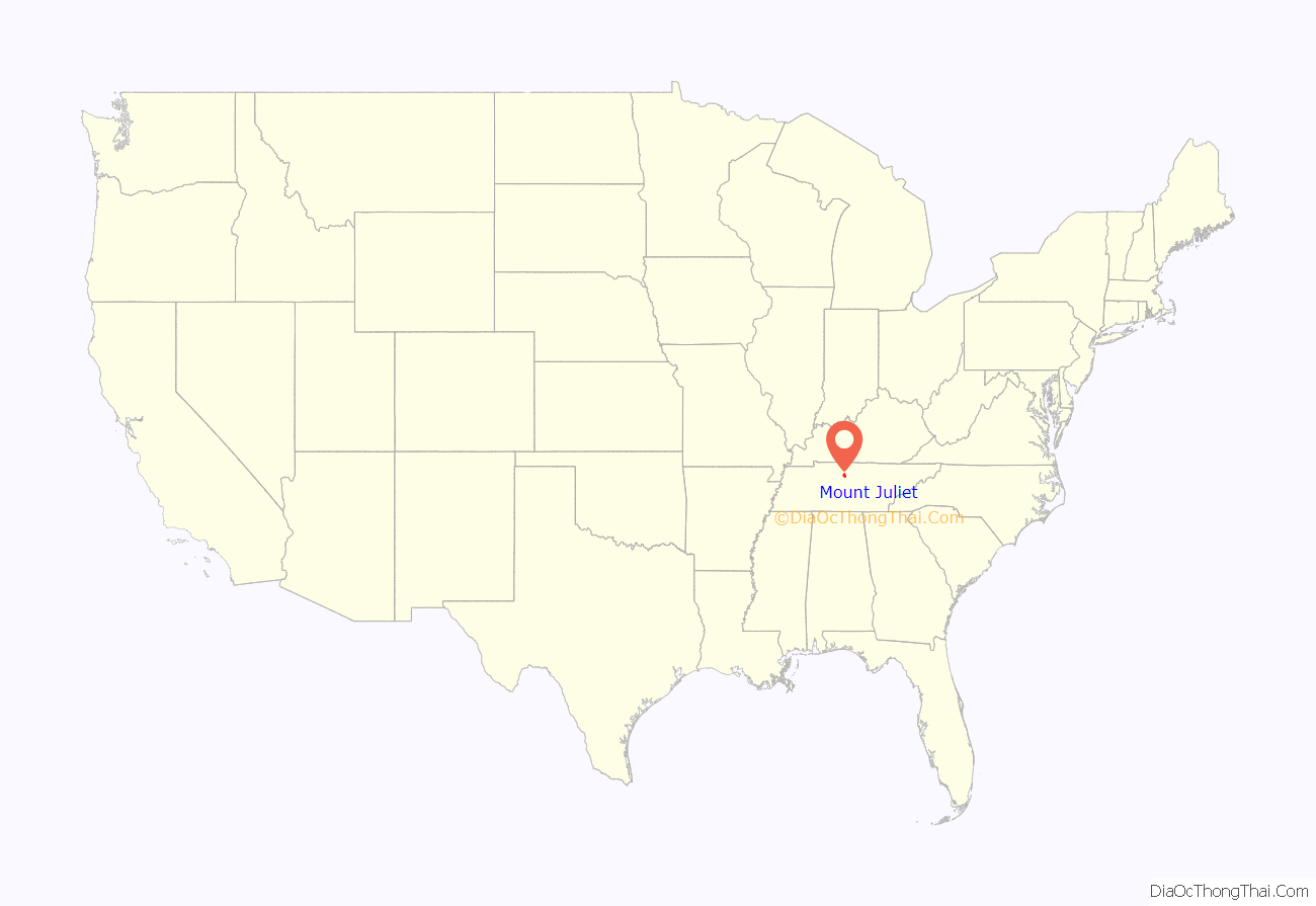
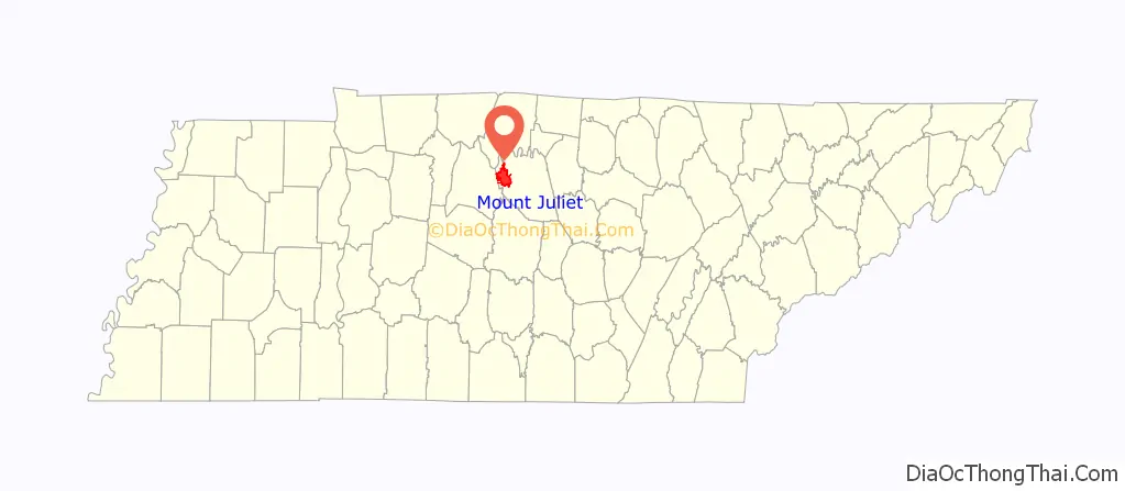
Mount Juliet location map. Where is Mount Juliet city?
History
Mt. Juliet was formed in 1835 and incorporated as a city in 1972. The most widely accepted theory regarding the naming of the town is that it is named for the Mount Juliet Estate, a manor house in County Kilkenny, Ireland. It is the only U.S. city with this name.
In the early morning hours of March 3, 2020, Mt. Juliet was struck by an EF3 tornado that destroyed hundreds of homes, along with West Wilson Middle School and Stoner Creek Elementary. Five people were killed by the tornado, three of which were in Mt. Juliet.
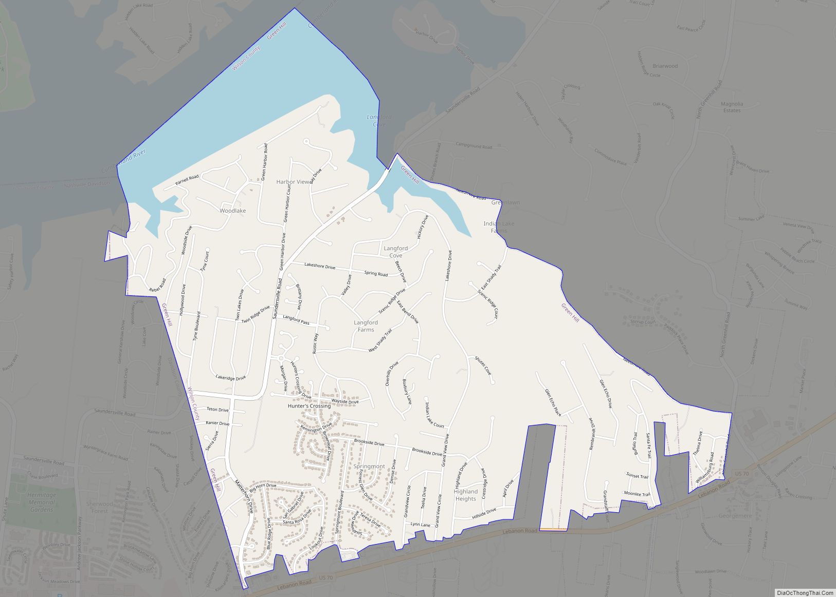
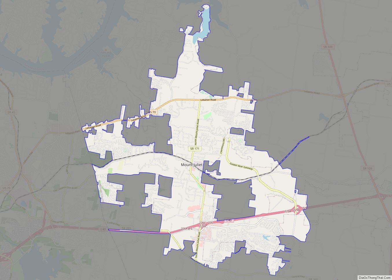
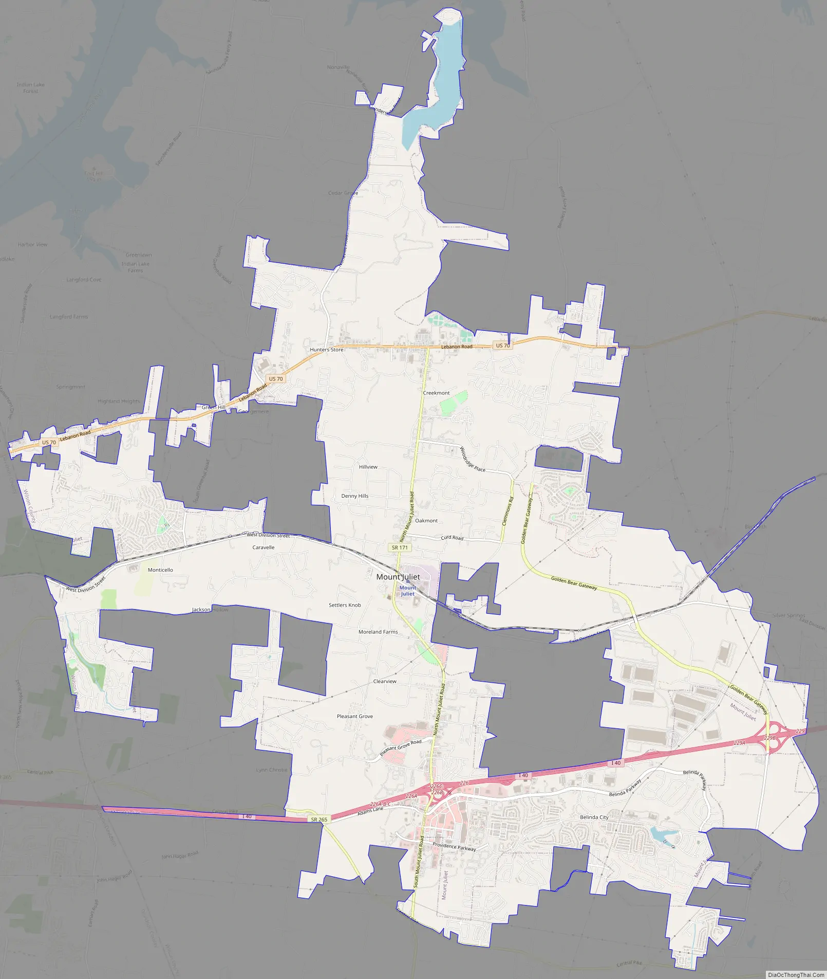
Mount Juliet Road Map
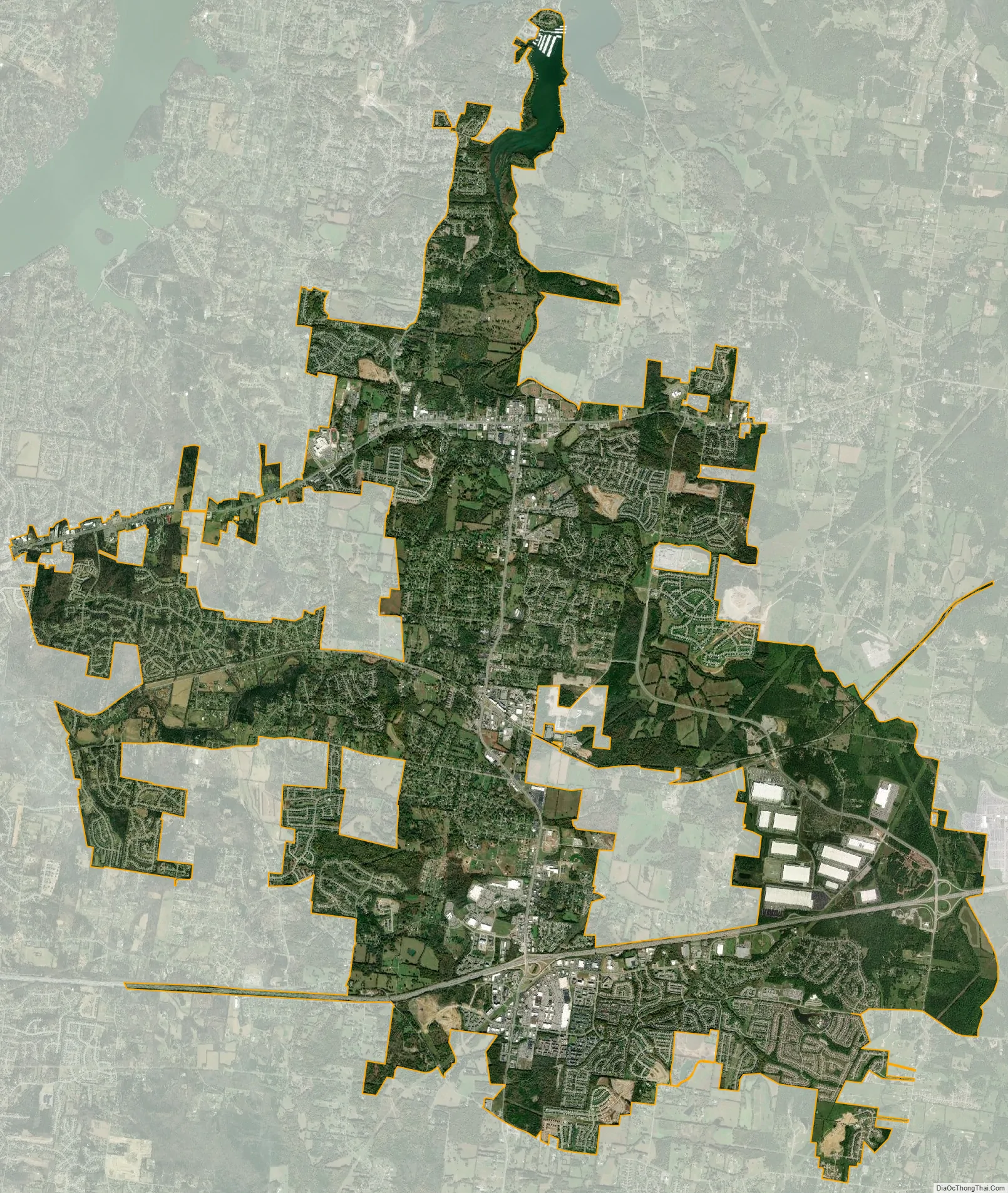
Mount Juliet city Satellite Map
Geography
Mt. Juliet is located at 36°12’10” North, 86°30’49” West (36.202654, -86.513583).
According to the United States Census Bureau, the city has a total area of 16.6 square miles (43 km), of which 16.2 square miles (42 km) is land and 0.3 square miles (0.78 km) is water. The total area is 1.99% water. Recent annexations along the east side of South Rutland Road as well as a land swap with the City of Lebanon for the Bel Air at Beckwith project (southeast quadrant of I-40/Beckwith Road interchange) have increased the city’s geographical area to approximately 21.78 square miles (56.4 km).
Mt. Juliet is located between Old Hickory Lake to its north and Percy Priest Lake to its south, both of which are man-made reservoirs.
See also
Map of Tennessee State and its subdivision:- Anderson
- Bedford
- Benton
- Bledsoe
- Blount
- Bradley
- Campbell
- Cannon
- Carroll
- Carter
- Cheatham
- Chester
- Claiborne
- Clay
- Cocke
- Coffee
- Crockett
- Cumberland
- Davidson
- Decatur
- DeKalb
- Dickson
- Dyer
- Fayette
- Fentress
- Franklin
- Gibson
- Giles
- Grainger
- Greene
- Grundy
- Hamblen
- Hamilton
- Hancock
- Hardeman
- Hardin
- Hawkins
- Haywood
- Henderson
- Henry
- Hickman
- Houston
- Humphreys
- Jackson
- Jefferson
- Johnson
- Knox
- Lake
- Lauderdale
- Lawrence
- Lewis
- Lincoln
- Loudon
- Macon
- Madison
- Marion
- Marshall
- Maury
- McMinn
- McNairy
- Meigs
- Monroe
- Montgomery
- Moore
- Morgan
- Obion
- Overton
- Perry
- Pickett
- Polk
- Putnam
- Rhea
- Roane
- Robertson
- Rutherford
- Scott
- Sequatchie
- Sevier
- Shelby
- Smith
- Stewart
- Sullivan
- Sumner
- Tipton
- Trousdale
- Unicoi
- Union
- Van Buren
- Warren
- Washington
- Wayne
- Weakley
- White
- Williamson
- Wilson
- Alabama
- Alaska
- Arizona
- Arkansas
- California
- Colorado
- Connecticut
- Delaware
- District of Columbia
- Florida
- Georgia
- Hawaii
- Idaho
- Illinois
- Indiana
- Iowa
- Kansas
- Kentucky
- Louisiana
- Maine
- Maryland
- Massachusetts
- Michigan
- Minnesota
- Mississippi
- Missouri
- Montana
- Nebraska
- Nevada
- New Hampshire
- New Jersey
- New Mexico
- New York
- North Carolina
- North Dakota
- Ohio
- Oklahoma
- Oregon
- Pennsylvania
- Rhode Island
- South Carolina
- South Dakota
- Tennessee
- Texas
- Utah
- Vermont
- Virginia
- Washington
- West Virginia
- Wisconsin
- Wyoming