Oak Hill is a city in Davidson County, Tennessee. The population was 4,529 at the 2010 census. The Tennessee Governor’s Mansion is located in the city. Although the city is administered under the Metropolitan Government of Nashville and Davidson County, it retains its own municipal government.
| Name: | Oak Hill city |
|---|---|
| LSAD Code: | 25 |
| LSAD Description: | city (suffix) |
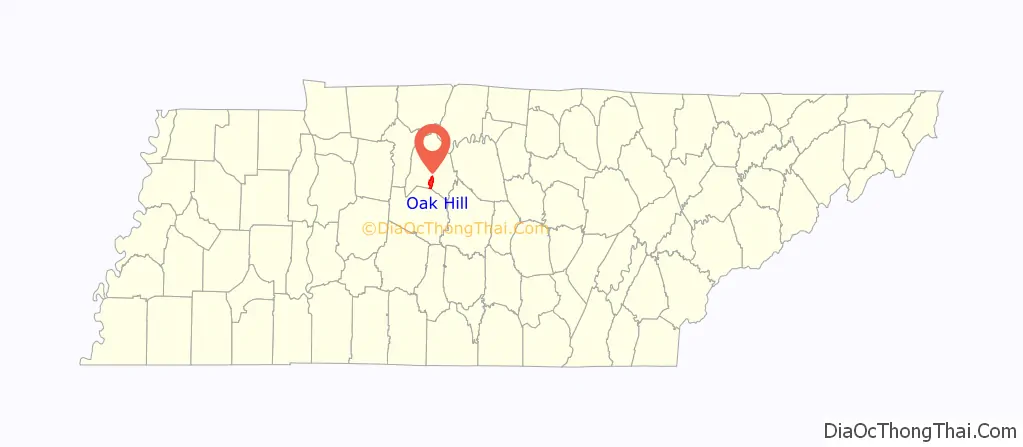
| State: | Tennessee |
| County: | Davidson County |
| Incorporated: | 1952 |
| Elevation: | 581 ft (177 m) |
| Total Area: | 7.96 sq mi (20.61 km²) |
| Land Area: | 7.84 sq mi (20.32 km²) |
| Water Area: | 0.11 sq mi (0.29 km²) |
| Total Population: | 4,891 |
| Population Density: | 623.45/sq mi (240.73/km²) |
| FIPS code: | 4754780 |
| GNISfeature ID: | 1296134 |
| Website: | www.oakhilltn.us |
Online Interactive Map
Click on ![]() to view map in "full screen" mode.
to view map in "full screen" mode.
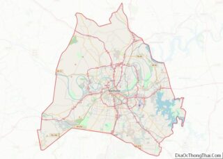
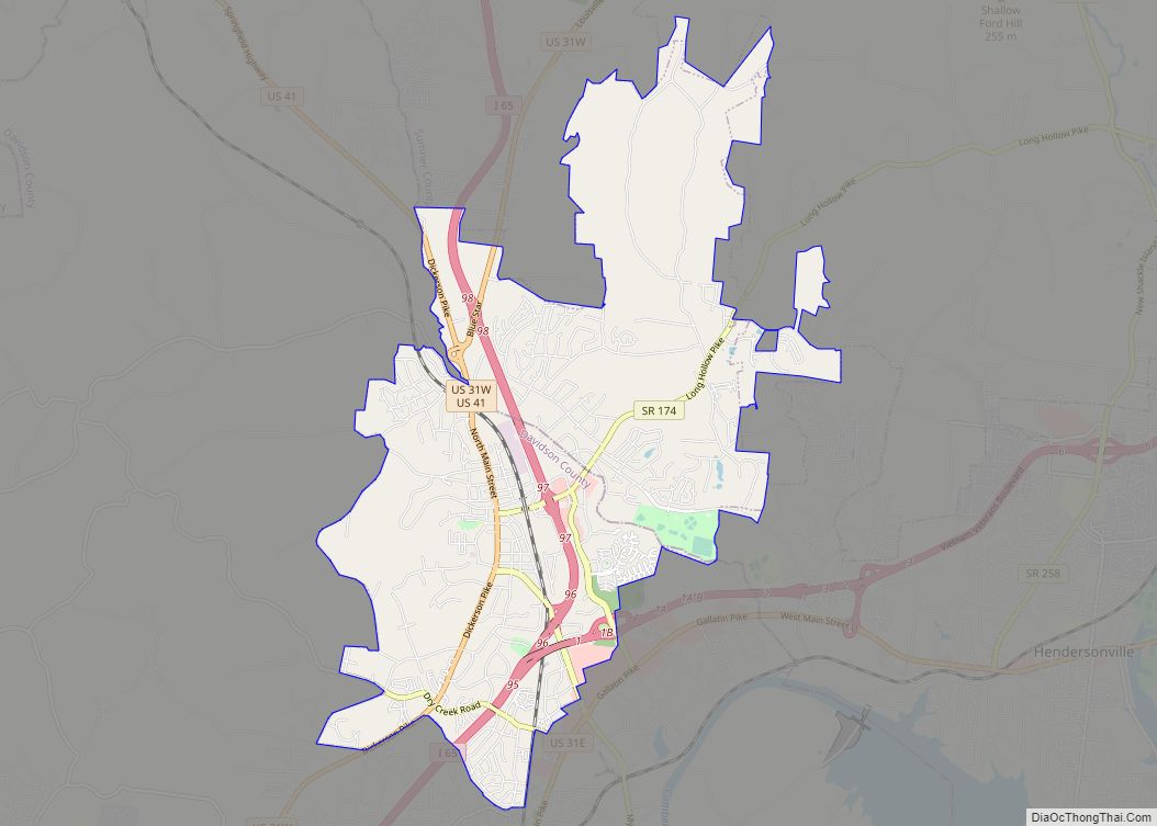
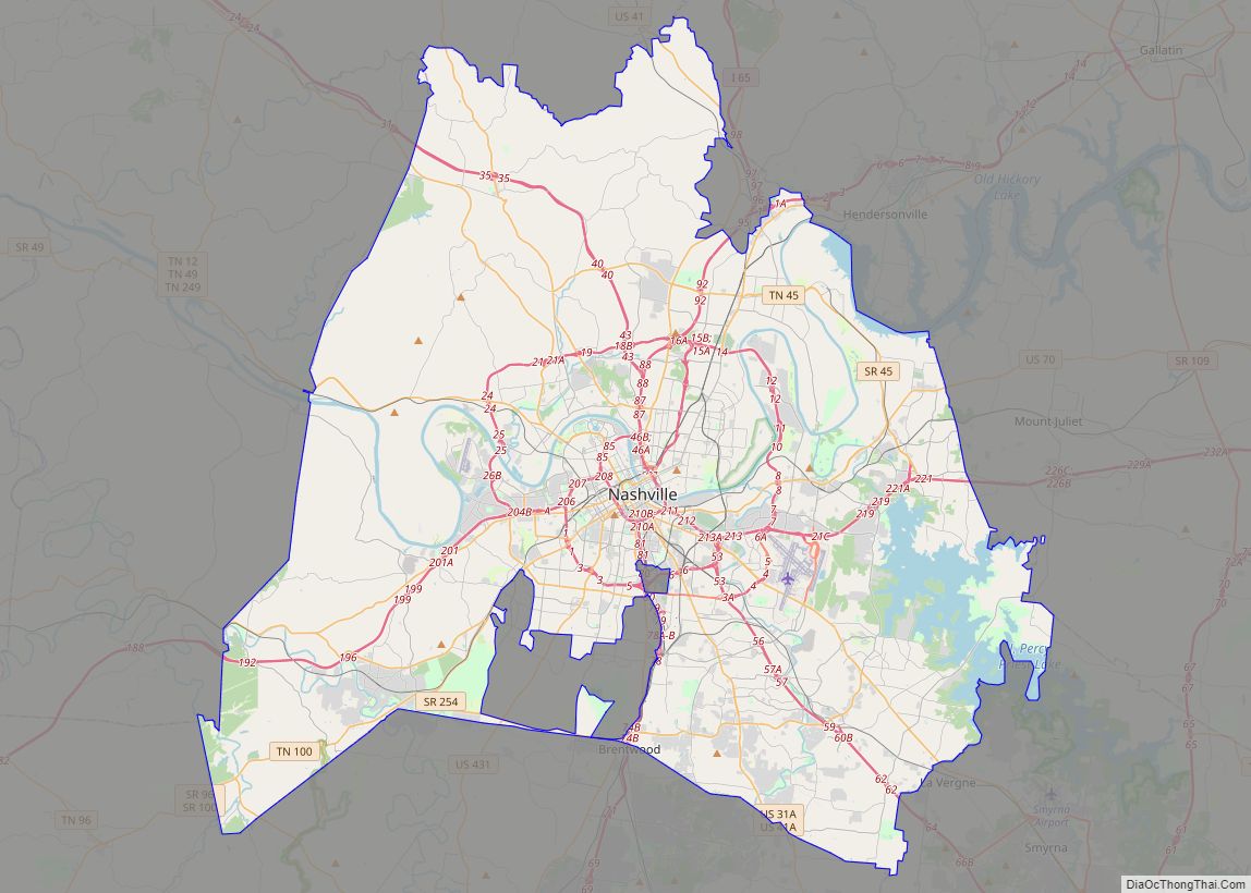
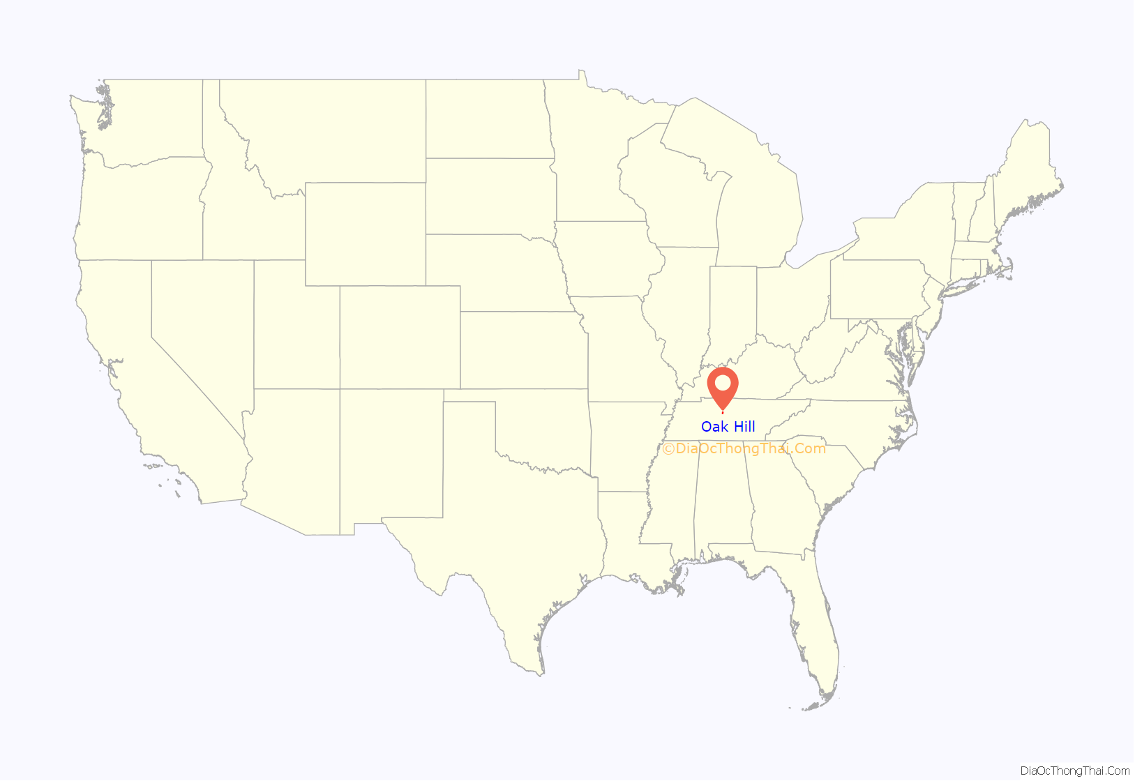
Oak Hill location map. Where is Oak Hill city?
History
During the 1790s, Judge John Overton established a horse-breeding farm at Oak Hill known as Travellers Rest. After World War II Oak Hill, like other Nashville neighborhoods, saw an increase of new residents and homes being built. Oak Hill incorporated as a city in 1952, just before the governments of Davidson County and Nashville merged.
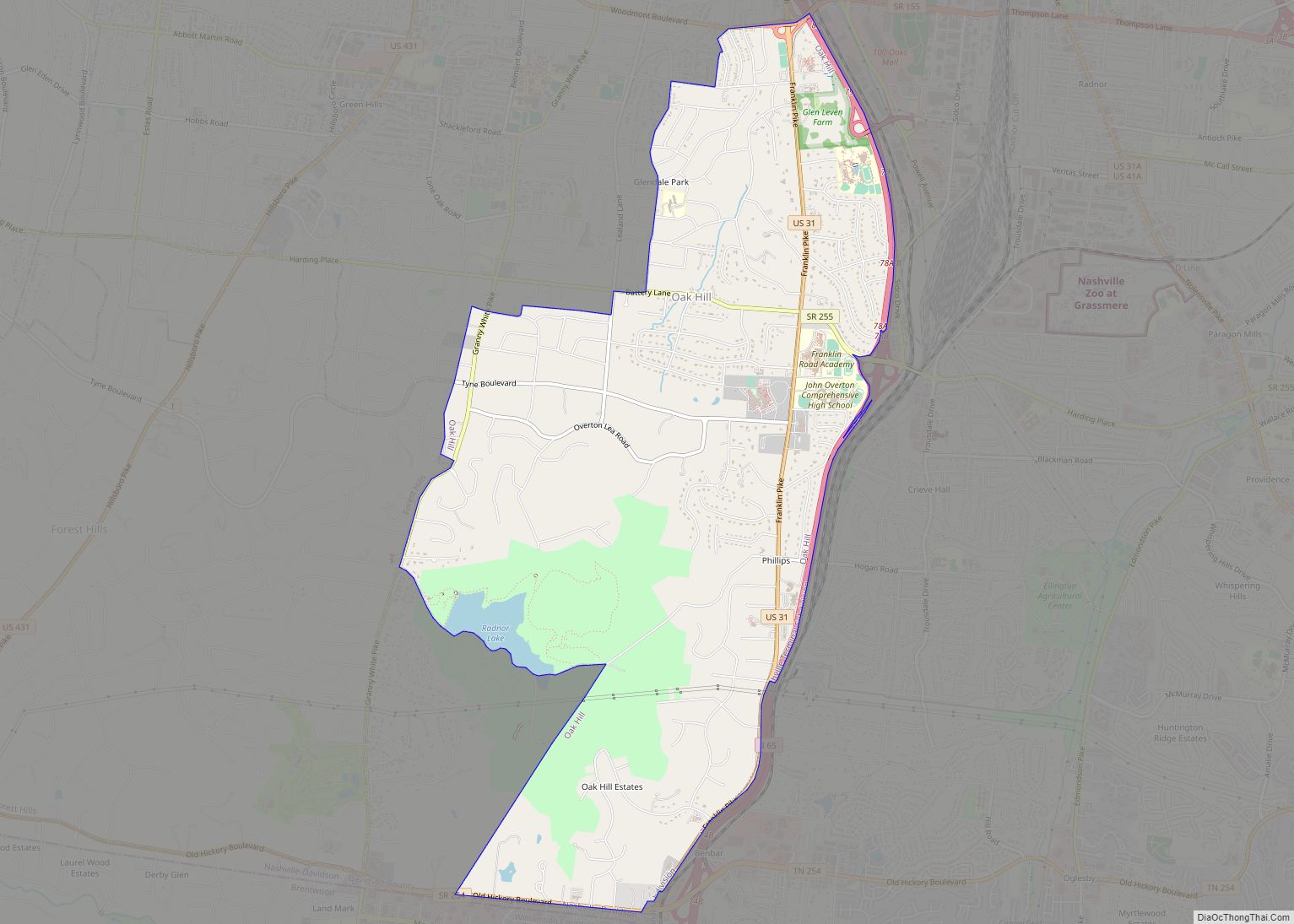
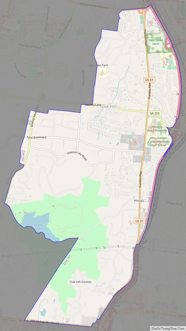
Oak Hill Road Map
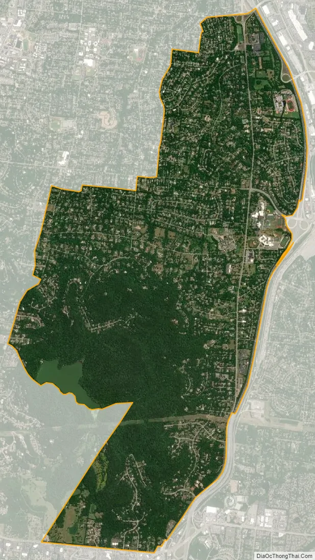
Oak Hill city Satellite Map
Geography
According to the United States Census Bureau, the city has a total area of 8.0 square miles (20.6 km), of which 7.8 square miles (20.3 km) is land and 0.12 square miles (0.3 km), or 1.50%, is water.
See also
Map of Tennessee State and its subdivision:- Anderson
- Bedford
- Benton
- Bledsoe
- Blount
- Bradley
- Campbell
- Cannon
- Carroll
- Carter
- Cheatham
- Chester
- Claiborne
- Clay
- Cocke
- Coffee
- Crockett
- Cumberland
- Davidson
- Decatur
- DeKalb
- Dickson
- Dyer
- Fayette
- Fentress
- Franklin
- Gibson
- Giles
- Grainger
- Greene
- Grundy
- Hamblen
- Hamilton
- Hancock
- Hardeman
- Hardin
- Hawkins
- Haywood
- Henderson
- Henry
- Hickman
- Houston
- Humphreys
- Jackson
- Jefferson
- Johnson
- Knox
- Lake
- Lauderdale
- Lawrence
- Lewis
- Lincoln
- Loudon
- Macon
- Madison
- Marion
- Marshall
- Maury
- McMinn
- McNairy
- Meigs
- Monroe
- Montgomery
- Moore
- Morgan
- Obion
- Overton
- Perry
- Pickett
- Polk
- Putnam
- Rhea
- Roane
- Robertson
- Rutherford
- Scott
- Sequatchie
- Sevier
- Shelby
- Smith
- Stewart
- Sullivan
- Sumner
- Tipton
- Trousdale
- Unicoi
- Union
- Van Buren
- Warren
- Washington
- Wayne
- Weakley
- White
- Williamson
- Wilson
- Alabama
- Alaska
- Arizona
- Arkansas
- California
- Colorado
- Connecticut
- Delaware
- District of Columbia
- Florida
- Georgia
- Hawaii
- Idaho
- Illinois
- Indiana
- Iowa
- Kansas
- Kentucky
- Louisiana
- Maine
- Maryland
- Massachusetts
- Michigan
- Minnesota
- Mississippi
- Missouri
- Montana
- Nebraska
- Nevada
- New Hampshire
- New Jersey
- New Mexico
- New York
- North Carolina
- North Dakota
- Ohio
- Oklahoma
- Oregon
- Pennsylvania
- Rhode Island
- South Carolina
- South Dakota
- Tennessee
- Texas
- Utah
- Vermont
- Virginia
- Washington
- West Virginia
- Wisconsin
- Wyoming