South San Francisco is a city in San Mateo County, California, United States, located on the San Francisco Peninsula in the San Francisco Bay Area. The city is colloquially known as “South City”. The population was 66,105 at the 2020 census.
| Name: | South San Francisco city |
|---|---|
| LSAD Code: | 25 |
| LSAD Description: | city (suffix) |
| State: | California |
| County: | San Mateo County |
| Incorporated: | September 19, 1908 |
| Elevation: | 16 ft (5 m) |
| Land Area: | 9.20 sq mi (23.84 km²) |
| Water Area: | 20.97 sq mi (54.32 km²) 69.69% |
| Population Density: | 2,200/sq mi (850/km²) |
| Area code: | 650 |
| FIPS code: | 0673262 |
| Website: | www.ssf.net |
Online Interactive Map
Click on ![]() to view map in "full screen" mode.
to view map in "full screen" mode.
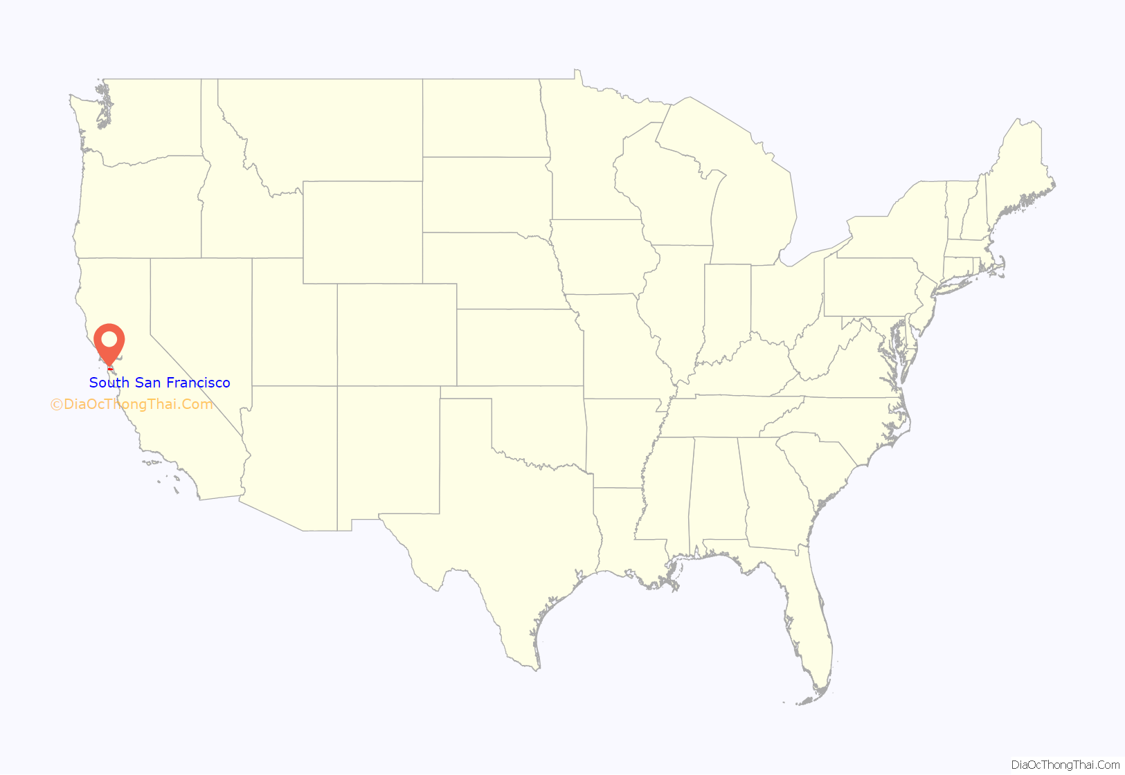
South San Francisco location map. Where is South San Francisco city?

History
Prior to European exploration, the northern San Francisco peninsula was inhabited by the Ramaytush, a linguistic sub-group of the Ohlone people. Their village of Urebure on San Bruno Creek was visited by the Gaspar de Portolà expedition in 1769; remains of long-term (5,000+ years) inhabitancy and seasonal encampments have been examined at the Siplichiquin and Buckeye shell-mounds on San Bruno Mountain. Charcoal-sampling indicates these 3,000+ year old sites may have been actively occupied early in the Spanish colonial period (late 1700s). The delta of Colma Creek was formerly an important habitat for the waterfowl known to be hunted by the Ramaytush in historic times, and archaeologic sites have been recorded near the creek. The City plan also recognizes the existing remains of a village (CA-SMA-299) along El Camino Real.
The area which is now South San Francisco was part of Rancho Buri Buri, a large Mexican land grant to the Sanchez family dating to 1827. In 1853 Charles Lux and a business partner, Alfred Edmondson, purchased 1,700 acres (7 km) in the north of Rancho Buri Buri. Around that time, the 12-Mile House – one of the Peninsula Mile Houses – was built as a stop on the San Jose Stage road. Lux bought out Edmonson’s interest in 1856 and founded the town of Baden (now a neighborhood of South San Francisco) near the 12-Mile House. In 1855 Lux bought another 1,464 acres (6 km) of Rancho Buri Buri land and became a partner of fellow San Francisco butcher and entrepreneur Henry Miller, forming the firm of Miller & Lux.
The city of South San Francisco was conceived as an industrial suburb and was promoted by representatives of the Beef Trust, a group including some of the country’s largest meat packing firms. A city plan was put forward in 1888 by Gustavus Franklin Swift, founder of the Swift & Company meat packing firm. The plan called for multiple individual meat-packing companies with a shared stockyard, as well as a residential area for employees. Swift proposed the name South San Francisco based on South Chicago and South Omaha, where the Swift company already had plants.
In 1890 Peter E. Iler of Omaha, Nebraska, an agent of the Beef Trust, purchased Lux’s property, and in 1891 ownership was transferred to the South San Francisco Land and Improvement Company. The area was divided into industrial and residential districts, and the company installed lighting, sewer connections, and water distributions in the residential areas. A second corporation, eventually known as the Western Meat Company, set up stock yards and meat packing facilities on 80 acres (32 ha) of bayfront property; the facility opened in 1892. Other industries soon moved in, including a pottery works, two brick companies, the paint manufacturer W.P. Fuller & Company, the South San Francisco Lumber Company, and the Pacific Jupiter Steel Company.
The city of South San Francisco was incorporated in 1908 following a dispute with San Mateo County, which had blocked the construction of a smelter on San Bruno Point supported by the locals. Following incorporation additional industries moved into the town, including two steel mills. A new City Hall was opened on November 11, 1920.
By the 1920s the city was “the smokestack capital of the Peninsula.” South San Francisco proudly called itself “The Industrial City”, a motto immortalized in 1923 by a huge sign on a hillside overlooking the city. Industry remained the city’s main economic focus through the 1950s. During the depression the city maintained 35 industrial operations, including four meat-packing businesses, six iron or steel plants, a smelter for precious metals, seven equipment manufacturers of various kinds, two large paint factories, three other chemical works, and three food packing establishments. During World War II shipbuilding also became a significant operation. From August 1940, until the end of the War, a total of 48 ships were built and launched at the Western Pipe & Steel Shipyards.
At the end of the war the city’s focus shifted away from “smokestack industries” toward light industry, warehousing, and residential development. The major manufacturers closed, and new development was focused on office parks, housing, high-rise hotels, and yacht harbors. The biotechnology giant Genentech opened in 1976, leading to South San Francisco’s new identity as “the birthplace of biotechnology”. The population grew to 63,632 as of the 2010 census.
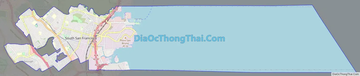
South San Francisco Road Map
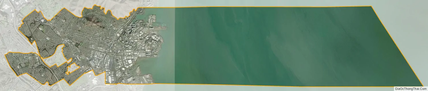
South San Francisco city Satellite Map
Geography
According to the United States Census Bureau, the city has a total area of 30.2 square miles (78 km), of which 9.1 square miles (24 km) of it is land and 21.0 square miles (54 km) of it (69.69%) is water.
South San Francisco lies north of San Bruno and San Francisco International Airport in the Colma Creek valley south of Daly City, Colma, Brisbane, and San Bruno Mountain; east of Pacifica and the hills of the northern Coast Range lying along the San Andreas Fault; west of the waters of San Francisco Bay. Locals often refer to the town as South City, in much the same way that San Francisco is called “The City.” South San Francisco does not touch on San Francisco, with either Brisbane, Colma, or Daly City lying between them.
Most of the valley faces east toward San Francisco Bay, affording bay views from higher levels. South San Francisco has mild winters and dry cool summers. The hills to the west shield the eastern parts of the city from some of the fog that prevails in neighboring areas.
The population grew from 4,411 in 1920 to 67,009 in 2014. It has tripled since World War II with the opening of such subdivisions as Buri Buri, Winston Manor and Westborough on the slopes west of El Camino;
The city is particularly noted for the South San Francisco hillside sign on Sign Hill, which rises to the north of the city, with large white letters that proclaim “South San Francisco, The Industrial City”. The sign, a tribute to the city’s industrial past, is listed on the National Register of Historic Places.
Climate
South San Francisco, along with most of the Bay Area, has a mild mediterranean climate (Köppen climate classification Csb), with warm, dry summers and cool, relatively wet winters. The microclimate of South San Francisco is dominated by wind from the nearby Pacific Ocean, which typically keeps the daytime temperatures quite cool year round, even during the summer months. January is the coolest month with August being the warmest month. The record highest temperature of 106 °F (41 °C) and was recorded on June 14, 1961. The record lowest temperature of 24 °F (-4.4 °C) was recorded on December 9, 1972. The normal annual precipitation is 19.64 inches (498.9 mm).
South San Francisco is frequently windy. Summer is the windiest season, with winds averaging 13.6 mph (21.9 km/h); winter is the least windy season, with winds averaging 7.5 mph (12.1 km/h).
See also
Map of California State and its subdivision:- Alameda
- Alpine
- Amador
- Butte
- Calaveras
- Colusa
- Contra Costa
- Del Norte
- El Dorado
- Fresno
- Glenn
- Humboldt
- Imperial
- Inyo
- Kern
- Kings
- Lake
- Lassen
- Los Angeles
- Madera
- Marin
- Mariposa
- Mendocino
- Merced
- Modoc
- Mono
- Monterey
- Napa
- Nevada
- Orange
- Placer
- Plumas
- Riverside
- Sacramento
- San Benito
- San Bernardino
- San Diego
- San Francisco
- San Joaquin
- San Luis Obispo
- San Mateo
- Santa Barbara
- Santa Clara
- Santa Cruz
- Shasta
- Sierra
- Siskiyou
- Solano
- Sonoma
- Stanislaus
- Sutter
- Tehama
- Trinity
- Tulare
- Tuolumne
- Ventura
- Yolo
- Yuba
- Alabama
- Alaska
- Arizona
- Arkansas
- California
- Colorado
- Connecticut
- Delaware
- District of Columbia
- Florida
- Georgia
- Hawaii
- Idaho
- Illinois
- Indiana
- Iowa
- Kansas
- Kentucky
- Louisiana
- Maine
- Maryland
- Massachusetts
- Michigan
- Minnesota
- Mississippi
- Missouri
- Montana
- Nebraska
- Nevada
- New Hampshire
- New Jersey
- New Mexico
- New York
- North Carolina
- North Dakota
- Ohio
- Oklahoma
- Oregon
- Pennsylvania
- Rhode Island
- South Carolina
- South Dakota
- Tennessee
- Texas
- Utah
- Vermont
- Virginia
- Washington
- West Virginia
- Wisconsin
- Wyoming


