Hillsborough is an incorporated town in San Mateo County, California, in the San Francisco Bay Area. It is located 17 miles (27 km) south of San Francisco on the San Francisco Peninsula, bordered by Burlingame to the north, San Mateo to the east, Highlands-Baywood Park to the south, and Interstate 280 to the west. The population was 11,387 at the 2020 census.
| Name: | Hillsborough town |
|---|---|
| LSAD Code: | 43 |
| LSAD Description: | town (suffix) |
| State: | California |
| County: | San Mateo County |
| Incorporated: | May 5, 1910 |
| Elevation: | 322 ft (98 m) |
| Total Area: | 6.17 sq mi (15.97 km²) |
| Land Area: | 6.17 sq mi (15.97 km²) |
| Water Area: | 0.00 sq mi (0.00 km²) 0% |
| Total Population: | 11,387 |
| Population Density: | 1,847.1/sq mi (713.15/km²) |
| ZIP code: | 94010 |
| Area code: | 650 |
| FIPS code: | 0633798 |
| Website: | www.hillsborough.net |
Online Interactive Map
Click on ![]() to view map in "full screen" mode.
to view map in "full screen" mode.
Hillsborough location map. Where is Hillsborough town?


History
Hillsborough is located on the Rancho San Mateo Mexican land grant which was purchased by William Davis Merry Howard, son of a wealthy Hillsborough, New Hampshire, shipping magnate, in 1846. Howard settled his family in this area, which attracted wealthy San Franciscans. On May 5, 1910, Hillsborough residents voted to incorporate. From the town’s foundation until 1963, it was an exclusive community for wealthy whites. In 1963, Jack and Betty Ken, the first-generation children of Chinese Immigrants, purchased land in the town. This made them the first non-white people to own land in the town, effectively desegregating Hillsborough.
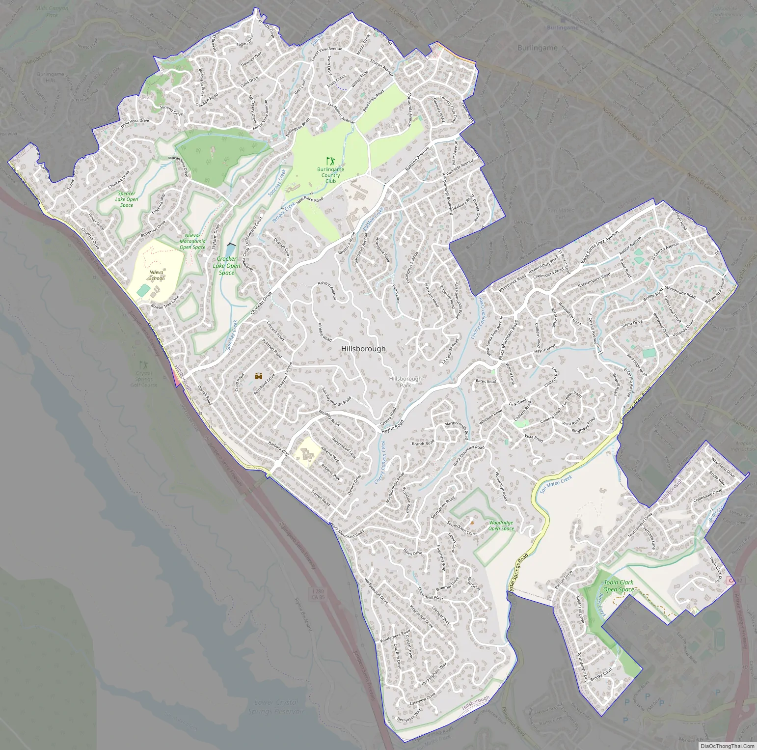
Hillsborough Road Map
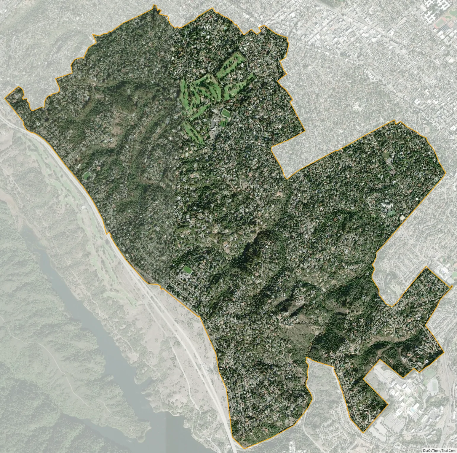
Hillsborough city Satellite Map
Geography
Hillsborough is located at 37°33′37″N 122°21′23″W / 37.560199°N 122.356277°W / 37.560199; -122.356277.
According to the United States Census Bureau, the town has a total area of 6.2 square miles (16 km), all of it land. The area’s considerably winding, hilly topography, and impossibility of a grid layout make Hillsborough notoriously challenging to navigate. Many lots include fairly steep slopes, particularly the western side of the town, with the landscape generally flattening to the east as it descends from the 280 freeway to El Camino Real and the towns of Burlingame and San Mateo.
Three prominent streams drain the mostly wooded slopes of Hillsborough: San Mateo Creek, Cherry Canyon Creek, and Sanchez Creek. In all 3 cases the upper watersheds are closed-canopy California oak woodlands, with dominant trees of Coast Live Oak, Pacific Madrone and California Bay.
The upper drainage area of San Mateo Creek in Hillsborough contains significant serpentinite outcrops, which are known habitats for several rare plant species including the San Mateo woolly sunflower. Other common plants include toyon, gooseberry, lupine, monkeyflower and coffeeberry. Commonly observed mammals include California mule deer, raccoons, opossum, coyotes, rabbits, squirrels, and skunks.
Hillsborough is bordered by Burlingame to the north, San Mateo to the east, Highlands-Baywood Park to the south, and Interstate 280 to the west.
Hillsborough’s landscape is dominated by large homes; the town zoning and subdivision ordinances require a 2,500-square-foot (230 m) minimum house size and minimum lot size of 0.5 acres (2,000 m). As a result, there are no apartments, condominiums or townhouses in the city limits.
The town has no commercial zoning and thus no businesses within the town limits; the only non-residential properties are the town’s four public and three private schools, town and county government facilities, a golf course, a country club, and small parks.
See also
Map of California State and its subdivision:- Alameda
- Alpine
- Amador
- Butte
- Calaveras
- Colusa
- Contra Costa
- Del Norte
- El Dorado
- Fresno
- Glenn
- Humboldt
- Imperial
- Inyo
- Kern
- Kings
- Lake
- Lassen
- Los Angeles
- Madera
- Marin
- Mariposa
- Mendocino
- Merced
- Modoc
- Mono
- Monterey
- Napa
- Nevada
- Orange
- Placer
- Plumas
- Riverside
- Sacramento
- San Benito
- San Bernardino
- San Diego
- San Francisco
- San Joaquin
- San Luis Obispo
- San Mateo
- Santa Barbara
- Santa Clara
- Santa Cruz
- Shasta
- Sierra
- Siskiyou
- Solano
- Sonoma
- Stanislaus
- Sutter
- Tehama
- Trinity
- Tulare
- Tuolumne
- Ventura
- Yolo
- Yuba
- Alabama
- Alaska
- Arizona
- Arkansas
- California
- Colorado
- Connecticut
- Delaware
- District of Columbia
- Florida
- Georgia
- Hawaii
- Idaho
- Illinois
- Indiana
- Iowa
- Kansas
- Kentucky
- Louisiana
- Maine
- Maryland
- Massachusetts
- Michigan
- Minnesota
- Mississippi
- Missouri
- Montana
- Nebraska
- Nevada
- New Hampshire
- New Jersey
- New Mexico
- New York
- North Carolina
- North Dakota
- Ohio
- Oklahoma
- Oregon
- Pennsylvania
- Rhode Island
- South Carolina
- South Dakota
- Tennessee
- Texas
- Utah
- Vermont
- Virginia
- Washington
- West Virginia
- Wisconsin
- Wyoming


