San Mateo (Spanish for ‘Saint Matthew’); /ˌsæn məˈteɪ.oʊ/ (listen) SAN mə-TAY-oh) is a city in San Mateo County, California, United States, on the San Francisco Peninsula. About 20 miles (32 km) south of San Francisco, the city borders Burlingame to the north, Hillsborough to the west, San Francisco Bay and Foster City to the east and Belmont to the south. The population was 105,661 at the 2020 census.
San Mateo has a Mediterranean climate and is known for its rich history at the center of the San Francisco Bay Area. Some of the biggest economic drivers for the city include technology, health care and education.
| Name: | San Mateo city |
|---|---|
| LSAD Code: | 25 |
| LSAD Description: | city (suffix) |
| State: | California |
| County: | San Mateo County |
| Incorporated: | September 4, 1894 |
| Elevation: | 46 ft (14 m) |
| Total Area: | 15.85 sq mi (41.04 km²) |
| Land Area: | 12.13 sq mi (31.42 km²) |
| Water Area: | 3.71 sq mi (9.62 km²) 23.63% |
| Total Population: | 105,661 |
| Population Density: | 8,711/sq mi (3,363/km²) |
| ZIP code: | 94401–94404, 94497 |
| Area code: | 650 |
| FIPS code: | 0668252 |
| Website: | www.cityofsanmateo.org |
Online Interactive Map
Click on ![]() to view map in "full screen" mode.
to view map in "full screen" mode.
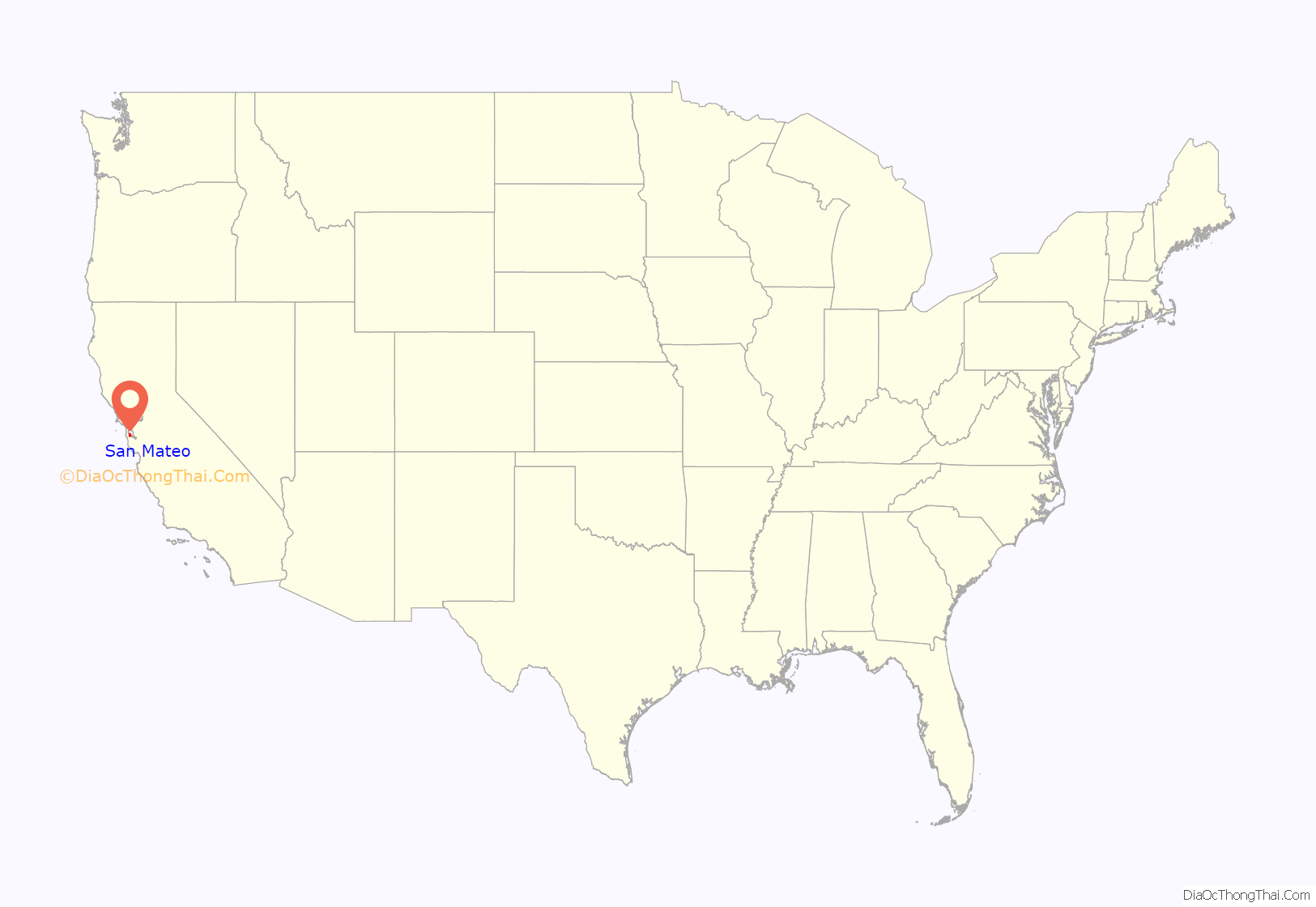
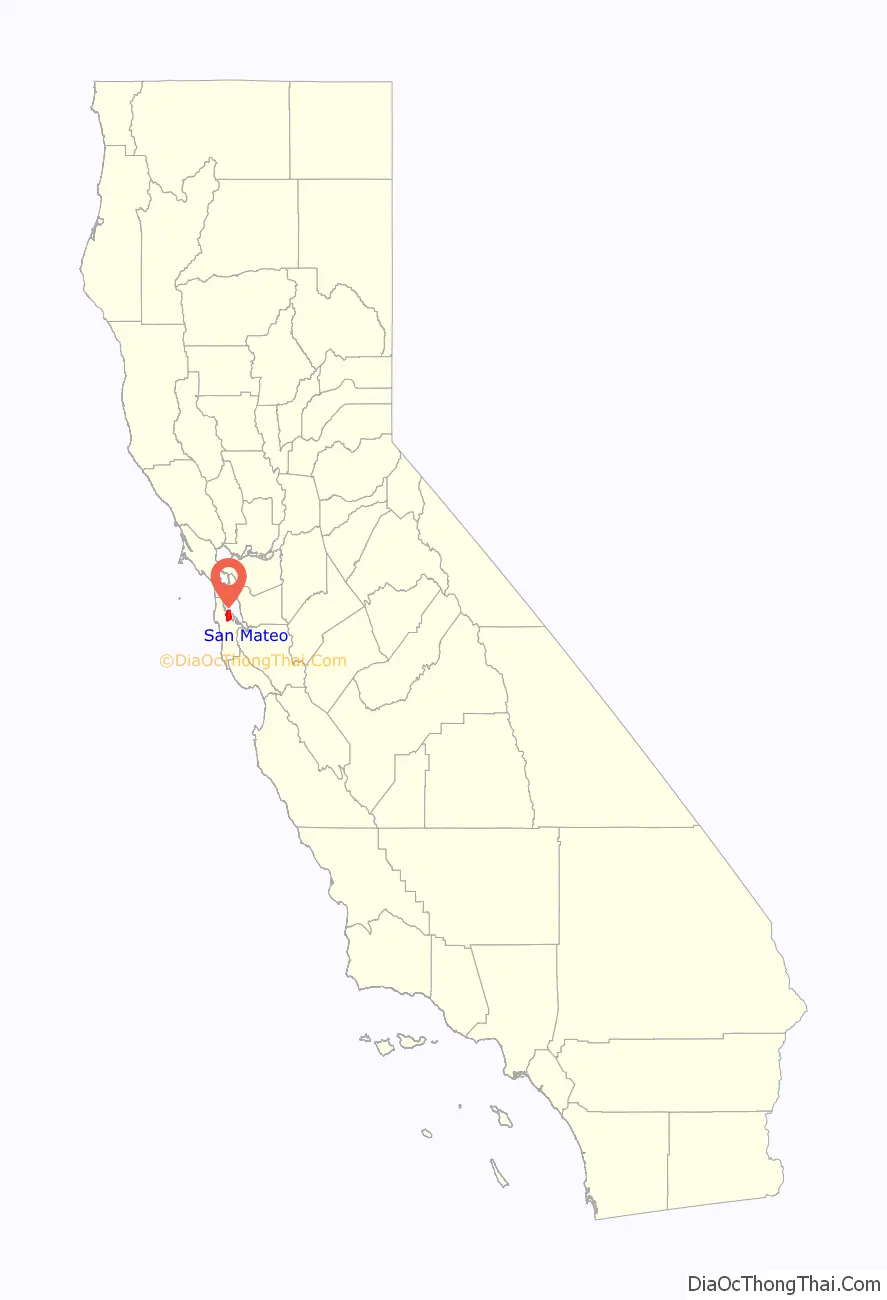
San Mateo location map. Where is San Mateo city?
History
The Ramaytush people lived in the land, prior to its becoming the city of San Mateo.
Spanish era
In 1789, the Spanish missionaries had named a Native American village along Laurel Creek as Los Laureles or the Laurels (Mission Dolores, 1789). At the time of Mexican Independence, 30 native Californians were at San Mateo, most likely from the Salson tribelet.
Mexican era
Captain Frederick William Beechey in 1827 traveling with the hills on their right, known in that part as the Sierra del Sur, began to approach the road, which passing over a small eminence, opened out upon “a wide country of meadow land, with clusters of fine oak free from underwood… It strongly resembled a nobleman’s park: herds of cattle and horses were grazing upon the rich pasture, and numerous fallow‑deer, startled at the approach of strangers, bounded off to seek protection among the hills… This spot is named San Matheo, and belongs to the mission of San Francisco.”
The city of San Mateo was documented by Spanish colonists as part of the Rancho de las Pulgas (literally “Ranch of the Fleas”) and the Rancho San Mateo, the earliest history is held in the archives of Mission Dolores.
Post-Conquest era
In the 1850s, following the American Conquest of California, many San Franciscans began building summer homes in the mid-Peninsula, because of the milder climate. While most of this early settlement occurred in adjacent Hillsborough and Burlingame, a number of historically important mansions and buildings were constructed in San Mateo.
A.P. Giannini, founder of the Bank of Italy (which later became the Bank of America), lived here most of his life. His mansion, Seven Oaks, is listed in the National Register of Historic Places (No. 99001181). Located at 20 El Cerrito Avenue, it has been deteriorating as it has not been preserved or occupied for years.
In 1858, Sun Water Station, a stage station of the Butterfield Overland Mail route, was established in San Mateo. It was located 9 miles (14 km) south of Clarks Station in what is now San Bruno and 9 miles north of the next station at Redwood City.
The Howard Estate was built in 1859 on the hill accessed by Crystal Springs Road. The Parrott Estate was erected in 1860 in the same area, giving rise to two conflicting names for the hill, Howard Hill and Parrot Hill. After use of the automobile changed traffic patterns, neither historic name was commonly applied to that hill. The Borel Estate was developed near Borel Creek in 1874. It has been redeveloped since the late 20th century for use as modern offices and shops. The property is managed and owned by Borel Place Associates and the Borel Estate Company.
Hayward Park, the 1880 American Queen Anne-style residence of Alvinza Hayward (often said to be “California’s first millionaire” from his silver and banking fortunes), was built on an 800-acre (3.2 km) estate in San Mateo which included a deer park and racetrack, roughly bounded by present-day El Camino Real (on the west), 9th Avenue (on the north), B Street (on the east) and 16th Avenue (on the south). A smaller portion of the property and the mansion, was converted into The Peninsula Hotel in 1908, following Hayward’s death in 1904. The hotel burned down in a spectacular fire on 25 June 1920.
20th century
In 1893, Pedro Evencio had been called the last of the Ramaytush Native American of San Mateo. Although Joseph (José) Evencio (the younger) was reported to be his descendent living at Coyote Point until World War II, “Indian Joe,” (Joe Mestes) was the American Indian who was actually hired by the Howard family to oversee their land holding at Coyote Point. He is reported to have had a tribal affiliation in Montana. His final whereabouts were reported to be a care facility in Oakland after he had been removed from Coyote Point when a Merchant Marine Academy was established there.
In the early 20th century, Japanese immigrants came to San Mateo to work in the salt ponds and flower industry. Although Japanese-Americans only account for 2.2% of the population today, they continue to be a major cultural influence and a draw for the rest of the region. The Eugene J. De Sabla Japanese Teahouse and Garden was established in 1894 at 70 De Sabla Road, designed by Makoto Hagiwara, designer of the Japanese garden in Golden Gate Park in San Francisco. He arranged for Japanese artisans to be brought to the United States primarily for its teahouse construction.
The parcel was purchased in 1988 by San Francisco businessman Achille Paladini and wife Joan, who have restored it. The garden features hundreds of varieties of plants and several rare trees. A large koi pond surrounds an island. The property was placed on the National Register of Historic Places in 1992.
In December 1967, Sgt. Joe Artavia, then serving in Vietnam with Alpha Company, 1st Battalion, 327th Infantry Regiment of the 101st Airborne Division wrote to his sister, Linda Giese, who was a resident of San Carlos working in San Mateo, asking if San Mateo or San Francisco could adopt the company, saying that it would bring “the morale of the guys up as high as the clouds”. San Mateo passed a resolution on March 4, 1968, officially adopting Alpha Company and letters and gifts began arriving from the citizens of San Mateo. Joe would be killed in action on March 24, 1968, less than three weeks after the resolution. Linda would travel to Vietnam to meet with the men of Alpha Company for Christmas in 1968 and deliver personalized medallions from the City of San Mateo. In 1972, San Mateo requested and received permission to have Alpha Company visit the city when they left Vietnam, later holding a parade in January 1972, believed to be the only parade honoring the military during the Vietnam War. In 1988, Joseph Brazan wrote a screenplay entitled A Dove Among Eagles chronicling the adoption of Alpha Company by San Mateo and the real-life romance between Linda and Artavia’s commander, Lt. Stephen Patterson. The city expanded its support to the entire 1st Battalion in 1991, when they were deployed to Kuwait under Operation Desert Storm.
Bay Meadows horse-racing track was torn down in 2008.
21st century
In the November 2022 election, Councilmember Diane Papan was elected to the California State Assembly, creating a vacancy on the 5-person city council. At the December 5, 2022 council reorganization meeting, two of the remaining four councilmembers chose not to follow the standard precedent of selecting a new mayor, which normally rotates to the councilmember who has been in office the longest. With the vote split at 2-2, the city went a week without a mayor. After a second meeting that also ended without a decision, Amourence Lee was selected as the mayor at the third meeting on December 12.
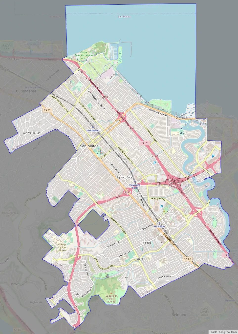
San Mateo Road Map
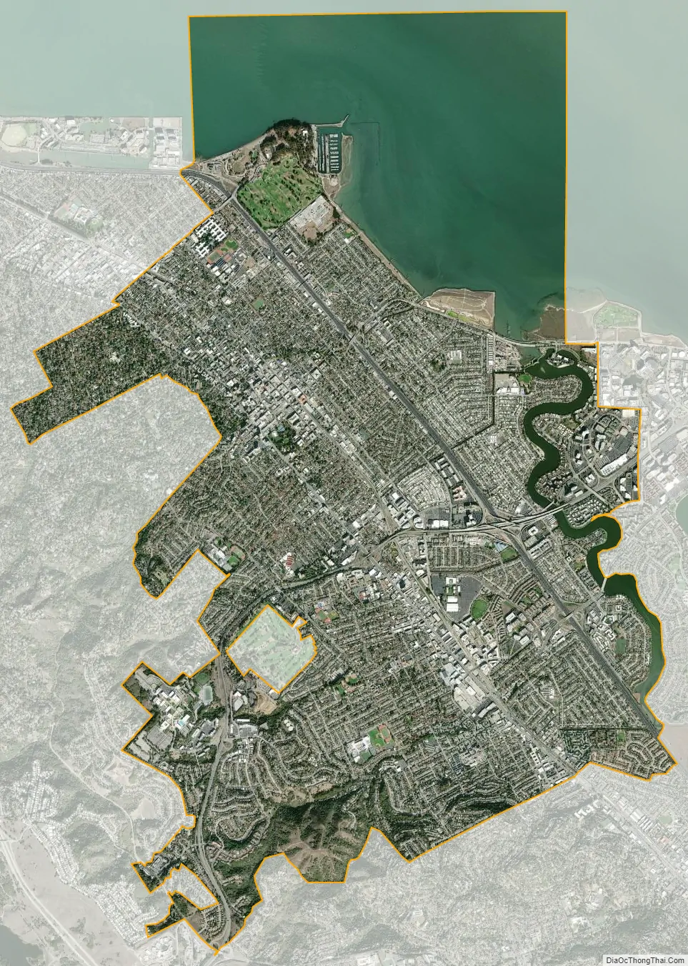
San Mateo city Satellite Map
Geography
San Mateo is located at 37°33′15″N 122°18′47″W / 37.55417°N 122.31306°W / 37.55417; -122.31306 (37.554286, −122.313044). According to the United States Census Bureau, the city has a total area of 15.9 square miles (41 km), of which 12.1 square miles (31 km) are land and 3.8 square miles (9.8 km), comprising 23.63%, are covered by water.
The best-known natural area is Coyote Point Park, a rock outcropped peninsula that juts out into the San Francisco Bay. The early Spanish navigators named it la punta de San Mateo. Crews of American cargo ships carrying grain in the bay renamed it Big Coyote. Sailors had a penchant for naming promontories at the edge of San Francisco Bay after the coyote; across the bay in Fremont are the Coyote Hills, part of Coyote Hills Regional Park. By the 1890s, the shore area was developed as a popular beach called San Mateo Beach. In 1842, the Spanish had named it playa de San Mateo. Today, Coyote Point is home to CuriOdyssey, formerly known as the Coyote Point Museum, a major natural history museum and wildlife center in the state. The animal care facility for the Peninsula Humane Society is also situated at Coyote Point, where the adoption facility is located in Burlingame, CA.
The variety of natural habitats includes mixed oak woodland, riparian zones, and bayland marshes. One endangered species, the California clapper rail, was sighted feeding on mudflats by the Third Avenue bridge in San Mateo. The marsh areas are also likely habitat for the endangered salt marsh harvest mouse, which inhabits the middle and high zones of salt and brackish marshes, as well as for the endangered marsh plant, Point Reyes bird’s beak.
Sugarloaf Mountain, whose name has been documented in 1870, is a prominent landform between the forks of Laurel Creek. In the late 20th century, this mixed oak woodland and chaparral habitat was a site of controversy related to proposals to develop a portion of the mountain for residential use. It has been preserved for use as park and open space area, and is home to the endangered mission blue butterfly.
Sawyer Camp Trail, located on the western edge of San Mateo along the Crystal Springs Reservoir, is another popular destination for joggers, pedestrians, and bikers. This roughly 6-mile (9.7 km) trail begins in San Mateo and stretches north toward Hillsborough and San Bruno, parallel to the 280 freeway.
Neighborhoods
In general, San Mateo’s downtown core and the neighborhoods east of El Camino Real are more populous and have a greater density than the neighborhoods to the west of El Camino Real, where there is a lower population density.
San Mateo has one of the larger, better-developed suburban downtowns in the San Francisco Bay Area. It is located roughly between Tilton Ave. to the northwest, 9th Ave. to the southeast, Delaware St. to the northeast and El Camino Real to the southwest. The downtown core contains over 800 shops and restaurants, many located in historic buildings from the late 19th and early 20th centuries. The non-profit Downtown San Mateo Association (DSMA) works on behalf of downtown businesses to promote them and improve the downtown area.
Central Park is considered to be San Mateo’s signature park with a baseball field, tennis courts, sculptures, picnic areas, playground, Japanese tea garden, recreation center, miniature train, rose garden and the San Mateo Arboretum. The 16.3-acre (6.6 ha) property was purchased by the city in 1922. A historically influential area for the Japanese-American community, the downtown is home to many Japanese restaurants and shops. A large, 12-screen movie theater complex is located off the Main Street alley between 2nd and 3rd Ave. The San Mateo Caltrain station is situated downtown. The area also contains many large and small multi-story office buildings, apartments, government buildings and Mills Medical Center.
Segments of South B Street between 1st and 3rd Ave. and the southbound lane between Baldwin and 1st Ave. were temporarily closed to vehicular traffic in 2020 to allow for expanded outdoor dining. The San Mateo City Council extended the temporary closure through the end of 2021 and voted in September 2021 to create a permanent pedestrian mall between 1st and 3rd Ave. The plan requires a 12-foot (3.7 m) fire lane in the center of the street for public safety vehicles and necessary garbage or delivery services. The city aims to conduct the project in two phases: First, by installing retractable bollards and updating traffic signals and signage, then by raising the level of the street to be flush with sidewalk and reimagining its landscaping.
The Bay Meadows neighborhood is an 83-acre (34 ha) mixed-use transit-oriented development on the site of the former Bay Meadows Racetrack, a horse racing venue that closed in 2008. The area includes hundreds of new residential units, office space, retail space and parks and a town square. Ground broke in 2012 and construction on various projects continues as of 2021.
Hillsdale Shopping Center is a mall in San Mateo County, featuring over 120 stores in the mall itself and surrounded by many big box stores. Tenants include anchors Nordstrom, Ethan Allen and Macy’s. The construction of a new food court and the outdoor North Block Plaza expanded the mall in 2019. New entertainment additions include luxury movie theater Cinépolis and a Pinstripes bowling alley off El Camino Real. The Hillsdale Caltrain station is located across El Camino.
See also
Map of California State and its subdivision:- Alameda
- Alpine
- Amador
- Butte
- Calaveras
- Colusa
- Contra Costa
- Del Norte
- El Dorado
- Fresno
- Glenn
- Humboldt
- Imperial
- Inyo
- Kern
- Kings
- Lake
- Lassen
- Los Angeles
- Madera
- Marin
- Mariposa
- Mendocino
- Merced
- Modoc
- Mono
- Monterey
- Napa
- Nevada
- Orange
- Placer
- Plumas
- Riverside
- Sacramento
- San Benito
- San Bernardino
- San Diego
- San Francisco
- San Joaquin
- San Luis Obispo
- San Mateo
- Santa Barbara
- Santa Clara
- Santa Cruz
- Shasta
- Sierra
- Siskiyou
- Solano
- Sonoma
- Stanislaus
- Sutter
- Tehama
- Trinity
- Tulare
- Tuolumne
- Ventura
- Yolo
- Yuba
- Alabama
- Alaska
- Arizona
- Arkansas
- California
- Colorado
- Connecticut
- Delaware
- District of Columbia
- Florida
- Georgia
- Hawaii
- Idaho
- Illinois
- Indiana
- Iowa
- Kansas
- Kentucky
- Louisiana
- Maine
- Maryland
- Massachusetts
- Michigan
- Minnesota
- Mississippi
- Missouri
- Montana
- Nebraska
- Nevada
- New Hampshire
- New Jersey
- New Mexico
- New York
- North Carolina
- North Dakota
- Ohio
- Oklahoma
- Oregon
- Pennsylvania
- Rhode Island
- South Carolina
- South Dakota
- Tennessee
- Texas
- Utah
- Vermont
- Virginia
- Washington
- West Virginia
- Wisconsin
- Wyoming


