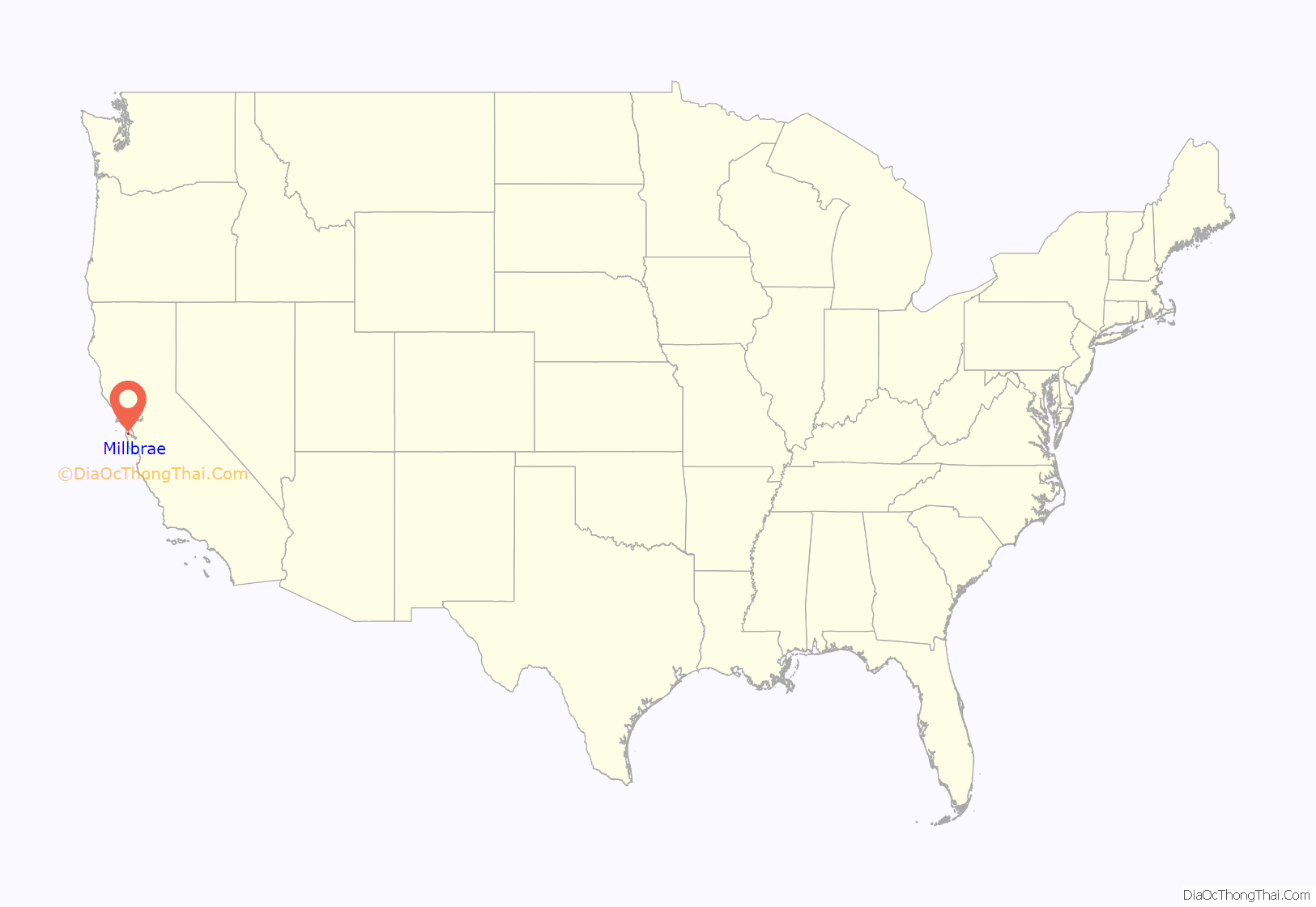
Millbrae is a city located in northern San Mateo County, California, United States. To its northeast is San Francisco International Airport, San Bruno is on its northwest, and Burlingame on its southeast. It is bordered by San Andreas Lake to the southwest. The population was 23,216 at the 2020 census.
| Name: | Millbrae city |
|---|---|
| LSAD Code: | 25 |
| LSAD Description: | city (suffix) |
| State: | California |
| County: | San Mateo County |
| Incorporated: | January 14, 1948 |
| Elevation: | 33 ft (10 m) |
| Total Area: | 3.29 sq mi (8.53 km²) |
| Land Area: | 3.27 sq mi (8.47 km²) |
| Water Area: | 0.02 sq mi (0.06 km²) 0.36% |
| Total Population: | 23,216 |
| Population Density: | 6,851.0/sq mi (2,645.20/km²) |
| ZIP code: | 94030 |
| Area code: | 650 |
| FIPS code: | 0647486 |
| GNISfeature ID: | 1659756 |
| Website: | www.ci.millbrae.ca.us |
Online Interactive Map
Click on ![]() to view map in "full screen" mode.
to view map in "full screen" mode.
Millbrae location map. Where is Millbrae city?
History
The Ohlone people have been living in the Bay Area for hundreds of years. The closest villages to what is now Millbrae were located by the banks of San Bruno Creek, and they are known as Urebure and Siplichiquin. A third nearby village—whose original name is unknown—is called CA-SMA-299. The local Ohlone people are today called the Ramaytush Ohlone, however this name is a linguistic designation that arose relatively recently. Prior to colonization, the Ohlone did not operate as a single consolidated unit; they identified more with their local tribe and village than with the nation at large. The several local tribes that lived in the area prior to colonization coalesced into the modern Ramaytush people following the precipitous decline of their population in the 1800s.
1800s
In 1827, sub lieutenant José Antonio Sánchez, who was stationed at the Presidio, was granted permission by Mexican governor José María de Echeandía to occupy the rancho for “grazing and agricultural purposes”, as grazing land for Mission Dolores and the Presidio of San Francisco. The original Sixteen Mile House, a historical restaurant and rest stop, was a direct link to Millbrae’s early days. The rest stop was built in 1872 by members of the Sánchez family, the original landholders of the Rancho Buri Buri, which at one time comprised parts of present-day Millbrae and Burlingame.
Darius Ogden Mills purchased land in the 1860s from José de la Cruz Sánchez and family of Rancho Buri Buri to build a country estate. The former Mills estate was bordered by what is now Skyline Boulevard, Bayshore Highway U.S. Route 101, Millbrae Avenue and Trousdale Drive. The estate became known as “Millbrae” from “Mills” and the Scottish word “brae,” which means “rolling hills” or “hill slope.” The Millbrae estate mansion burned down in June 1954. After the fire the estate was subdivided and sold, with the bulk of the land going to the Paul W. Trousdale Construction Company in 1953 and eventually becoming the location for Mills High School, Spring Valley Elementary School, and Peninsula Hospital.
1900s
Millbrae is home to Green Hills Country Club, built in 1929, and designed by famed golf course architect Dr. Alister MacKenzie (who designed other noteworthy courses such as Augusta National, Cypress Point, Royal Melbourne, Pasatiempo, and many more). The course was originally known as the Union League Golf Club of San Francisco (1930 to 1933) and Millbrae Country Club (1933 to 1945). The course provides a green belt in the center of the city that is the home of many animals, such as the red-tail fox, that otherwise would not be able to survive in the urban setting. It also may be the only area of the city where natural creeks still flow overground.
Millbrae used a private patrol financed by fees from merchants and residents until 1941, when the San Mateo County Board of Supervisors created the Millbrae Police District. Records of the Internal Revenue Service document the licensing of several Millbrae bars for gambling; only after incorporation were gambling laws enforced in Millbrae and not until the 1950s was gambling defeated. In 1931, citizens organized a volunteer fire department, which remained entirely volunteer until 1938. The police and fire departments were housed together for several years at Hillcrest Boulevard and El Camino Real before the vital services moved to their permanent location in Millbrae’s civic center, a few blocks west of El Camino.
Spurred largely by the desire to secure the Mills’ estate for residential use and by the efforts of Millbrae’s weekly newspaper, the Millbrae Sun, residents heatedly discussed incorporation for over a decade before voting to incorporate. Finally, on January 14, 1948, residents of Millbrae traveled to Sacramento to present their new city’s charter. W.F. Leutenegger was elected mayor to represent Millbrae’s nearly 8,000 residents. That year, Green Hills Elementary School opened as Millbrae’s first new school in over 25 years, in anticipation of the educational needs of the post-war “baby boom” children. The new city’s chief industries were agriculture, floriculture, dairy, and porcelain manufacturing. Many families that built the new city have never left.
In the 1950s, Millbrae residents united to resist efforts to divide the city by the planned Junipero Serra Freeway (I-280), which was later routed parallel to Junipero Serra Boulevard, then through a canyon in San Bruno up to Skyline Boulevard.
Transportation has shaped Millbrae’s growth. From the start of the 20th century, San Francisco MUNI’s #40 “interurban” streetcar traveled through Millbrae, linking the city with San Francisco and San Mateo. Millbrae’s high school students rode the streetcar to attend Burlingame High School until Capuchino High School opened on September 11, 1950. The streetcar line was dismantled just after Millbrae’s incorporation, leaving the Southern Pacific Railroad as the only railway linking Millbrae with surrounding areas. The Sixteen Mile House marked Millbrae along the railroad route, located where the Millbrae O’Reilly Auto Parts stands today. In the 1940s, a hilltop was shaved away to produce landfill for the expanding San Francisco Airport, which received an “international” designation in 1954 with the completion of the Central Terminal.
An unsuccessful effort to save the original Sixteen Mile House in the 1970s led to the birth of the Millbrae Historical Society and eventual successful crusades to save the Millbrae train station and the historic building that has become the Millbrae Historical Museum. Such challenges, though inevitable, have only strengthened Millbrae’s resolve to preserve the city’s unique character and rich history.
2000s
As of May 2022, Millbrae is estimated to have over 22,500 residents. Residents are employed in various industries throughout the Bay Area and children attend one of five public elementary schools, or private schools. Millbrae has Sister City relationships with La Serena, Chile; Hanyu, Japan; and Mosta, Malta.
Millbrae Road Map
Millbrae city Satellite Map
Geography
Millbrae has a total area of 3.26 sq mi (8.4 km), of which 3.25 sq mi (8.4 km) is land and 0.01 sq mi (0.0 km) (0.36%) is water.
See also
Map of California State and its subdivision:- Alameda
- Alpine
- Amador
- Butte
- Calaveras
- Colusa
- Contra Costa
- Del Norte
- El Dorado
- Fresno
- Glenn
- Humboldt
- Imperial
- Inyo
- Kern
- Kings
- Lake
- Lassen
- Los Angeles
- Madera
- Marin
- Mariposa
- Mendocino
- Merced
- Modoc
- Mono
- Monterey
- Napa
- Nevada
- Orange
- Placer
- Plumas
- Riverside
- Sacramento
- San Benito
- San Bernardino
- San Diego
- San Francisco
- San Joaquin
- San Luis Obispo
- San Mateo
- Santa Barbara
- Santa Clara
- Santa Cruz
- Shasta
- Sierra
- Siskiyou
- Solano
- Sonoma
- Stanislaus
- Sutter
- Tehama
- Trinity
- Tulare
- Tuolumne
- Ventura
- Yolo
- Yuba
- Alabama
- Alaska
- Arizona
- Arkansas
- California
- Colorado
- Connecticut
- Delaware
- District of Columbia
- Florida
- Georgia
- Hawaii
- Idaho
- Illinois
- Indiana
- Iowa
- Kansas
- Kentucky
- Louisiana
- Maine
- Maryland
- Massachusetts
- Michigan
- Minnesota
- Mississippi
- Missouri
- Montana
- Nebraska
- Nevada
- New Hampshire
- New Jersey
- New Mexico
- New York
- North Carolina
- North Dakota
- Ohio
- Oklahoma
- Oregon
- Pennsylvania
- Rhode Island
- South Carolina
- South Dakota
- Tennessee
- Texas
- Utah
- Vermont
- Virginia
- Washington
- West Virginia
- Wisconsin
- Wyoming
