Pescadero (Spanish for “Fishmonger”) is an unincorporated town and census-designated place (CDP) in San Mateo County, California, two miles (3 km) east of State Route 1 and Pescadero State Beach. The town is 14.4 miles (23.2 km) south of Half Moon Bay. The ZIP Code is 94060 and the community is inside area code 650. The population was 595 at the 2020 census.
| Name: | Pescadero CDP |
|---|---|
| LSAD Code: | 57 |
| LSAD Description: | CDP (suffix) |
| State: | California |
| County: | San Mateo County |
| Total Area: | 4.035 sq mi (10.449 km²) |
| Land Area: | 4.026 sq mi (10.426 km²) |
| Water Area: | 0.009 sq mi (0.022 km²) 0.21% |
| Total Population: | 595 |
| Population Density: | 150/sq mi (57/km²) |
| ZIP code: | 94060 |
| Area code: | 650 |
| FIPS code: | 0656756 |
Online Interactive Map
Click on ![]() to view map in "full screen" mode.
to view map in "full screen" mode.
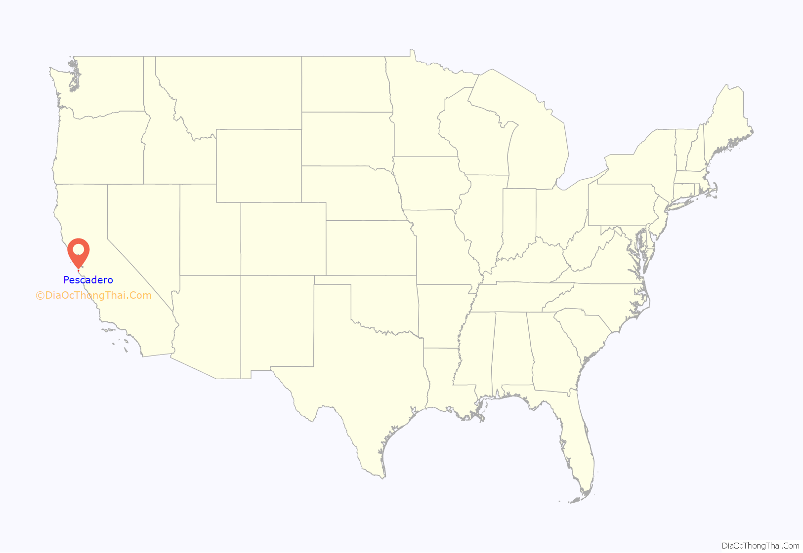
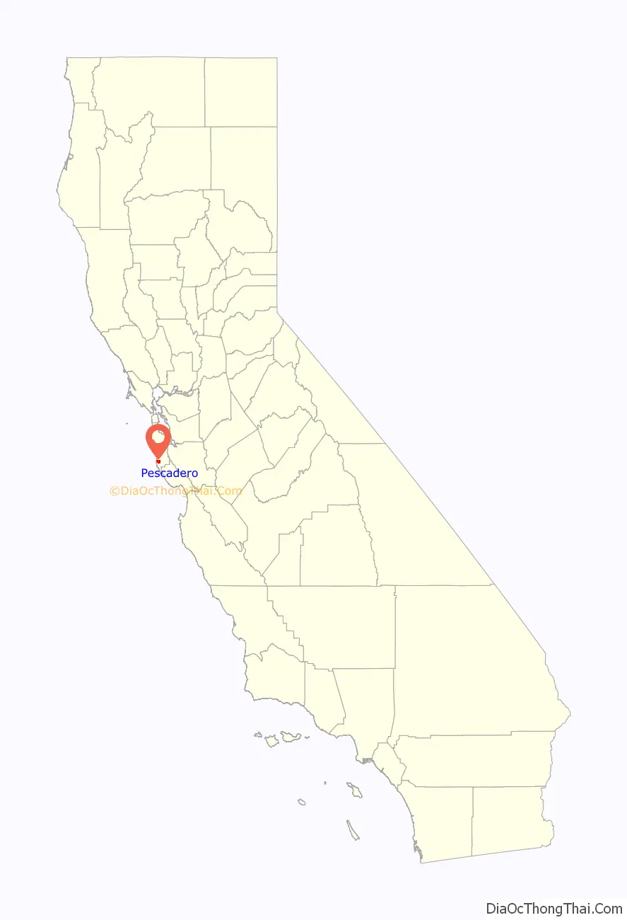
Pescadero location map. Where is Pescadero CDP?
History
The town of Pescadero is located on the Rancho Pescadero Mexican land grant; former Mission Santa Cruz pasture given to Juan José Gonzalez in 1833. Alexander Moore (1823–1902), an American pioneer, built his home in Pescadero Valley in 1853. The rich, fertile soil of the valley had attracted other settlers, and in the 1860s Pescadero was a prosperous town surrounded by farms and lumber mills.
According to a guidebook published by the California Coastal Commission, the residents of Pescadero recovered a large quantity of white paint from the 1853 wreck of the clipper ship Carrier Pigeon at Pigeon Point. The paint was “used liberally on all the town’s buildings”, and residents have since maintained the tradition of painting their houses white. However, other sources credit the 1896 wreck of the steamer Columbia as the source of the white paint.
An article in the Wells Fargo Messenger states that a stagecoach salvaged from the Carrier Pigeon was laboriously hoisted up the cliffs onto the road, and put into service within a week. The coach, built in Concord, New Hampshire, carried passengers and freight on the Pescadero road for the Wells Fargo Company for forty years, and, in 1914, was listed among the company’s prized possessions.
Another tale relates that an Irishman named John Daly, who was employed driving pigs from Santa Cruz to Alexander Moore’s Pescadero ranch, discovered some lumps of coal from the steamer Sea Bird’s cargo on the beach at Ano Nuevo. Mr. Daly endeavored to parley his discovery into money which he might spend on whiskey. Since coal deposits had been rumored to exist in the area, Mr. Daly proceeded with his lumps of coal to Santa Cruz, announcing to Captain Brannan and three others that he had discovered a coal mine at Gazos Creek. After collecting his monetary reward, he led the four men up Gazos Creek in search of the alleged coal outcropping, with the intention of escaping and leaving his benefactors behind empty-handed. However, Captain Brannan, who was armed, managed to capture Daly and extracted a confession. Daly was administered a whipping on the spot and later fled the area.
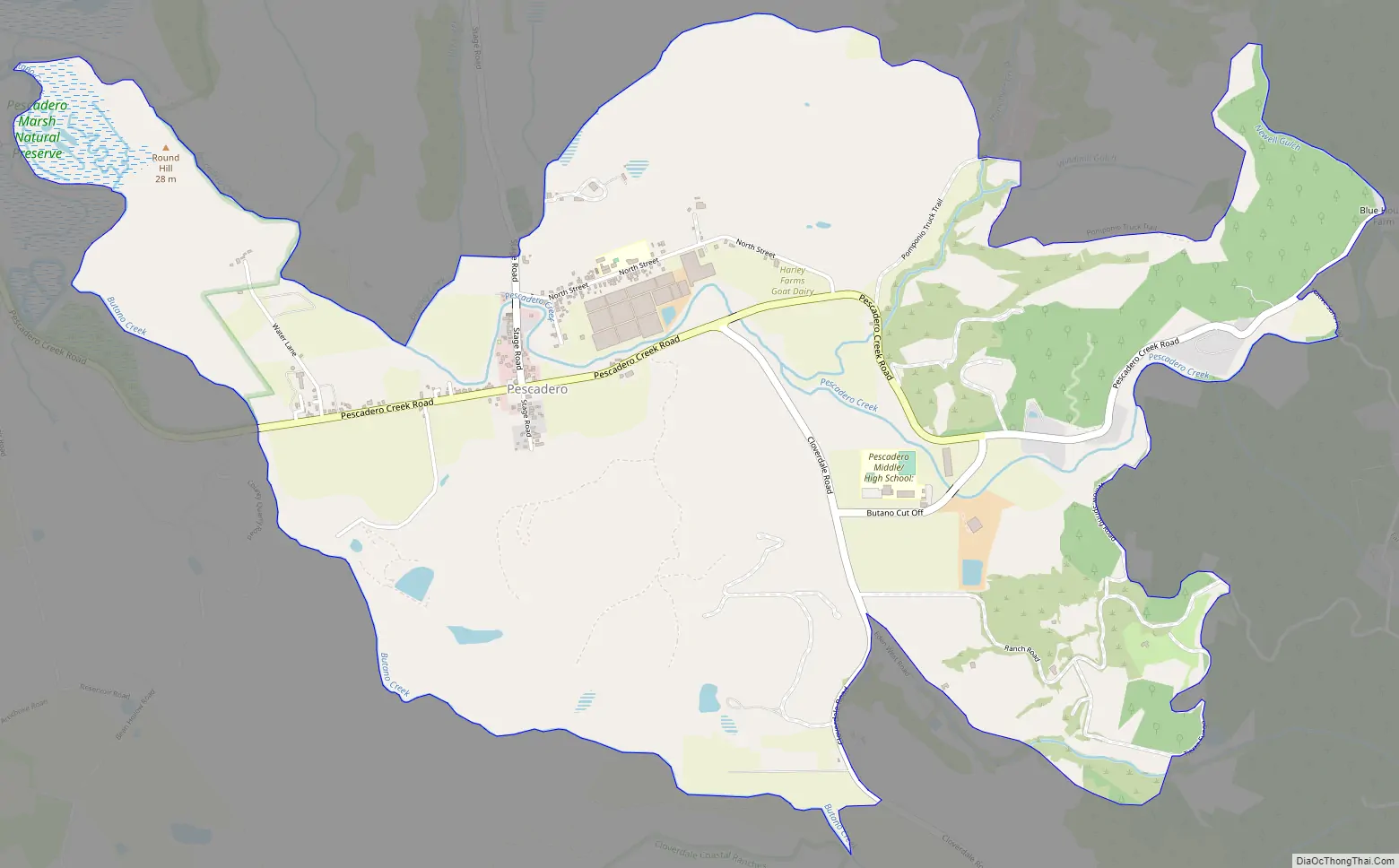
Pescadero Road Map
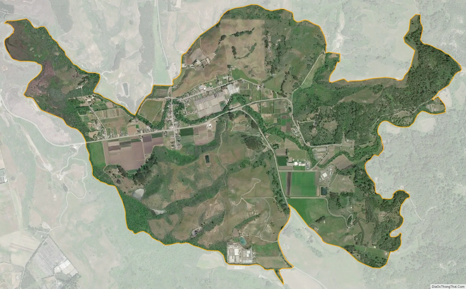
Pescadero city Satellite Map
Geography
According to the United States Census Bureau, the CDP covers an area of 4.0 square miles (10.4 km), 99.79% of it land and 0.21% of it water.
See also
Map of California State and its subdivision:- Alameda
- Alpine
- Amador
- Butte
- Calaveras
- Colusa
- Contra Costa
- Del Norte
- El Dorado
- Fresno
- Glenn
- Humboldt
- Imperial
- Inyo
- Kern
- Kings
- Lake
- Lassen
- Los Angeles
- Madera
- Marin
- Mariposa
- Mendocino
- Merced
- Modoc
- Mono
- Monterey
- Napa
- Nevada
- Orange
- Placer
- Plumas
- Riverside
- Sacramento
- San Benito
- San Bernardino
- San Diego
- San Francisco
- San Joaquin
- San Luis Obispo
- San Mateo
- Santa Barbara
- Santa Clara
- Santa Cruz
- Shasta
- Sierra
- Siskiyou
- Solano
- Sonoma
- Stanislaus
- Sutter
- Tehama
- Trinity
- Tulare
- Tuolumne
- Ventura
- Yolo
- Yuba
- Alabama
- Alaska
- Arizona
- Arkansas
- California
- Colorado
- Connecticut
- Delaware
- District of Columbia
- Florida
- Georgia
- Hawaii
- Idaho
- Illinois
- Indiana
- Iowa
- Kansas
- Kentucky
- Louisiana
- Maine
- Maryland
- Massachusetts
- Michigan
- Minnesota
- Mississippi
- Missouri
- Montana
- Nebraska
- Nevada
- New Hampshire
- New Jersey
- New Mexico
- New York
- North Carolina
- North Dakota
- Ohio
- Oklahoma
- Oregon
- Pennsylvania
- Rhode Island
- South Carolina
- South Dakota
- Tennessee
- Texas
- Utah
- Vermont
- Virginia
- Washington
- West Virginia
- Wisconsin
- Wyoming


