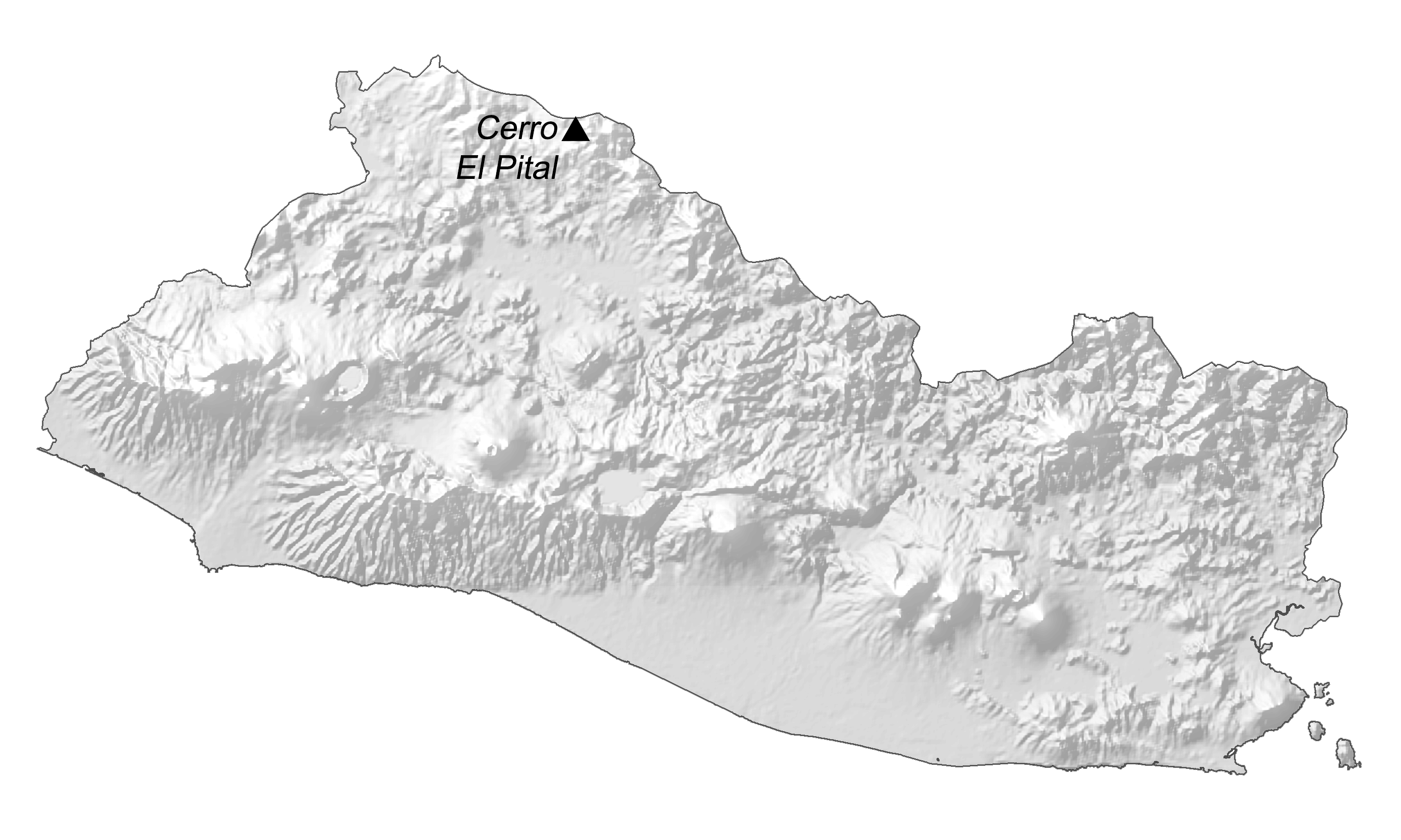
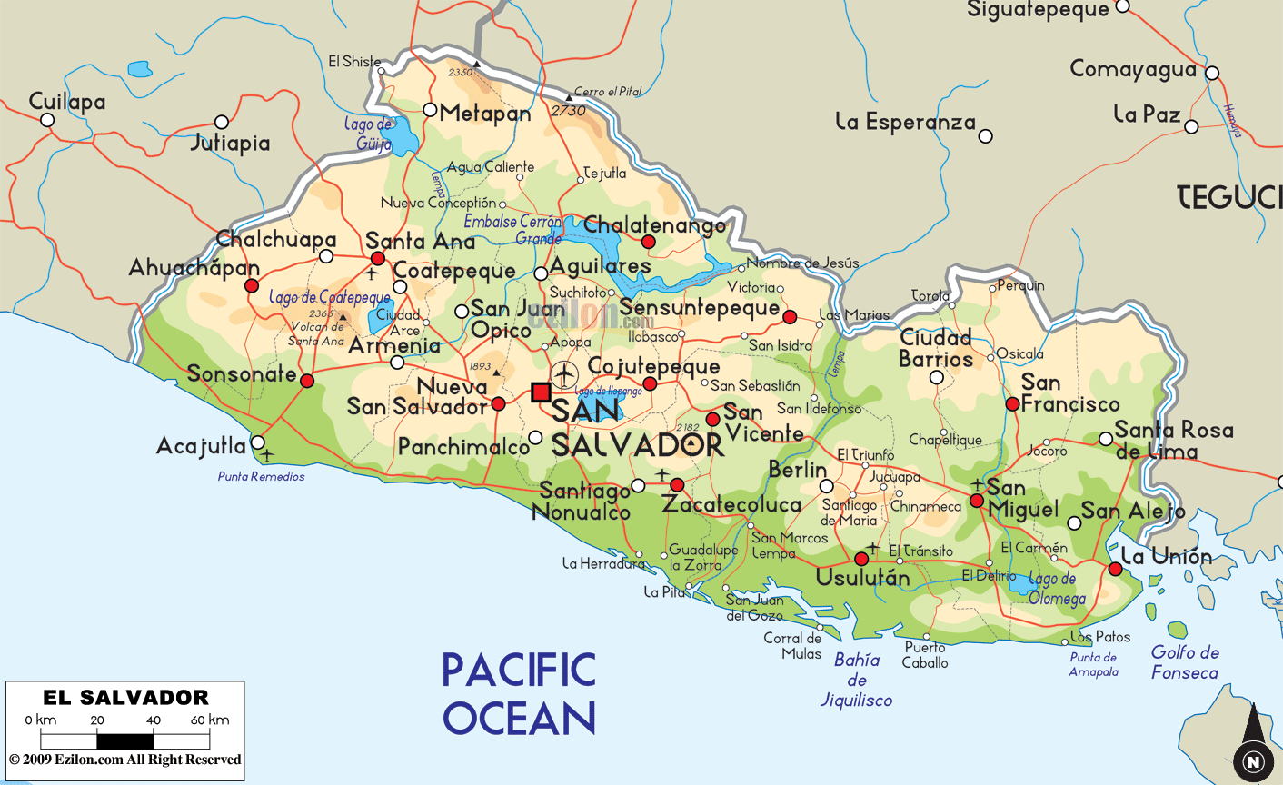
Covering a total area of 21,041 sq. km (8,124 sq mi), El Salvador is a small mountainous Central American country, where there are two parallel mountain ranges bordering a central plateau.
As observed on the physical map of El Salvador above, the Sierra Madre Mountains runs along the entire northern border with Honduras. In the south, the land lowers into a narrow coastal plain and a scattered chain of more than 20 volcanoes stretches across the land from west to east (some are still active, but major eruptions are rare).
Cerro El Pital – the highest point in the country, is situated on the Honduras border, at an elevation of 8,957ft (2730m). Its position has been marked on the map by an upright yellow triangle.
El Salvador, inspite of being a Central American nation has no coastline on the Caribbean but has hundreds of small rivers. The most significant among these rivers is the Lempa River; it rises in the mountains of Guatemala, then flows eastwards crossing a part of Honduras border and then turns south through the Central Highlands and across the central plateau empties into the Pacific Ocean. A dam built on the Lempa River created the large Cerron Reservoir. Numerous volcanic lakes cover the interior, mostly ringed by mountains. The largest among them is Lake Ilopango, sitting directly east of San Salvador – the capital city of El Salvador.
| Flag: |  |
|---|---|
| Legal Name: | Republic of El Salvador |
| Capital Value: | San Salvador |
| Largest City: |
San Salvador (1,105,766) |
| Official languages: | Spanish |
| Demonym(s): | Salvadoran Guanaco(a) (colloquial) |
| Government: | Unitary presidential republic |
| Legislature: | Legislative Assembly |
| Total Area: | 21,041 km² |
| Land Area: | 20,721 km² |
| Water Area: | 320 km² |
| Population: | 6,453,553 |
| Density: | 324.4/km (840.2/sq mi) (26th) |
| GDP: | $27.02 Billion |
| GDP Per Capita: | $4,187.25 |
| Currency Value: | US Dollar (USD) |
| Driving side: | right |
| Calling code: | +503 |
| Internet TLD: | .sv |
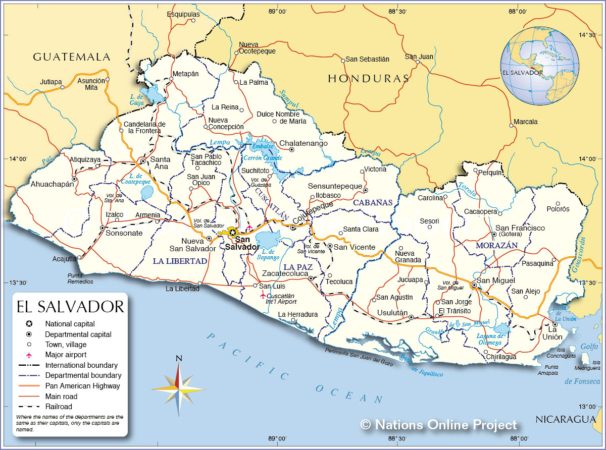
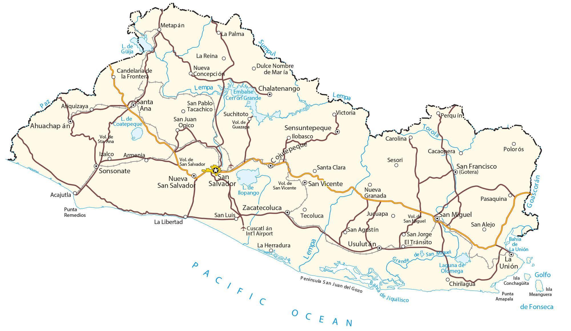
El Salvador is an amazing country with a remarkable landscape. It is nicknamed the “Land of Volcanoes” due to its impressive volcanic topography and the Sierra Madre Mountains that run through its heart. This El Salvador map showcases the major cities, towns, and roads of this Central American nation.
The map of El Salvador reveals the beauty of its volcanoes, the mountain range, and the diverse terrain. From the capital city of San Salvador to the vast Lake Ilopango, each of its attractions is marked on the map. It is a great way to explore the country and plan a vacation.
Online Interactive Political Map
Click on ![]() to view map in "full screen" mode.
to view map in "full screen" mode.
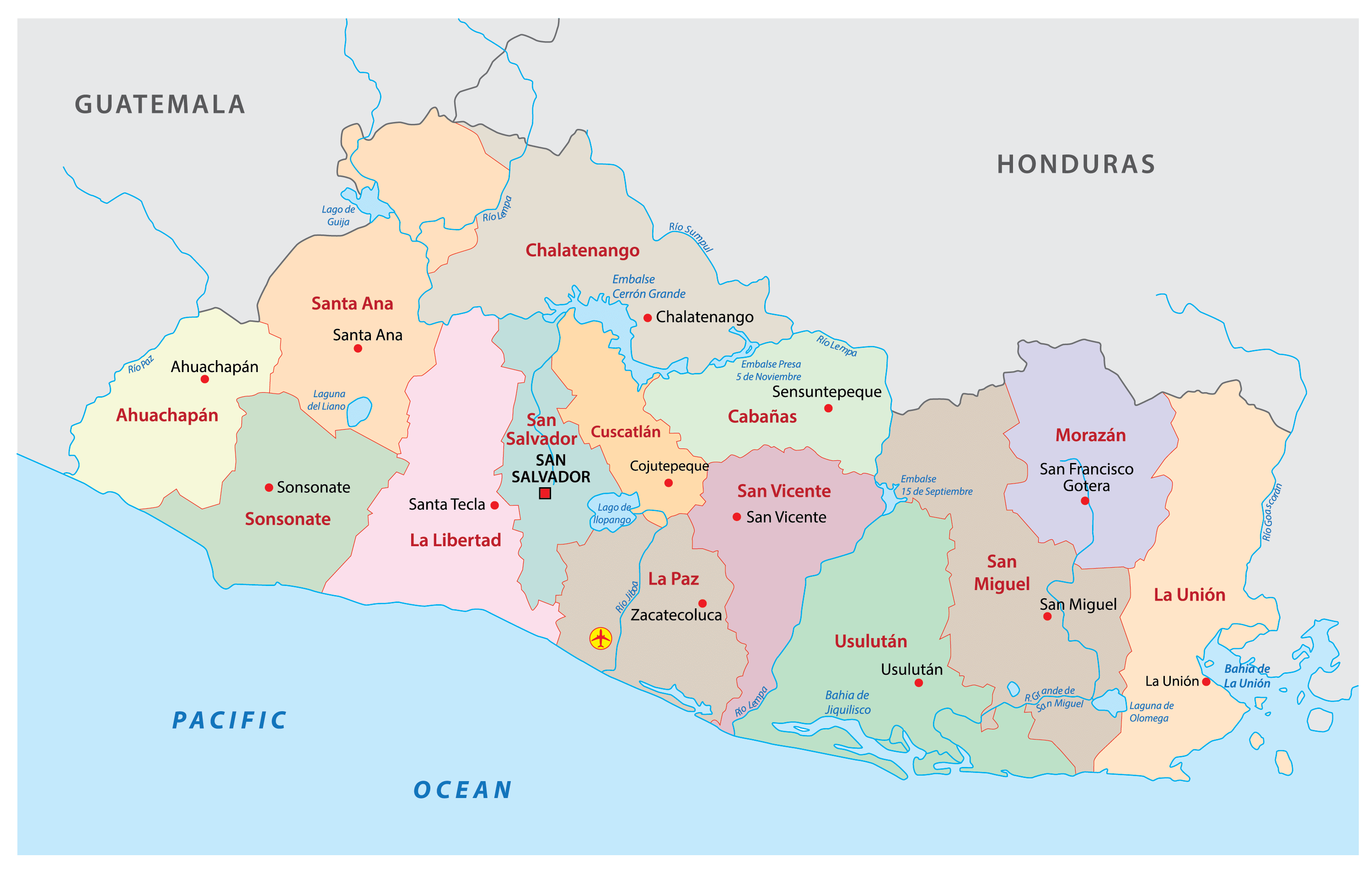
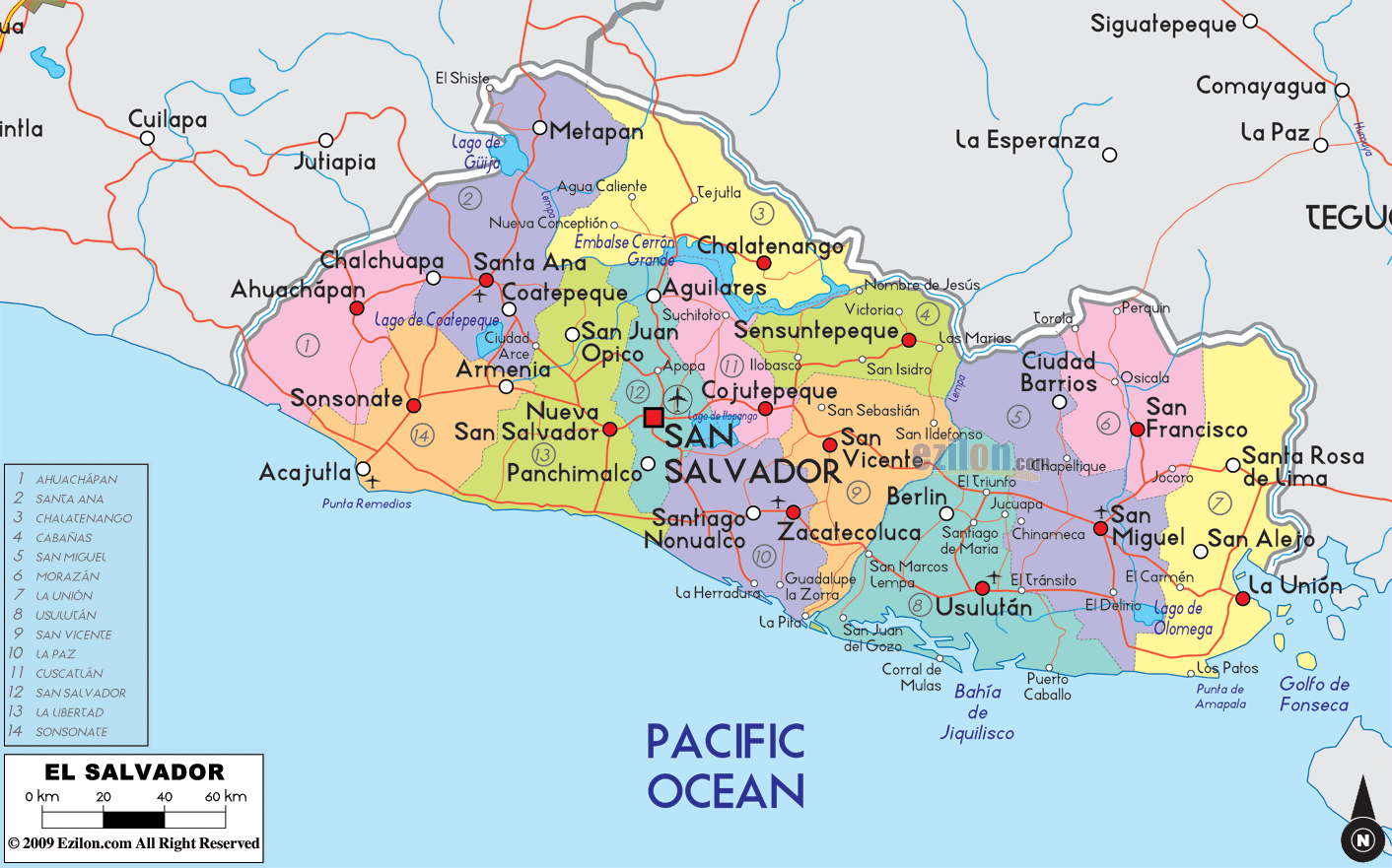
El Salvador (officially, the Republic of El Salvador) is divided into 14 departments (departamentos, sing. departamento). In alphabetical order, the departments are: Ahuachapan, Cabanas, Chalatenango, Cuscatlan, La Libertad, La Paz, La Union, Morazan, San Miguel, San Salvador, San Vicente, Santa Ana, Sonsonate and Usulutan. These departments are further subdivided into 262 municipalities (municipios).
Covering a total area of 21,041 sq. km, El Salvador is the smallest country in Central America. It is also the most densely populated Central American nation. Located in the Valley of the Hammocks, on the Ace Chaute River is, San Salvador – the capital, the largest and the most populous city of El Salvador. It is also the administrative, cultural, educational, economic and financial hub of the country.
Location Maps
Where is El Salvador?
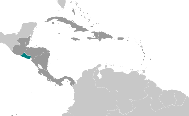
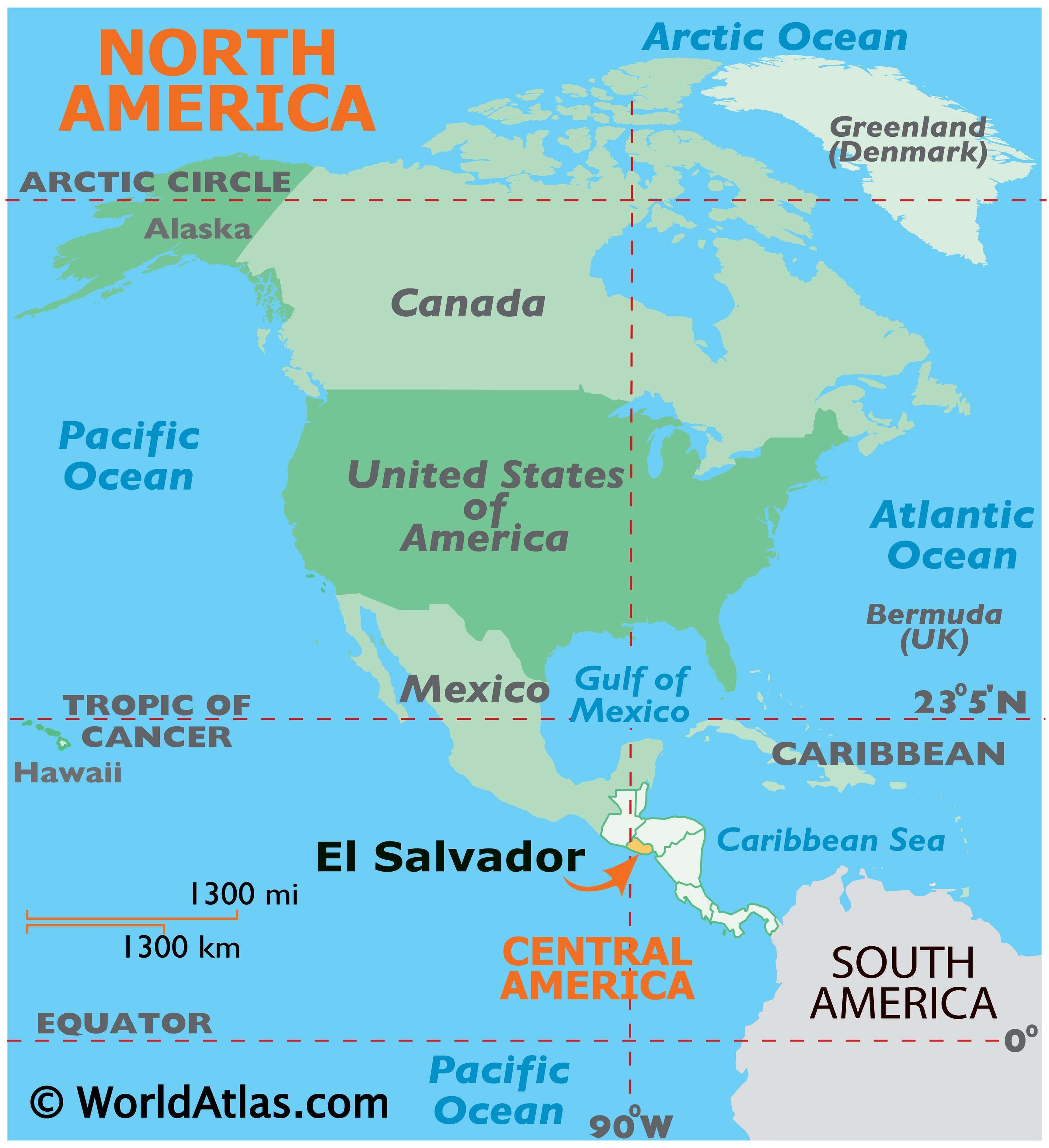
El Salvador is the smallest country in Central America. Unlike any other Central American country, it does not have a Caribbean coastline. Instead, it has roughly 300 kilometers (186 mi) of coastline along the Pacific Ocean and Gulf of Fonseca. Otherwise, it borders Guatemala to the northwest and Honduras to the northeast.
El Salvador is densely populated with nearly 7 million people. San Salvador is the capital and largest city of the country. The nation is nicknamed the “land of volcanoes” due to the presence of a volcano near almost every major city. The volcanoes share the same name as the cities that are closest to them.
High Definition Political Map of El Salvador
Physical Map of El Salvador

El Salvador Satellite Map

Elevation Map