Peosta is a city in Dubuque County, Iowa, United States, and an exurb of the city of Dubuque. It is part of the Dubuque, Iowa Metropolitan Statistical Area. The population was 1,908 in the 2020 census, an increase of 193% from 651 in 2000. Peosta experienced a 70% increase in population (estimated) from 2000 to 2007, making it the state’s 10th fastest-growing city during that period. Peosta is currently the sixth-largest city in Dubuque County, but it will likely soon pass Epworth (pop. 1,860) to become the fifth-largest. The community is home to the 2015 ASA D Northern Nationals Men’s Slow Pitch Champions, Kass & Company, a large industrial park, the largest campus of Northeast Iowa Community College, and a handful of new commercial businesses. However, the city is increasingly becoming a bedroom community, much like nearby Asbury, made up of suburban subdivisions.
| Name: | Peosta city |
|---|---|
| LSAD Code: | 25 |
| LSAD Description: | city (suffix) |
| State: | Iowa |
| County: | Dubuque County |
| Elevation: | 1,053 ft (321 m) |
| Land Area: | 2.60 sq mi (6.73 km²) |
| Water Area: | 0.00 sq mi (0.00 km²) |
| Population Density: | 734.69/sq mi (283.64/km²) |
| ZIP code: | 52068 |
| Area code: | 563 |
| FIPS code: | 1962130 |
| GNISfeature ID: | 0460080 |
| Website: | www.cityofpeosta.org |
Online Interactive Map
Click on ![]() to view map in "full screen" mode.
to view map in "full screen" mode.
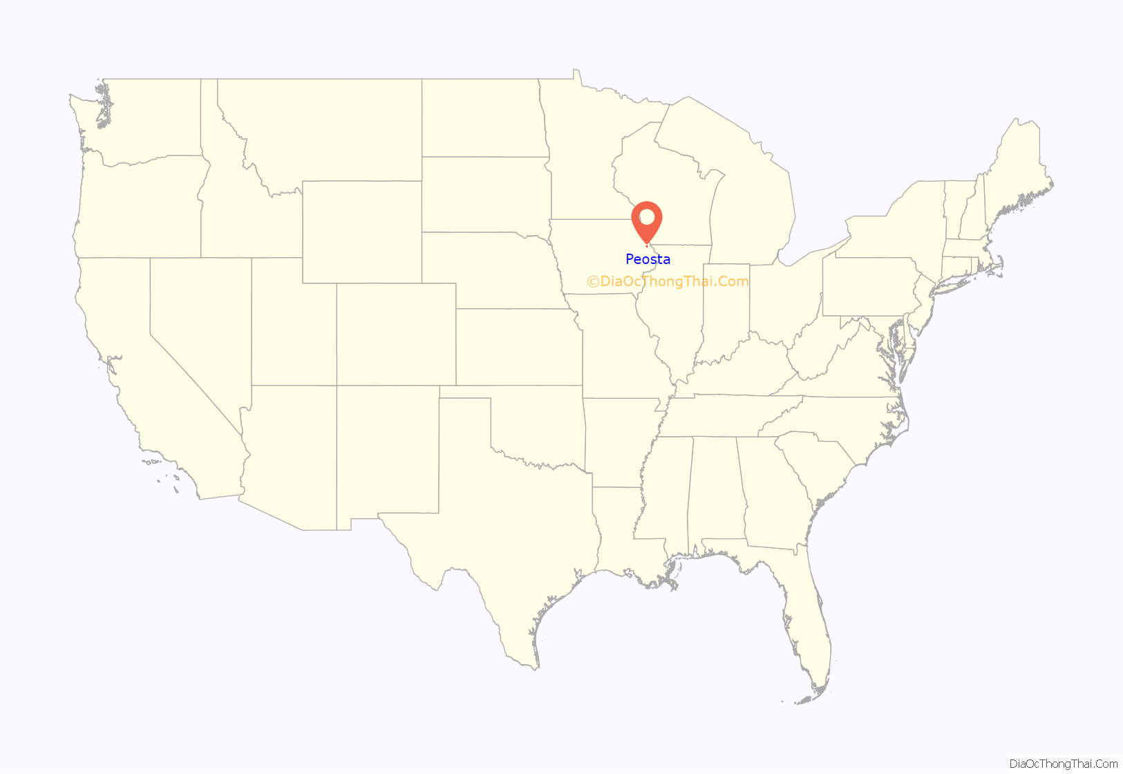
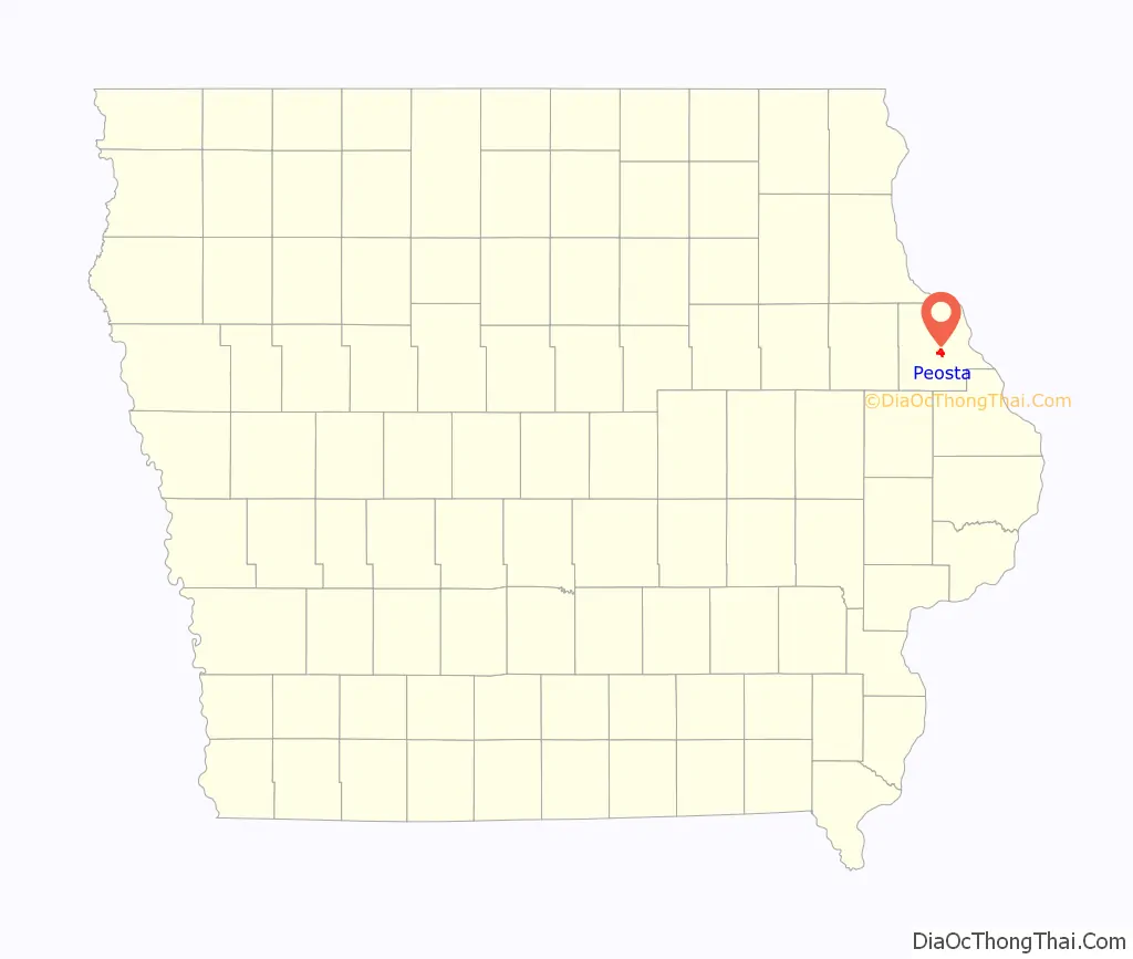
Peosta location map. Where is Peosta city?
History
Peosta is named after the leader of a local Native American tribe that once lived in Dubuque County. Chief Peosta, of the Mesquakie tribe, was a close friend of Julien Dubuque, one of the first European settlers in the area. Dubuque was also the founder of the City of Dubuque, Iowa, and was allegedly married to Chief Peosta’s daughter, who was reportedly named “Potosa”.
For most of its history, and even as recently as 1990, Peosta was a quiet rural town of approximately 100 people. The groundwork for later growth was laid in the 1960s, when the new four-lane U.S. Route 20 opened along the city’s southern edge, providing quick access to Dubuque. The city was also aided by the opening of Northeast Iowa Technical Institute (later NICC) in 1979. However, it was only when the city’s industrial park began to flourish in the 1990s that the population began to soar. Peosta grew from 128 people in 1990 to over 1,300 today, and it continues to climb rapidly. This 1000% growth in 20 years has helped attract new businesses and services to Peosta as well. The city now boasts two elementary schools, its own community center, hotel, church, industrial park and expanding neighborhoods.
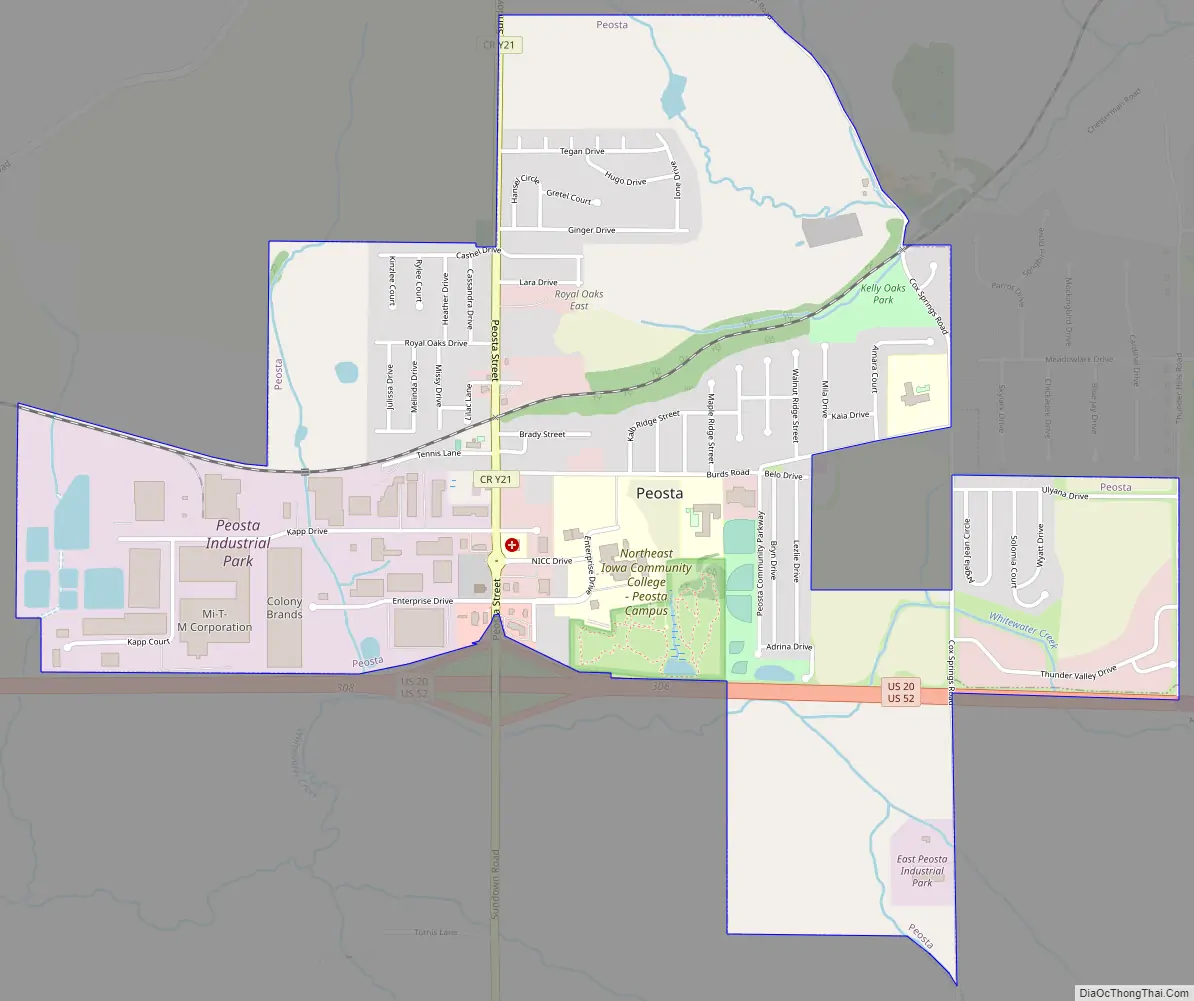
Peosta Road Map
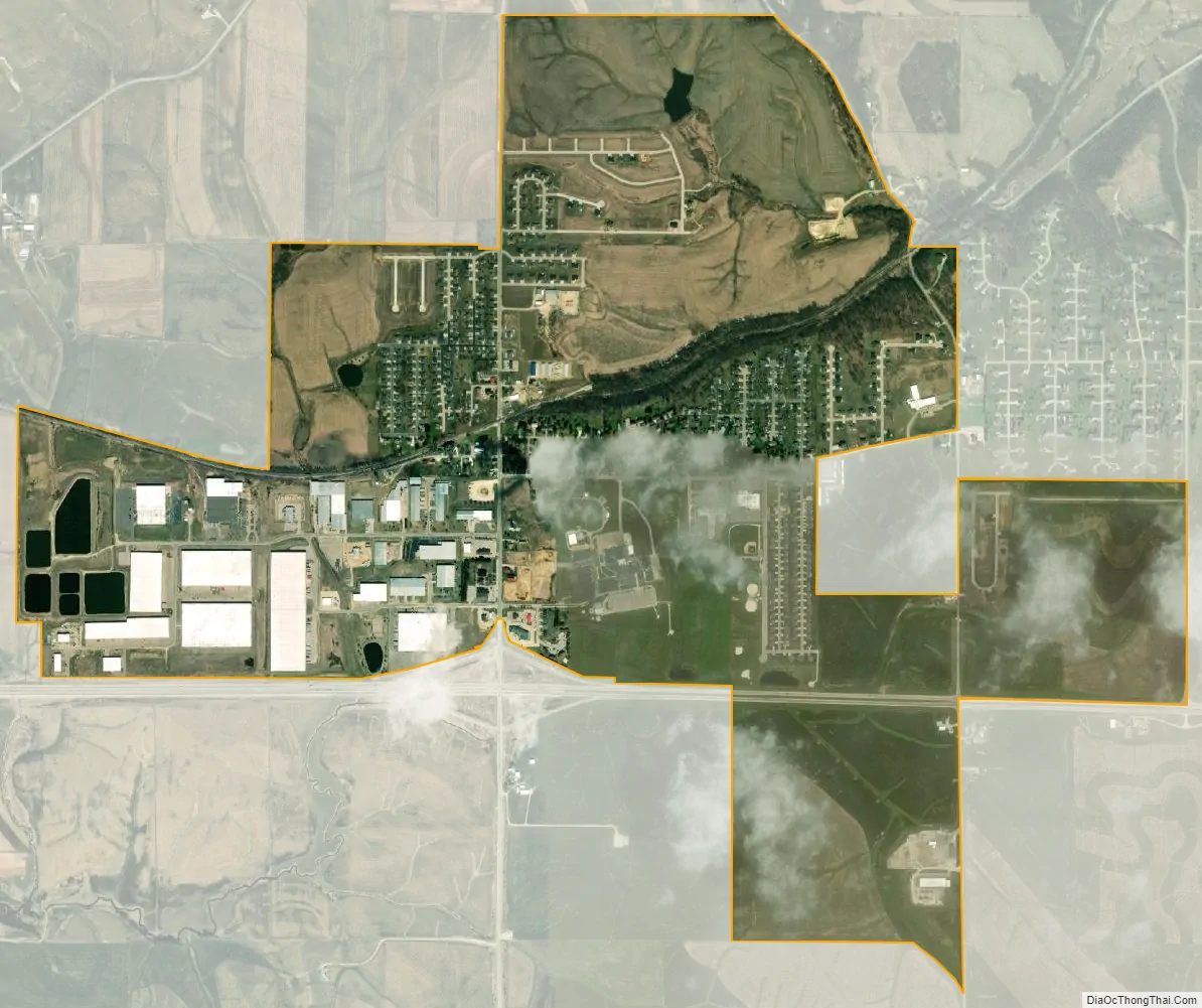
Peosta city Satellite Map
Geography
Peosta’s longitude and latitude coordinates in decimal form are 42.449157, -90.846420.
According to the United States Census Bureau, the city has a total area of 1.97 square miles (5.10 km), all land.
See also
Map of Iowa State and its subdivision:- Adair
- Adams
- Allamakee
- Appanoose
- Audubon
- Benton
- Black Hawk
- Boone
- Bremer
- Buchanan
- Buena Vista
- Butler
- Calhoun
- Carroll
- Cass
- Cedar
- Cerro Gordo
- Cherokee
- Chickasaw
- Clarke
- Clay
- Clayton
- Clinton
- Crawford
- Dallas
- Davis
- Decatur
- Delaware
- Des Moines
- Dickinson
- Dubuque
- Emmet
- Fayette
- Floyd
- Franklin
- Fremont
- Greene
- Grundy
- Guthrie
- Hamilton
- Hancock
- Hardin
- Harrison
- Henry
- Howard
- Humboldt
- Ida
- Iowa
- Jackson
- Jasper
- Jefferson
- Johnson
- Jones
- Keokuk
- Kossuth
- Lee
- Linn
- Louisa
- Lucas
- Lyon
- Madison
- Mahaska
- Marion
- Marshall
- Mills
- Mitchell
- Monona
- Monroe
- Montgomery
- Muscatine
- O'Brien
- Osceola
- Page
- Palo Alto
- Plymouth
- Pocahontas
- Polk
- Pottawattamie
- Poweshiek
- Ringgold
- Sac
- Scott
- Shelby
- Sioux
- Story
- Tama
- Taylor
- Union
- Van Buren
- Wapello
- Warren
- Washington
- Wayne
- Webster
- Winnebago
- Winneshiek
- Woodbury
- Worth
- Wright
- Alabama
- Alaska
- Arizona
- Arkansas
- California
- Colorado
- Connecticut
- Delaware
- District of Columbia
- Florida
- Georgia
- Hawaii
- Idaho
- Illinois
- Indiana
- Iowa
- Kansas
- Kentucky
- Louisiana
- Maine
- Maryland
- Massachusetts
- Michigan
- Minnesota
- Mississippi
- Missouri
- Montana
- Nebraska
- Nevada
- New Hampshire
- New Jersey
- New Mexico
- New York
- North Carolina
- North Dakota
- Ohio
- Oklahoma
- Oregon
- Pennsylvania
- Rhode Island
- South Carolina
- South Dakota
- Tennessee
- Texas
- Utah
- Vermont
- Virginia
- Washington
- West Virginia
- Wisconsin
- Wyoming