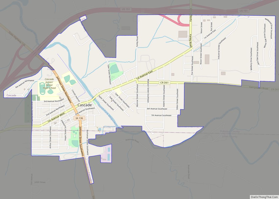
Cascade is a city in Dubuque and Jones counties, Iowa, United States. The Dubuque County portion is part of Dubuque Metropolitan Statistical Area, while the Jones County section is part of Cedar Rapids Metropolitan Statistical Area. The population was 2,386 at the 2020 census, up from 1,958 in 2000. The city is located within southwestern of Dubuque County and north-central Jones County.
Arguably the town’s most notable historic event was the 1925 flood. Between 1880 and 1936, the town was connected to Bellevue via the Chicago, St. Paul & Milwaukee Railroad Company. It was Iowa’s last narrow gauge railroad with a gauge of 3′. The roadbed curves and grades were considered too extreme for conversion to standard gauge
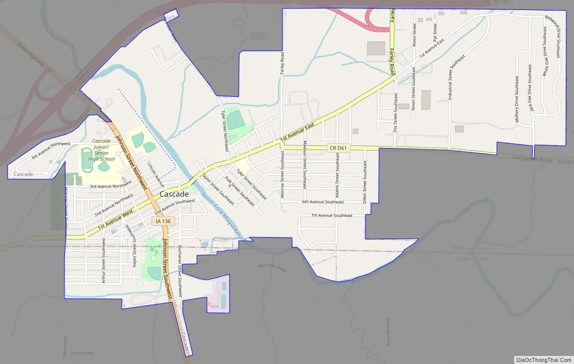
U.S. Route 151 runs through Cascade but in 2002, a four-lane bypass took traffic north around the city. Iowa Highway 136 runs from north to south through Cascade.
| Name: | Cascade city |
|---|---|
| LSAD Code: | 25 |
| LSAD Description: | city (suffix) |
| State: | Iowa |
| County: | Dubuque County, Jones County |
| Elevation: | 827 ft (252 m) |
| Land Area: | 1.92 sq mi (4.97 km²) |
| Water Area: | 0.00 sq mi (0.00 km²) |
| Population Density: | 1,242.06/sq mi (479.65/km²) |
| ZIP code: | 52033 |
| Area code: | 563 |
| FIPS code: | 1911305 |
| GNISfeature ID: | 0455196 |
| Website: | www.cascadeiowa.org |
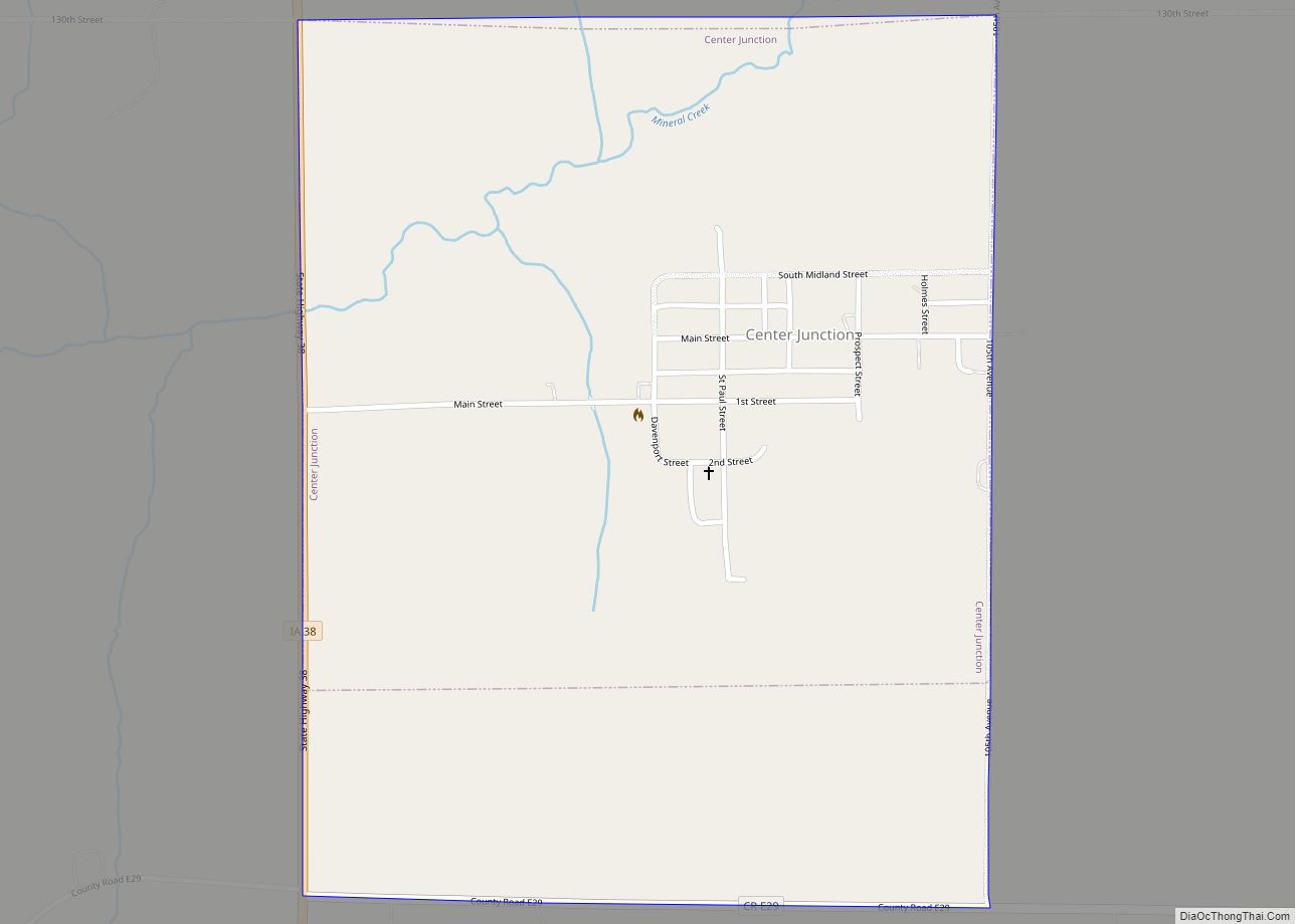
Online Interactive Map
Click on ![]() to view map in "full screen" mode.
to view map in "full screen" mode.
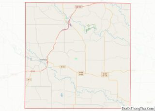
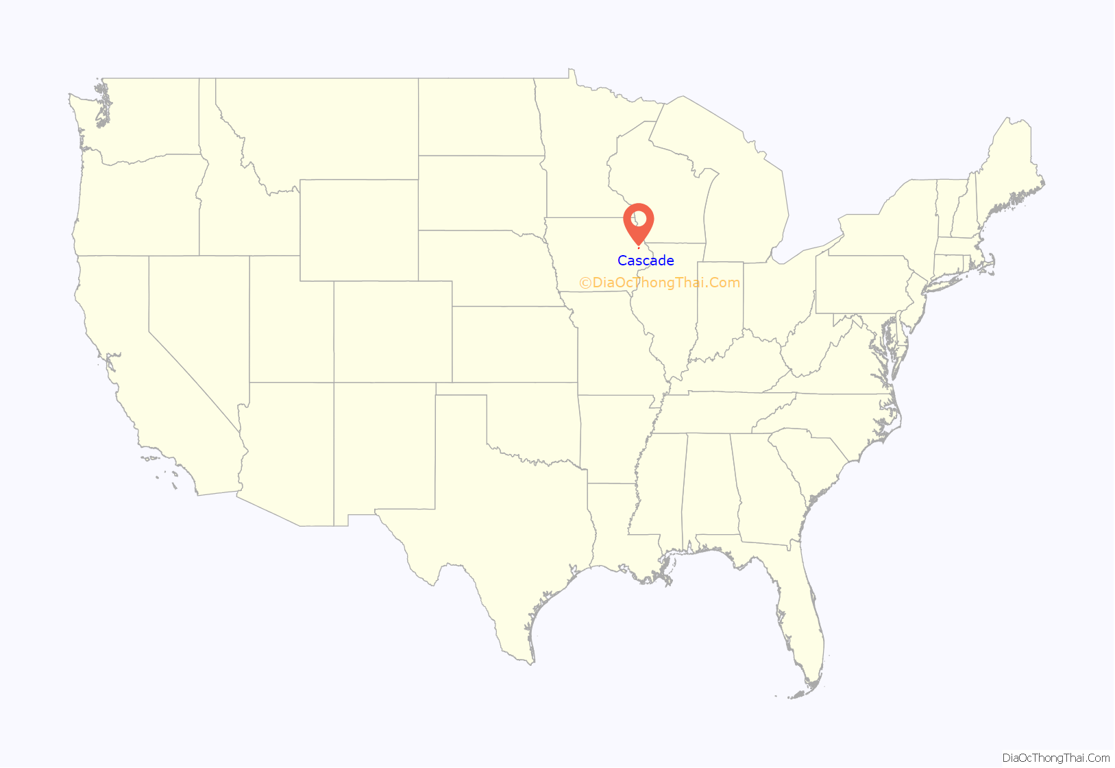
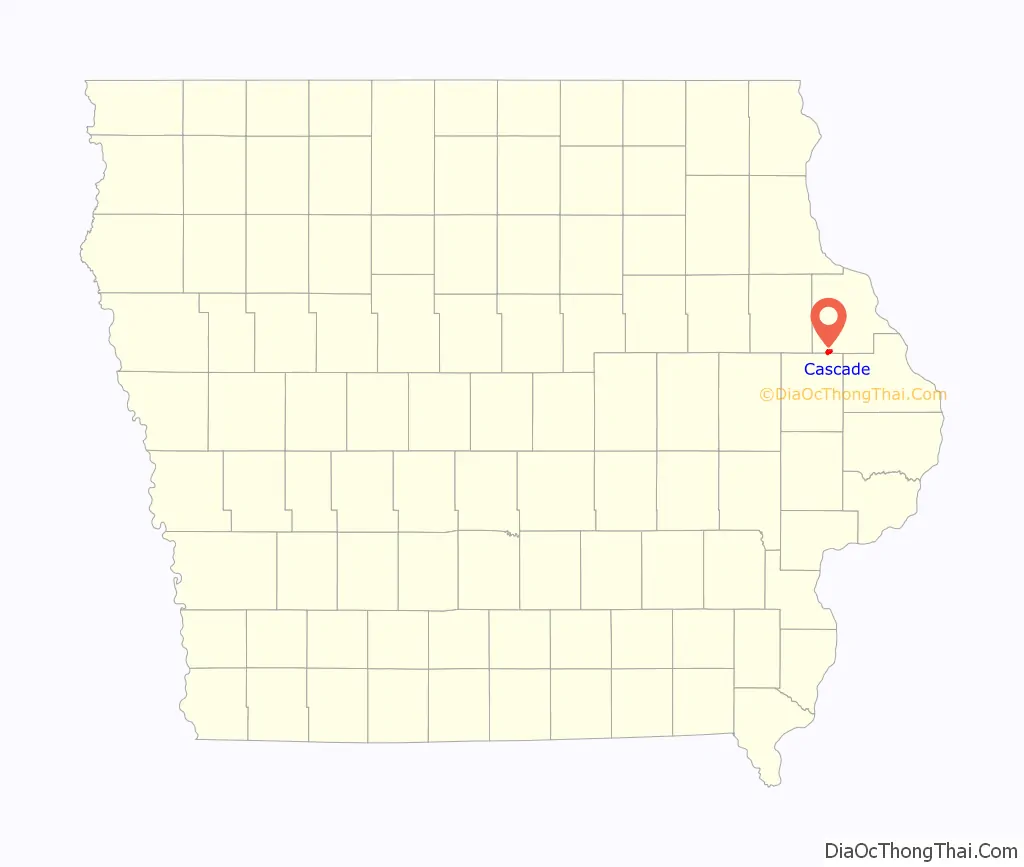
Cascade location map. Where is Cascade city?
Cascade Road Map
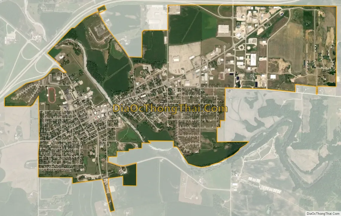
Cascade city Satellite Map
Geography
According to the United States Census Bureau, the city has a total area of 1.87 square miles (4.84 km), all land. The North Fork Maquoketa River passes through Cascade.
Cascade is located 25 miles southwest of Dubuque.
See also
Map of Iowa State and its subdivision:- Adair
- Adams
- Allamakee
- Appanoose
- Audubon
- Benton
- Black Hawk
- Boone
- Bremer
- Buchanan
- Buena Vista
- Butler
- Calhoun
- Carroll
- Cass
- Cedar
- Cerro Gordo
- Cherokee
- Chickasaw
- Clarke
- Clay
- Clayton
- Clinton
- Crawford
- Dallas
- Davis
- Decatur
- Delaware
- Des Moines
- Dickinson
- Dubuque
- Emmet
- Fayette
- Floyd
- Franklin
- Fremont
- Greene
- Grundy
- Guthrie
- Hamilton
- Hancock
- Hardin
- Harrison
- Henry
- Howard
- Humboldt
- Ida
- Iowa
- Jackson
- Jasper
- Jefferson
- Johnson
- Jones
- Keokuk
- Kossuth
- Lee
- Linn
- Louisa
- Lucas
- Lyon
- Madison
- Mahaska
- Marion
- Marshall
- Mills
- Mitchell
- Monona
- Monroe
- Montgomery
- Muscatine
- O'Brien
- Osceola
- Page
- Palo Alto
- Plymouth
- Pocahontas
- Polk
- Pottawattamie
- Poweshiek
- Ringgold
- Sac
- Scott
- Shelby
- Sioux
- Story
- Tama
- Taylor
- Union
- Van Buren
- Wapello
- Warren
- Washington
- Wayne
- Webster
- Winnebago
- Winneshiek
- Woodbury
- Worth
- Wright
- Alabama
- Alaska
- Arizona
- Arkansas
- California
- Colorado
- Connecticut
- Delaware
- District of Columbia
- Florida
- Georgia
- Hawaii
- Idaho
- Illinois
- Indiana
- Iowa
- Kansas
- Kentucky
- Louisiana
- Maine
- Maryland
- Massachusetts
- Michigan
- Minnesota
- Mississippi
- Missouri
- Montana
- Nebraska
- Nevada
- New Hampshire
- New Jersey
- New Mexico
- New York
- North Carolina
- North Dakota
- Ohio
- Oklahoma
- Oregon
- Pennsylvania
- Rhode Island
- South Carolina
- South Dakota
- Tennessee
- Texas
- Utah
- Vermont
- Virginia
- Washington
- West Virginia
- Wisconsin
- Wyoming