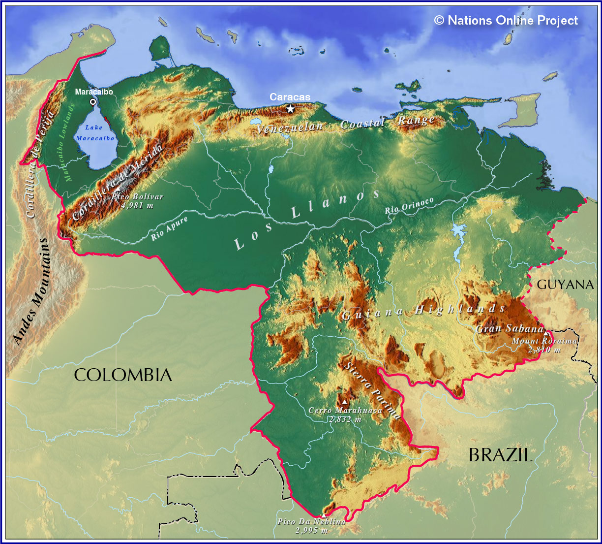
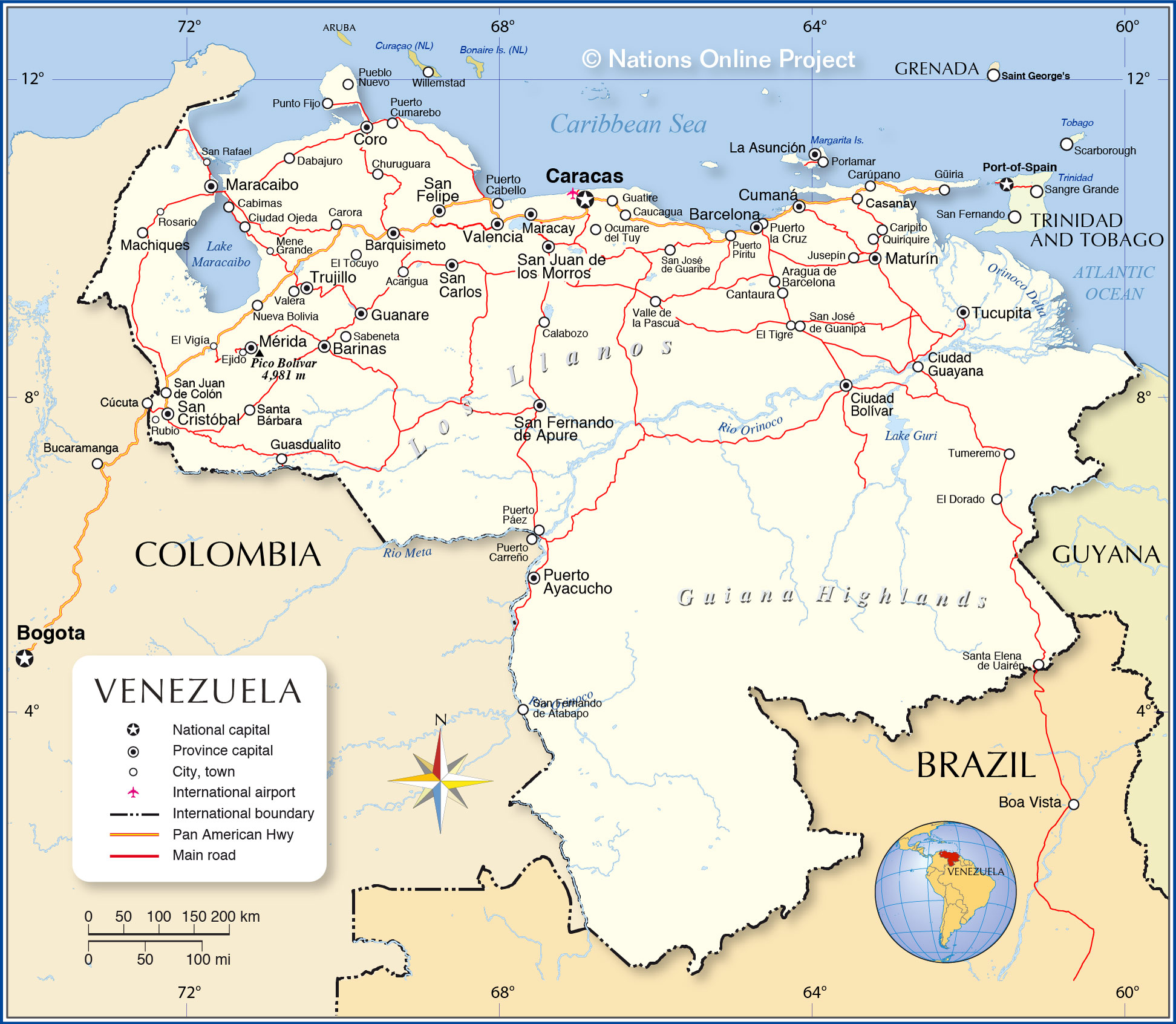
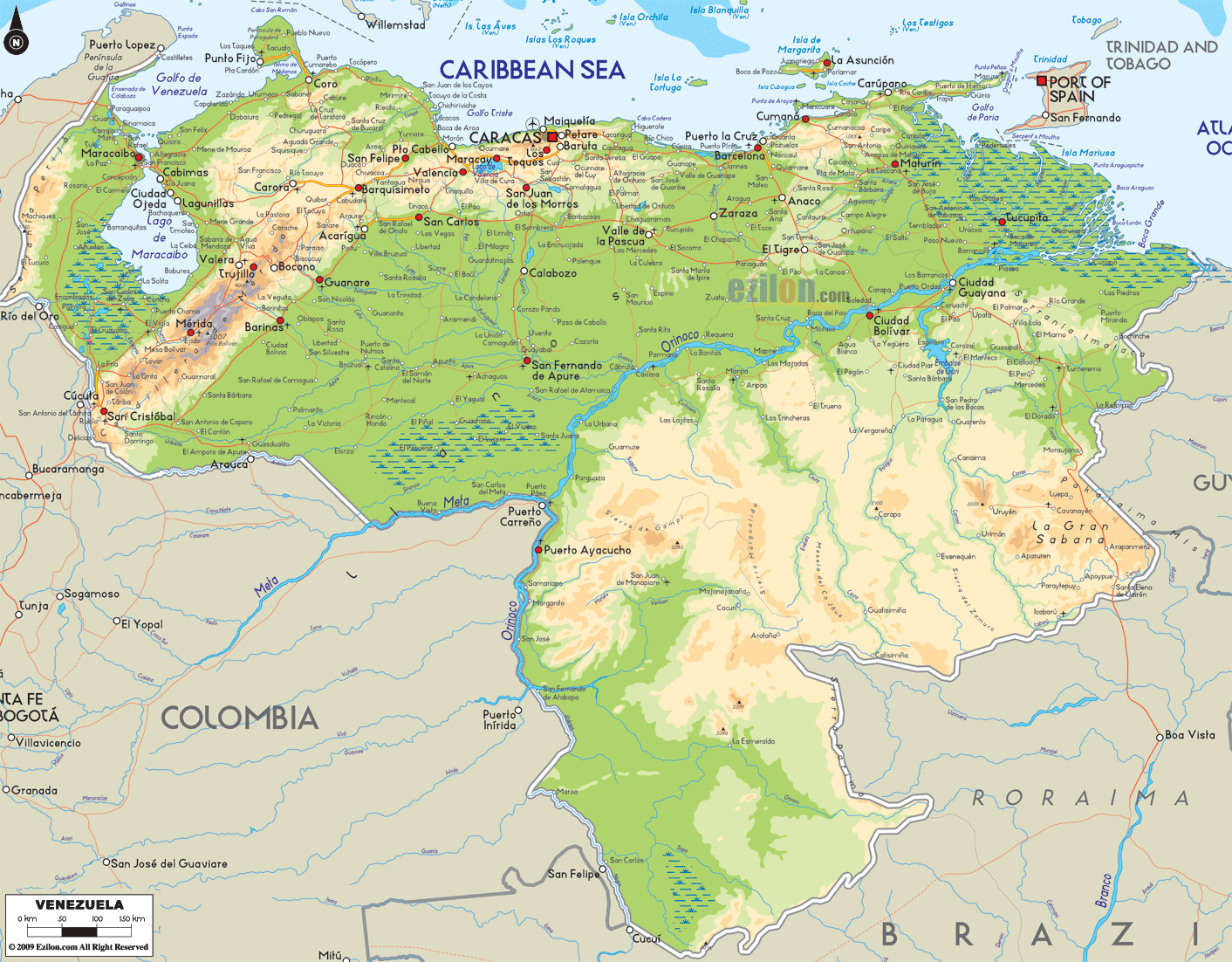
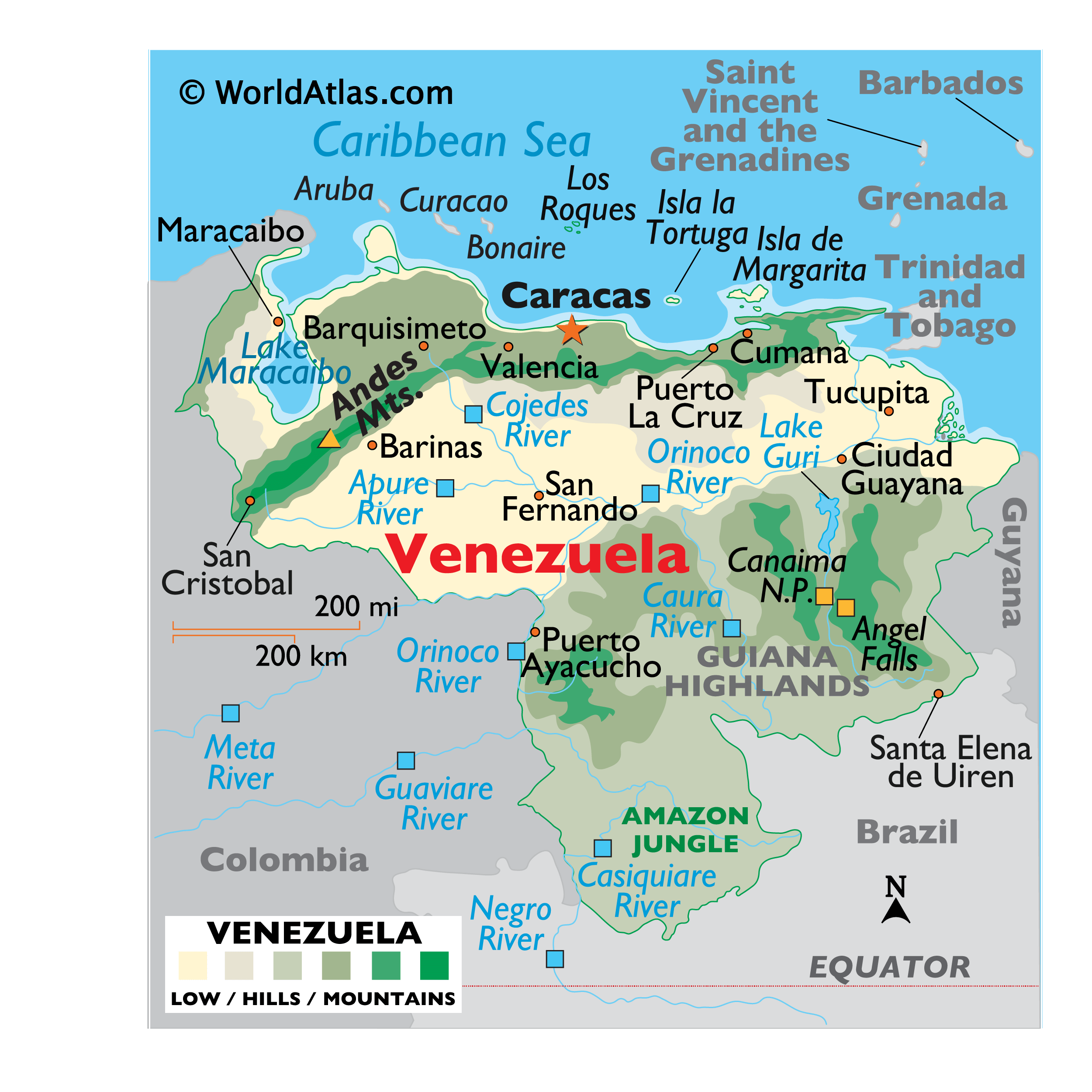
Covering a total area of 916,445 sq.km (353,841 sq mi), Venezuela, located on the northern coast of South America is the world’s 33rd largest country. As observed on the physical map of Venezuela, the Orinoco River and Venezuela’s mountain ranges divide the country into some distinct topographical regions, all with different climates.
The Maracaibo Lowlands of the far northwest are dry, windless and hot; the Andes Mountains and northern highlands are more temperate and much cooler in the higher elevations; the central plain fronting the Orinoco River covers about one-third of the country, most of it is less than 50 meters in elevation, and generally quite warm. The wild and largely unexplored Guiana Highlands covering the southeast, with elevations of up to 3,500 meters, are jungle-tropical, hot and very humid.
The country’s highest point – Pico Bolivar at 4,979 m (16,335ft) [as marked on the map as an upright yellow triangle] lies in the northern mountains.
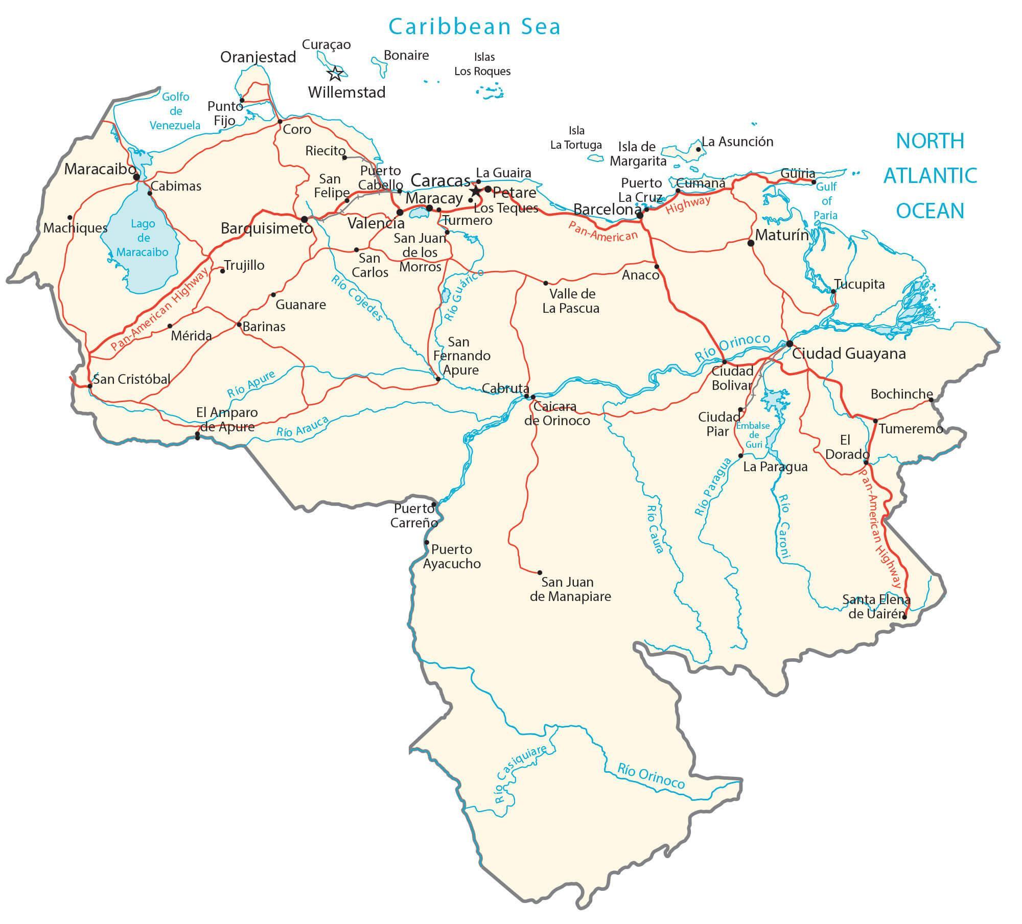
The world’s highest waterfall – the Andes Mountains Angel Falls is located in the Guiana Highlands; standing at 2,421 feet, (751 m) or more than 12 times the height of America’s and Canada’s Niagara Falls. With over 10,000 rivers (mostly small) within Venezuela’s borders, the Orinoco is by far the most important. It’s the third-longest river in South America, after the Parana and the Amazon; it has more than 2,000 tributaries – including the Apure, Arauca, Caron, Caura, Guaviare, Meta and Ventuari. Most of the other rivers that rise in the northern mountains flow south-eastward to the Apure. Significant lakes include Lake Guri and Lake Maracaibo – the largest lake in South America.
| Flag: |  |
|---|---|
| Legal Name: | Bolivarian Republic of Venezuela |
| Capital Value: | Caracas |
| Official languages: | Spanish |
| Demonym(s): | Venezuelan |
| Government: | Federal presidential republic under an authoritarian regime |
| Legislature: | National Assembly |
| Total Area: | 912,050 km² |
| Land Area: | 882,050 km² |
| Water Area: | 30,000 km² |
| Population: | 28,515,829 |
| Density: | 33.74/km (87.4/sq mi) (144st) |
| GDP: | $482.36 Billion |
| GDP Per Capita: | $16,054.49 |
| Currency Value: | Bolivars (VEB) |
| Driving side: | right |
| Calling code: | +58 |
| Internet TLD: | .ve |
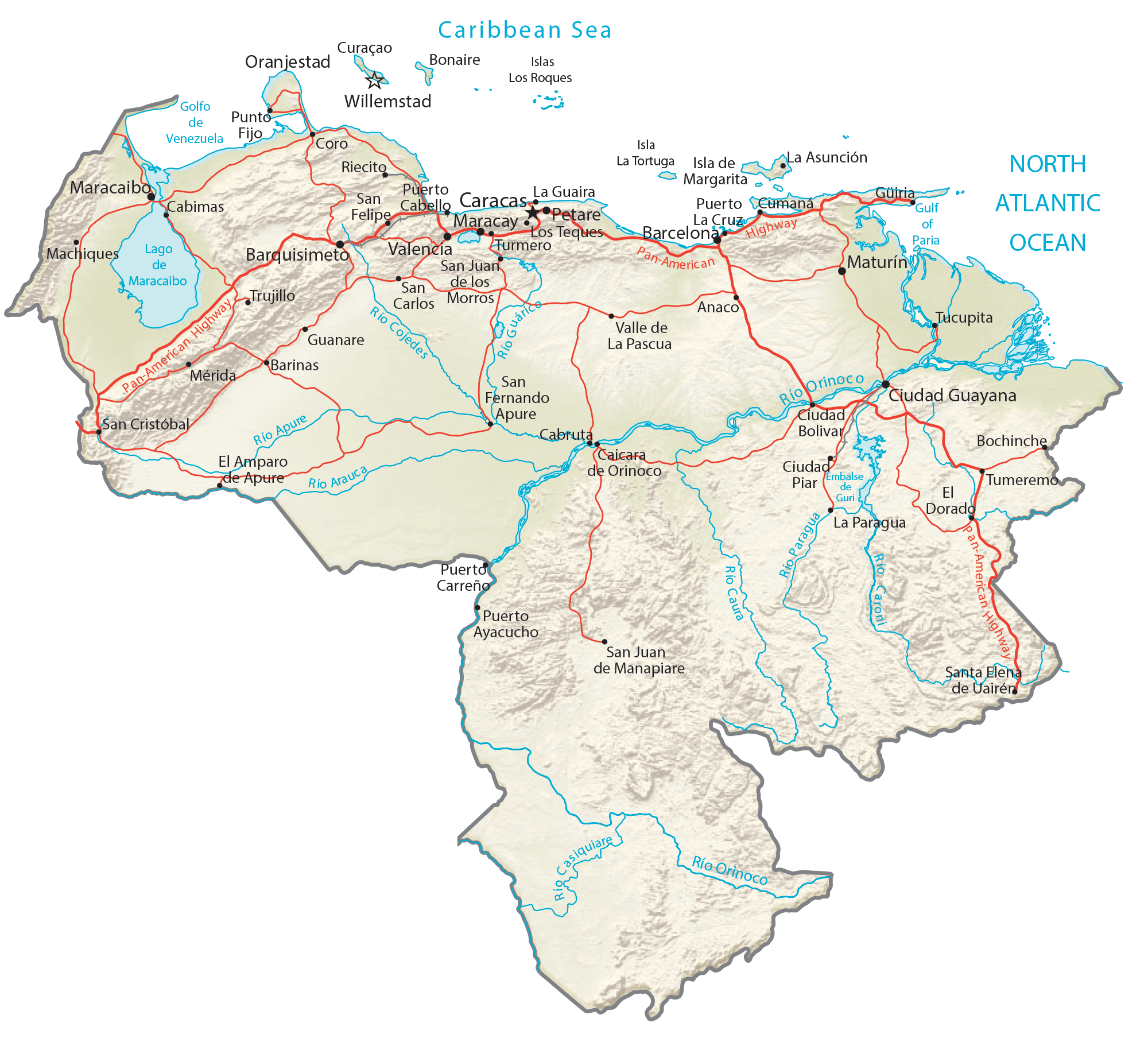
Venezuela is a country of vast and diverse geographical features. From the towering Andes Mountains to the vast Maracaibo Lowlands, the country offers a variety of landscapes that are both stunning and unique. To get a better understanding of the country’s geography, take a look at this interactive map of Venezuela. It includes satellite imagery and an elevation map that highlight everything from the Andes Mountains to the Maracaibo Lowlands. You can also find cities, towns, highways, roads, lakes, and rivers. This map offers a great way to explore the different regions of Venezuela and gain insight into its many wonders.
Online Interactive Political Map
Click on ![]() to view map in "full screen" mode.
to view map in "full screen" mode.
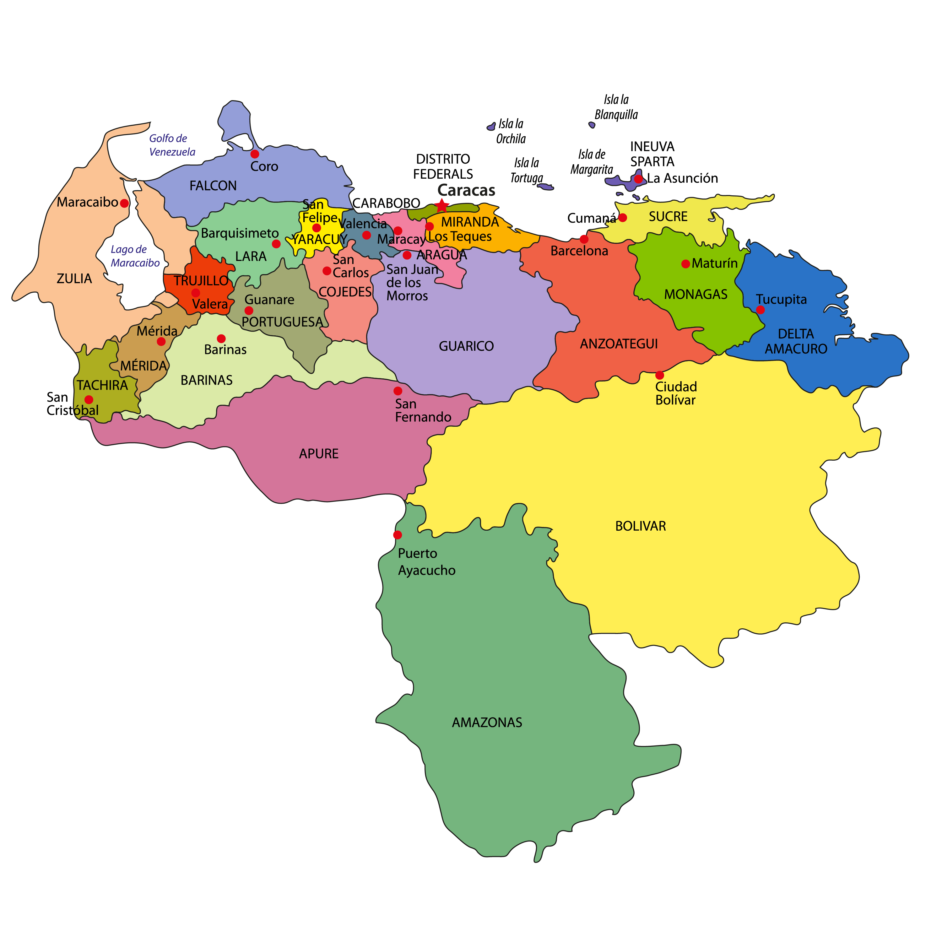
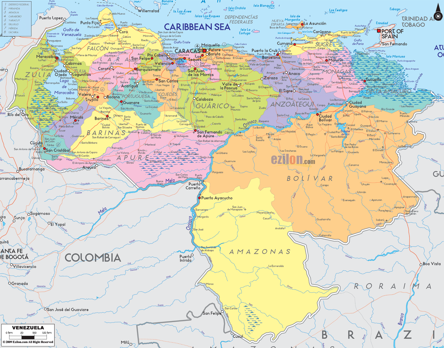
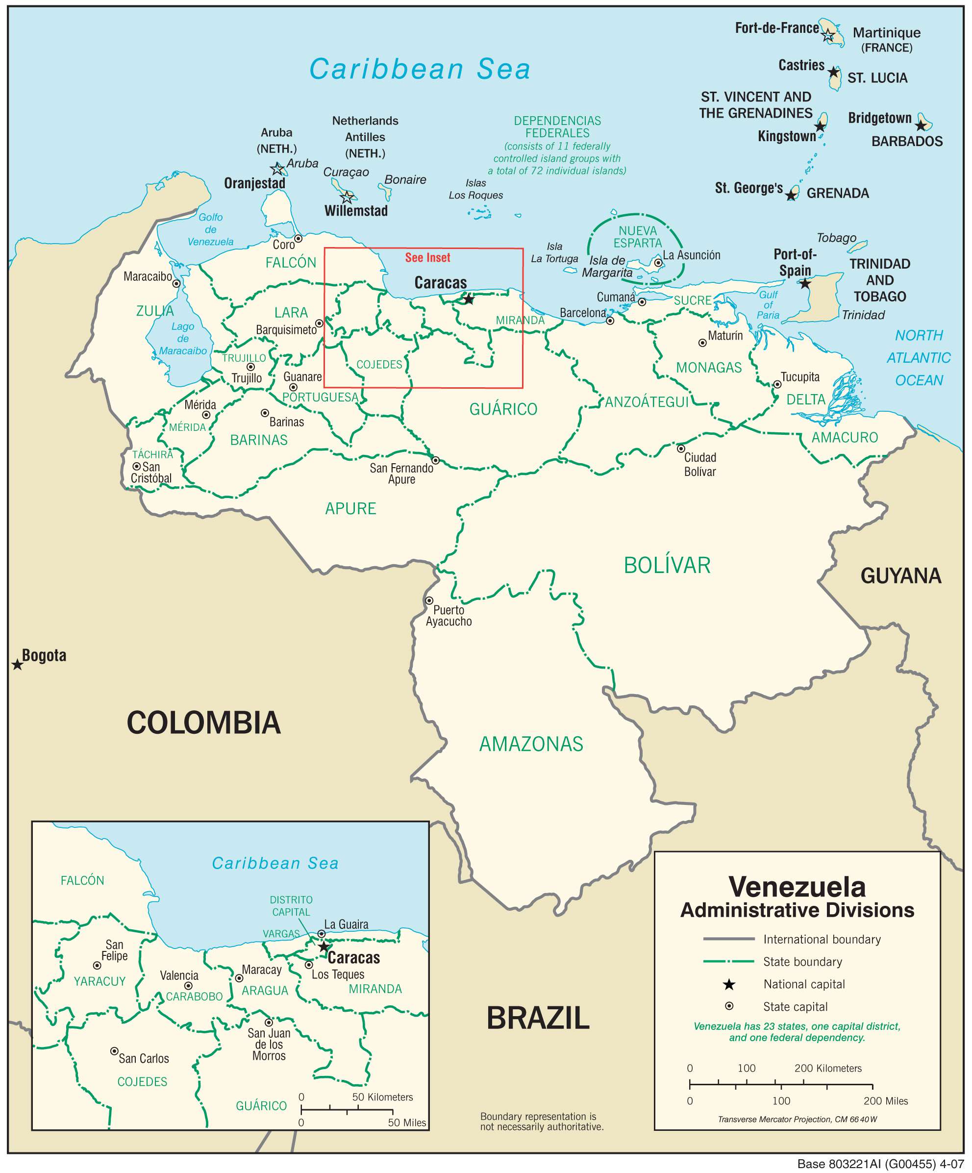
Venezuela (officially, the Bolivarian Republic of Venezuela) is divided into 23 states (estados, singular – estado), 1 Capital district (Distrito Capital), and Federal Dependencies (Dependencias Federales). In alphabetical order, the States are: Amazonas, Anzoategui, Apure, Aragua, Barinas, Bolivar, Carabobo, Cojedes, Delta Amacuro,Falcon, Guarico, Lara, Merida, Miranda, Monagas, Nueva Esparta, Portuguesa, Sucre, Tachira, Trujillo, Vargas, Yaracuy and Zulia. The country is further subdivided into a total of 335 municipalities and over 1000 parishes.The Federal Dependencies comprises of Venezuela’s many offshore islands and islets in the Caribbean Sea.
Covering a total area of 916,445 sq.km, Venezuela is the world’s 33rd largest country. Located along the Guaire River in the country’s northern part is, Caracas – the capital, the largest and the most populous city of Venezuela. It is also the country’s cultural capital as well as the administrative, educational, industrial and commercial center of Venezuela.
Location Maps
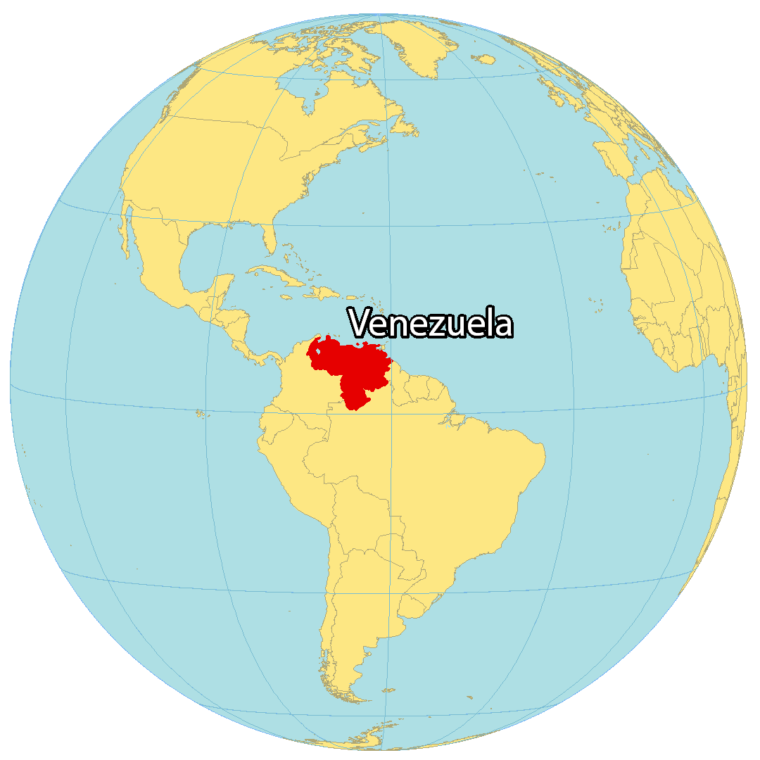
Where is Venezuela?
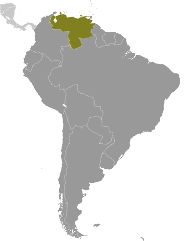
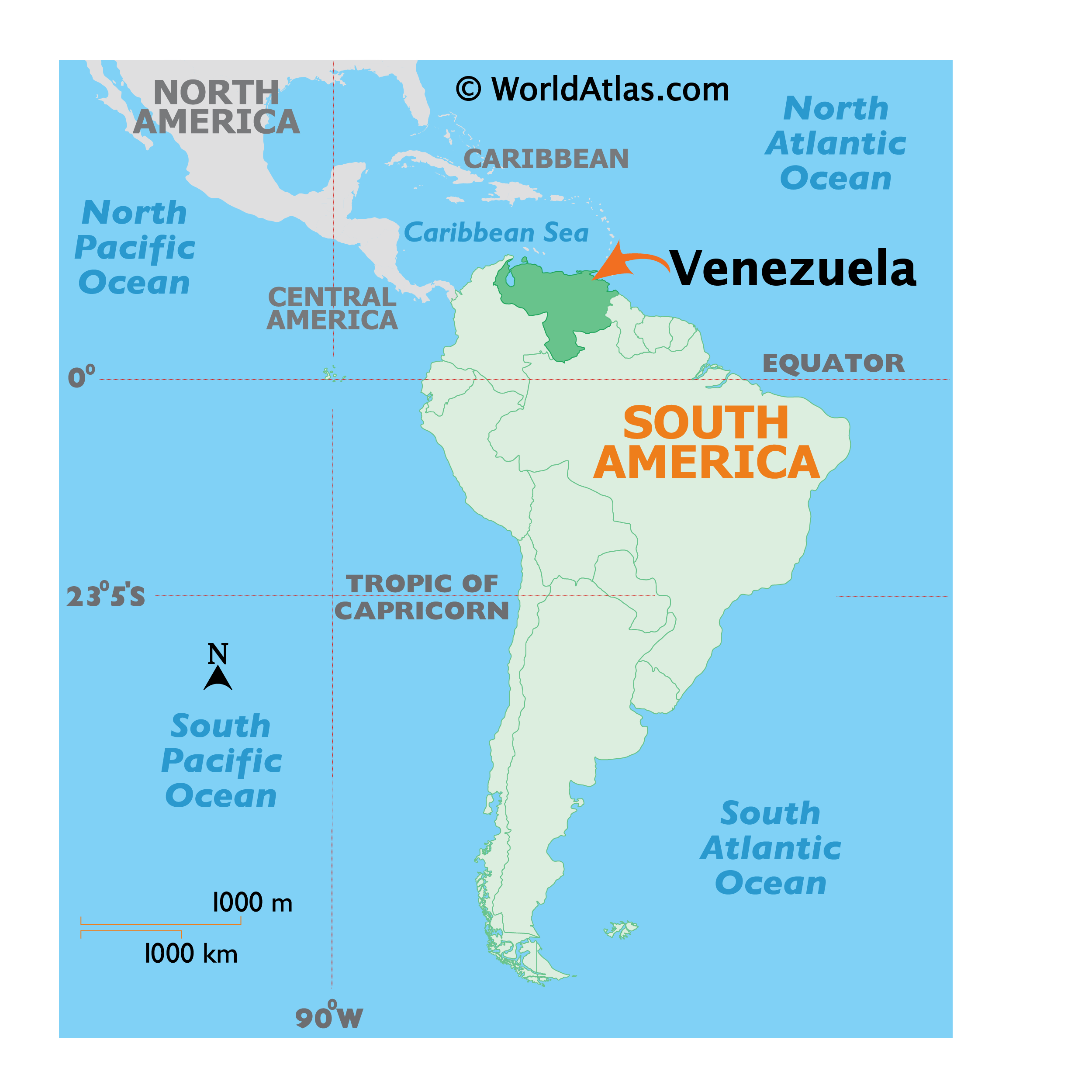
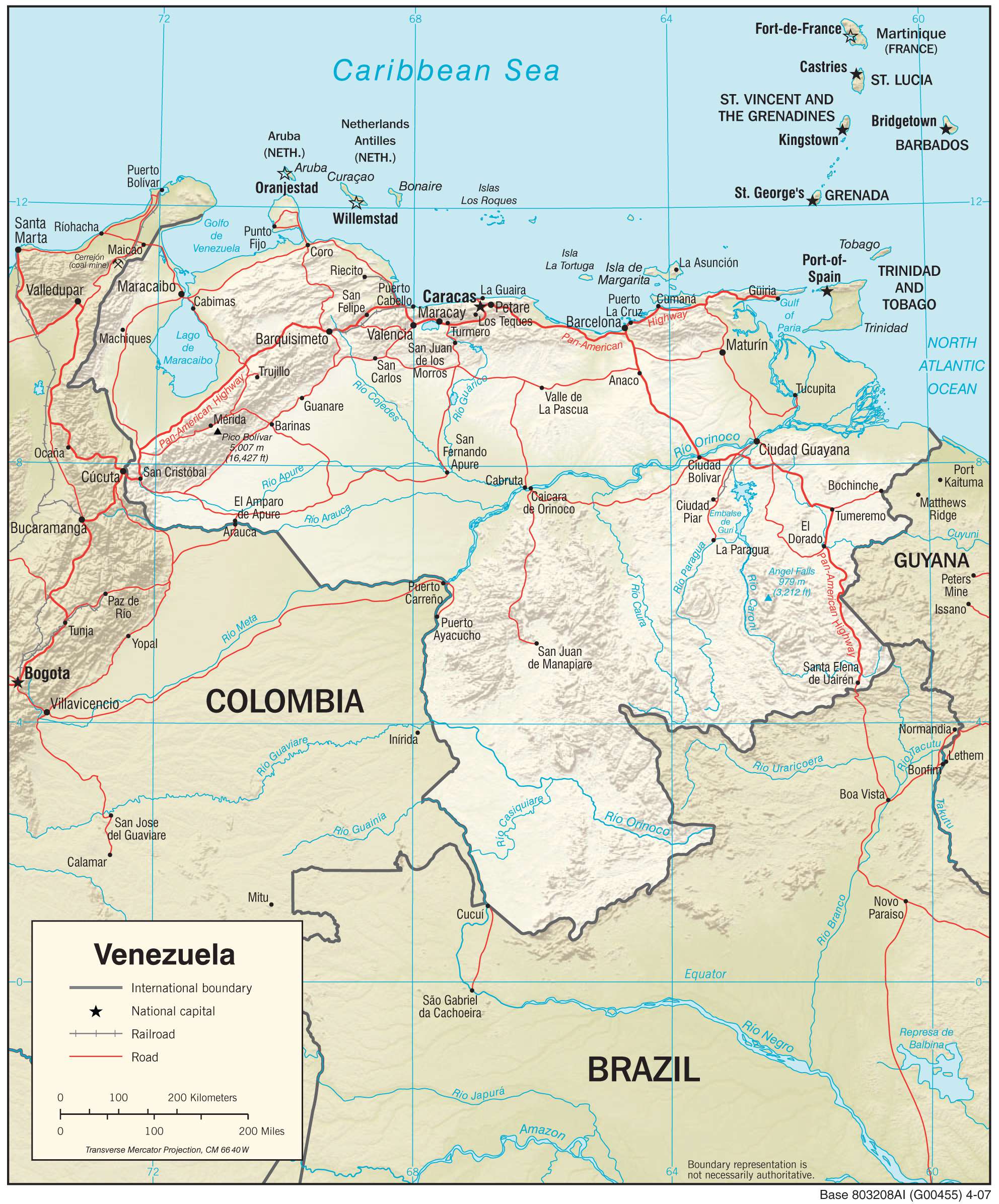
Venezuela is located in the northern region of South America along the Caribbean Sea. It borders three other countries including Guyana to the east, Brazil to the south, and Colombia to the west. Its northern coast contains island resorts such as the Isla de Margarita and the Los Roques archipelago.
Venezuela has the most proven oil reserves in the world, larger than Saudi Arabia or Canada. Additionally, it has the second-biggest natural gas reserves in the Western Hemisphere. Caracas is the capital and largest city of Venezuela. Other major cities include Maracaibo, Maracay, and Valencia with each of them exceeding one million people.
High Definition Political Map of Venezuela
Venezuela Administrative Map
Physical Map of Venezuela
Transportation Map of Venezuela

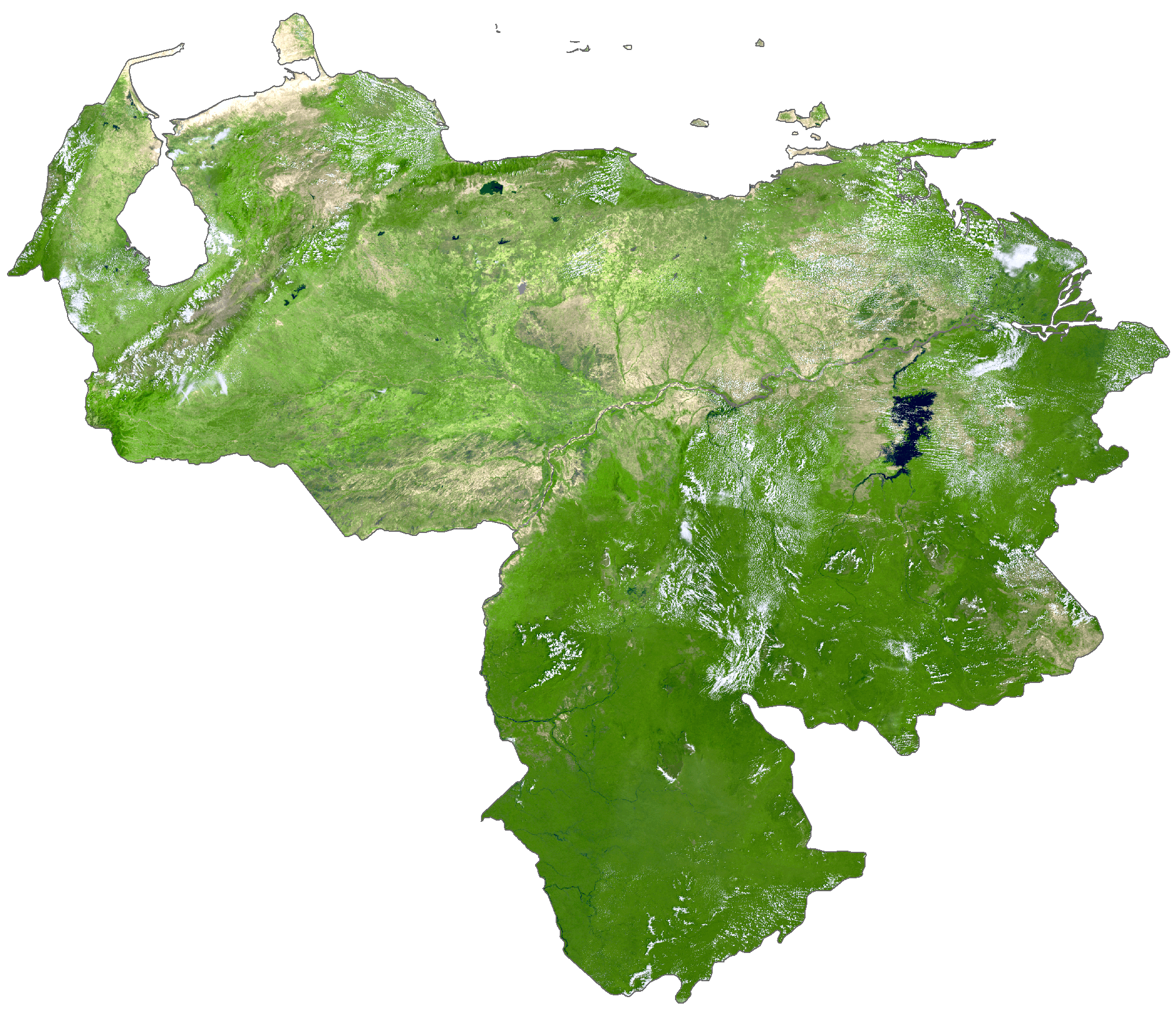
Venezuela Satellite Map
Topo Map